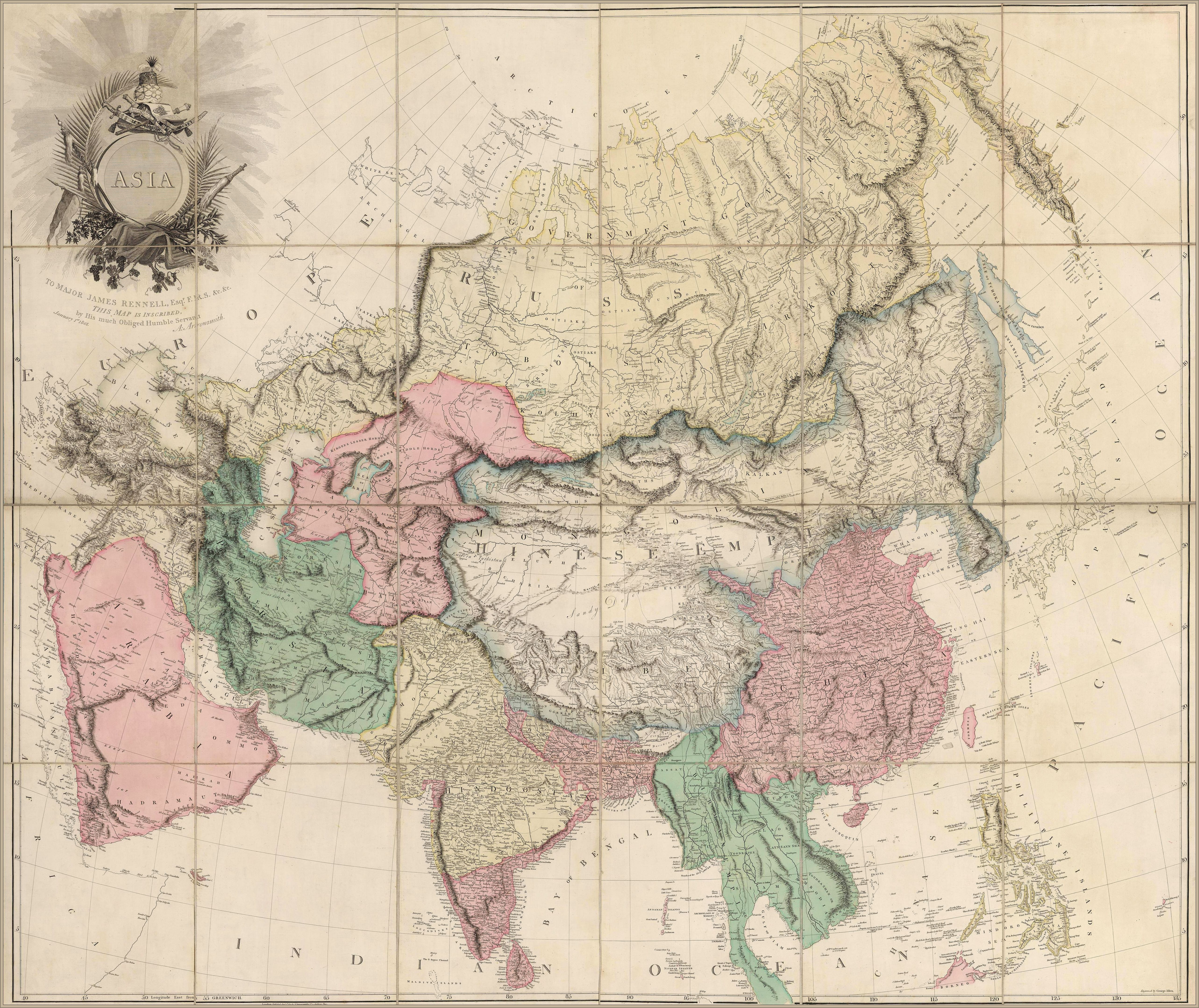
1801 Map of Asia
1801 Map of Asia
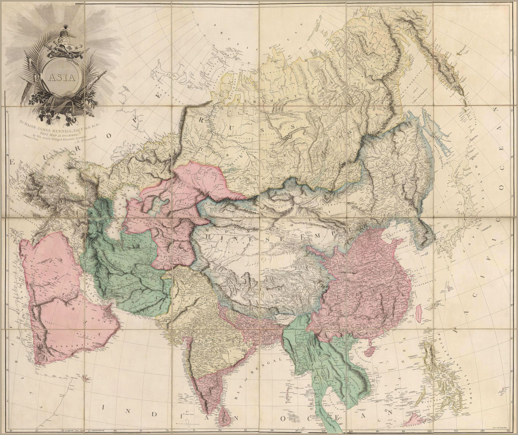
‘Fascinating! Some random observations:
The Caucasus range has scoliosis
The Red Sea is called the “Arabian Gulf” (rather than the bay between Arabia and India, which is unlabelled)
Lake Balkhash is swol
Mongolia includes Xinjiang
The Tarim Basin is called “Little Bucharia”, and Uzbekistan/Tajikistan is called “Great Bucharia”
The Chinese Empire includes Nepal, Bhutan, Korea, Sakhalin, and the mainland coast up to the Strait of Tartary
There are places labelled “Eluths” scattered all over eastern China (edit: apparently “Eluths” was an alternate name for the Oirat)‘–AbouBenAdhem