Early Spanish map of Guiana from 1560 (published 1877)
Early Spanish map of Guiana from 1560 (published 1877)
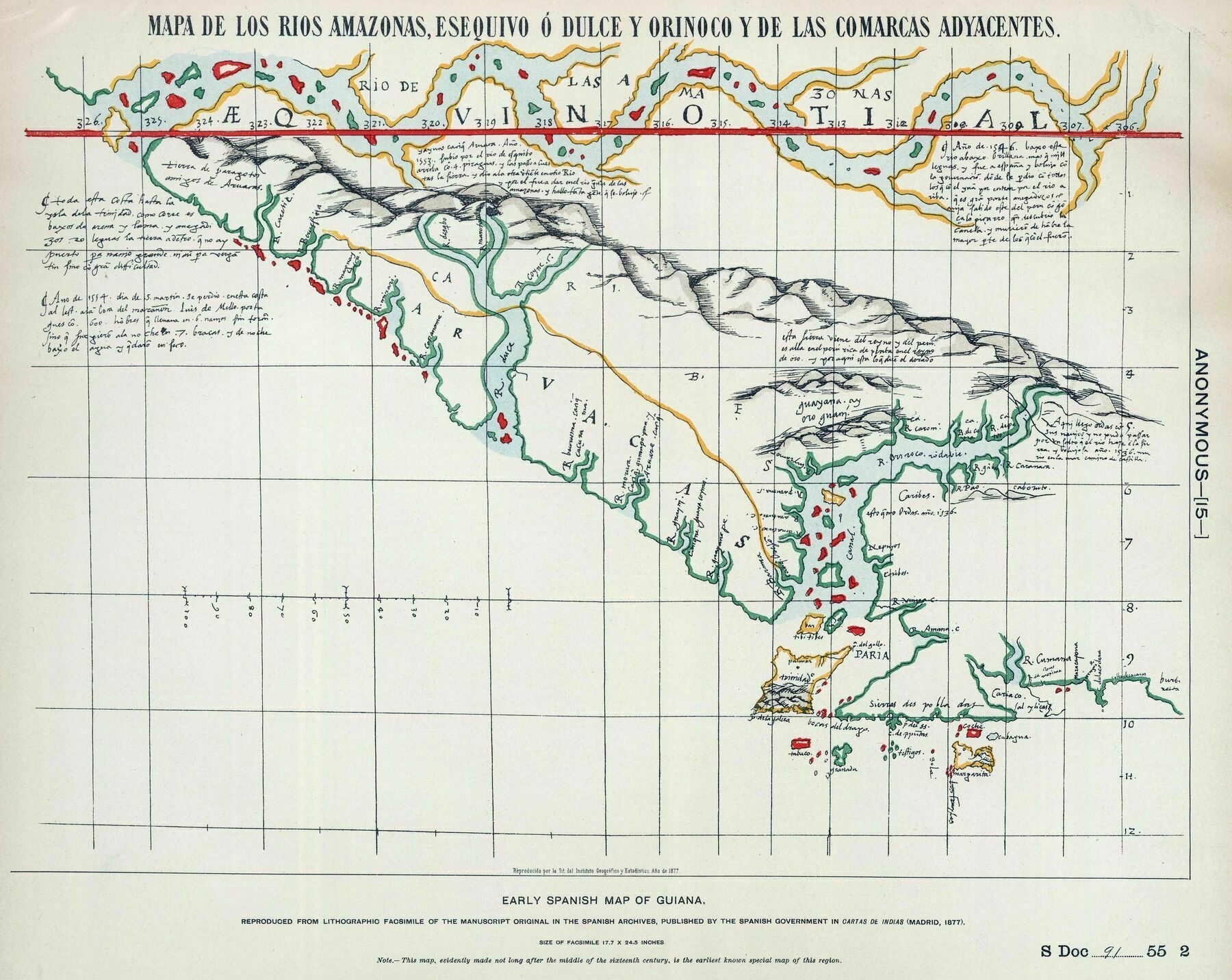
‘This is “upside down” right? Trinidad is at the bottom’
Early Spanish map of Guiana from 1560 (published 1877)
‘This is “upside down” right? Trinidad is at the bottom’
Main ethnic groups in Melbourne by statistical area (2016)
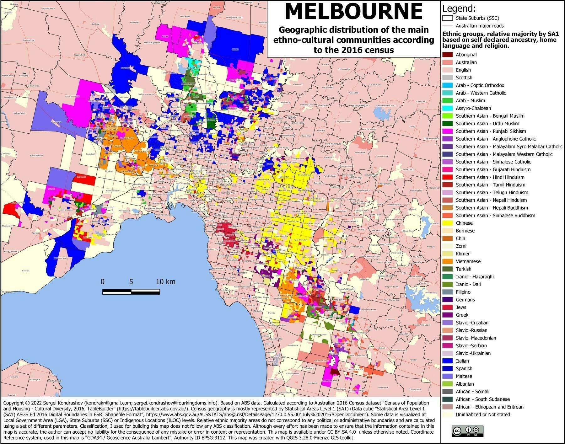
‘Just looked up my home suburb. Yep sounds about right’
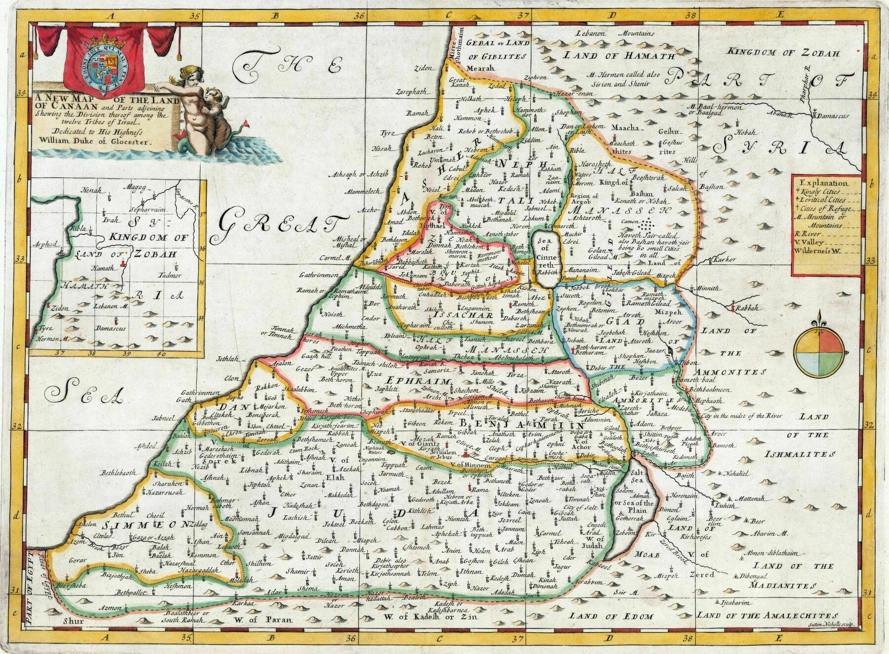
1712 map of the Land of Canaan, showing divisions among the twelve tribes of Israel - by Edward Wells
1689 map of Bosnia
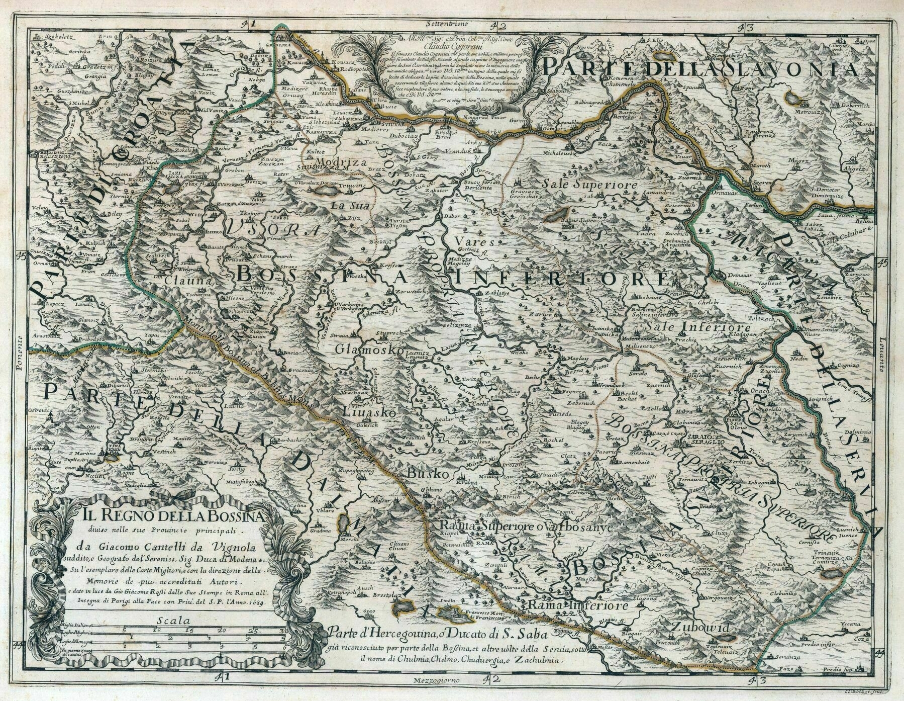
‘This was when Bosnia was completely landlocked, a decade before it got ocean access. Apparently Dubrovnik was worried about being attacked, so they gave a 30 mile strip of land on the coast to the Ottoman Empire as a buffer zone, which did work, but this is why Croatia is split in two even today, with travelers forced to transit through Bosnia, with 3 customs checks, until a new bridge was finished last year that now connects Croatia, bypassing Bosnia.’
1880s map showing the railway systems of Australia
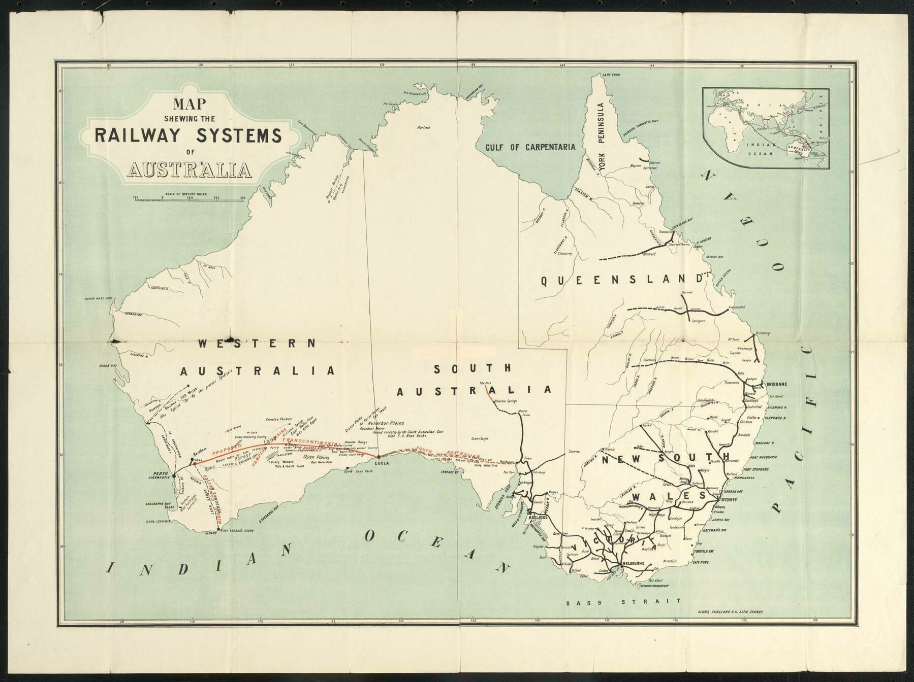
‘Was going to whinge they left out Tasmania, but then again, being the 1880’s, Tasmania was a totally independent colony, no more a part of ‘Australia’ (as a unified concept) than NZ, Malaysia, or any other British colony in the region. But from the modern perspective, it seems odd. The focus on the trans-continental seems to be the primary reason for the choice of area covered/features shown
Also because no one gives a shit about tasmania
As a Tasmanian I agree’
The distribution of the Irish language in 1871 - From E.G. Ravenstein, “On the Celtic Languages of the British Isles: A Statistical Survey”, in Journal of the Statistical Society of London, vol. 42, no. 3, (September, 1879)
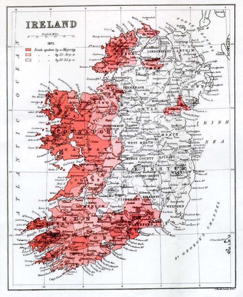
‘Bearing in mind most of the red areas are very sparsely populated (and were at the time of the map, too) does anybody have an estimate as to what percentage of the total population would fall into the various red and pink categories?
They weren’t as sparsely populated back then though. Yes it’s post famine, but the depopulation of the West took place over 150 years’
The City of Brooklyn, USA (1879)
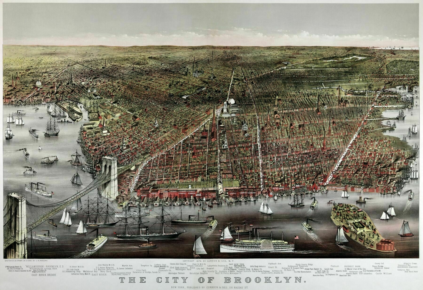
‘I guess I didn’t know offhand when the Brooklyn bridge was built, but if you had asked me I would have definitely guessed sometime after 1900.
The construction commenced in 1869 and was completed in 1883.
It’s designer, John Roebling, has an older bridge, still in use today in Cincinnati, the John A. Roebling Bridge which was built from 1856-1867 which is nearly as grand in stature.’
Forest Cover % in Australian States and Territories

‘Imagine not having a state with 50+% forest cover.
This comment was made by a Tasmanian’
Main ethno-linguistic groups in Europe (1899)
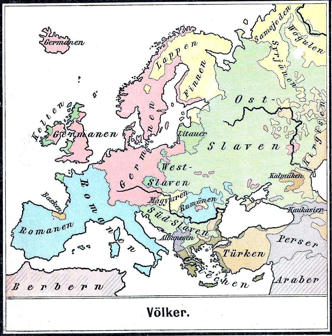
‘As a berber, what made me relief is that the map depicted North Africa accurately, ethnic arabs are a microscopic minority here, there are arabized berbers who kept berber customs to an extent, and berbers who kept speaking their languages, the idea of arab north africa started in the 30s with the rise of panarabism, and the arabization policy done by algerian and moroccan governments to erase berber identity’
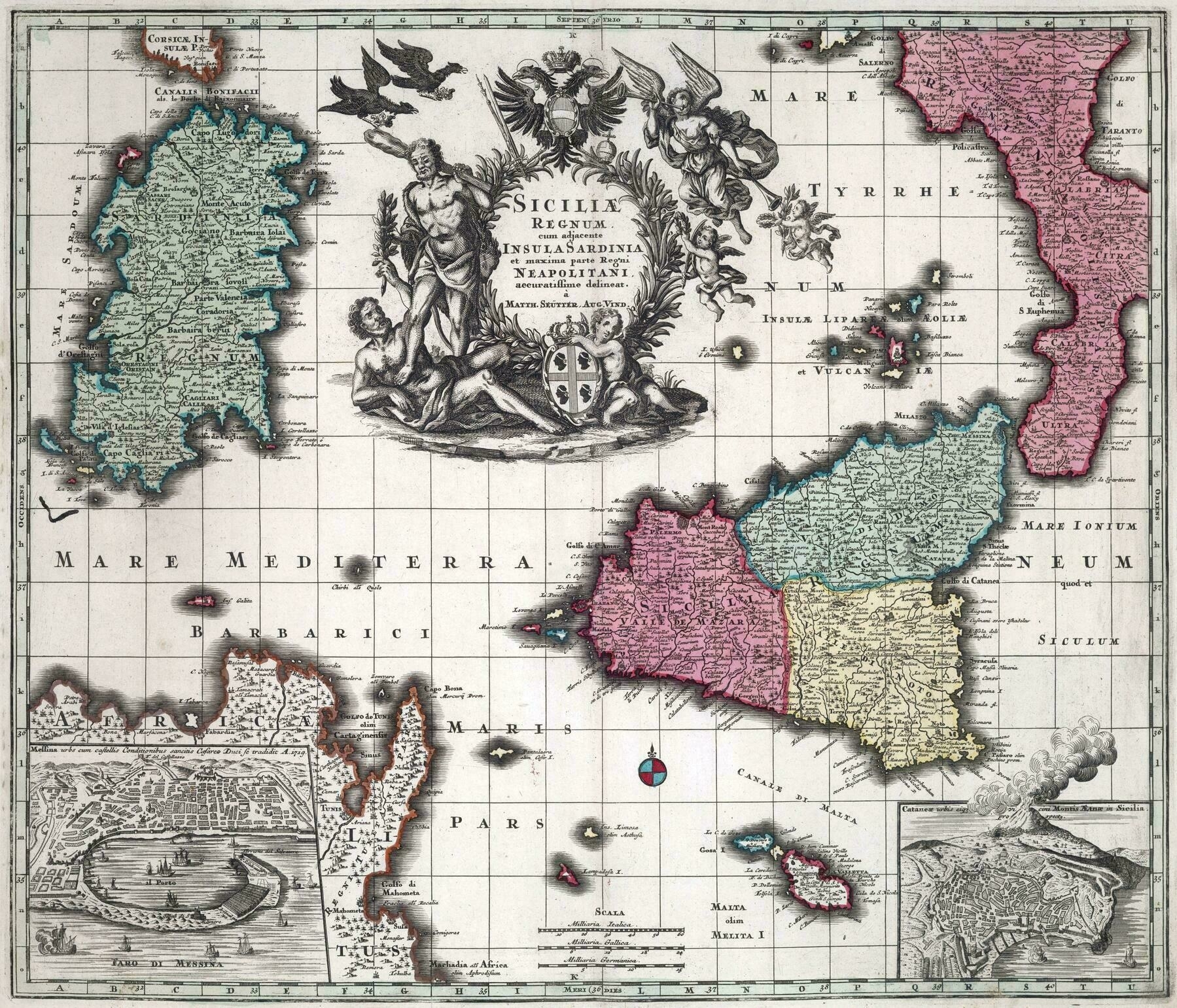
1729 map of Sicily, Sardinia and the foot of Italy - by Matthaeus Seutter
Topographic map of Switzerland (1969)
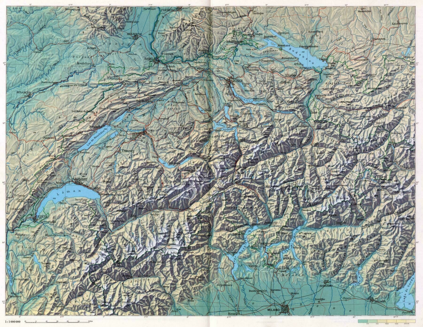
‘I like how you can draw lines across the most defined features and will come out with the same general shape of Switzerland’
1961 map of the Portuguese Empire
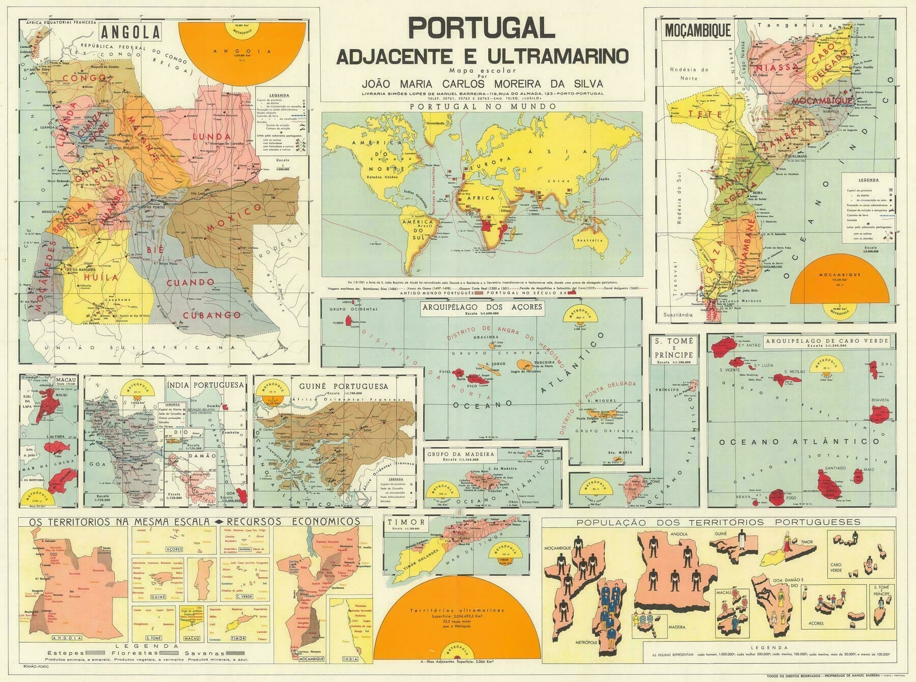
‘Great map.
Few things I noticed - Dutch Timor is mentioned as Portuguese Timor’s western neighbour, not Indonesia.
The modern German flag, rather than the flag of the German Empire, is used to represent Great War battles between the two countries in Africa.
The Chinese islands to the west of Taipa and Coloane have Portuguese names, that I wasn’t previously aware of.
Interesting stuff!’
1861 birds eye view of the eastern United States - by Thomas Packer
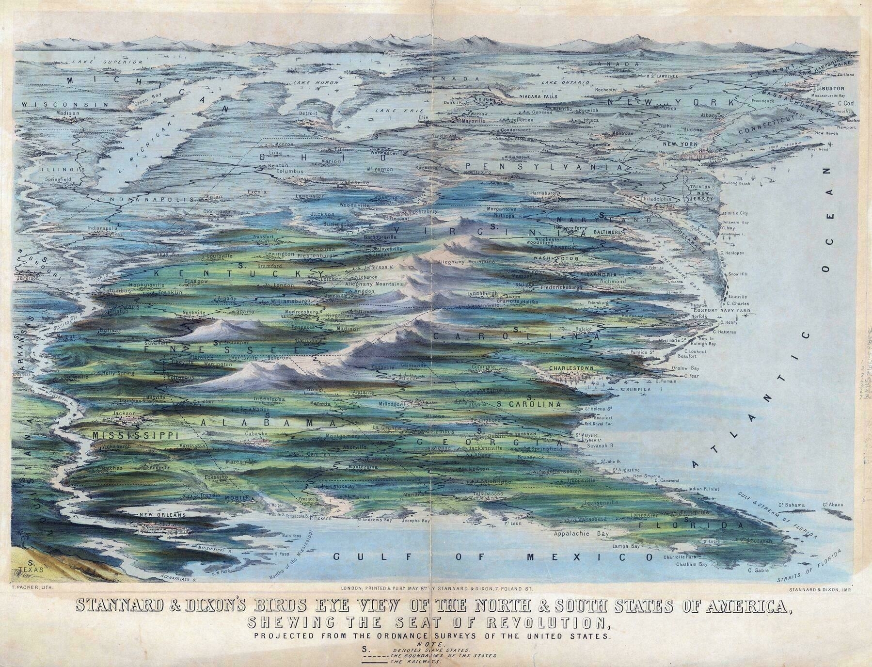
‘This is maybe the oddest projection I’ve ever seen. Thanks for posting it!’
1930s pictorial map of the short-lived territory of Central Australia
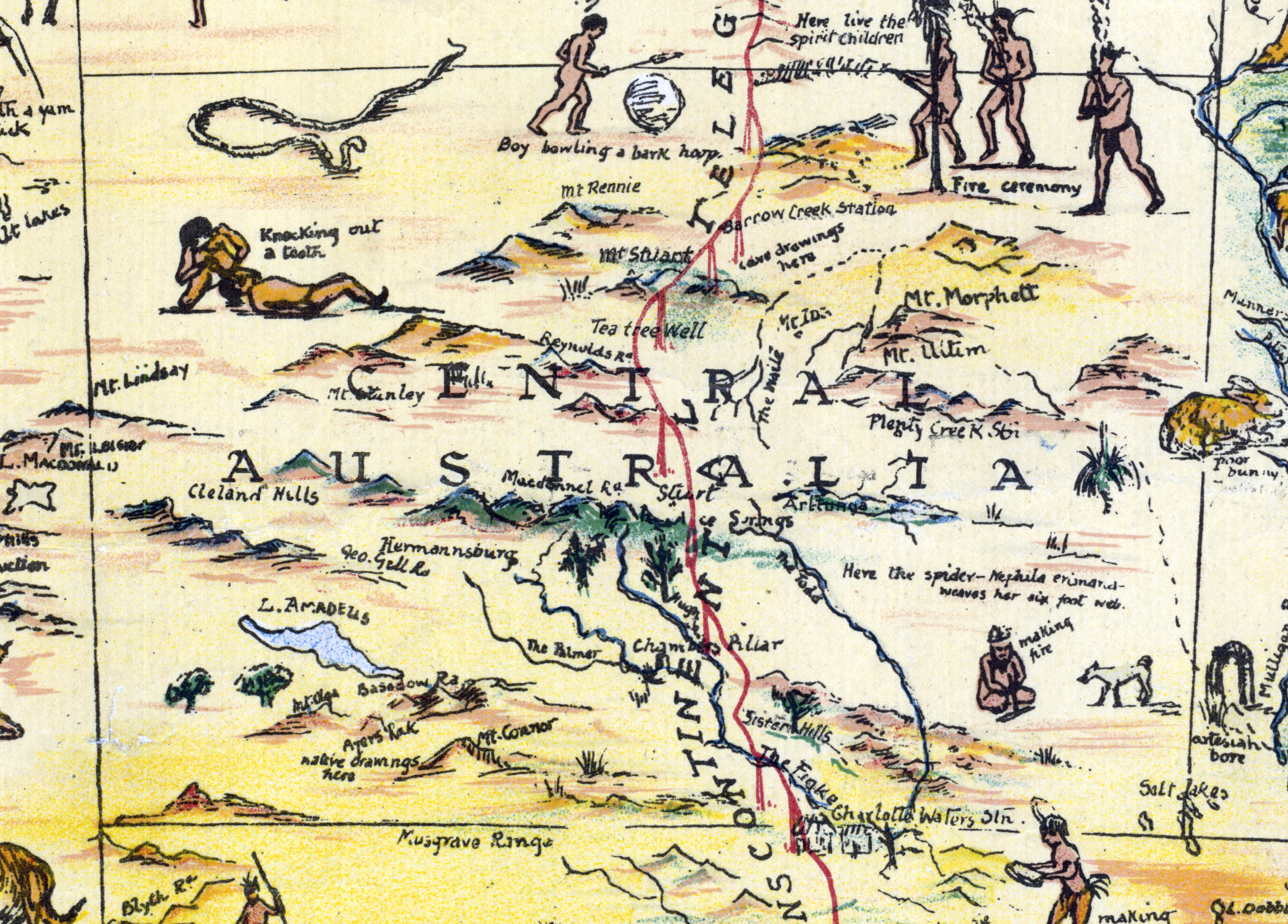
‘Knocking out a tooth! 😬’
1856 map of Georgia and Florida - by John Bartholomew
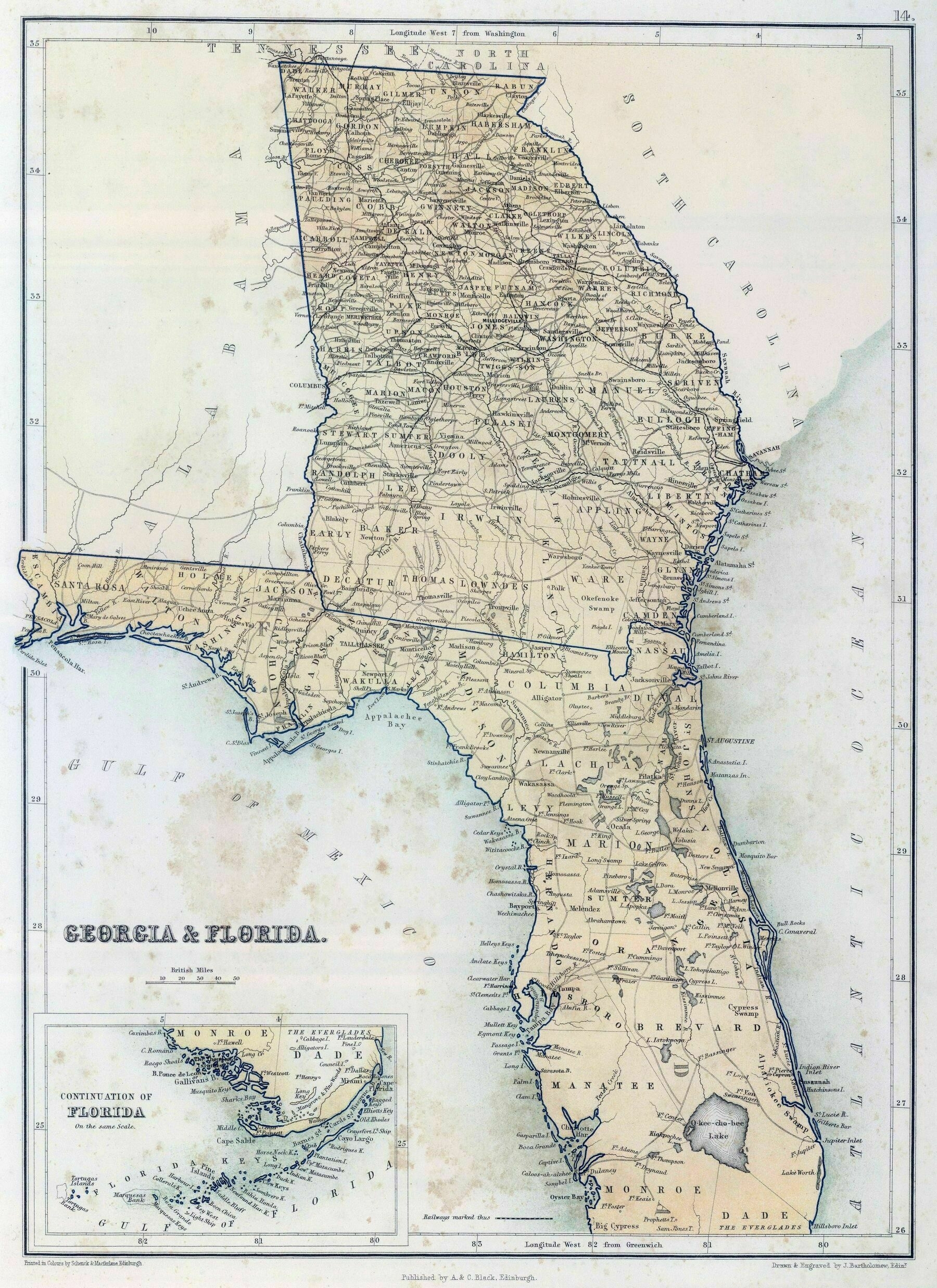
‘Florgia? Georida?’
1805 map of Australia
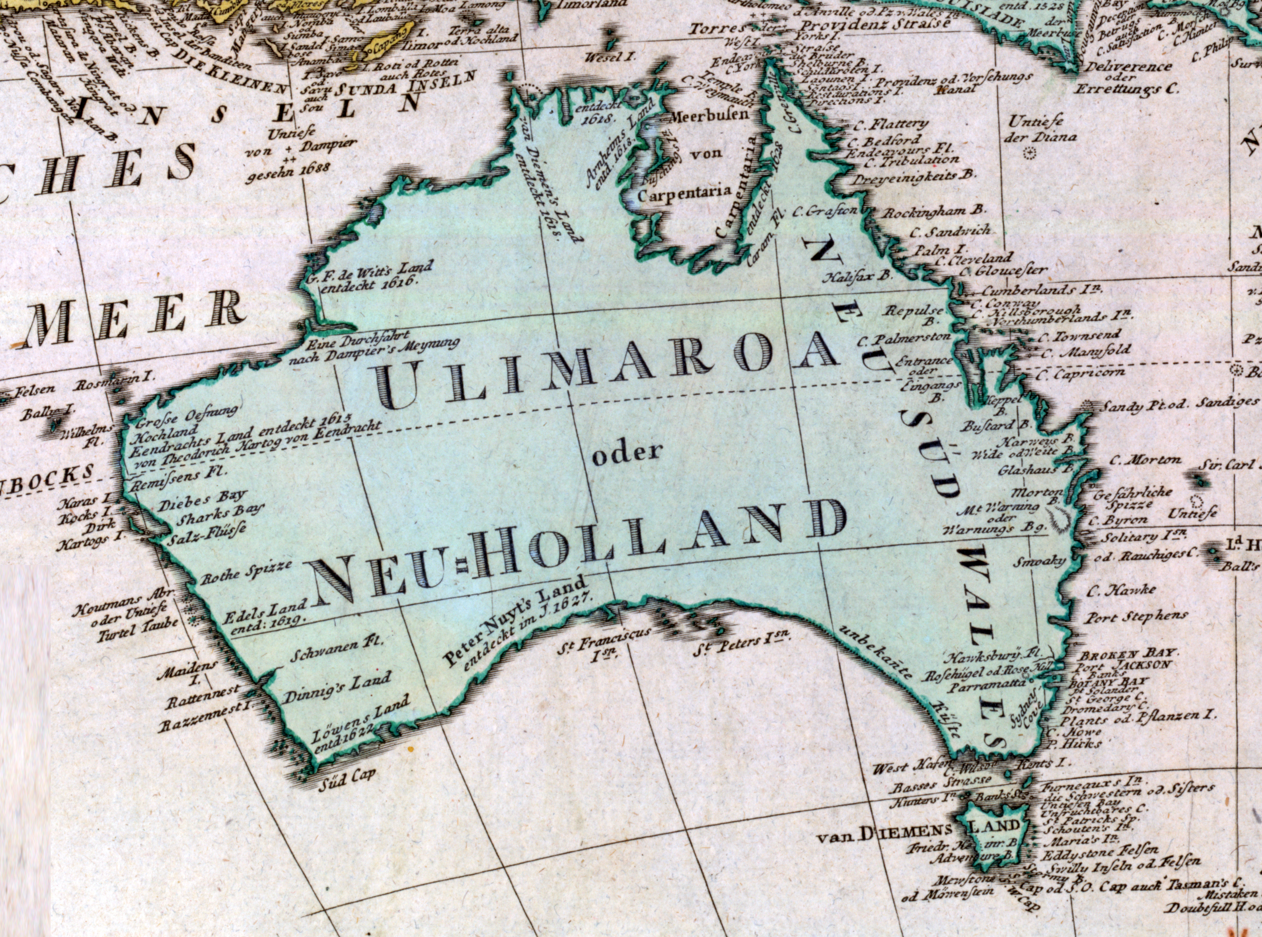
‘The Ulimaroa name has some interesting background- that’s a real TIL! - thank you!
Same! Very cool. And in the age of Spanish, Portugese, Dutch and British ruling the waves, a Swedish cartographer is out of left field
That Australia was very nearly claimed by the French, and the populate or perish mentality is well known - this was a snippet that I really didn’t know, especially: did the Maoris know of Australia? Really cool’
Passenger Railways of Australia

‘It’s weird seeing what I had previously compartmentalised as separate train networks actually forming a connected whole
I travel frequently on the XPT trains between Brisbane, Sydney and Melbourne, so I’ve developed a map in my head of the networks of those regions.
Melbourne: you arrive at Southern Cross station, there are charging stations, $10 shower facilities, and other trains that’ll take you around Melbourne and Victoria.
Sydney: this station used to be a maze for me, there are bathrooms, but I don’t think I noticed any showers or charging stations.
Brisbane: the XPT always arrives and departs at the worst times imaginable, so you have to wait at Central station and not Roma St station most of the time. The station is also under construction so yeah literally nothing for you here.
Also no need for bus cards in Melbourne or Sydney, but in Brisbane you need it for the Airport - Central - Beenleigh - Varsity Lakes route still I think. Not sure when bus cards will stop being a thing but yeah’
1720 map showing California as an island - by Nicolas de Fer
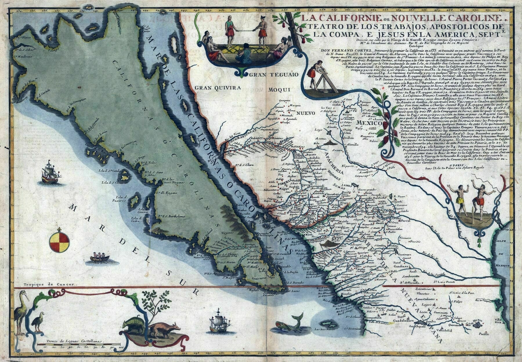
‘Would be interesting to know the route they travelled through California. I guess they crossed the gulf thinking Cali was an Island, and continued north not realising they were on the same landmass they departed from. Looks like they got all the way up to Monterey Bay but still thought they were on an island!
Iirc they sailed across for a long time. The Spanish were also sailing up down the coast. At one point they were sailing between Monterey and Drakes Bay up around Point Reyes which is around the area labeled Mendocino. This route took them by the San Francisco Bay but they didn’t know it was there for like 200 years. They sailed past it and never noticed the inlet because it was always foggy. Another interesting thing is that the area labeled something like “Sebas” is probably the Russian River Basin. This happens to be the most northern extension of the Spanish Empire and the Most Southern extension of the Russian Empire
Thank you for the reply! Had no idea the Russians went as far as California, and I also didn’t notice the “S. Fran” on the map until you mentioned it. Very interesting, I’ll have to look up more about it. Hard to believe that only 300 years ago this was all uncharted territory, for Europeans anyway’
Illinois population density (2020)

‘Anything other than blue = corn/soybean, every last acre. Illinois is an agricultural powerhouse as well as having the 3rd largest city/metro with nearly 10 million people’