1915 map of The Gambia
1915 map of The Gambia
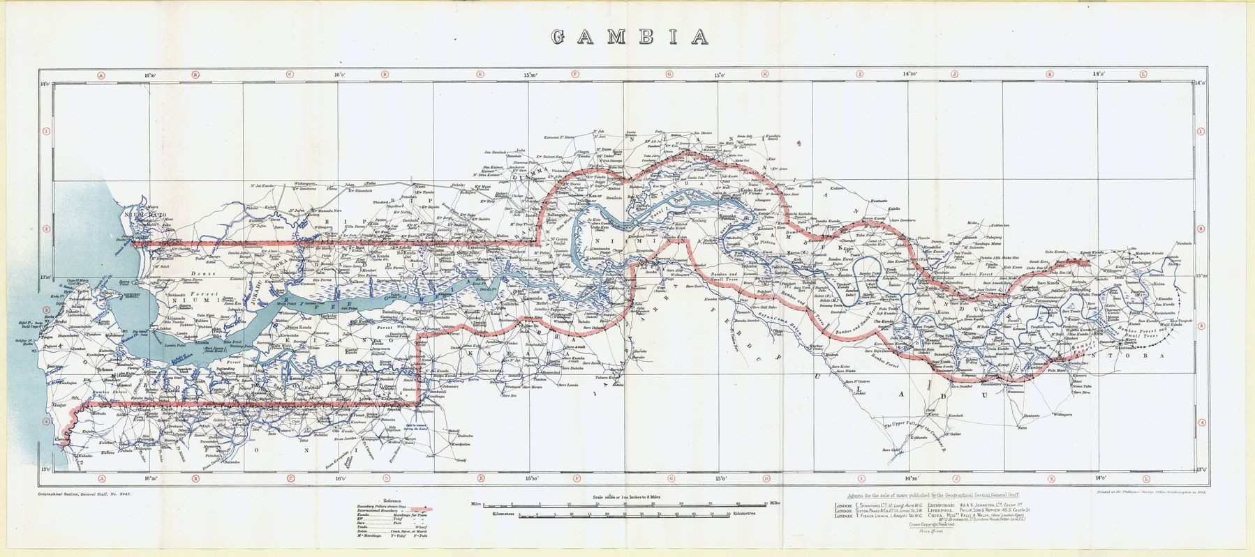
‘Probably just a story but I’m sure I read somewhere that the border was defined by the range of the cannons on a British man-of-war sailing up the river. Might explain why it becomes undefined as the river becomes harder to navigate’–redd.it/fk2smr