1893 birds-eye view of the Great Salt Lake Basin, and the upper Columbia (Snake and Clark Fork) and upper Missouri drainages
1893 birds-eye view of the Great Salt Lake Basin, and the upper Columbia (Snake and Clark Fork) and upper Missouri drainages
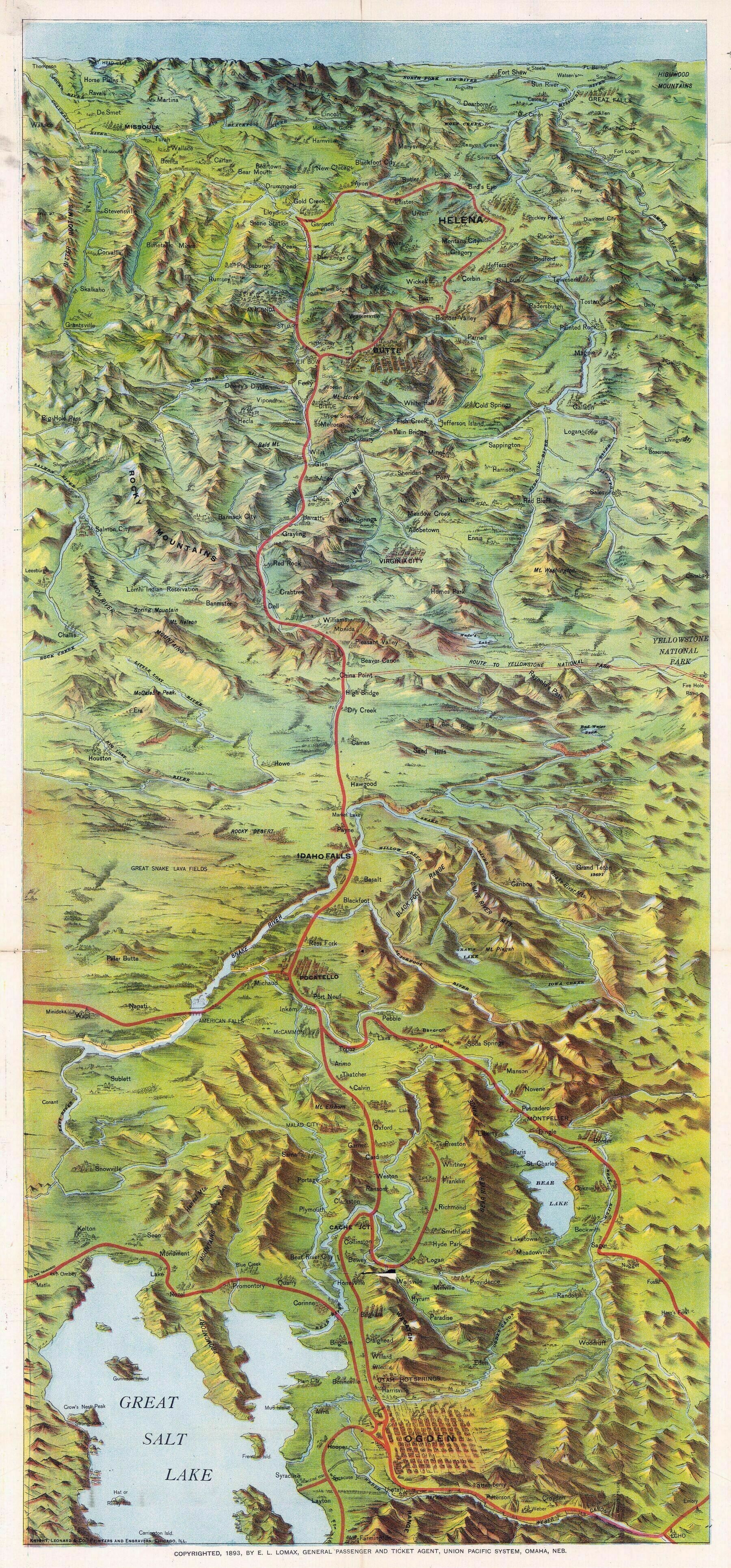
‘So the railroad basically followed the course to Montana that I-15 now traverses. It’s fun to think about what it would have been like to take the “Road to Yellowstone National Park” from the RR station at China Point. The map makes it look like a nearly straight and flat trail into the park. But some details on the map don’t add up: either the road actually started at Monida staying North of the mountains then via Raynolds Pass, or it cut through some steep and winding mountains to get up there from China Point, or it actually stayed to the south of that range, crossing the divide at Targhee Pass. 15 years later, you could just take the Oregon Short Line railroad from Idaho Falls up Henry’s Fork to West Yellowstone. That route is now accessible only by non-motorized means’–lightsuitman