1639 Dutch map of the New York City region / by Joan Vingboons
1639 Dutch map of the New York City region / by Joan Vingboons. This is one of the earliest maps of the region
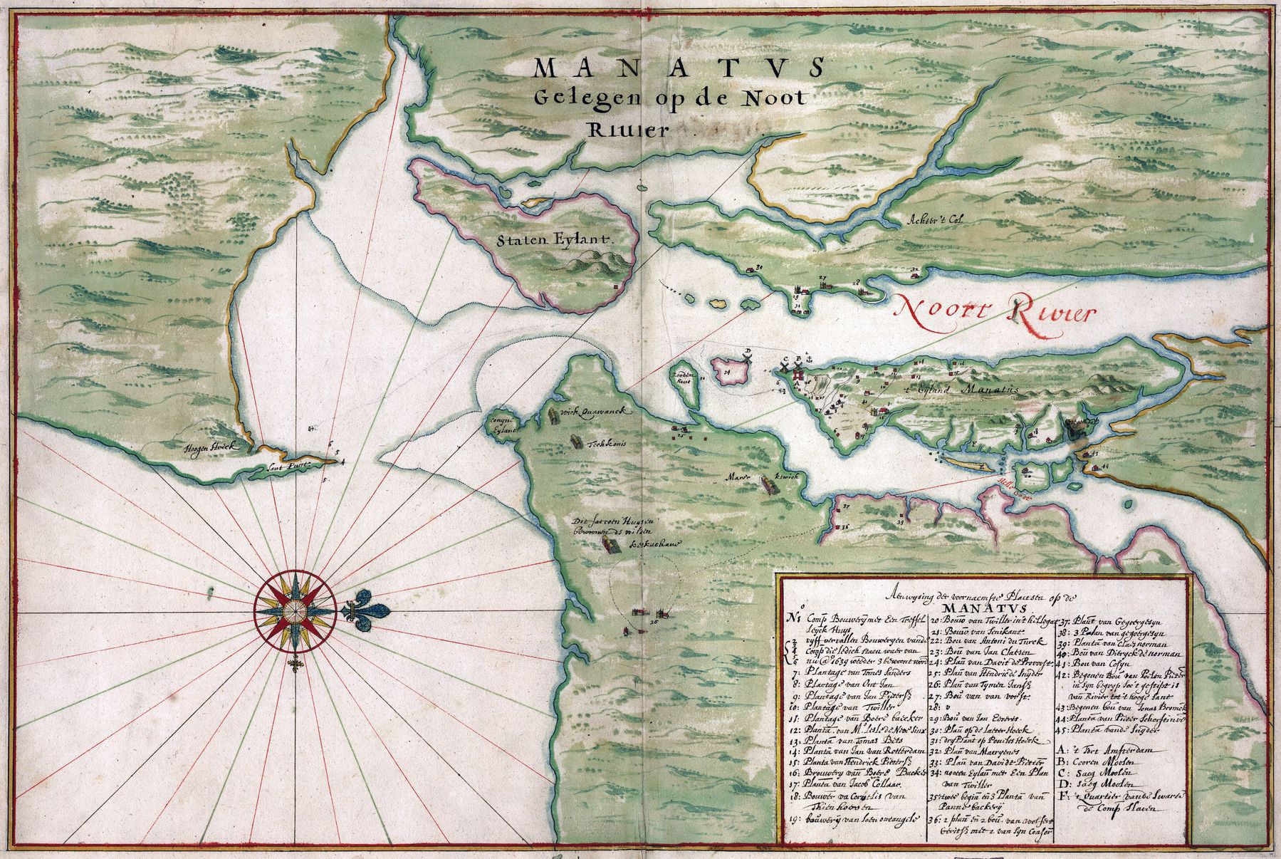
‘Other landmarks.
Near present-day Sandy Hook Bay, NJ on the left/south, we see “Hoogen Hoeck” / High Corner and “Sant Punt” / Sand Point.
On the top of the map we see “MANATVS, Gelegen op de Noot Riuier” / Manhattan, situated on the North River. (Noot actually means nut, but you can see Noort Rivier / North River in the river.)
Staten Eylant, named after the primary Dutch governing body the Staten-Generaal (Estates General), is of course today’s Staten Island.
In Jersey (up right corner/north-west), we see “Achter ’t Col” / Behind the Ridge, near present-day Ridgefield, NJ.
On Manhattan, on the right/north: “’t Eijland Manatus” / the Island Manhattan. There’s something in Harlem as well, but I can’t read it.
The island near Governor’s Island reads “Rooden Houc”, which is present-day Red Hook, Brooklyn. On the left/south of Brooklyn we see a peninsula named “Conyne Eylant”, or Rabbit’s Island, but it’s most famous as today’s Coney Island.
Finally, we see four longhouses in Brooklyn. The “Wickquawanck” seem to correspond with the Wecquasgeek. The “Teckkonis” don’t ring a bell. The “Marorktwick” might be the Merikoke of the Matoac. The last longhouse is described as “Dit satroen (?) huys bewoond de wilden Koskackani” / “This house is inhabited by the savage Koskackani”, which I also can’t place’–MetalRetsam