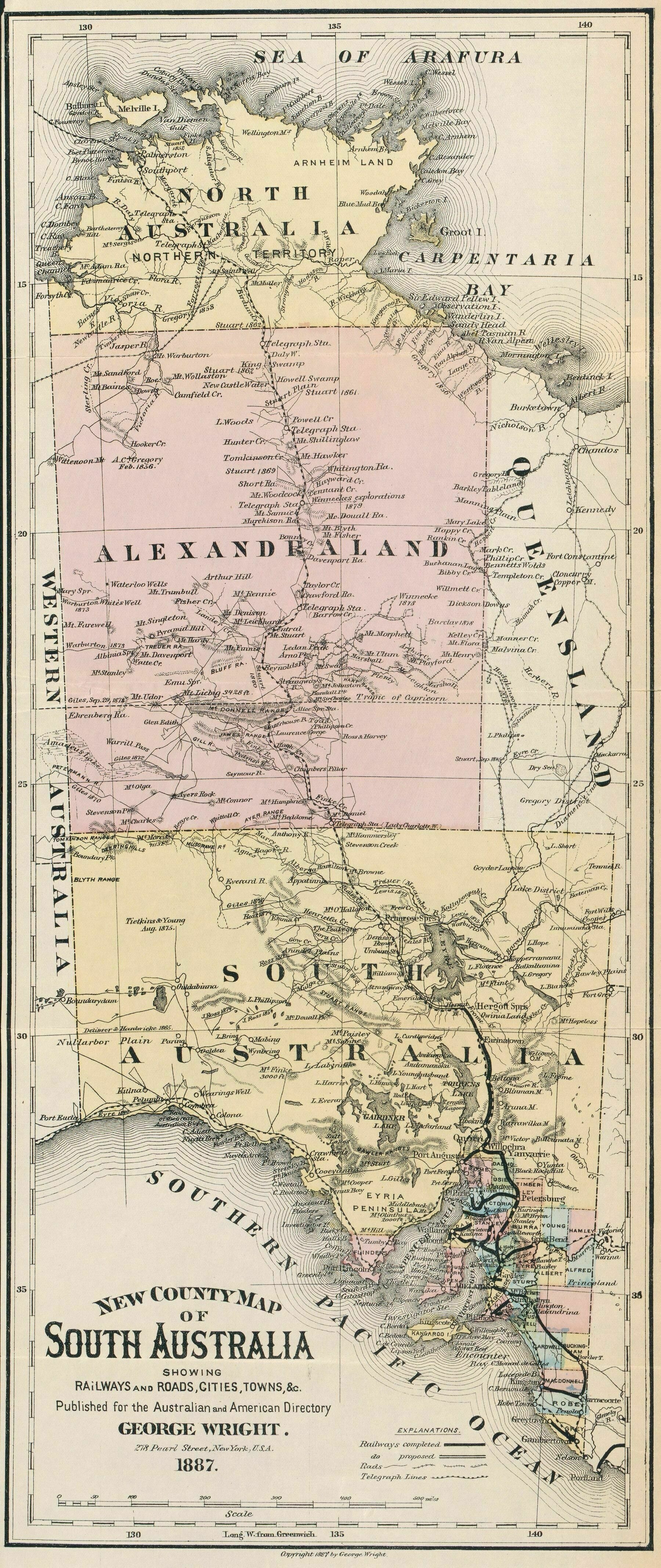
1887 county map of South Australia, showing 'North Australia' and 'Alexandraland'
1887 county map of South Australia, showing ‘North Australia’ and ‘Alexandraland’
‘More information on Alexandra Land from Wikipedia
“In 1862, John McDouall Stuart succeeded in traversing Central Australia from south to north. His expedition mapped out the route which was later followed by the Australian Overland Telegraph Line.[6] Stuart wanted the newly discovered region to be called “Alexandra Land”, in honour of the Princess of Wales.[7] The name was gazetted in 1865 applying to the portion South of 16°S of what is now the Northern Territory.[8] For some time, Northern Territory including Arnhem Land referred to the region North of that’