1819 map of insular south east Asia and Australasia with notes on European discoveries of Australia
1819 map of insular south east Asia and Australasia with notes on European discoveries of Australia. The picture shows a Maori canoe view in New Zealand, with a Kangaroo
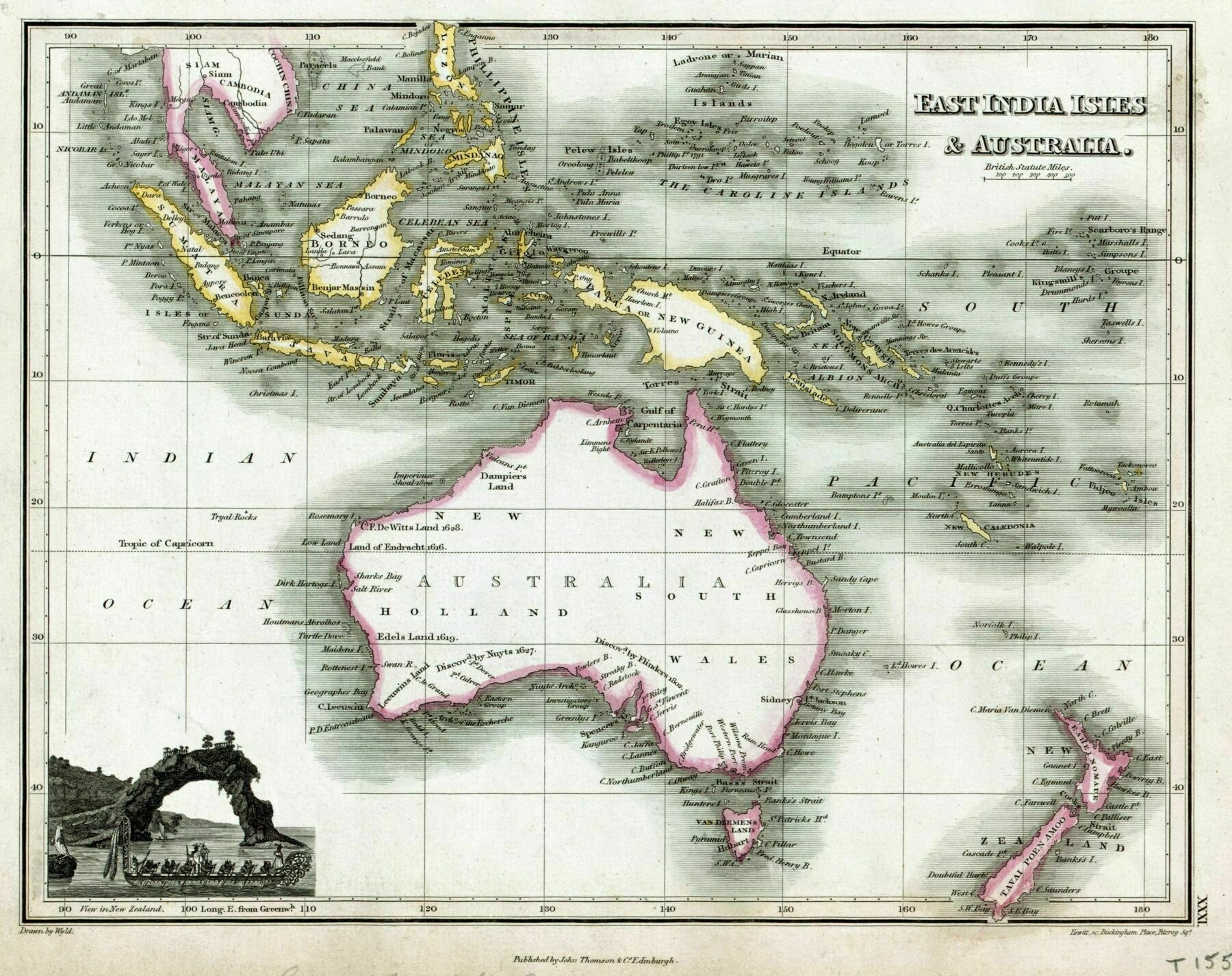
‘Off the east coast of the South Island, Banks Peninsula is shown as Banks’s Island, as drawn by Cook in 1770, but by 1819 it had been charted as a peninsula for a decade.
In the far south, Stewart Island is shown joined to the South island, again as drawn by Cook, and again by 1819 it was known for a decade that it was not thus joined but separated by Foveaux Strait’