1850 map showing the comparative length of the world's rivers and lakes
1850 map showing the comparative length of the world’s rivers and lakes. It includes a list of rivers and lakes at the bottom
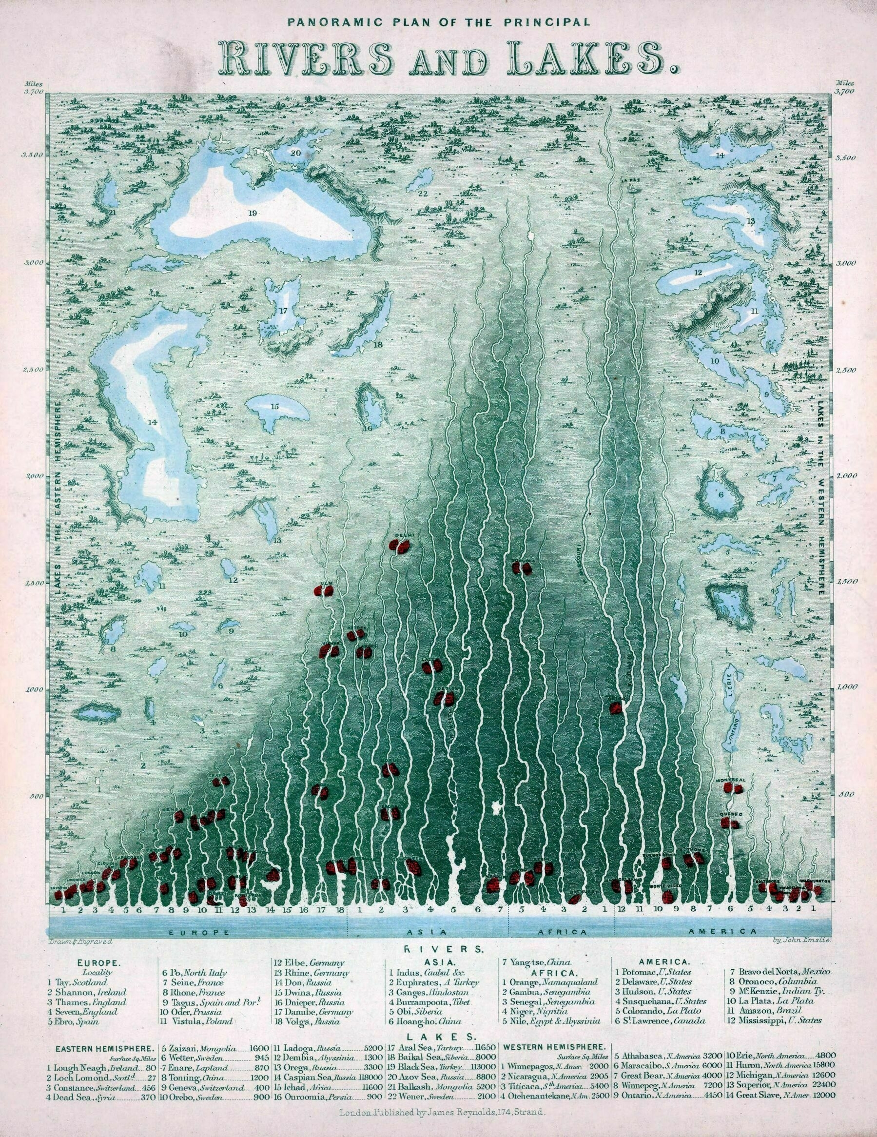
‘The main oddity with the Mississippi-Missouri system is that the Missouri is the longest of the two by a good long bit – the main reason that the Mississippi is considered the main river is really just because European mapmakers discovered it first.
However, even when the whole thing is measured from the Missouri’s headwaters – where it should be measured from, strictly speaking – it’s still shorter than the Amazon and Nile, although by a lot less than when it’s measured from the Mississippi’s headwaters.
Mainly, people tend to get excited when they realize the screwy way that the Mississippi’s length is usually reckoned, or sometimes just simply add the two rivers together. This map is old, too, and the interior of Africa wasn’t that well explored, so the precise length of the Nile probably wasn’t actually known – so by what people knew at this point, the considerably better-surveyed Missouri probably was the longest river of all.
(And that may also be a factor – the modern idea that the Mississippi is the longest river may very well still percolate from a time when that was an entirely reasonable conclusion.)’