1866 strip map showing 2600 miles of the Mississippi River from its delta to its source at Lake Itaska
1866 strip map showing 2600 miles of the Mississippi River from its delta to its source at Lake Itaska
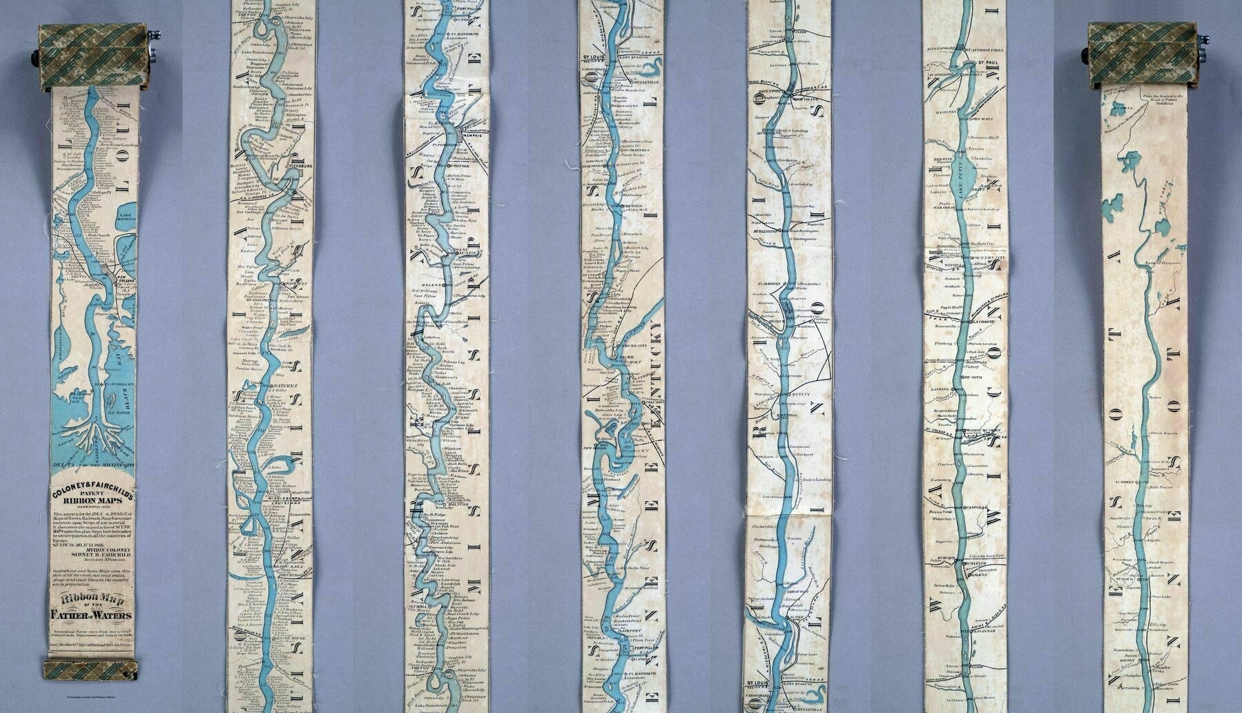
‘Wonderful map but how on earth do you take that picture?
You just take lots of individual photos and then just stitch them together’