1819 map of Asia and Oceania
1819 map of Asia and Oceania
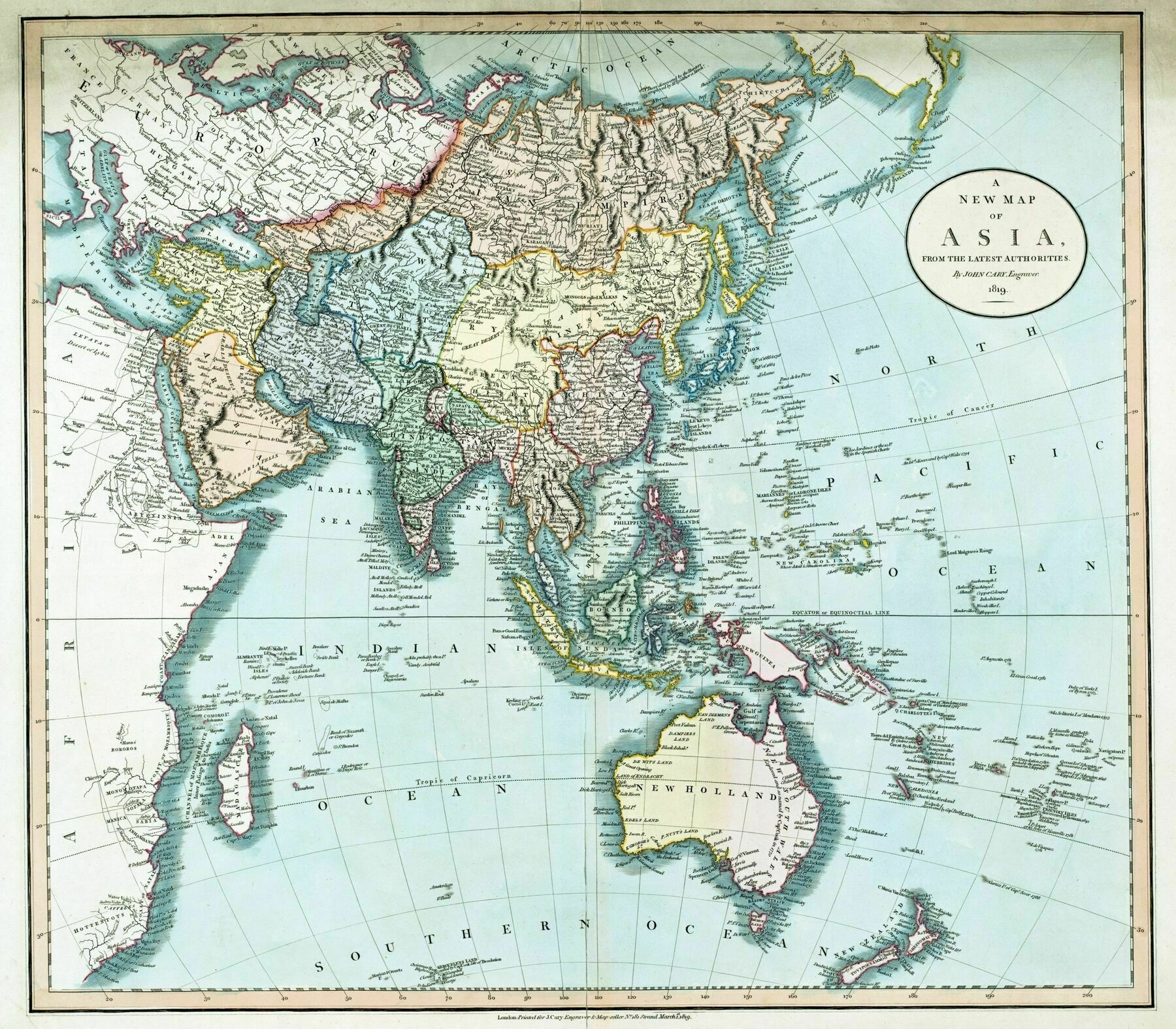
‘Interesting it’s still referred to as New Holland with ongoing British colonisation
No. Perth, in Western Australia, was not founded until 10 years after this map, by the British. Also Adelaide in South Australia, and even Melbourne in Eastern Australia.
The east coast of Australia–unmapped by the Dutch–was mapped by James Cook in 1770 and thus known as New South Wales. Sydney was established in 1788. So it’s correct that the other three coasts of Australia were still known as New Holland.
It’s a lesson in how things can be named but not recognised as belonging to a particular power until they are colonised, since actual use of the land supposes an entitlement to it.
The Dutch were great explorers and commercial agents but since they found no commercial use in Australia they didn’t have any need to assert a claim to their discoveries.
Australia is a fascinating lesson in this aspect. The same applies to New Zealand which the Dutch discovered 127 years before Cook fully mapped it on his way to Australia. If the Dutch had behaved differently they would have exerted more influence’