1857 map of Kansas
1857 map of Kansas
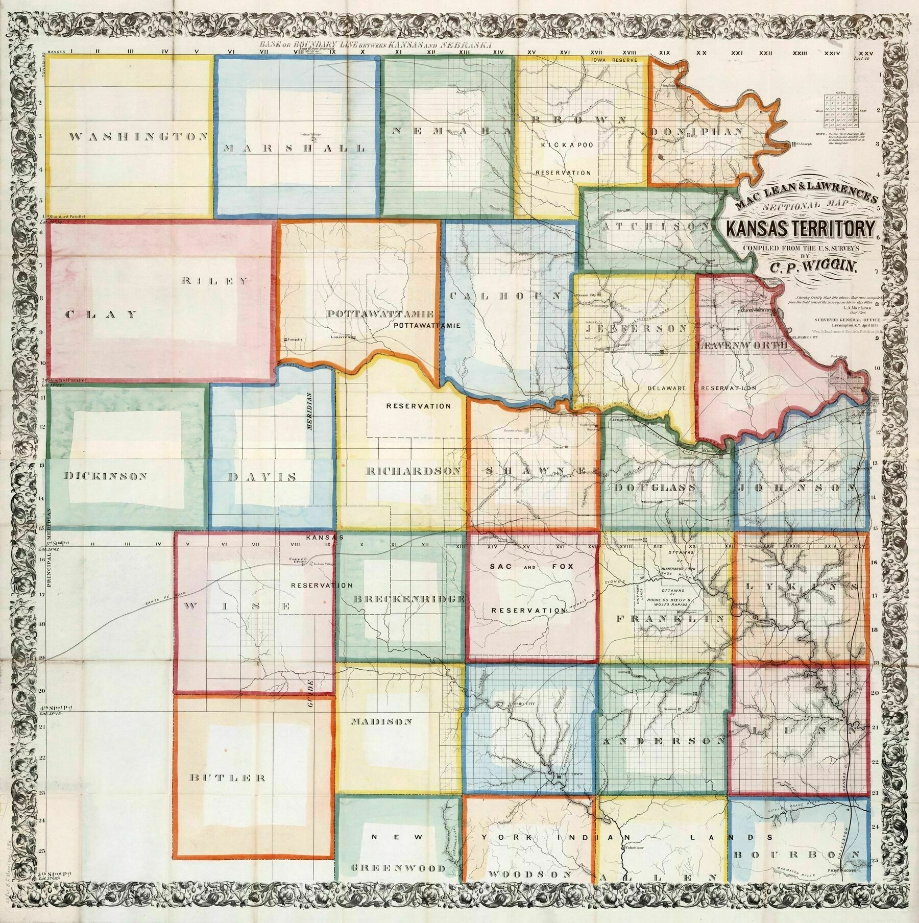
‘Squares inside of a square
It’s almost like farming works best in a square, to maximize effective space and construction of roads and fences
You’ve obviously not been in the eastern part of Kansas: it includes the Flint Hills, and the Osage cuesta ecoregion, especially the northern sections, are anything but flat. Triangles, circles, and other geometric shapes are harder to construct without there being leftover space, and let’s face it: land was money even back then. The decision to lay out the grids were simply a convenience to the surveying technologies of the day that made it much easier to lay out straight lines rather than follow the contours of the land, which probably would have made more sense as far as long term land management practices….’