1790s map of the Pacific and surrounding area
1790s map of the Pacific and surrounding area
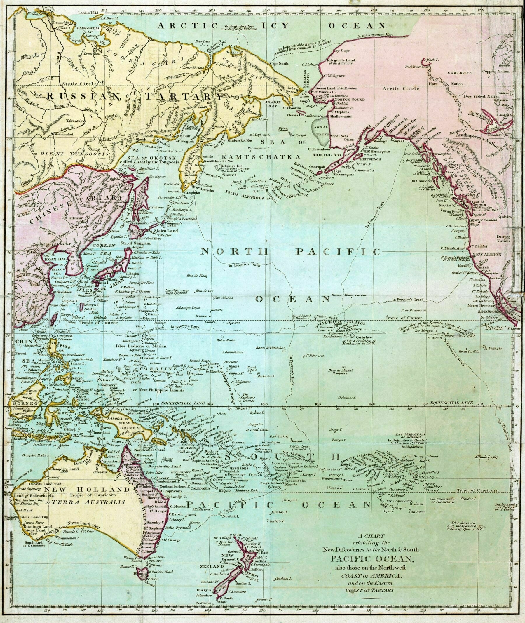
‘Random things that catch my eye:
- For whatever reason (seasonal ice?) the Russian Arctic was charted before the Canadian Arctic. That part of the Arctic didn’t get fully clarified for another century, requiring a lot of expeditions, many of them never making it out of the ice. You might have heard about the Franklin Expedition, there were many like that. A lot of great survival stories.
- To me, the Pacific in this map is surprisingly thoroughly charted, so soon after Captain Cook discovered many of these places.
- Notice the discussion of the phantom islands east of Hawaii that “do not exist”, and must be the same as Hawaii. It’s interesting that the islands are on the map anyways.
- Okinawa is enormous here. Apparently not just on this map.
- Apparently Hokkaido was then known as Jeso. It was formally incorporated into Japan shortly after this time, in response to the encroachment of Russians. The Russians also gobbled up the Northern and Eastern parts of Manchuria after this time’