Japanese pictorial map of Australia from 1942
Japanese pictorial map of Australia from 1942
‘It’s looks interesting, it would be great to see a translation
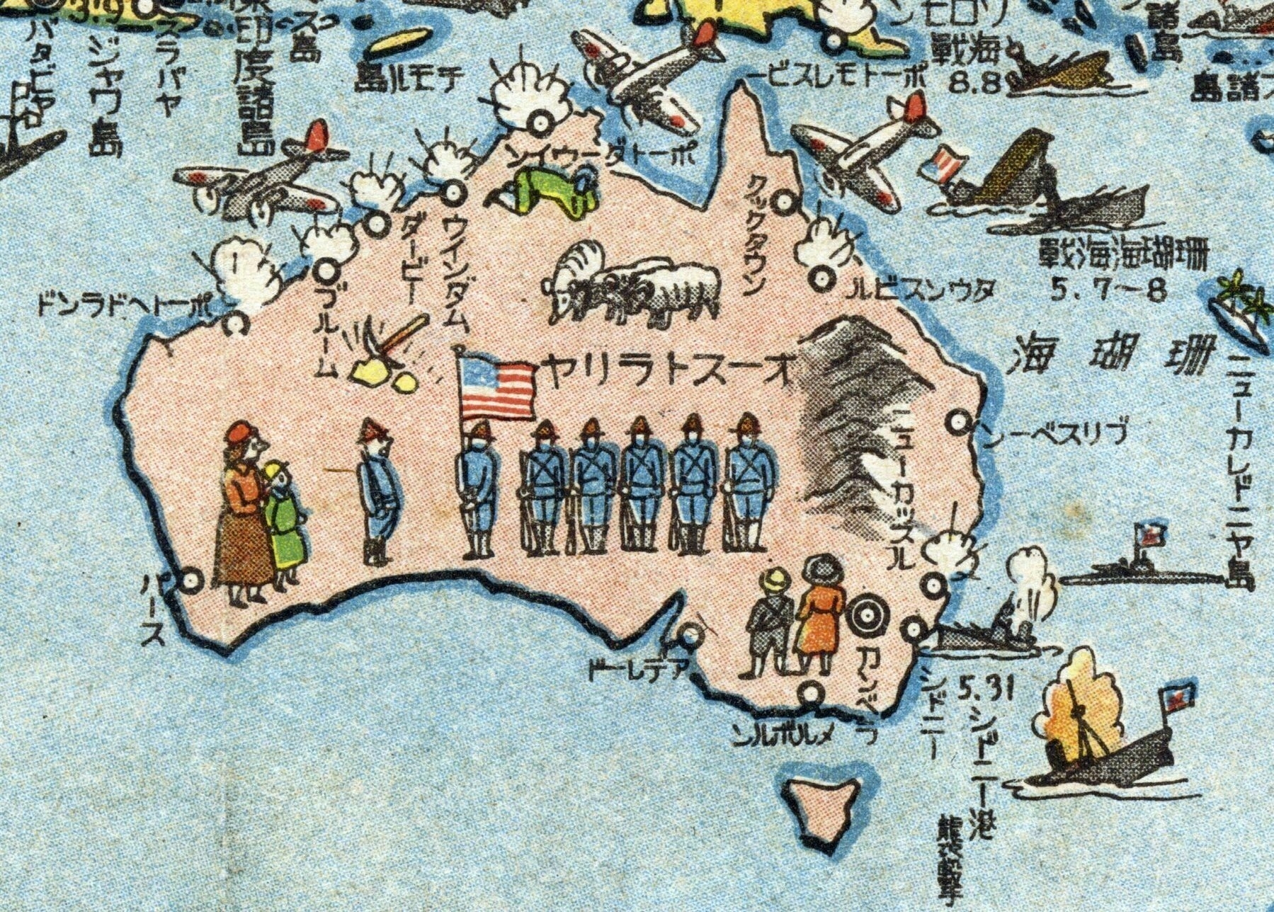
Here goes (a bit long, but for those who are interested), clockwise on the mainland from Perth:
パース (written top to bottom) - Perth
ポートへドランド (written right to left) - Port Hedland
ブルーム (T to B) - Broome
ダービー (T to B) - Derby
ウィンダム (T to B) - Wyndham
ポートダーウィン (R to L) - Port Darwin
クックタウン (T to B) - Cooktown
タウンスビル (R to L) - Townsville
ブリスベーン (R to L) - Brisbane
ニューカッスル (T to B) - Newcastle
シドニー (T to B) - Sydney
カンベラ (T to B) - Canberra
メルボルン (R to L) - Melbourne
アデレード (R to L) - Adelaide
…and in the middle, オーストラリヤ (R to L) - Australia
Now the ones outside Australia and along the top and right side of the map, dates are written by the month first:
バタビヤ (T to B) - Batavia (capital of the Dutch West Indies, present-day Jakarta)
ジャワ島 (T to B) - Java island
スラバヤ (T to B) - Surabaya
蘭領東印度諸島 (T to B) - Dutch West Indies (cut-off but the last 5 characters are readable)
チモル島 (R to L) - Timor island
ポートモレスビー (R to L) - Port Moresby
ソロモン海戦 8.8 (R to L) - Battle of the Solomon Sea (also known as Battle of Savo Island), August 8th
珊瑚海海戦 5.7~8 (R to L) - Battle of the Coral Sea, May 7th to 8th
珊瑚海 (R to L) - Coral Sea
ニューカレドニヤ島 (T to B) - New Caledonia island
シドニー港襲撃 5.31 (T to B) - Attack on Sydney Harbour, May 31st’