Australian Water Catchments
Australian Water Catchments
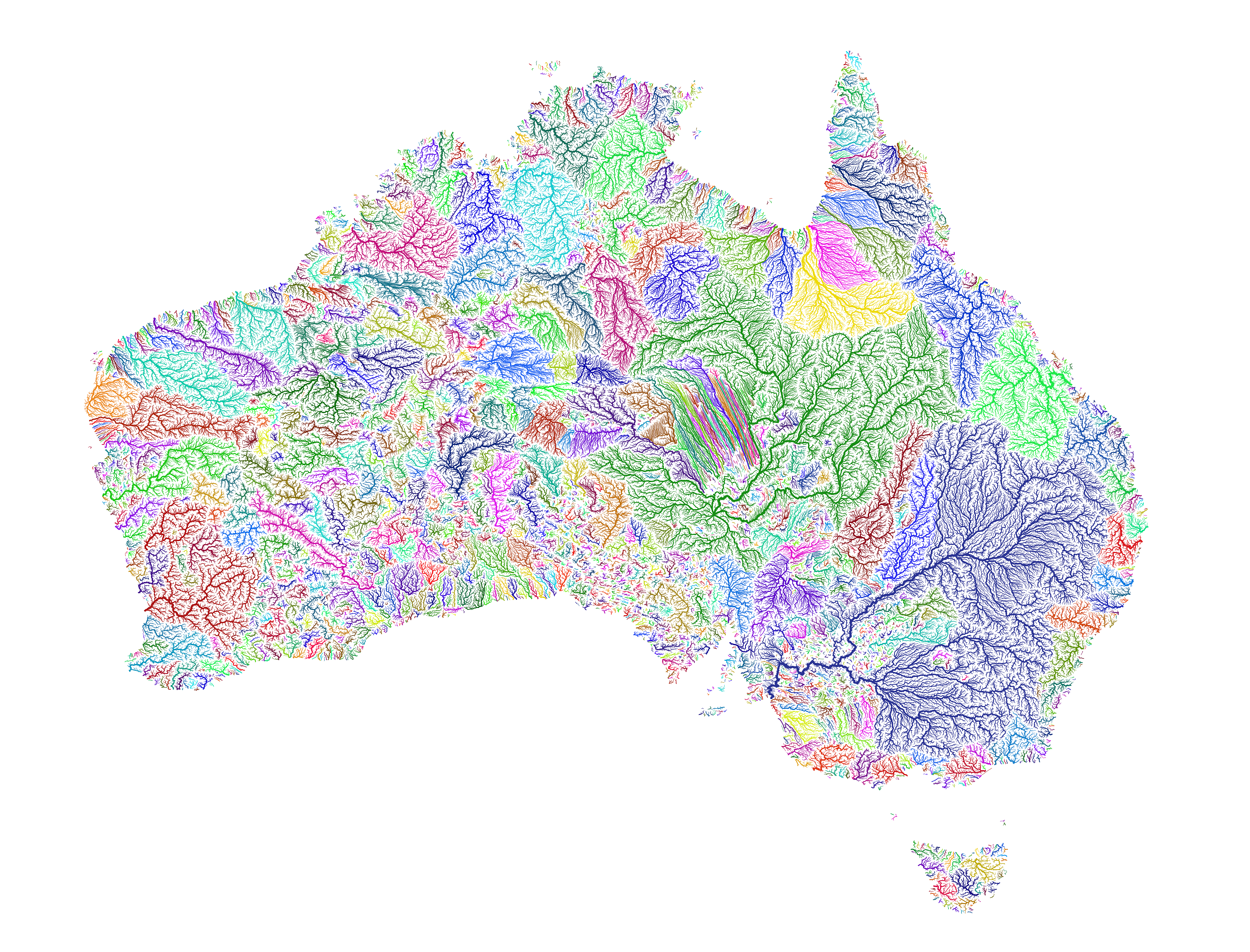
“anyone know what the strange grouping of straight lines in the middle is?
It’s the parallel dunes of the Simpson Desert. The map is procedurally generated by simulating where water would travel if there were enough to flow on the surface. Assuming the flow wouldn’t breach the dunes, it forces drainage into parallel lines between the dunes. In reality though, the fact that it basically never rains there, or at least in any significant enough amounts to create run-off means that these courses are more hypothetical than anything.”