1812 map of Australia
1812 map of Australia - by Conrad Malte-Brun and Pierre Lapie
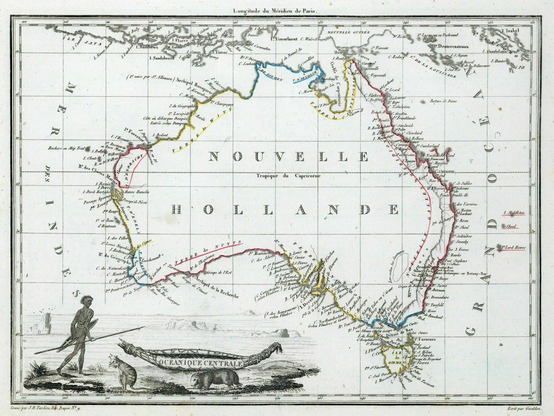
‘Quality map considering the tech they had back then. Imagine sailing round that bad boy and plotting it so accurately with triangulation, a compass some calipers and a sextant. Hardcore dudes.’