1846 map of the United States and Mexico
1846 map of the United States and Mexico - by John Haven
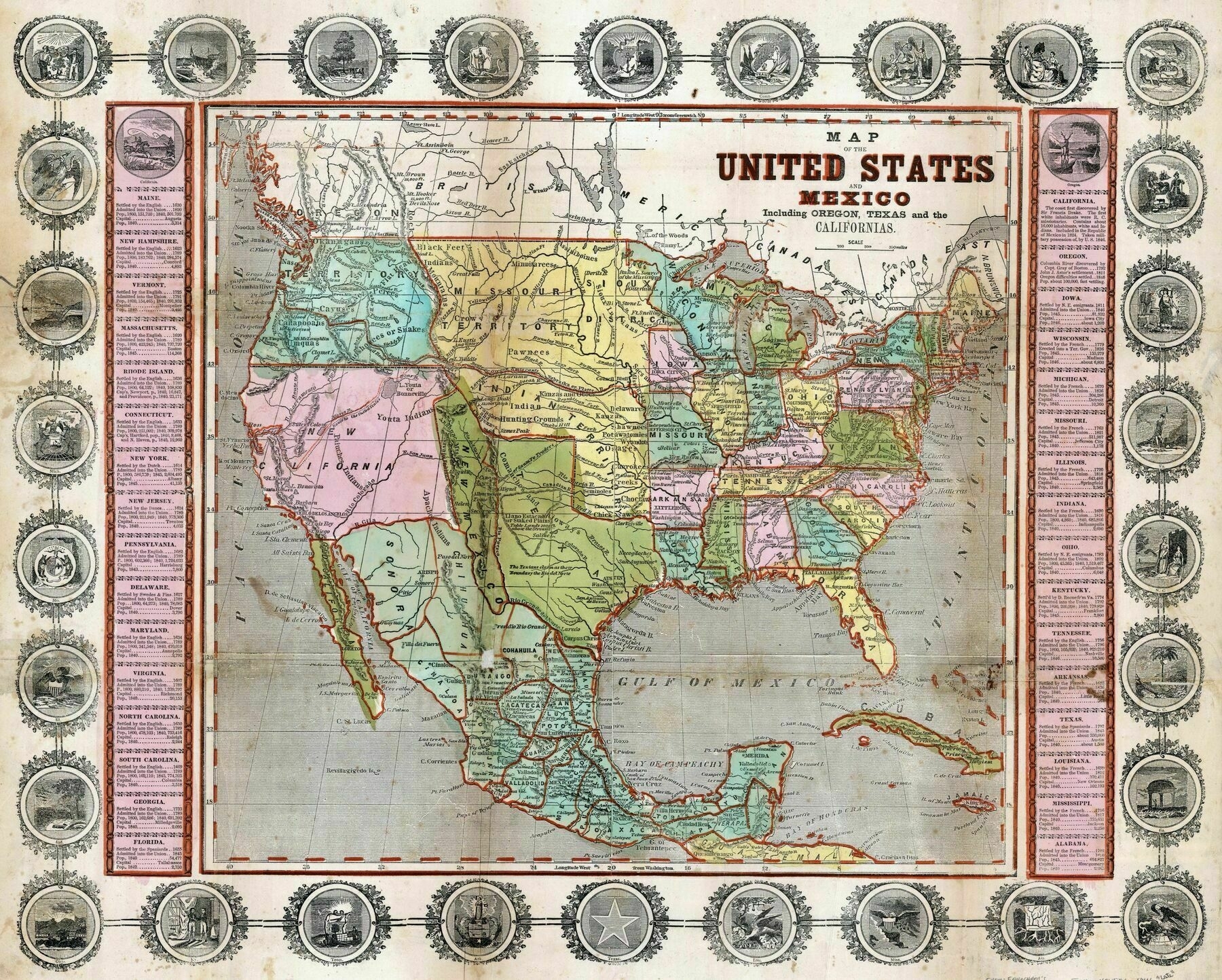
‘Noticed that Georgia, Michigan, and Louisiana have different capitals than today.
Iowa and Texas are both admitted to the union near the publishing date of this map, but they have different borders.
Confusing that there is a state named Missouri and also a Missouri territory.’