Japanese pictorial map of Australia from 1924
Japanese pictorial map of Australia from 1924
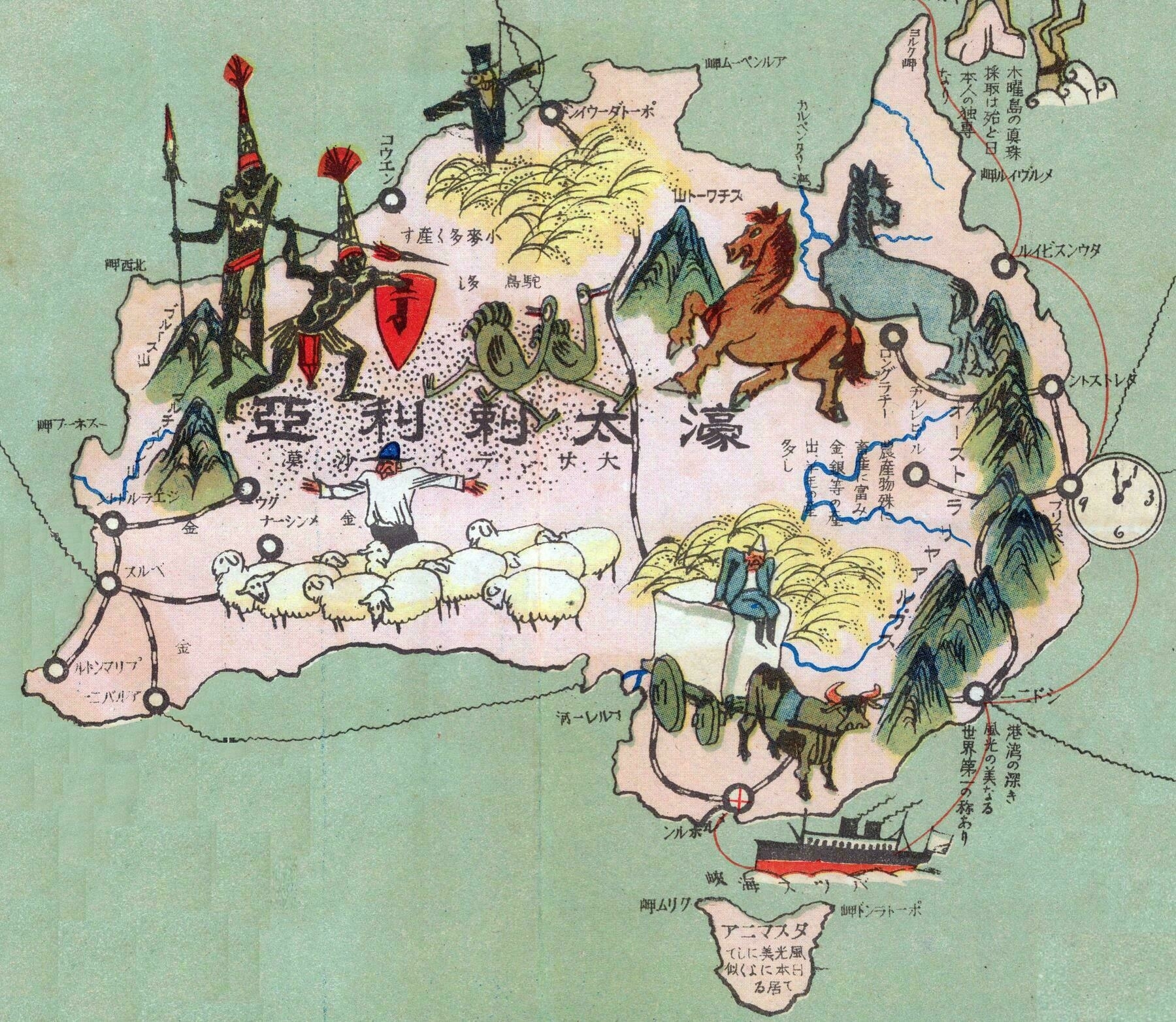
‘Quirks I have noticed as someone who knows a bit of Japanese.
Perth is written as パルス (Parusu) we here as now it is known as パース (Paasu).
Fremantle is marked as a completely separate city from Perth about 200km away from its actual location. Marked roughly where Busselton is. Also Fremantle has since been renamed from プリマントル (Purimantoru) to フリーマントル (Furiimantoru).
The mountain range down the entire east coast is called the “Australian Alps”.
The map seems to heavily focus on coastal cities with a port. Mentioning Gladstone QLD instead of the much larger Rockhampton just up the road is an example.
I would love to know why Longreach and Charleville QLD both got a mention. Was there an Australian military installation there at some point?
I can’t make sense of the mountains around the central or west coast. The mountain in the NT is labelled as Mount Stuart/Stewart, which is likely Central Mount Stuart. But that’s an 800m high hill, so why single it out?’