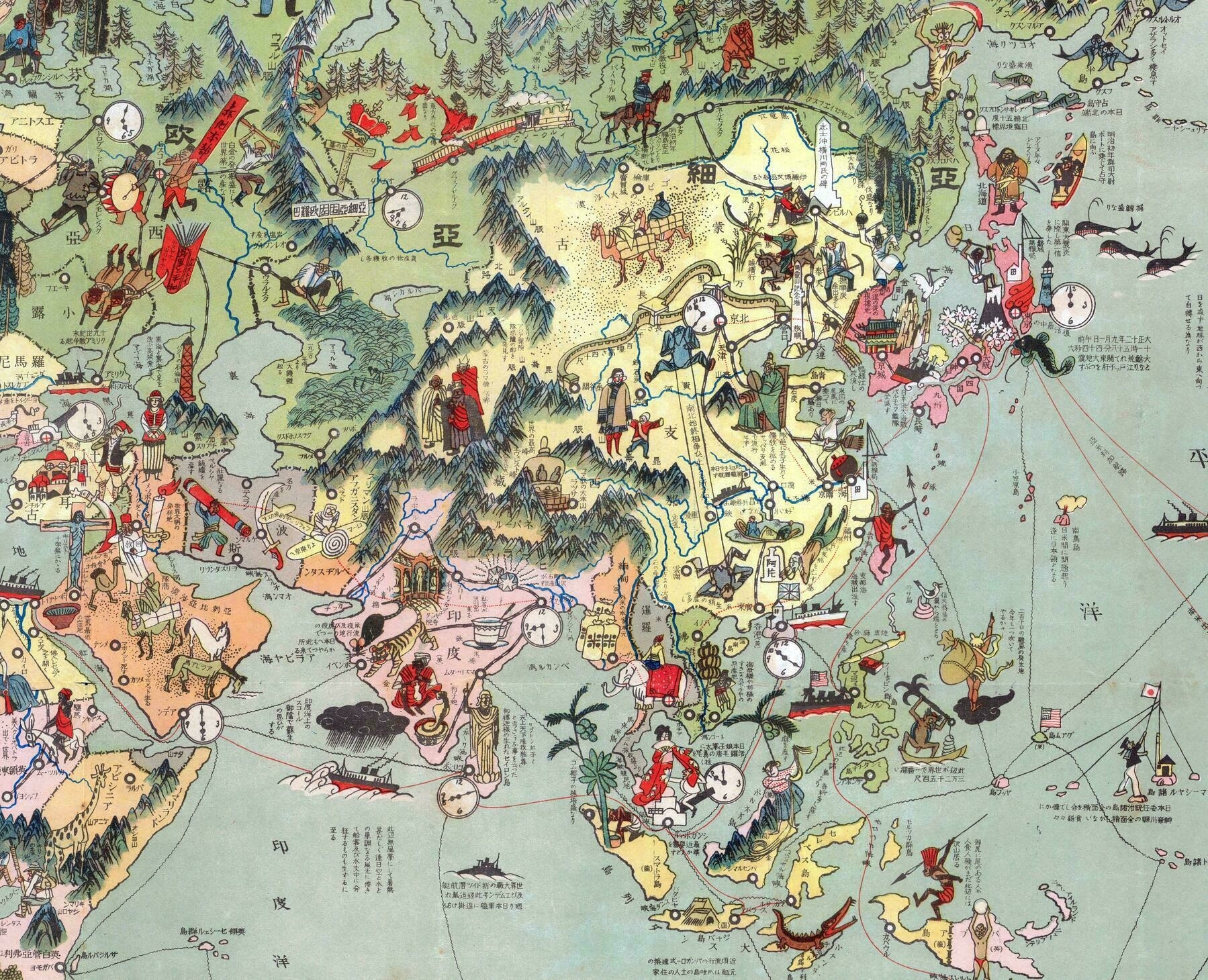
Japanese pictorial map of Asia from 1924
Japanese pictorial map of Asia from 1924

‘I really love these Japanese illustrated maps from the 1920s and 1930s. They are aways so colorful, and its interesting to see what little details the illustrators put on the map. Some things that jump out to me here are:
- The sinking Russian ship between Japan and Korea to mark the location of the 1904 Battle of Tsushima.
- The Japanese sailor raising a flag amongst the islands in the Central Pacific; former German colonies given to Japan after World War I (known as the “Mandates”.)
- A large gun turret representing the British naval base at Singapore.
- A Bolshevik spreading literature along the Trans-Siberian Railway.
- A cross with a crown on it at Yekaterinburg, where Czar Nicholas and his family were executed.’
