Population density map of the United States in 1790 (published 1903)
Population density map of the United States in 1790 (published 1903)
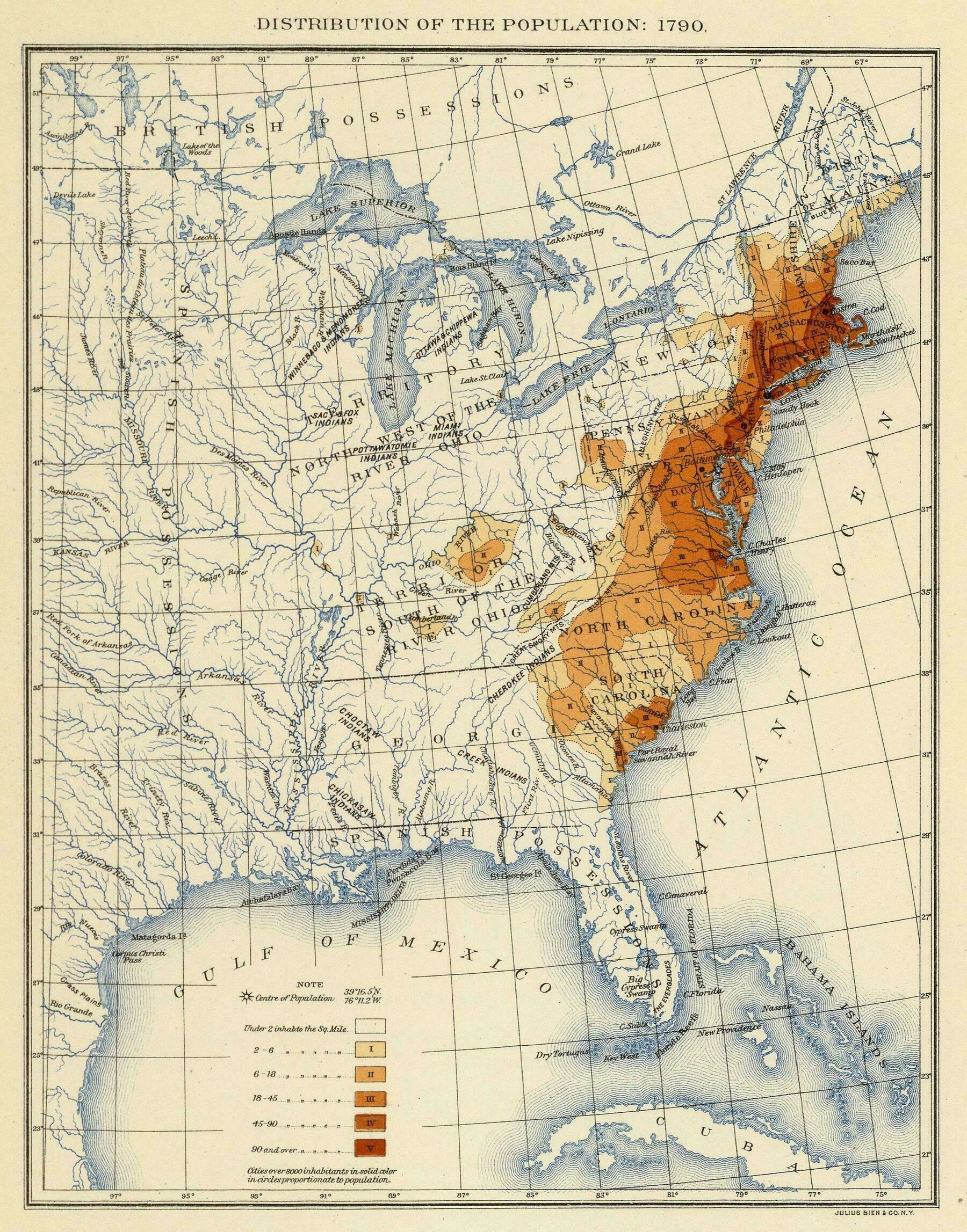
‘White is the populated parts, but not by them
I’m sure I already know the answer to this, but I wonder if the map makers gave any consideration to areas with larger populations that they knew about, and just decided that the the “under 2 per sq mi” still applied in those cases.
Again, I’m thinking I know the answer already. Being generous maybe in “the population” at the top, the means our’