Districts of the Australian Capital Territory (1954)
Districts of the Australian Capital Territory (1954)
‘I like the straight line in the north west of the ACT where they ran out of time and gave up on surveying’
Districts of the Australian Capital Territory (1954)
‘I like the straight line in the north west of the ACT where they ran out of time and gave up on surveying’
The 419 biogeographical subregions of Australia
‘This is cool. Now I know exactly where the weather man is referring to’
Central Europe during the time of the Hohenstaufen Emperors (1250)
‘Wow, I thought Italy was fragmented at that time, but I didn’t know that Western Germany was even more! I wonder whether some Northern or Central Italian cities which were still fairly independent in XIII century, such as Bologna, should have been shown as separated entities from the territory around. In any case, very interesting map. Greetings from Kirchenstaat!’
Borders of the District of Port Phillip [Victoria] in 1840
‘Gotta say, I’m not a fan of thictoria … Hi not a fan of thictoria, I’m Dad👨’
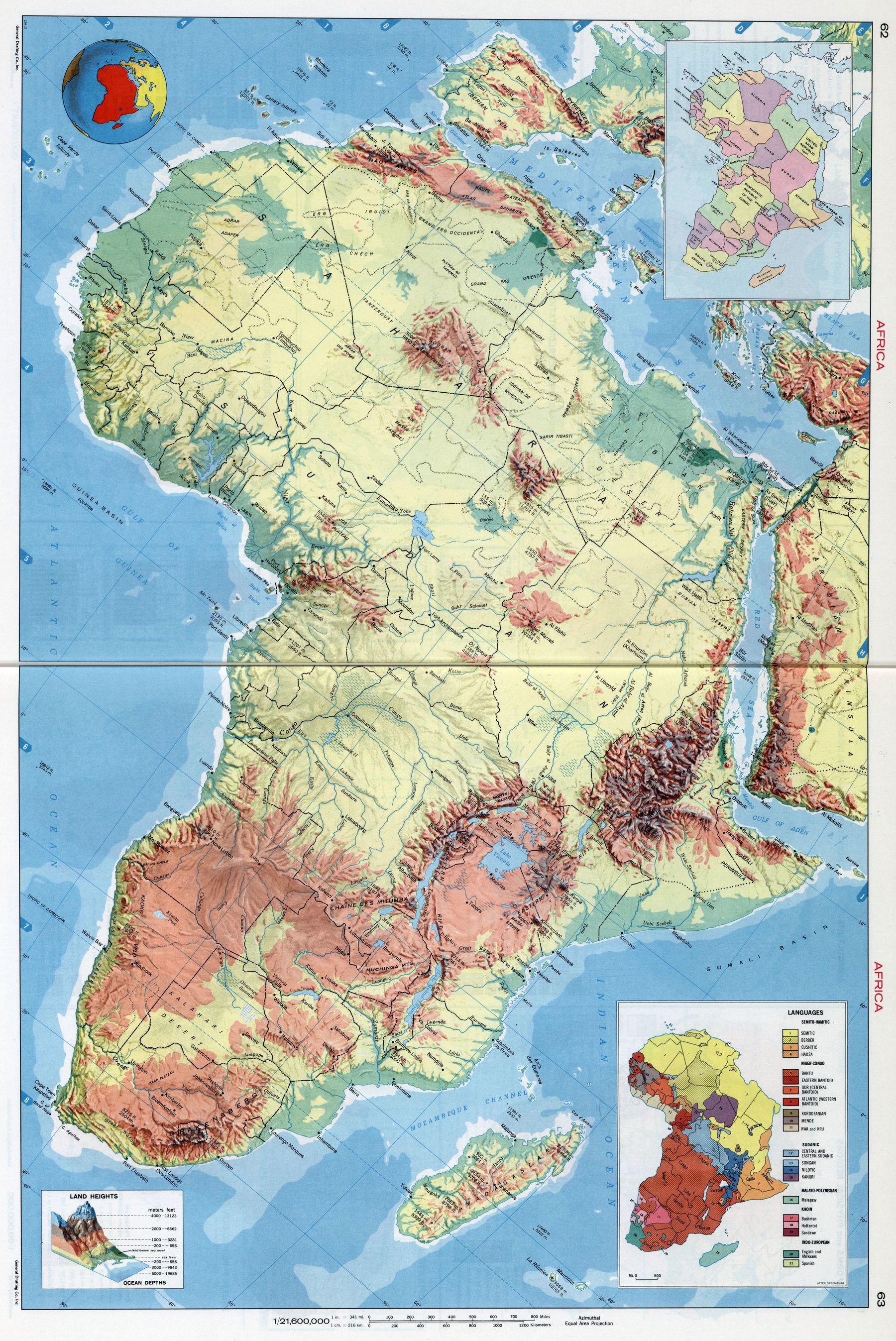
1968 shaded relief map of Africa (with political and language map insets)
‘I have never seen this alignment before!’–tonwood
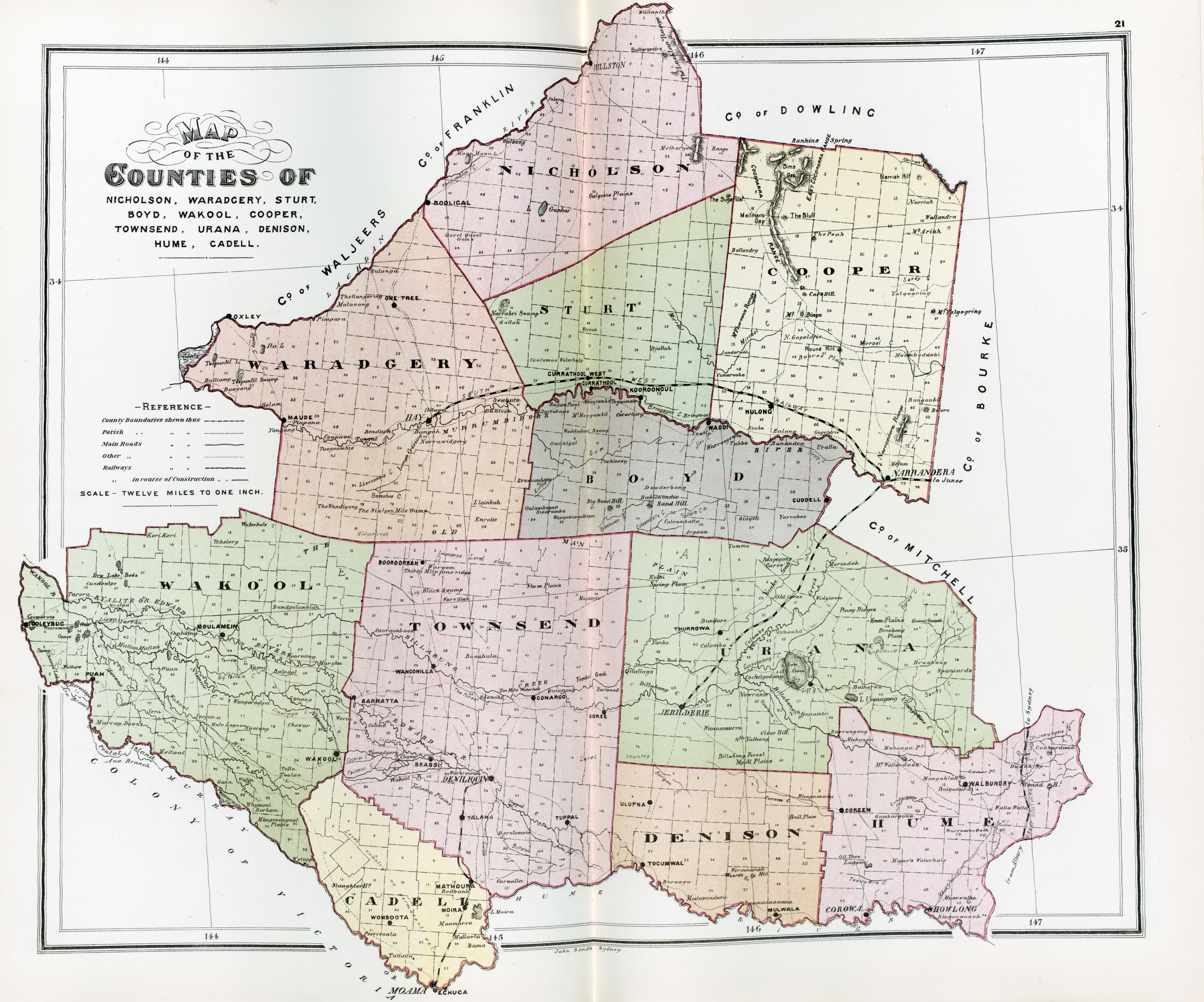
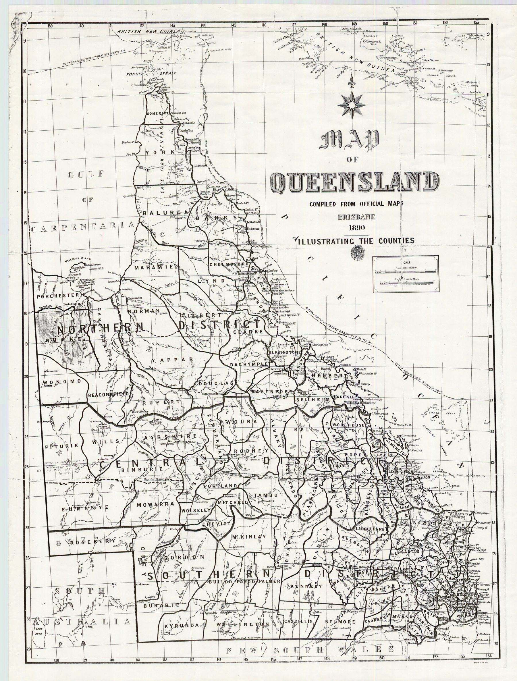
The 322 counties of Queensland, pre-2015
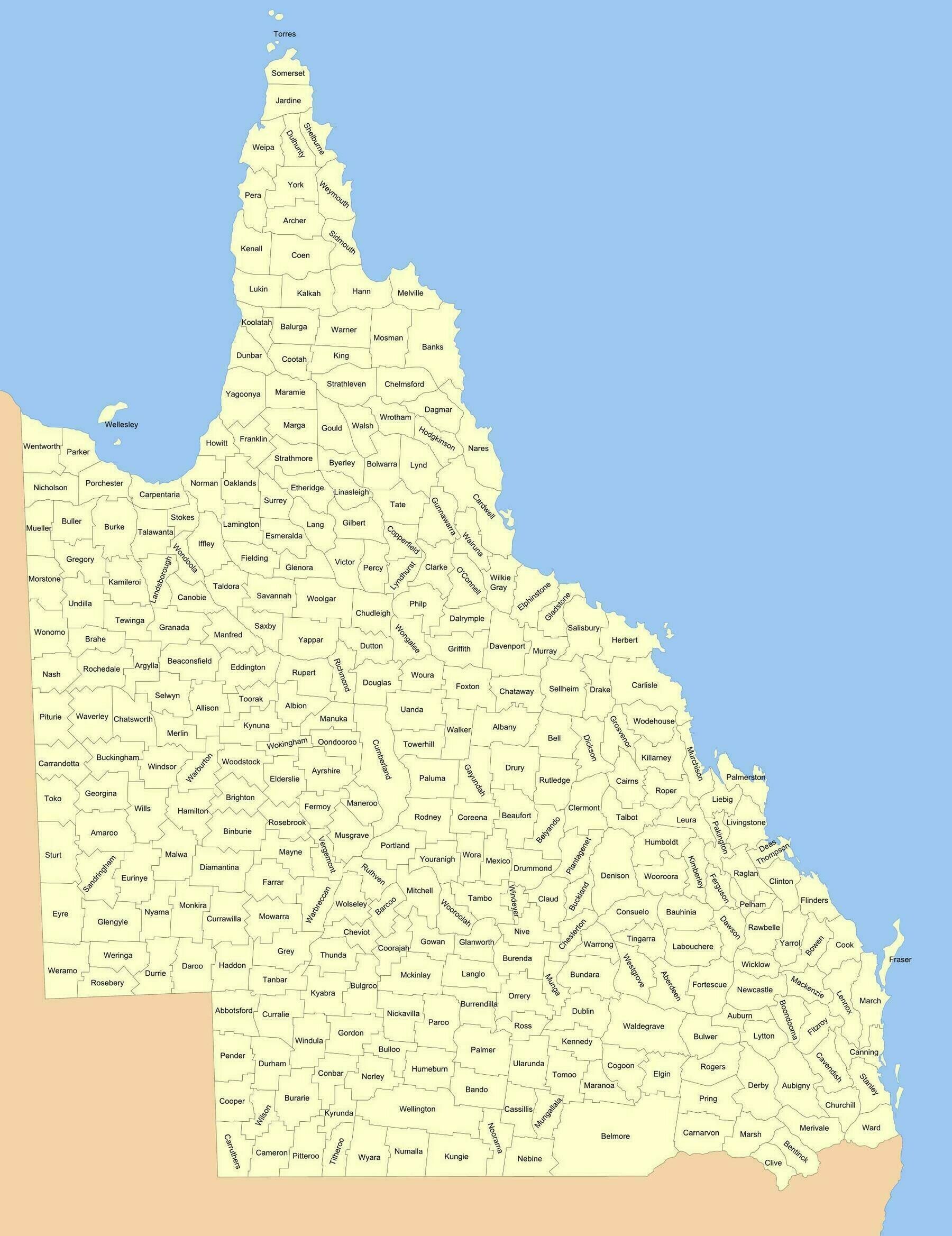
‘Some of these counties would have more letters in their name than people living in their area’–Kanos812
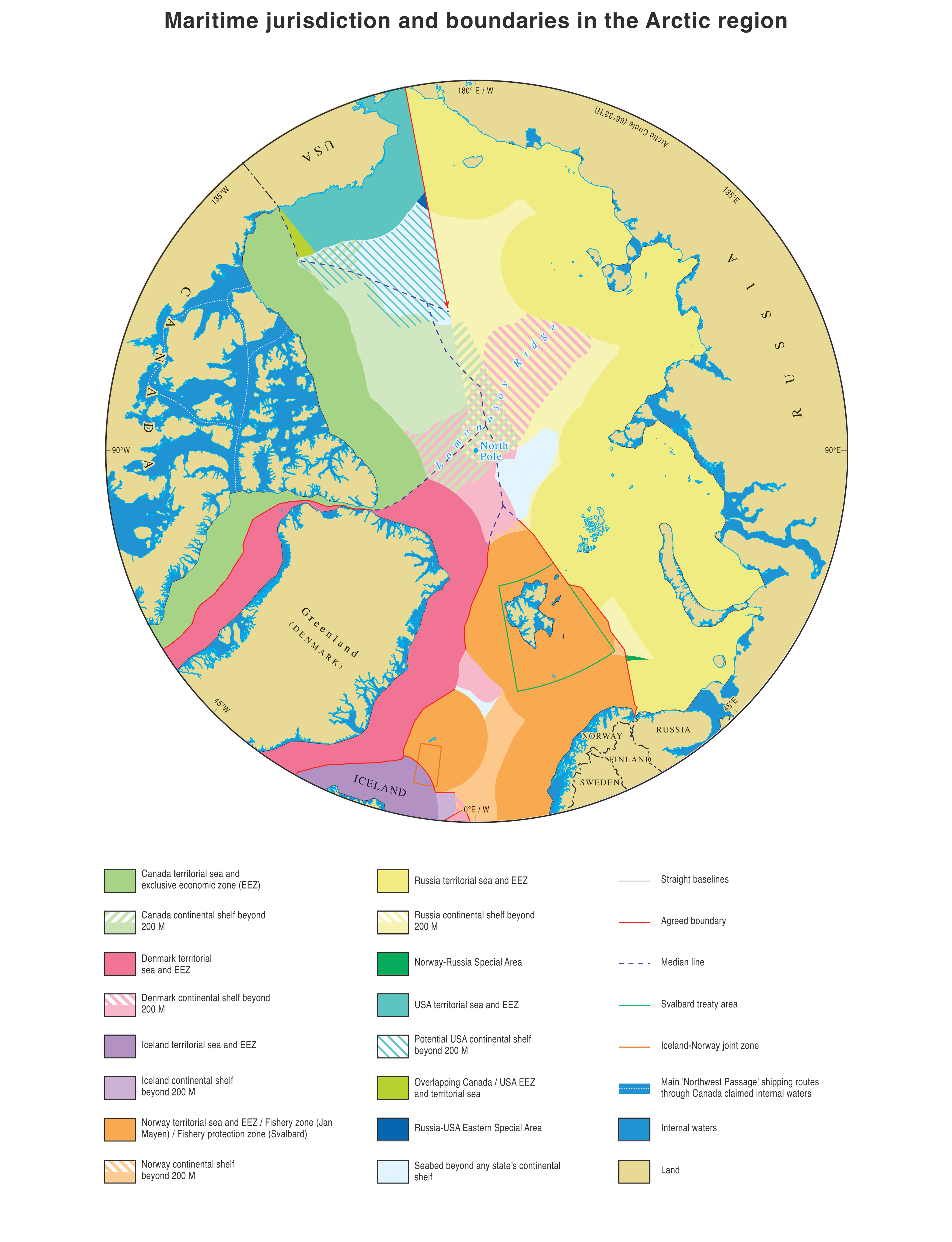
Australia’s Maritime Jurisdiction around Macquarie Island
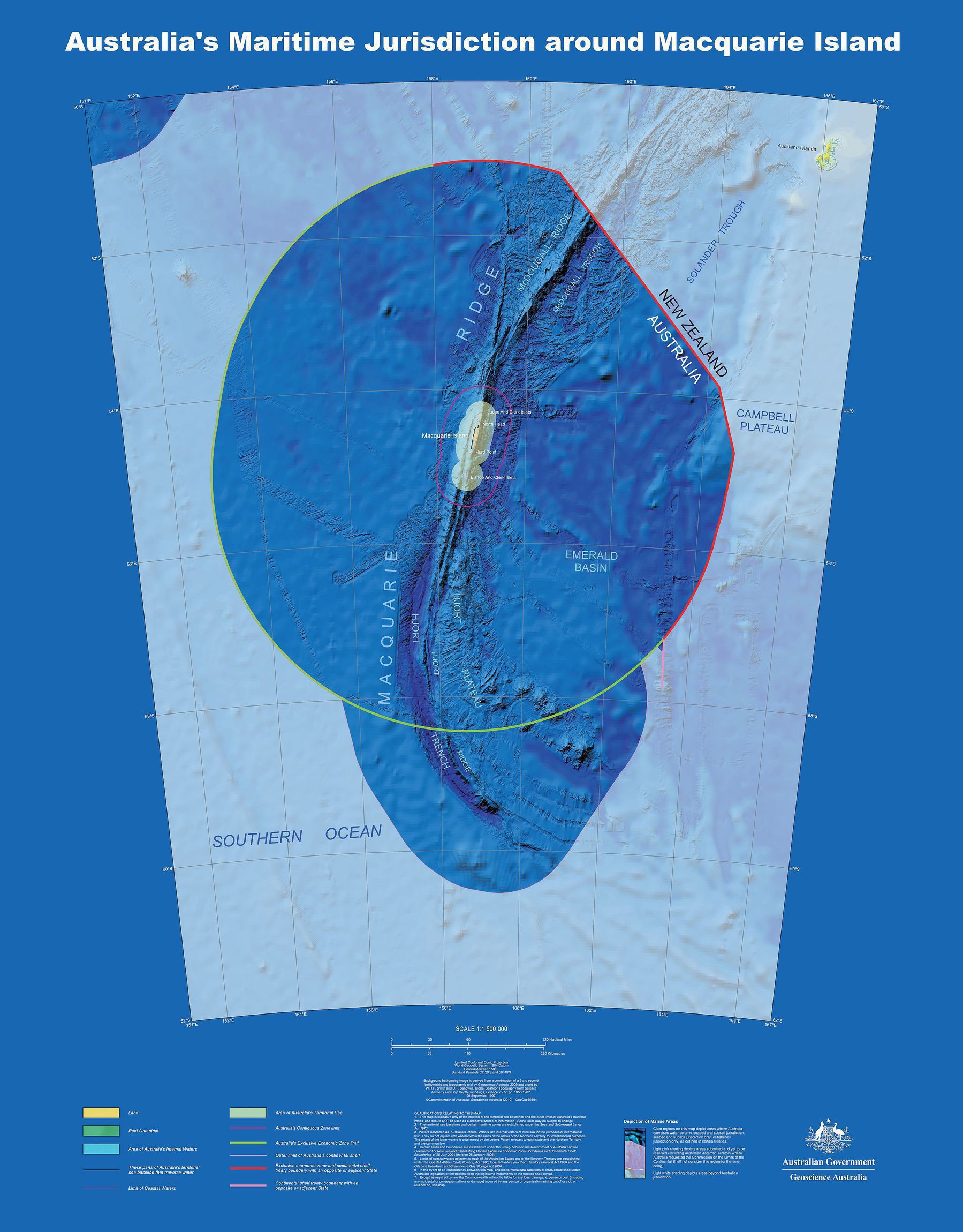
‘This sent me on a 30 minute Wikipedia journey. I ended up at Charles the third of Spain. Interesting bloke btw’–1stPostISwear
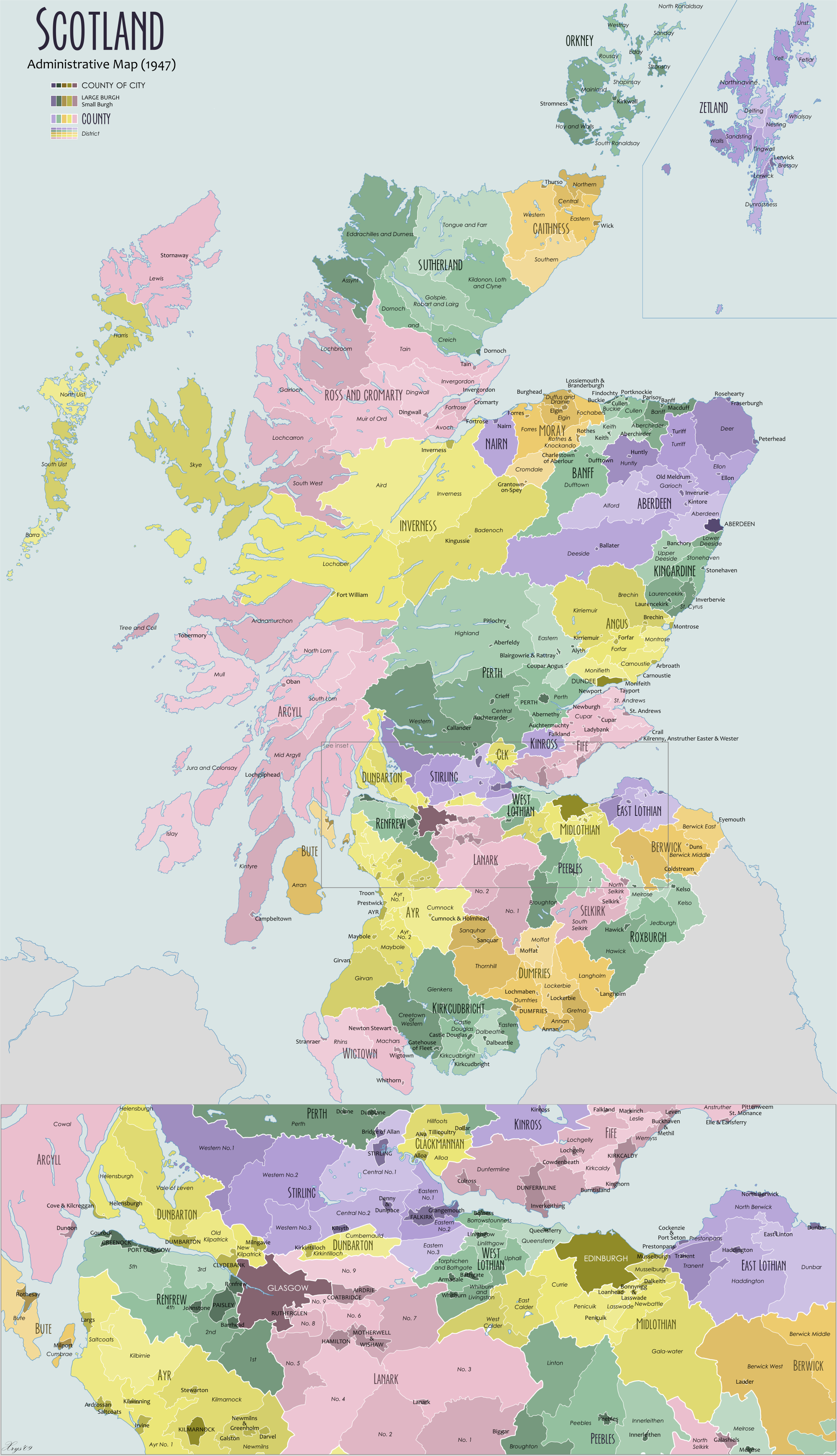
Boundaries of the A.C.T. - 1946
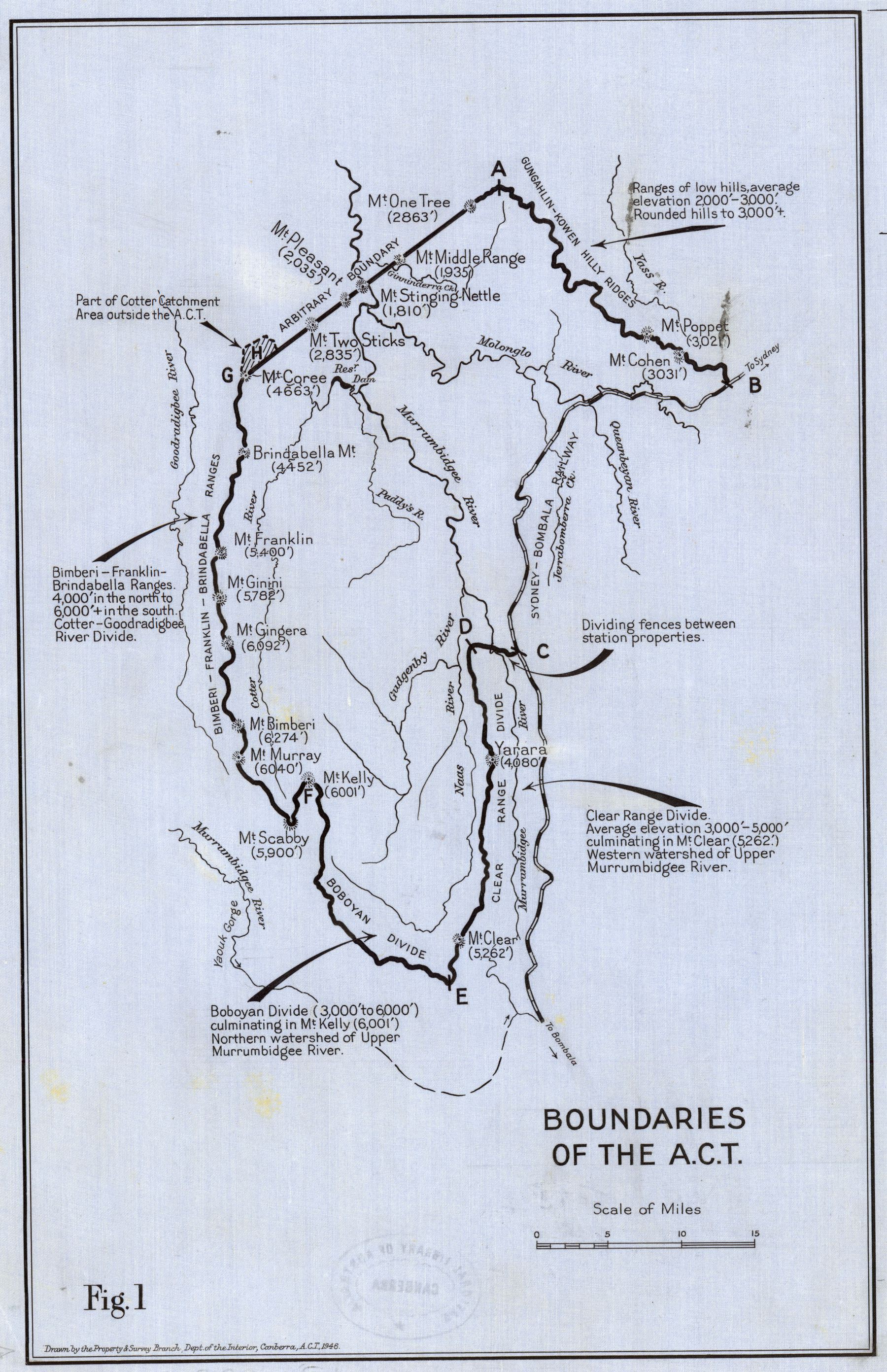
‘The borders were generally defined by the watersheds of rivers in the region so the ACT had a secure water supply. 119 years later, that decision seems sensible, and there aren’t any problems with people commuting across the border’–Appropriate_Volume
New Borders in India from August 2019 - dividing the state of Jammu and Kashmir into two union territories to be called Union Territory of Jammu and Kashmir and Union Territory of Ladakh
States and Territories in the United States of America 1824-1828
“Ah, the dreaded Toledo Strip…”–rezheisenberg2
Congressional Districts of the 116th Congress of the United States, January 2019-2021
[8900 x 6600]
Historical diagrams showing the subdivision of Australia (published 1904)
[5951 x 4269]
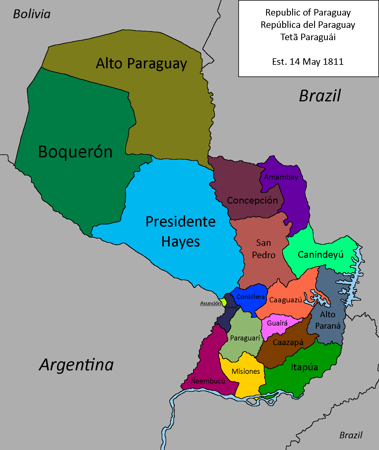
“iirc Rutherford B. Hayes mediated the end of a war they had with Bolivia”–ScorpionX-123
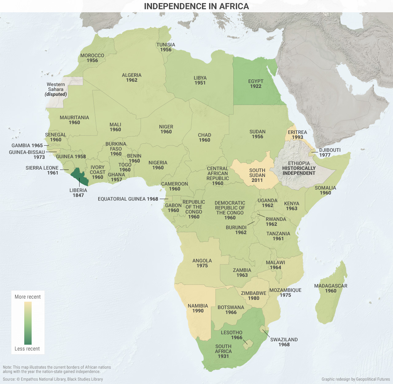
“Crazy to think our Grandparents growing up during the world wars saw a completely different map of Africa than what we see today”– ThisBiatchEmpty
