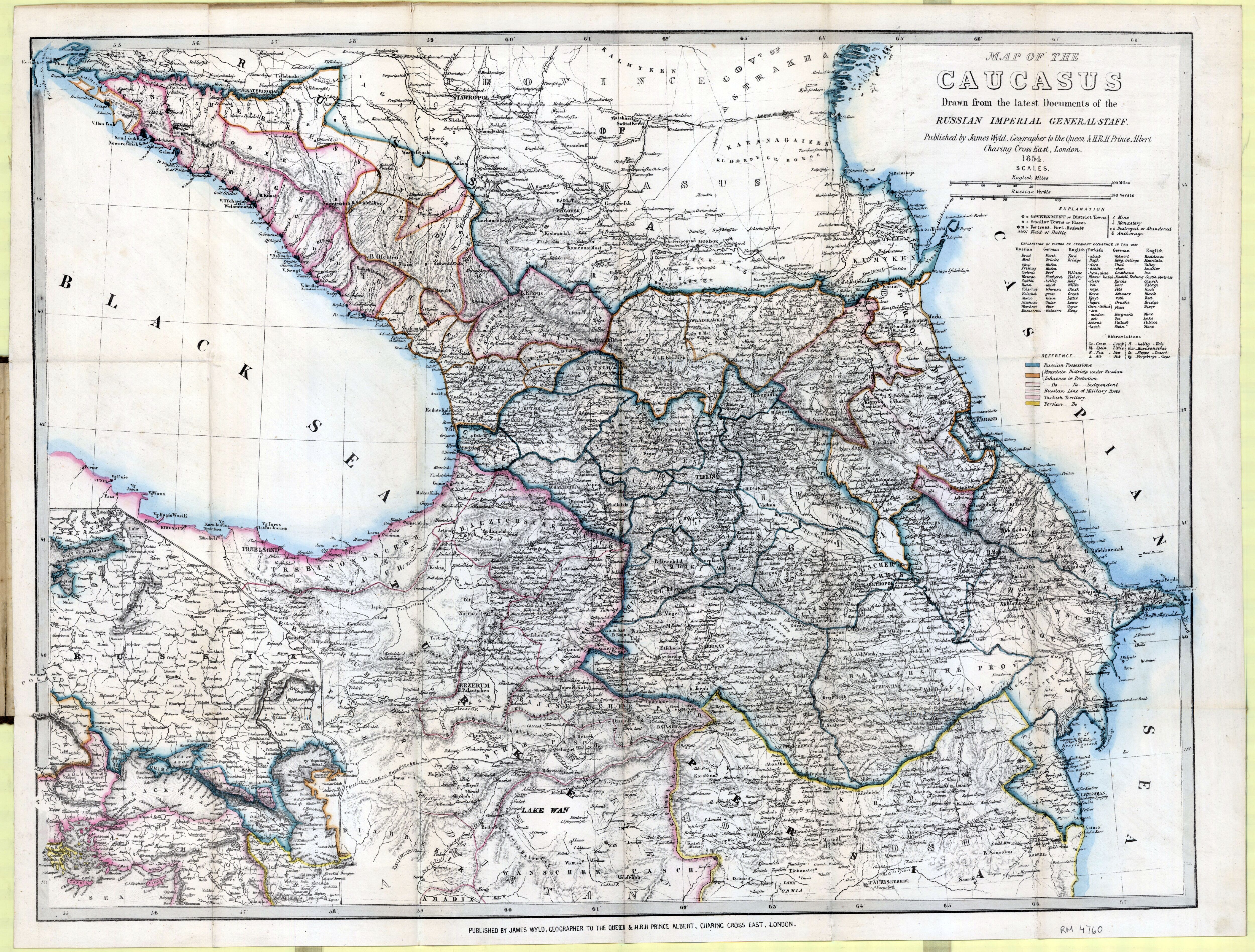
1723 map of the Caucasus, Caspian and surrounding region - by Guillaume de L'Isle
1723 map of the Caucasus, Caspian and surrounding region - by Guillaume de L’Isle
1723 map of the Caucasus, Caspian and surrounding region - by Guillaume de L’Isle
1878 ethnographic map of European Russia - by Aleksandr Fyodorovich Rittikh
‘I recognize Volga Germans, Bessarabia Germans and Crimean Germans
Germans were a significant minority in almost all parts of Eastern Europe’
1939 map of Russia in Europe and its border states
‘This is super interesting. Thanks for posting!’
Ethno-Linguistic Composition of the Caucasus, 1990
‘This is a really detailed and interesting map thank you :)‘–HiroYeeeto
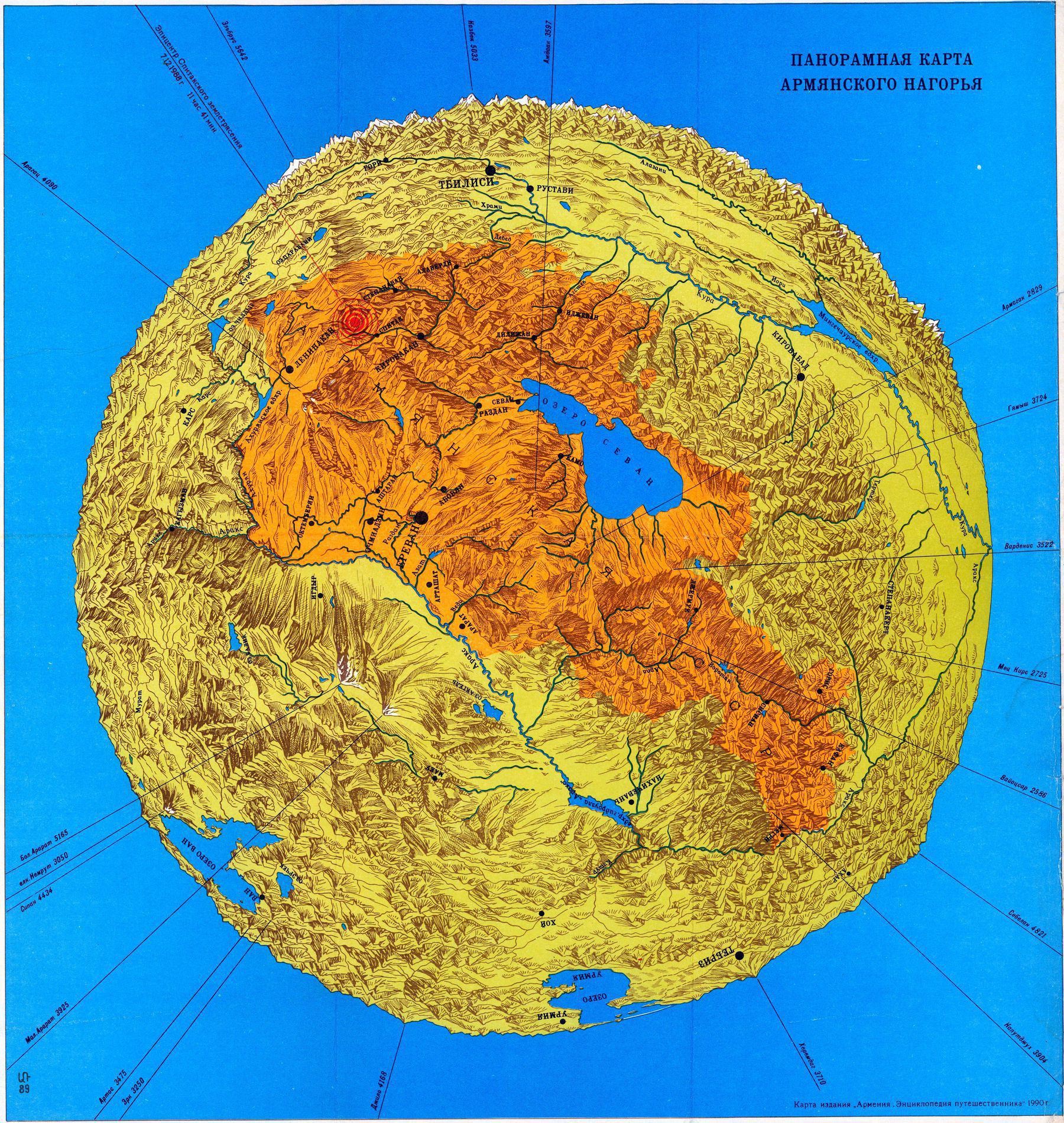
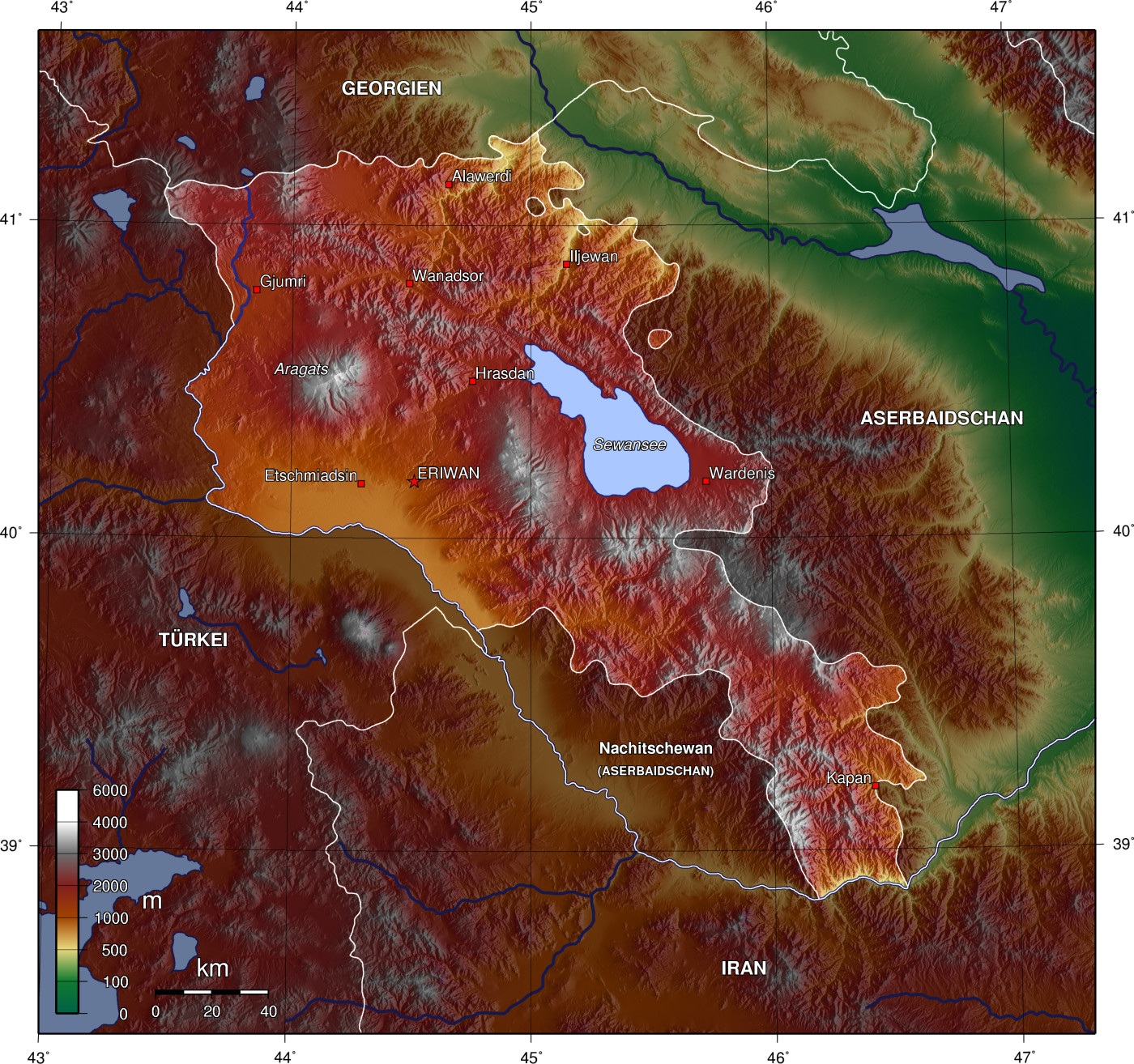
Panoramic raised relief map of Armenia (1990) In red is the epicenter of the 1988 Spitak Earthquake
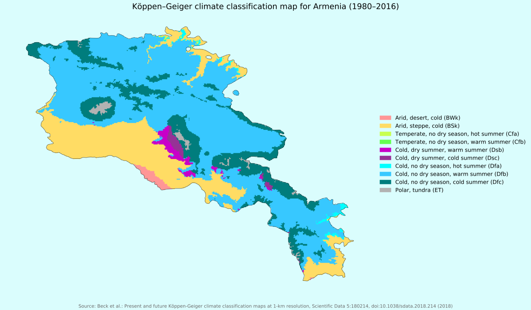
Altitude Variations Within Armenia
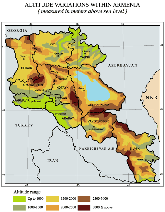
“I looks like a third of the country is either a giant lake or giant mountains. A little like Switzerland if lake Constance and lake Geneva were merged”–jmdeamer
The Republic of Mountainous Armenia - existing from December 1920 to June 1921
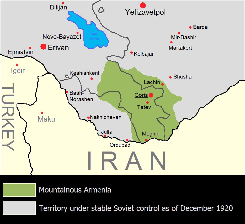
“The Republic of Mountainous Armenia (Armenian: Լեռնահայաստանի Հանրապետութիւն Leřnahayastani Hanrapetutyun), also known as simply Mountainous Armenia (Լեռնահայաստան Leřnahayastan), was an anti-Bolshevik Armenian state roughly corresponding with the territory that is now the present-day Armenian provinces of Vayots Dzor and Syunik, and some parts of the present-day Republic of Azerbaijan (Nakhchivan Autonomous Republic in the west and the de facto Republic of Artsakh in the east)“–WikiTextBot
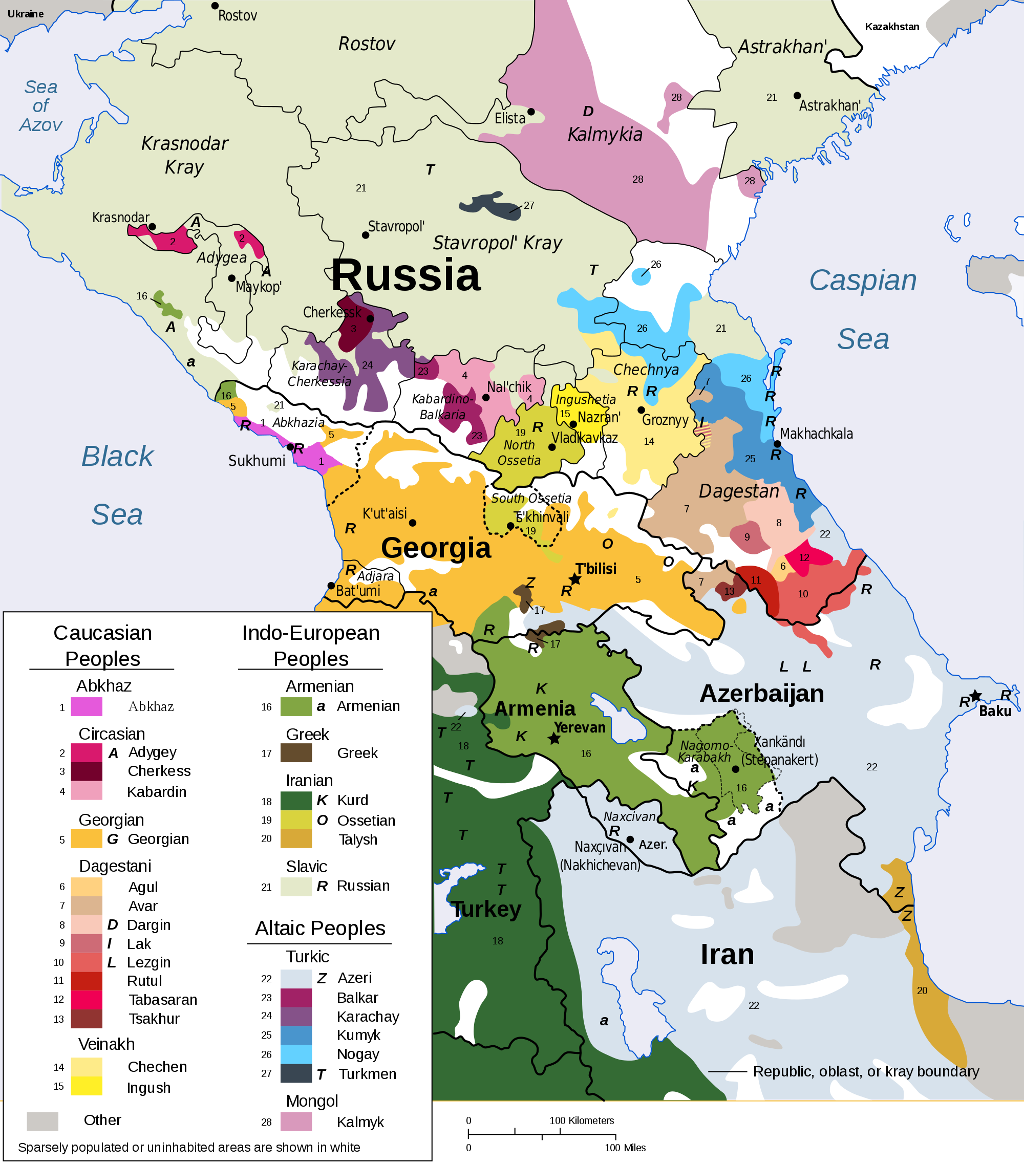
“The fact that Mongolian is spoken this far West is always fascinating to me”–CountZapolai