1682 map of Sardinia and Corsica - by Frederick de Wit
1682 map of Sardinia and Corsica - by Frederick de Wit
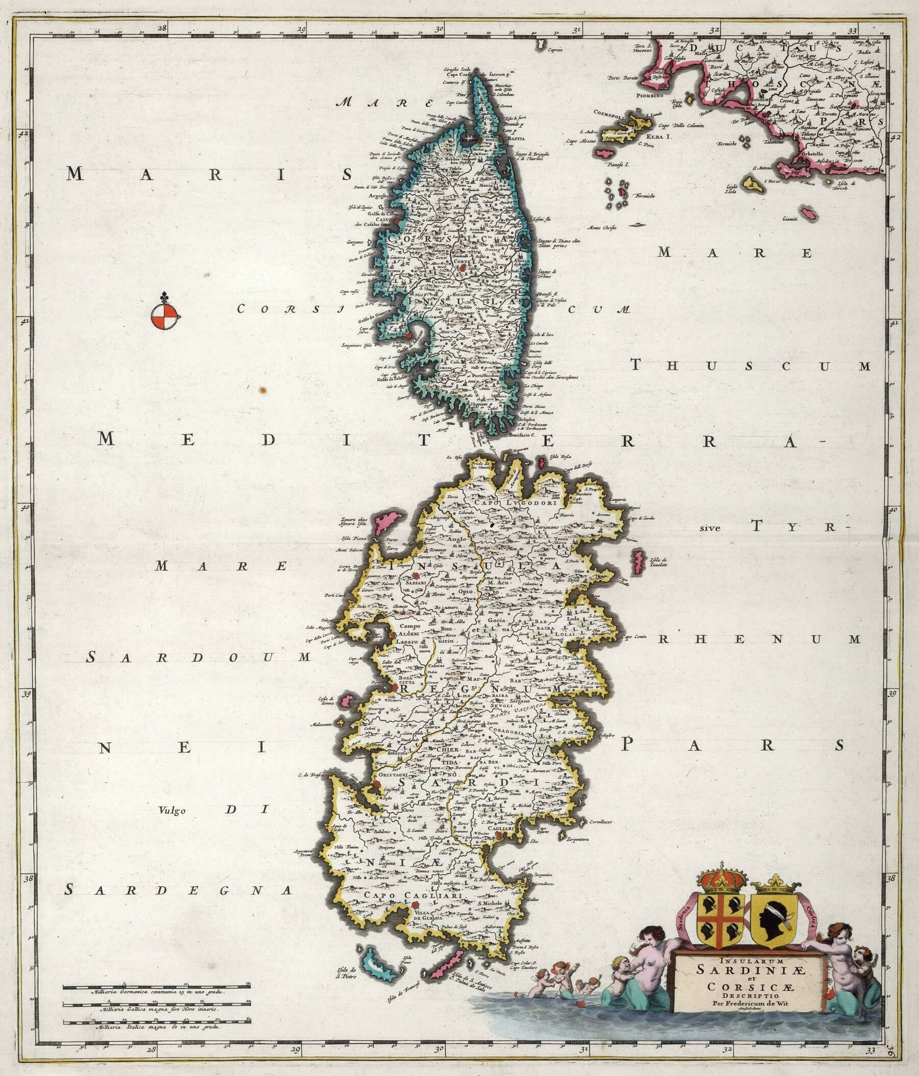
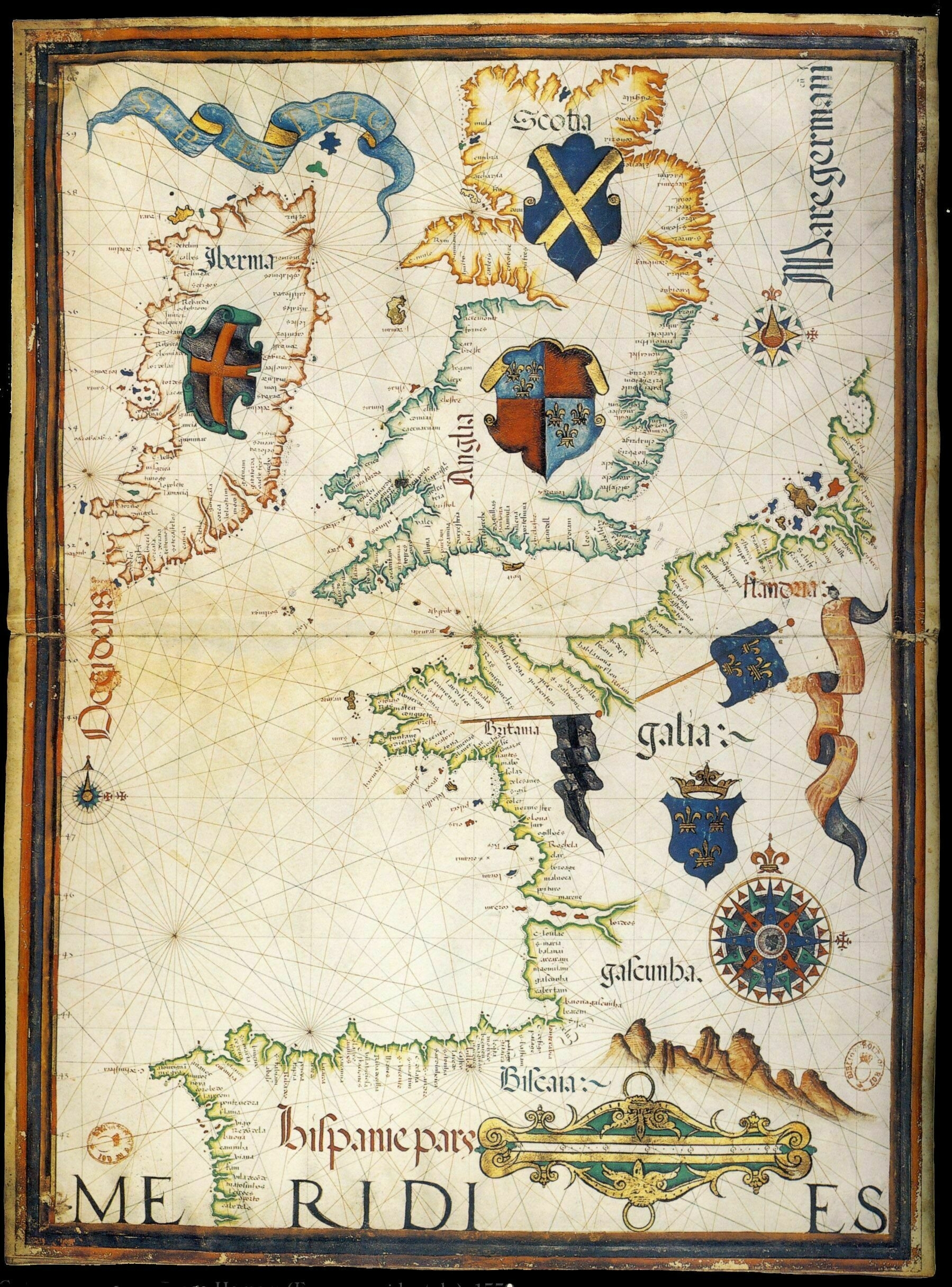
‘A very naughty boy who really likes artillery is from one of these’
1682 map of Sardinia and Corsica - by Frederick de Wit
‘A very naughty boy who really likes artillery is from one of these’
1634 map of rivers in France
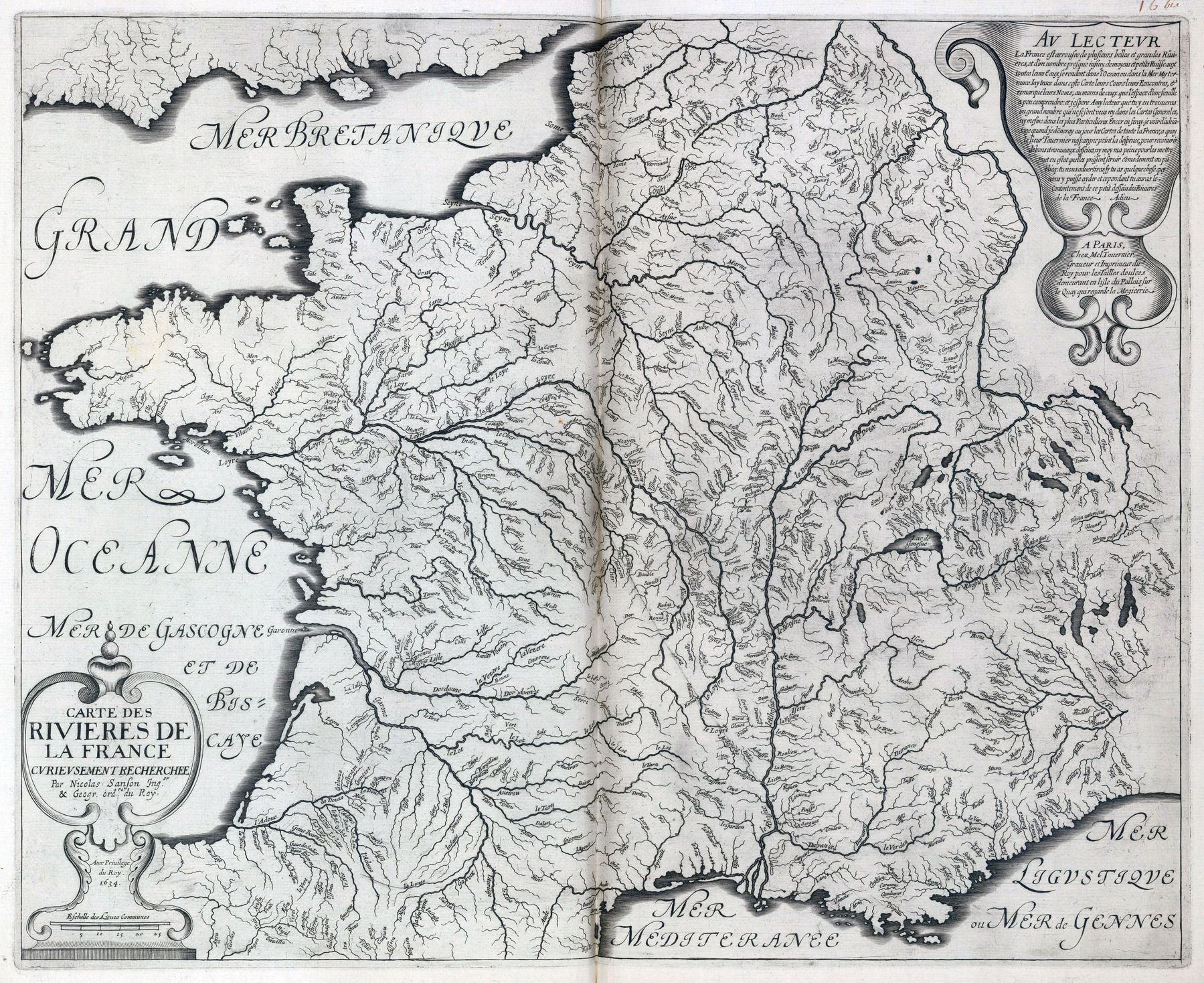
‘interesting, I didn’t know the French also called the channel “La mer Britannique”’–Tryphon59200
Movement of the travellers transported via the French railroads in 1891 (published 1893)
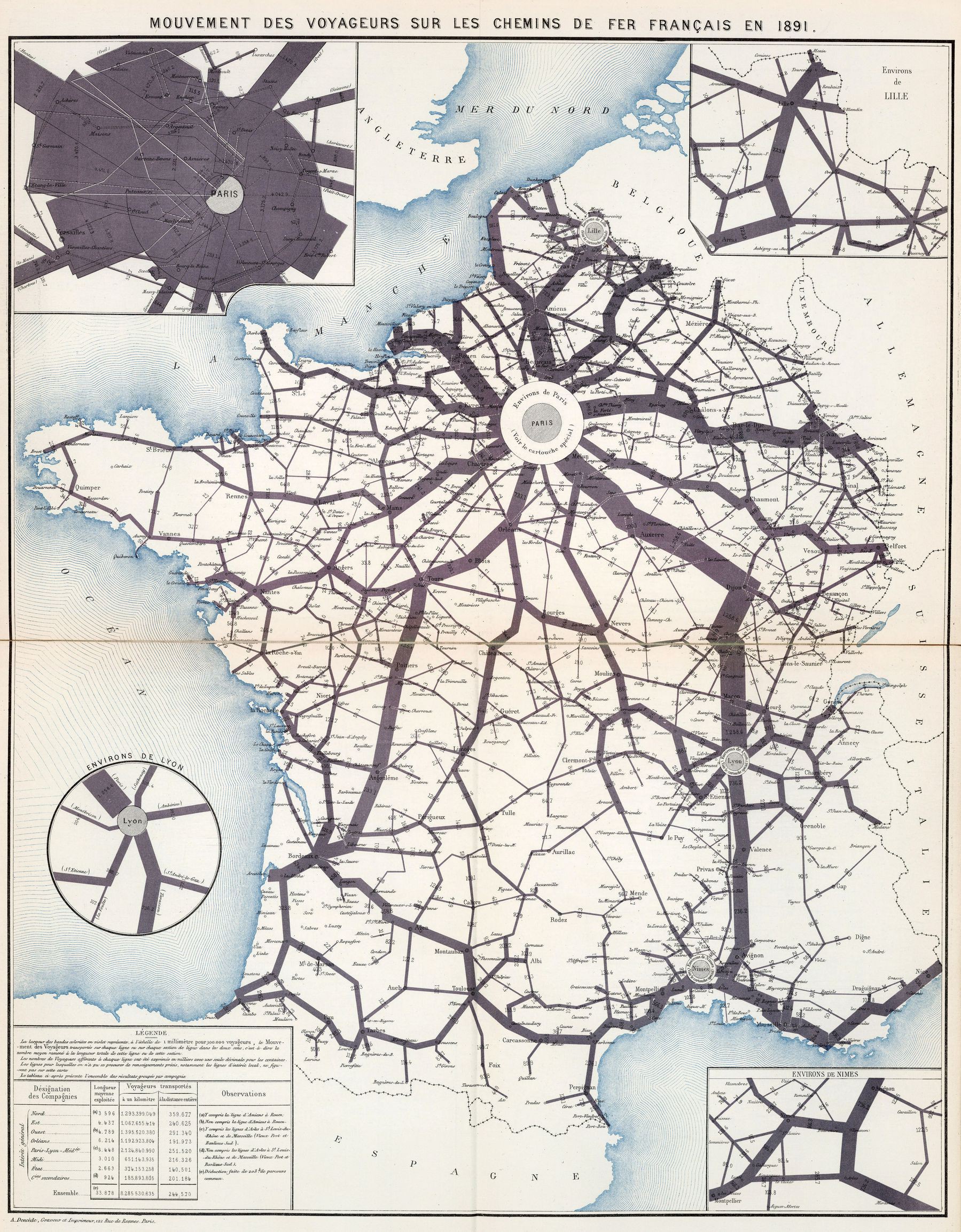
‘Someone may want to correct me, as I don’t speak French, but –
The width of the bands colored in purple represent on the scale of 1 millimeter per 100,000 passengers, the movement of travelers transported on each line section in both directions, that is to say the average number reduced to the total length of this line or this section.
The numbers of travelers attached to each line have been expressed in thousands with a single decimal for the hundreds’–AJgloe
Rural and urban communes in France
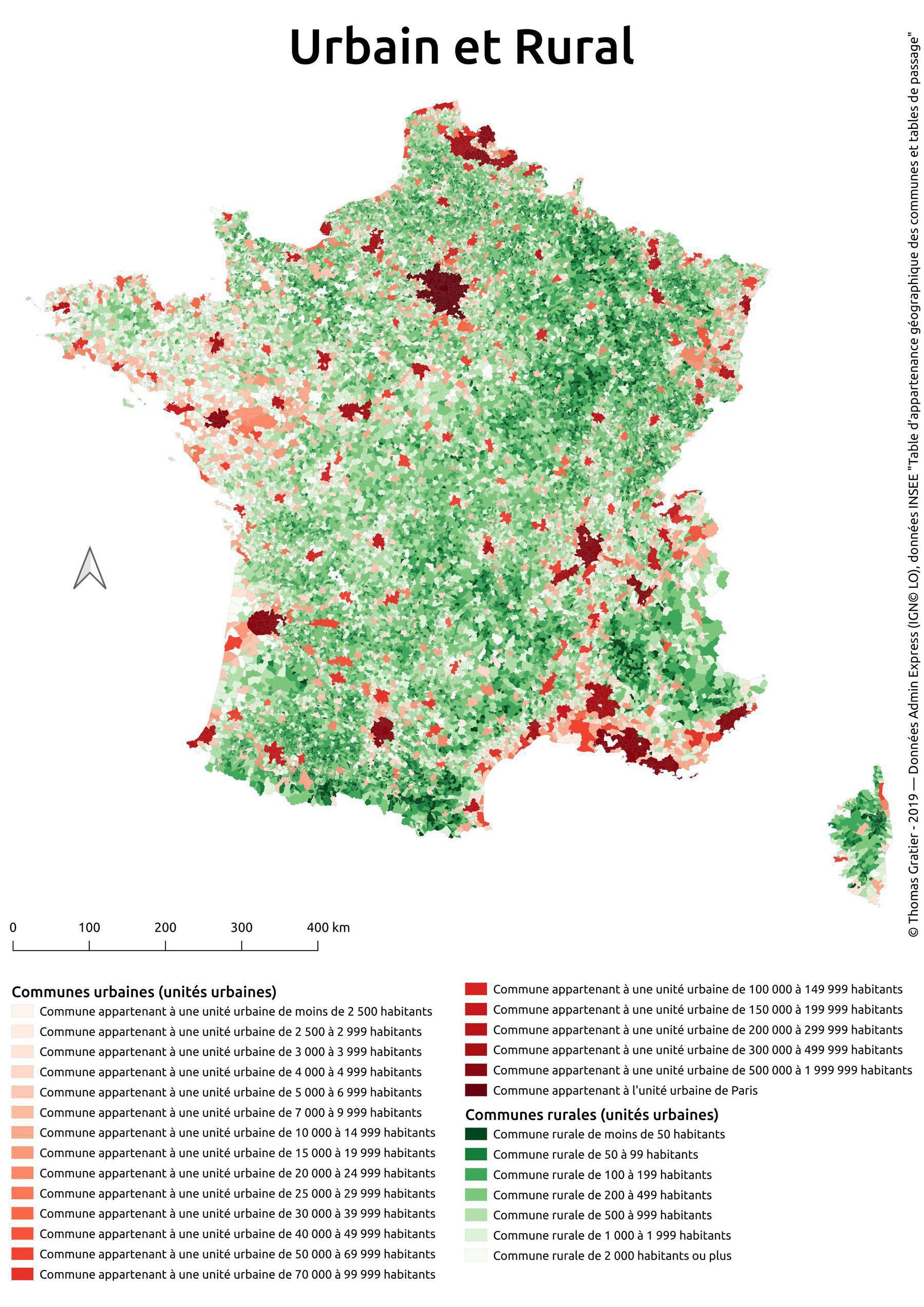
‘For ease of interpretation: Green areas are very sparsely populates. Red areas are very dense, and white areas are in-between’–MrMoneyMoneyBags
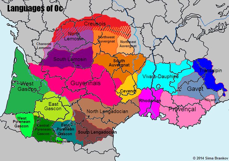
Corsican dialects
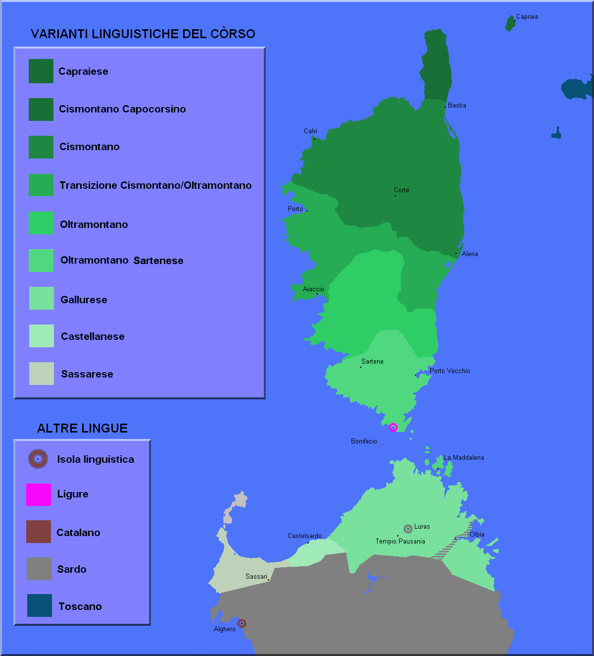
‘It’s interesting that corso is the closest language to tuscan and therefore to standard Italian, far more close than any other Italian regional language’–medhelan
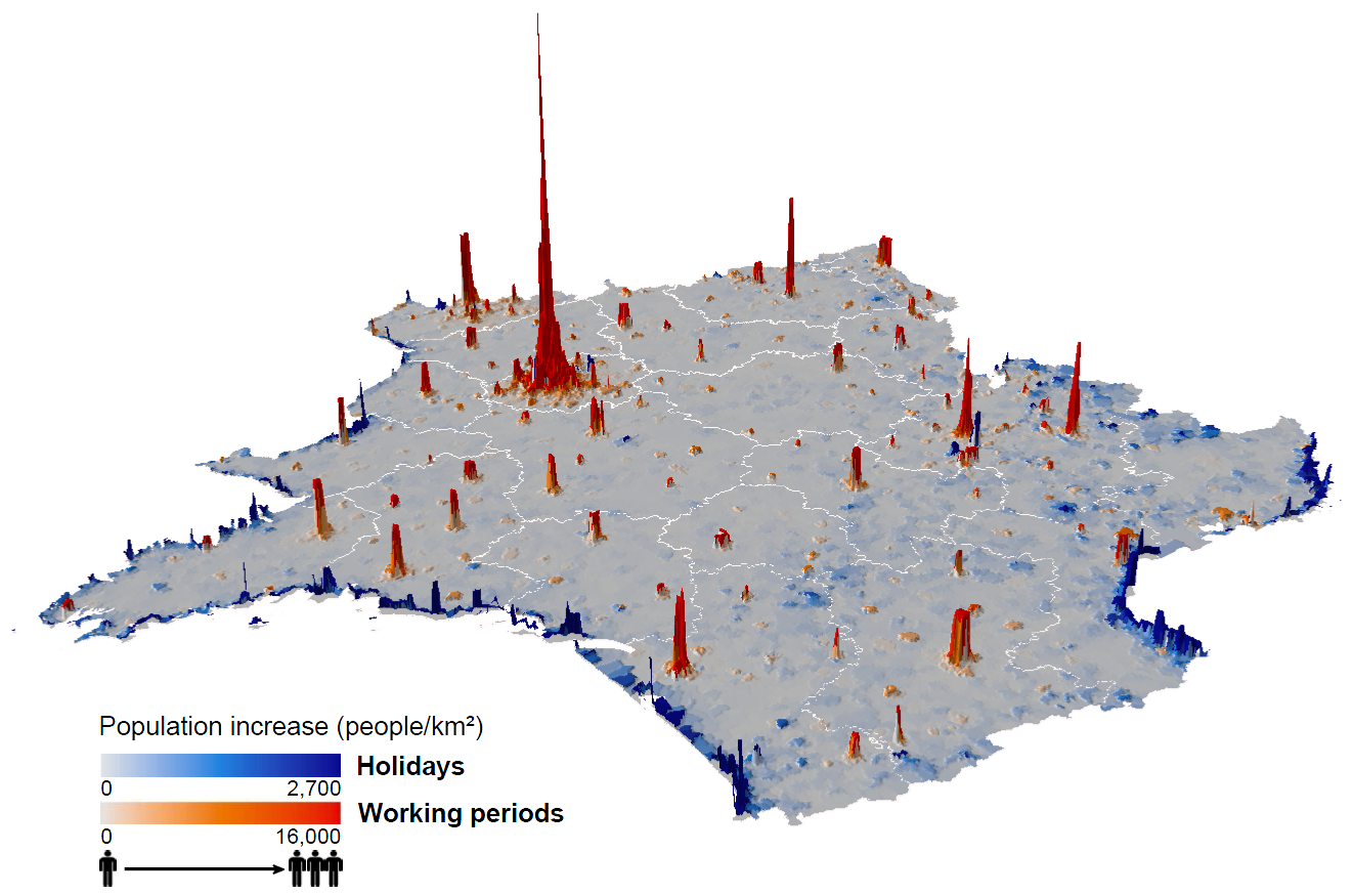
Map of population distribution changes in France between holidays and workdays - derived from mobile phone data
‘I can see the Eiffel tower…Looks like the Burj Khalifa’
A Mountain in the Sea : satellite terrain map of Corsica
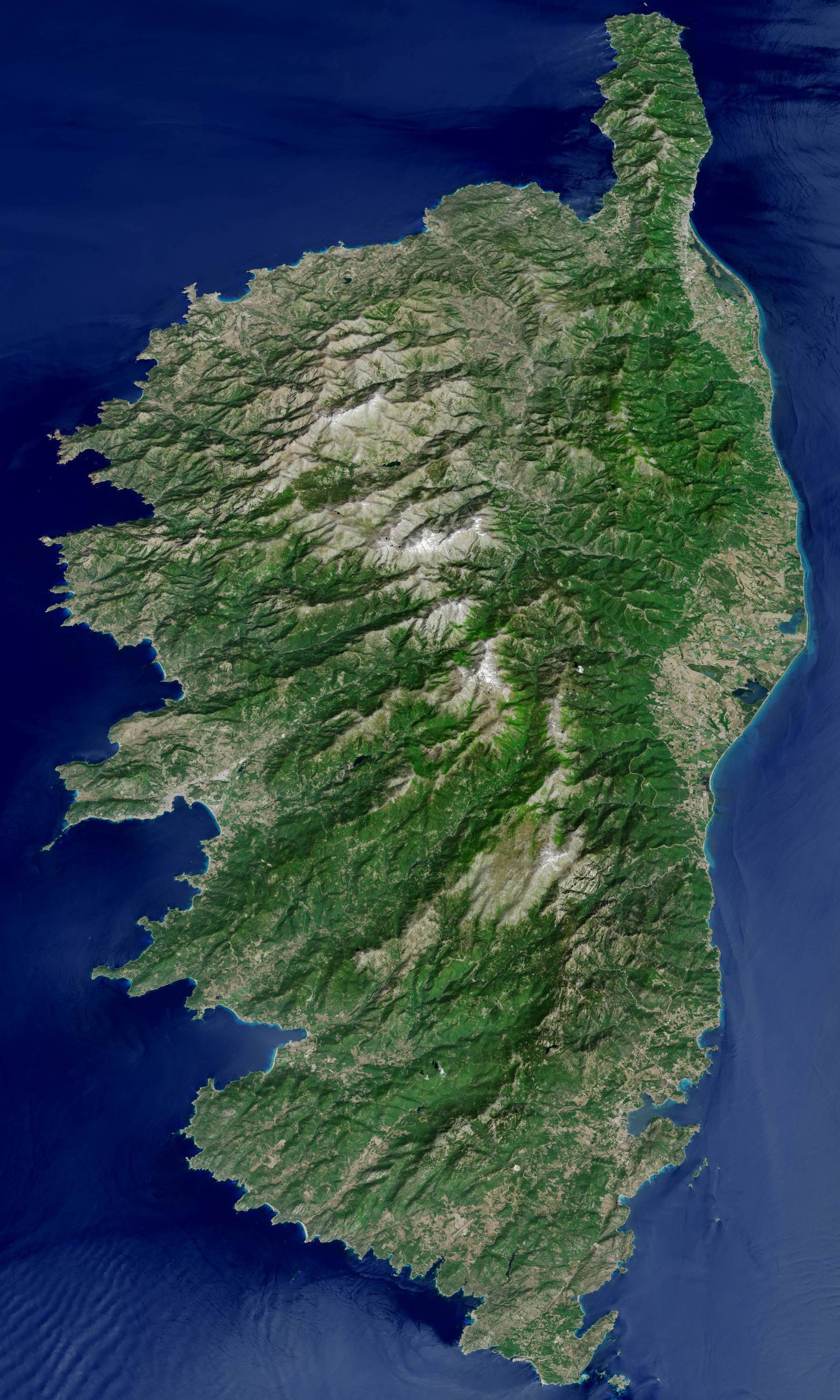
“looks kind of like upside down ireland … Yes, but with topography”
Relief map of France
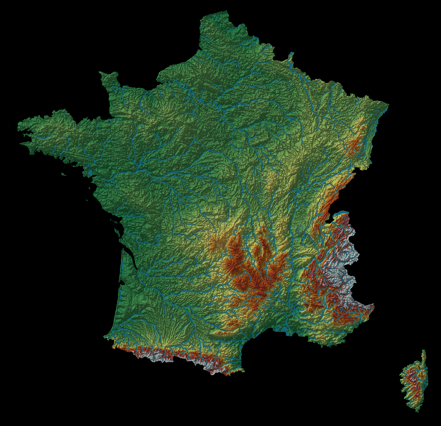
“The natural borders created by the mountain ranges are really interesting. I love understanding why borders are where they are. Geography can be so cool … It’s also one of the reasons why Russia historically really wanted to be in control of the Baltics and Poland. The axis from Kaliningrad to Moldova is the thinnest point of the Eurasian plain and has the Carpathians for natural defense. Beyond that it’s just an increasingly wider undefensible flatland until you reach the Urals”
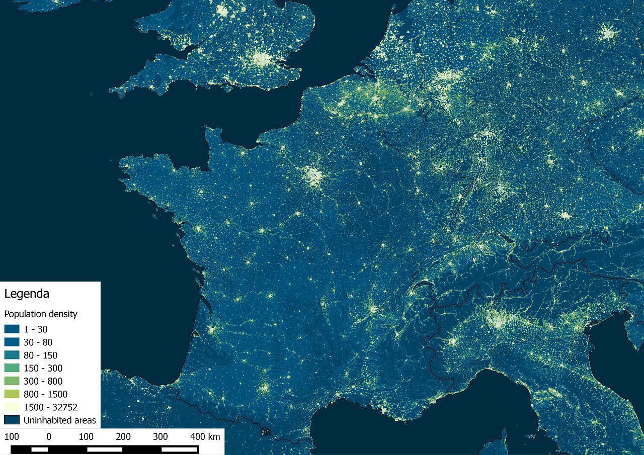
Population density of France and the surrounding region in a 1 sq km grid
“Landes is what makes the Bordeaux terroir possible, and it’s a human planted forest. I drove through it last summer, it’s a weird forest”–stupid_sexyflanders
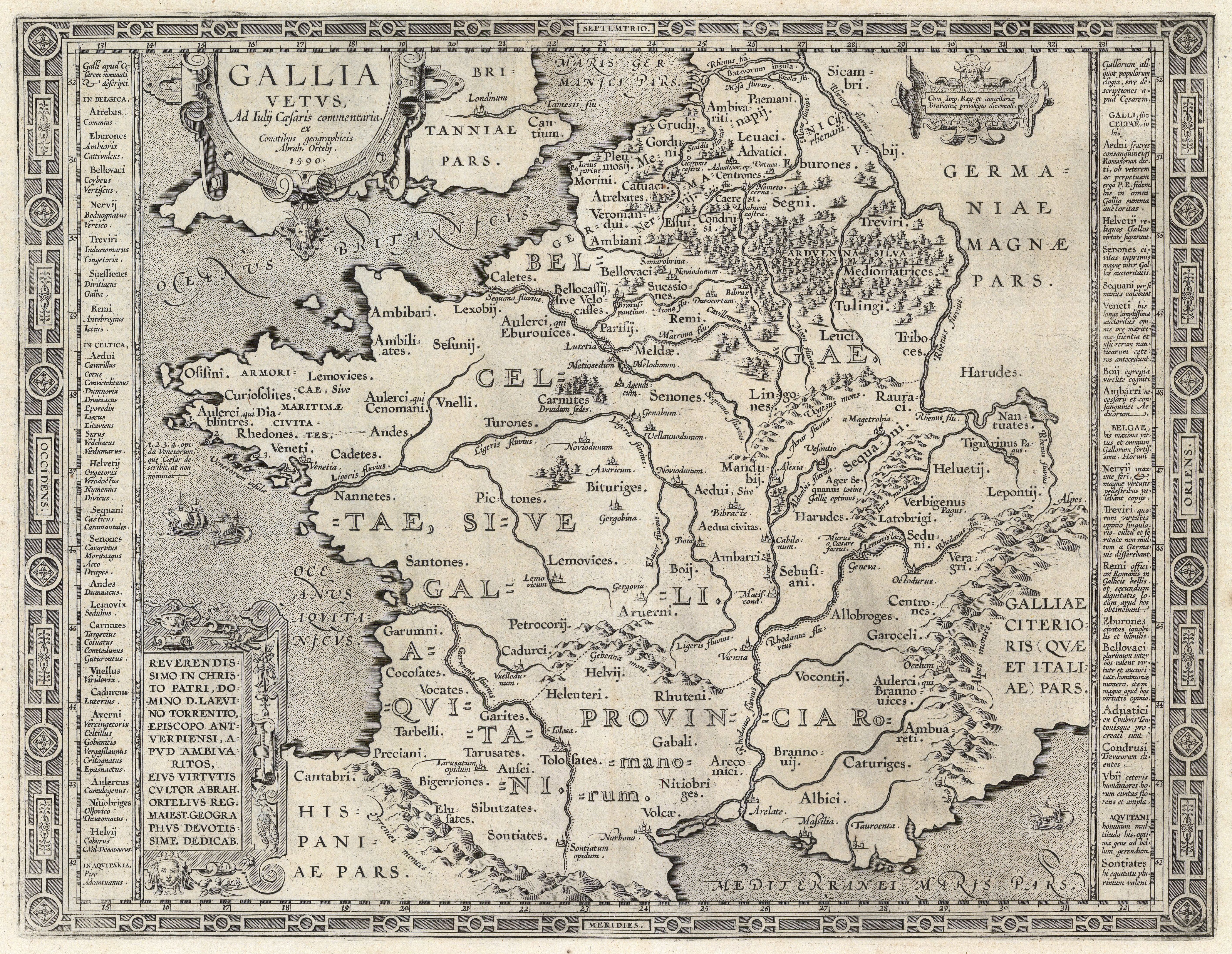
1590 map of France
[5633 x 3348]
What percentage of France’s population cover what percentage of its territory?
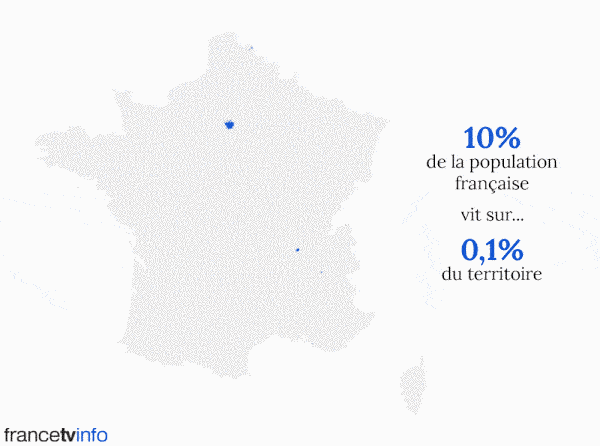
“And the 80/20 rule proves true again”–Realtrain
Occitan languages of southern France
“There’s still a few hundred thousand speakers in France, mostly elderly. The number keeps dropping and the various dialects will likely die out soon”–MikeMontrealer
Forests in Metropolitan France
“the very most of those forests are not natural but grown for exploitation and planted with non-local species.
They have a low biodiversity, and low resilience to climate change. The last ten years heat waves are killing significative portions of those forests. That would not happen on such a scale with natural grown and balanced forests. Also real natural and ancient forest (with local species) would keep its moisture in summer and avoid fires, as well as keeping a very high biodiversity level.
Those are poor and sad forests, and now that i am a bit aware of this, i cant be enthousiastic at all with an only quantitative approch of forests and nature”–SGarnier
Buildings in and around Paris
Exaggerated relief map of France
[2048 × 2048]

1731 map of Paris - by capitaine Roussel
[9775 × 6989]
(Composite Map) Pl. XXVI. Paris en 1731.
1816 map of France - by Adrien Hubert Brue
[9242 × 6221]