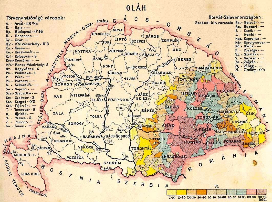
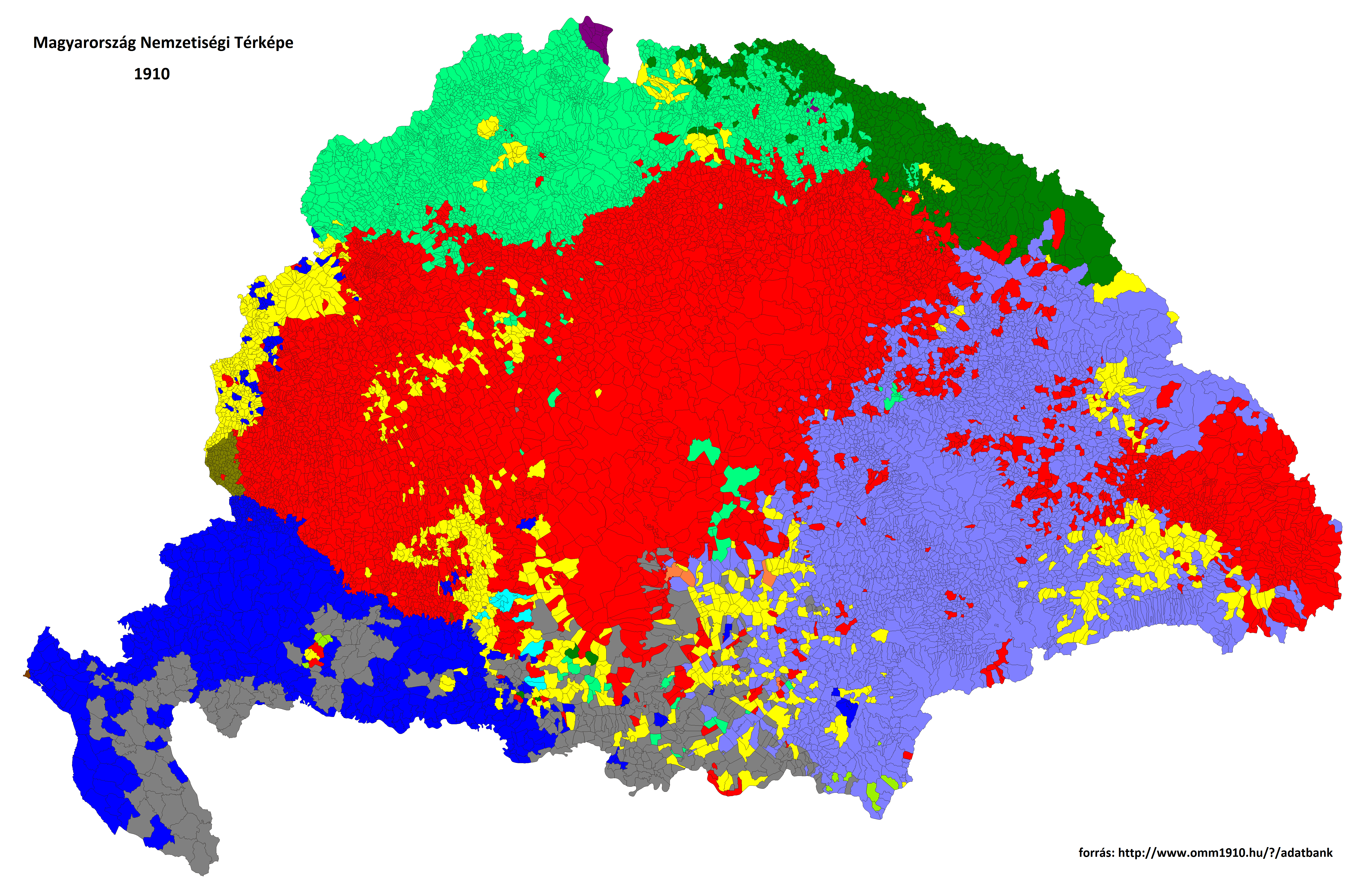
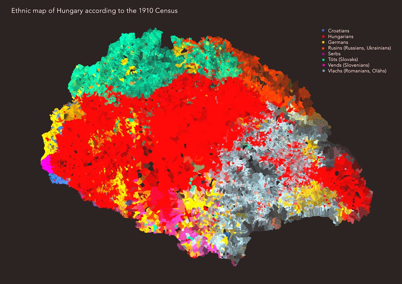
Ethnographic map of Hungary, according to the census of 1910
Ethnographic map of Hungary, according to the census of 1910 - by Paul Teleki
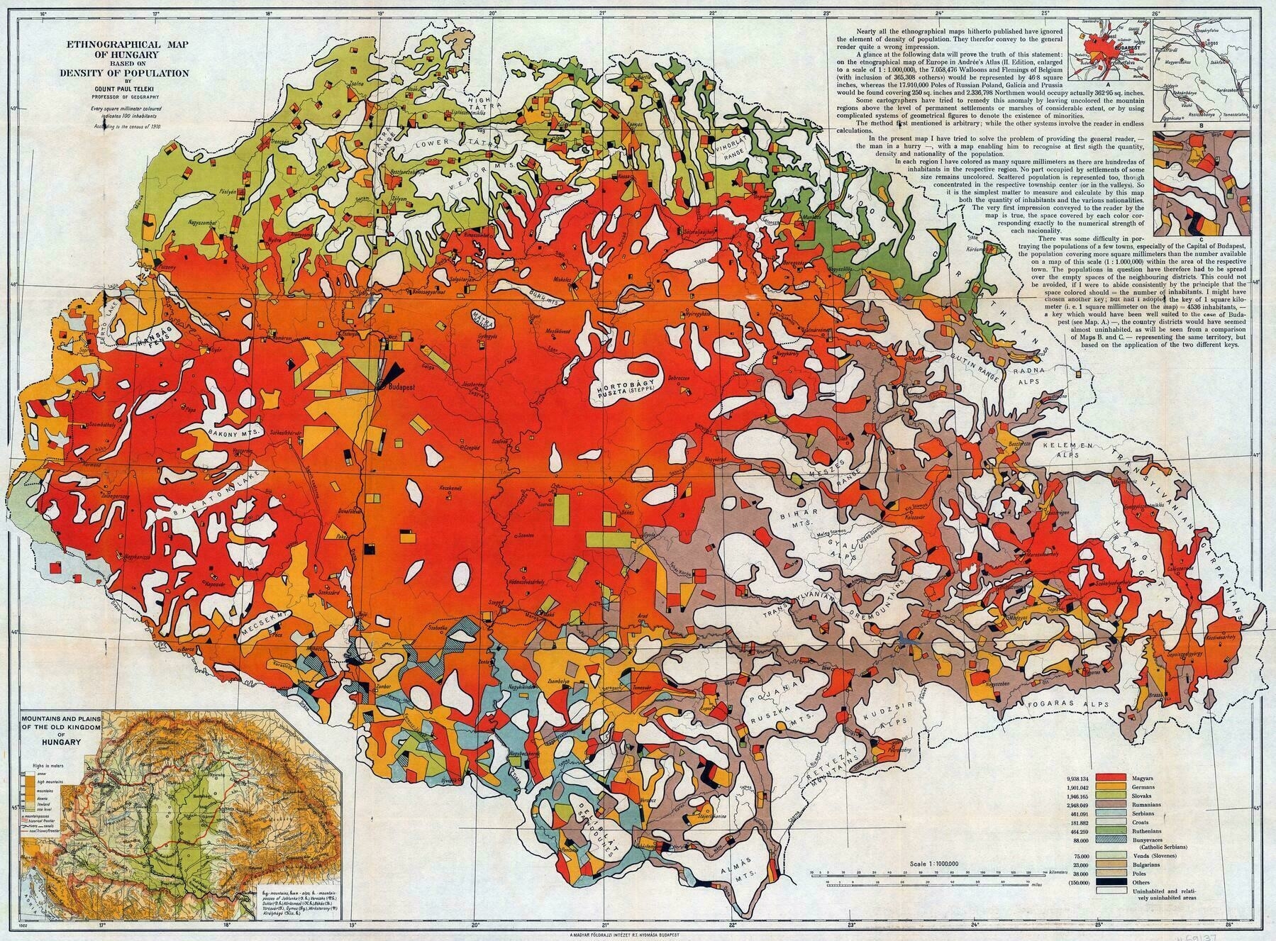
‘Tbh it was even more fair now that I look at it on a redmap
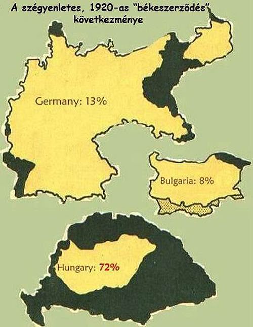
That’s because you vaguely recognise the new shape of Hungary in the main Red area, but don’t see that the new state borders were drawn on average 50 kms inside the red area. As a result over 2 million Hungarians living in majority Hungarian regions found themselves outside of Hungary overnight, without ever being asked. Almost all these parts were annexed to the successor states because of strategic considerations, fertile agricultural land in the case of Southern Czechoslovakia, important railway junctions in most other cases. Despite being overwhelmingly Hungarian. So much for “national self-determination”
The other 1.5 million Hungarians lived further from the new borders, 0.5 millions of them Transylvanian Szeklers, the remaining 1 million in smaller enclaves, or completely dispersed.
Or consider that the 3 million Romanians received a bigger chunk territory (103K km2) when already having their own country, than what was left for 10 million Hungarians (93K km2). Yeah, super fair.
Plus, but this is hindsight of course, basically all successor states treated their minorities far worse than Austro-Hungary ever did.’

