1700 map of Sumatra
1663 map of southeast Asia and Australia - by Joan Blaeu
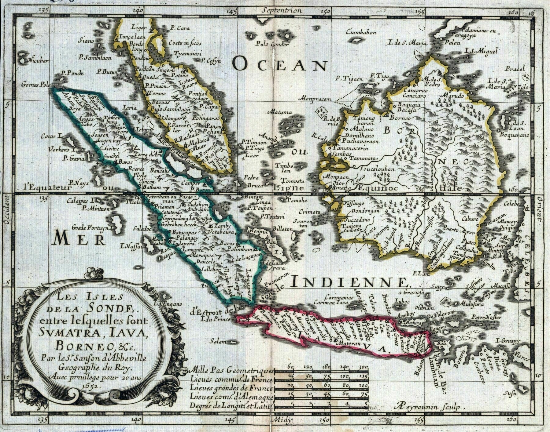
1652 map of Sumatra, Java and Borneo
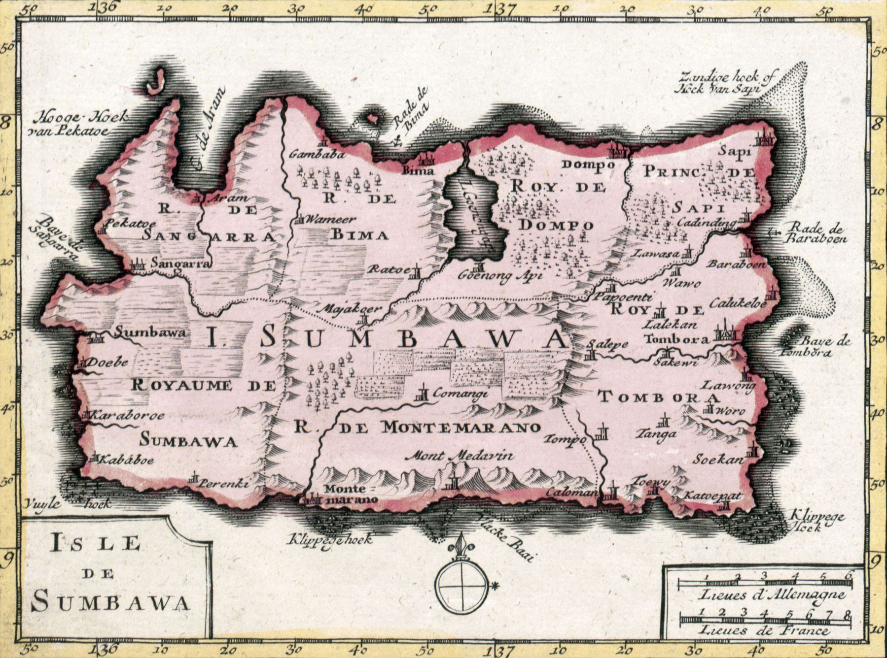
1792 map of Sumbawa, Indonesia
1792 map of Sumbawa, Indonesia
‘Royaume / Roy. is Kingdom btw’–postthereddit
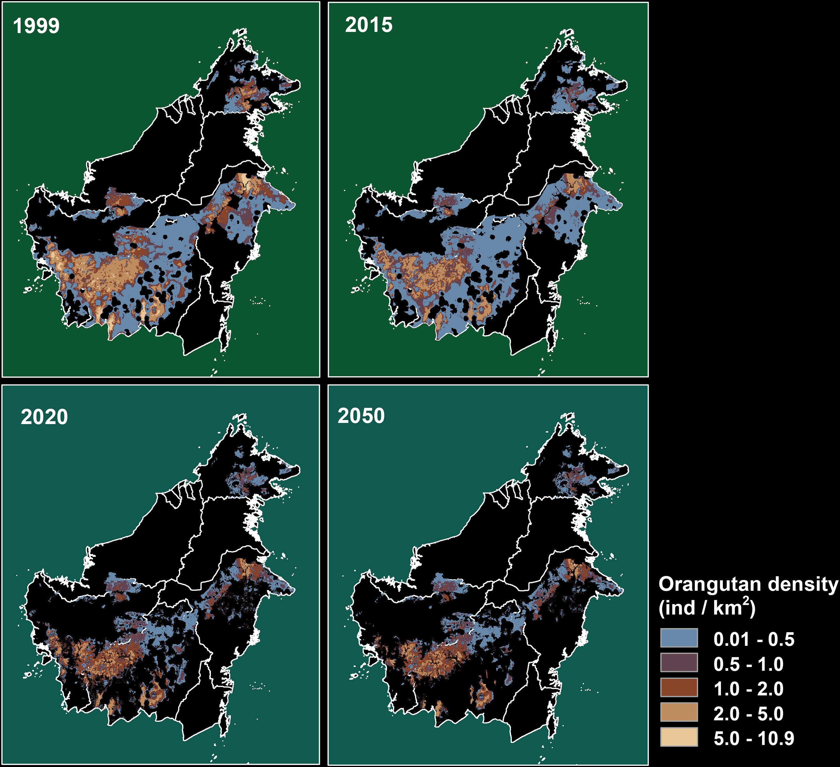
Borneo Orangutan Population Density, 1999-2050
Languages of Northern Sumatra
Languages of Northern Sumatra
“Ah yes. gay”–TheAkwardOne
“Bold move in Aceh”–Quacky33
1740 map of the islands of Sumatra, Java and Borneo - by Joachim Ottens
1740 map of the islands of Sumatra, Java and Borneo - by Joachim Ottens
[9695 x 8449]
1785 map of Indonesia
1785 map of Indonesia
[8634 × 6385]
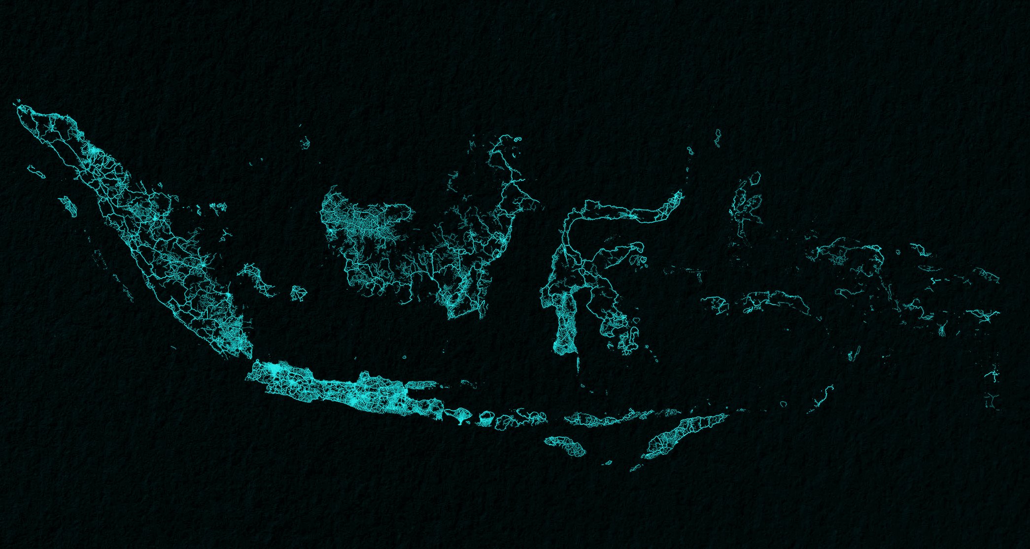
Indonesia drawn up by roads
Indonesia drawn up by roads
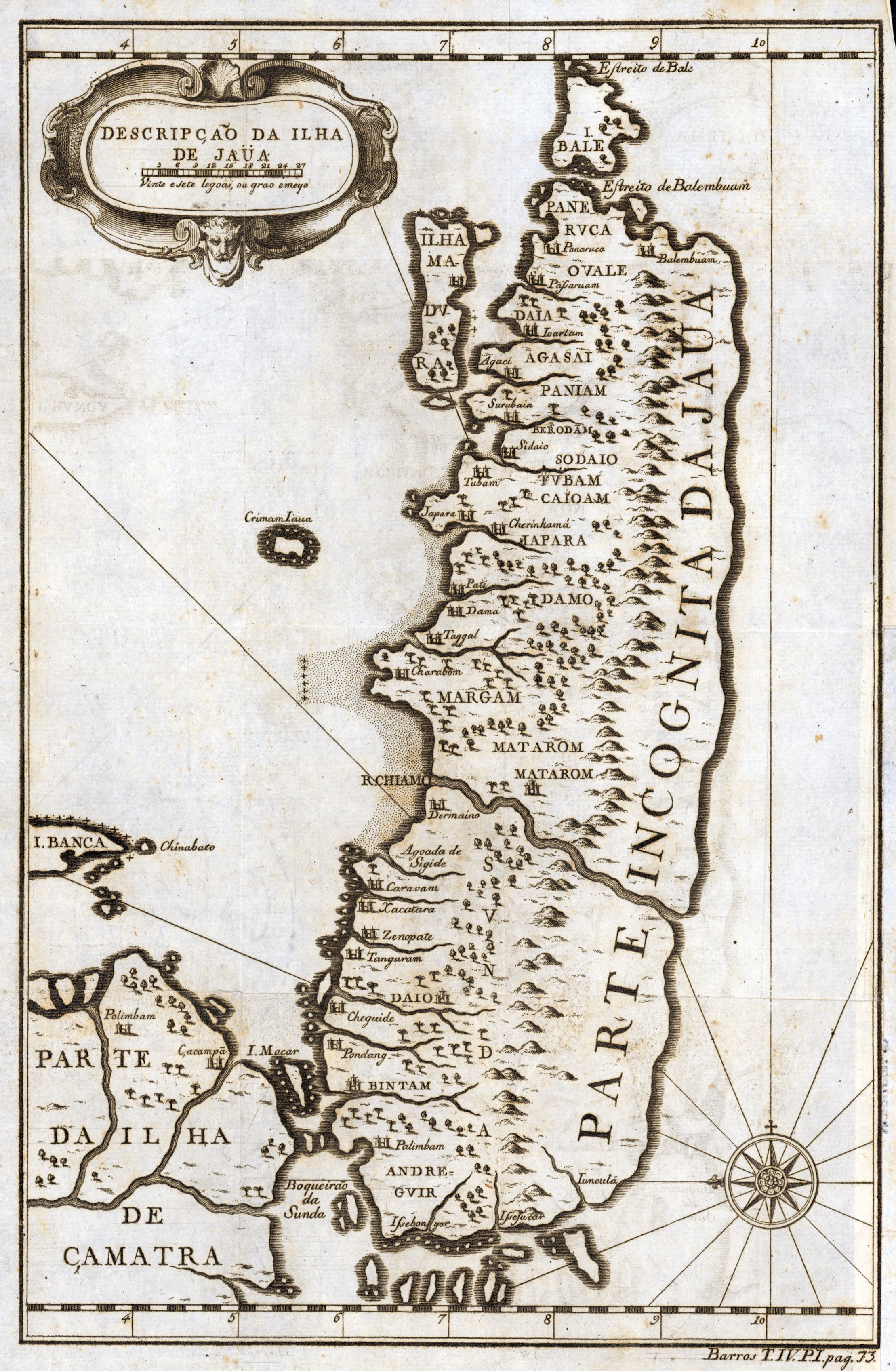
1725 map of Java, Indonesia

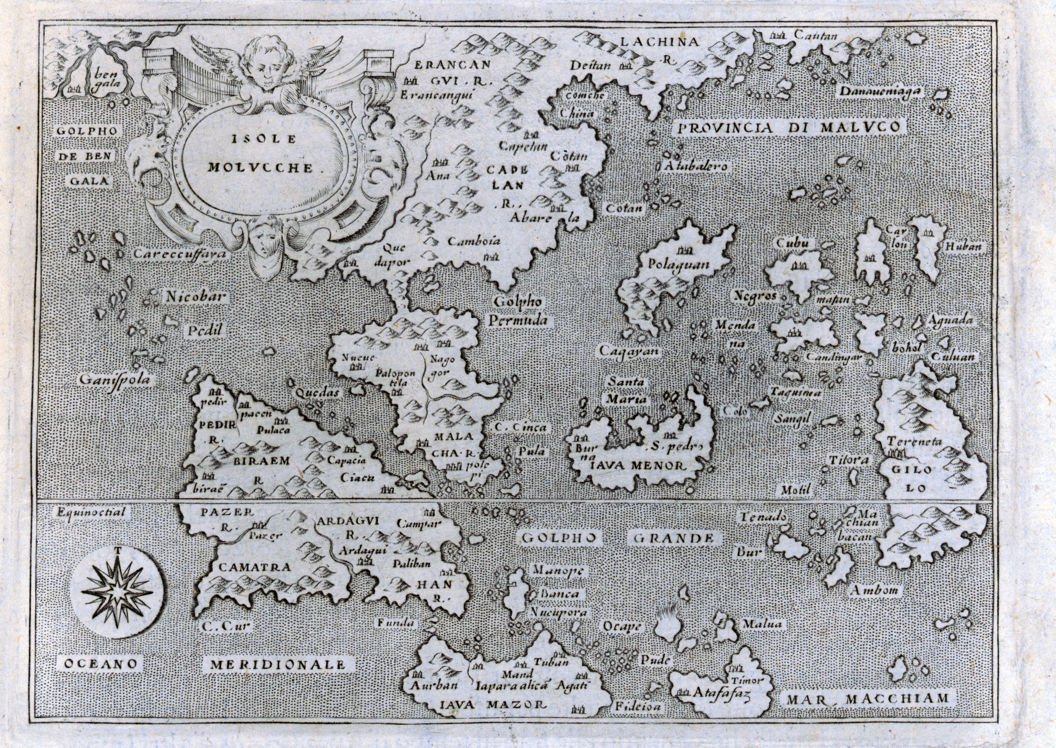
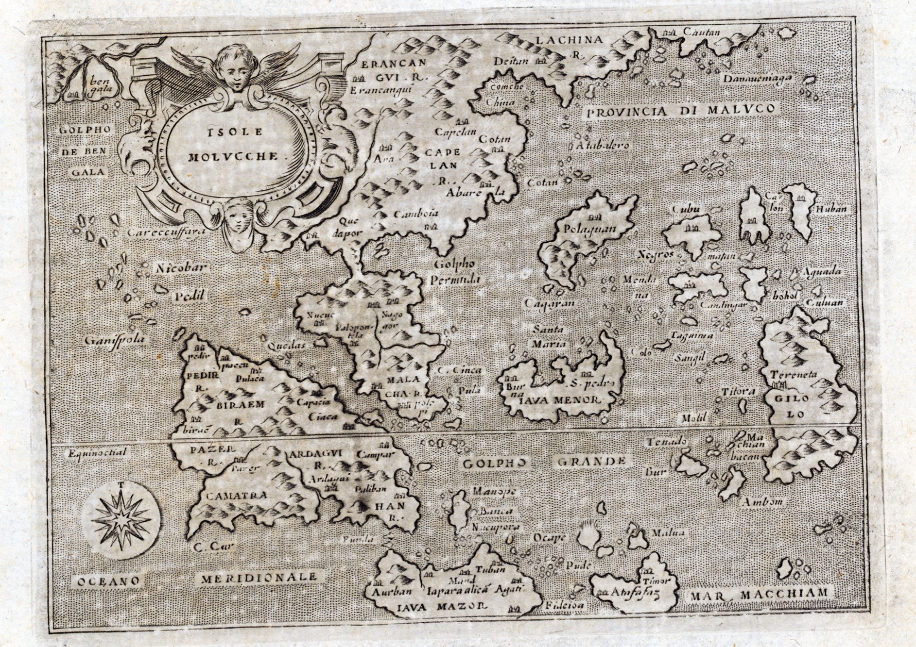
1576 map of Indonesia - by Tomaso Porcacchi
1604 map of the Moluccas Islands in Indonesia
1605 Map of the Malay Peninsula and Thailand - by Jodocus Hondius

1615 Map of Java, Bali and southern part of Sumatra
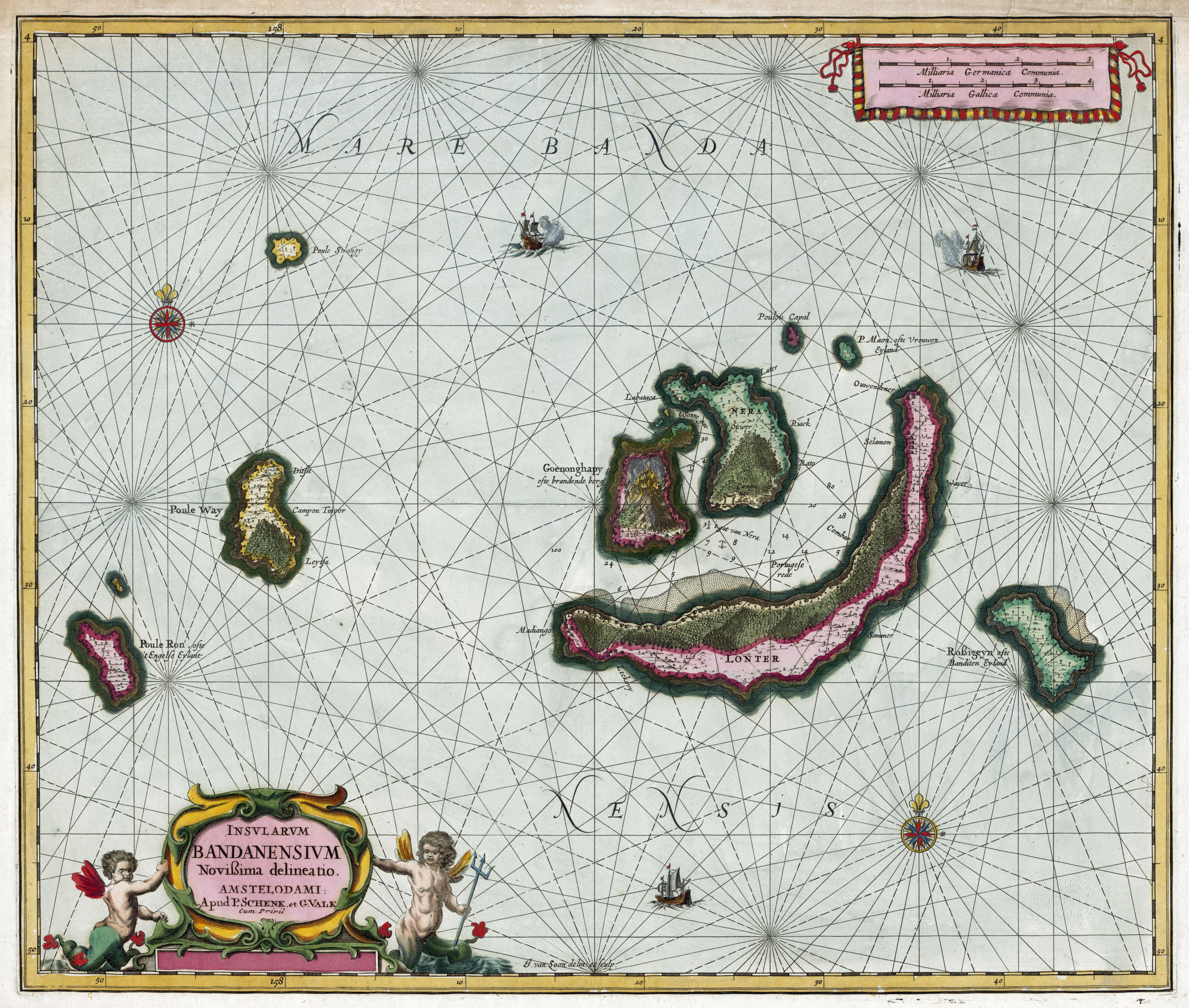
1657 map of the Banda Islands in Indonesia
1696 map of the Maluku Islands in the Indonesian archipelago - by Vincenzo Coronelli

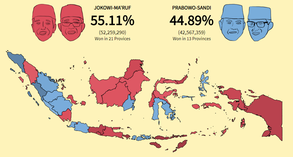
Choropleth Map of 2019 Indonesian Presidential Election Results
“Must suck to be president when you have to travel to 10,000 different islands”–rackstoday
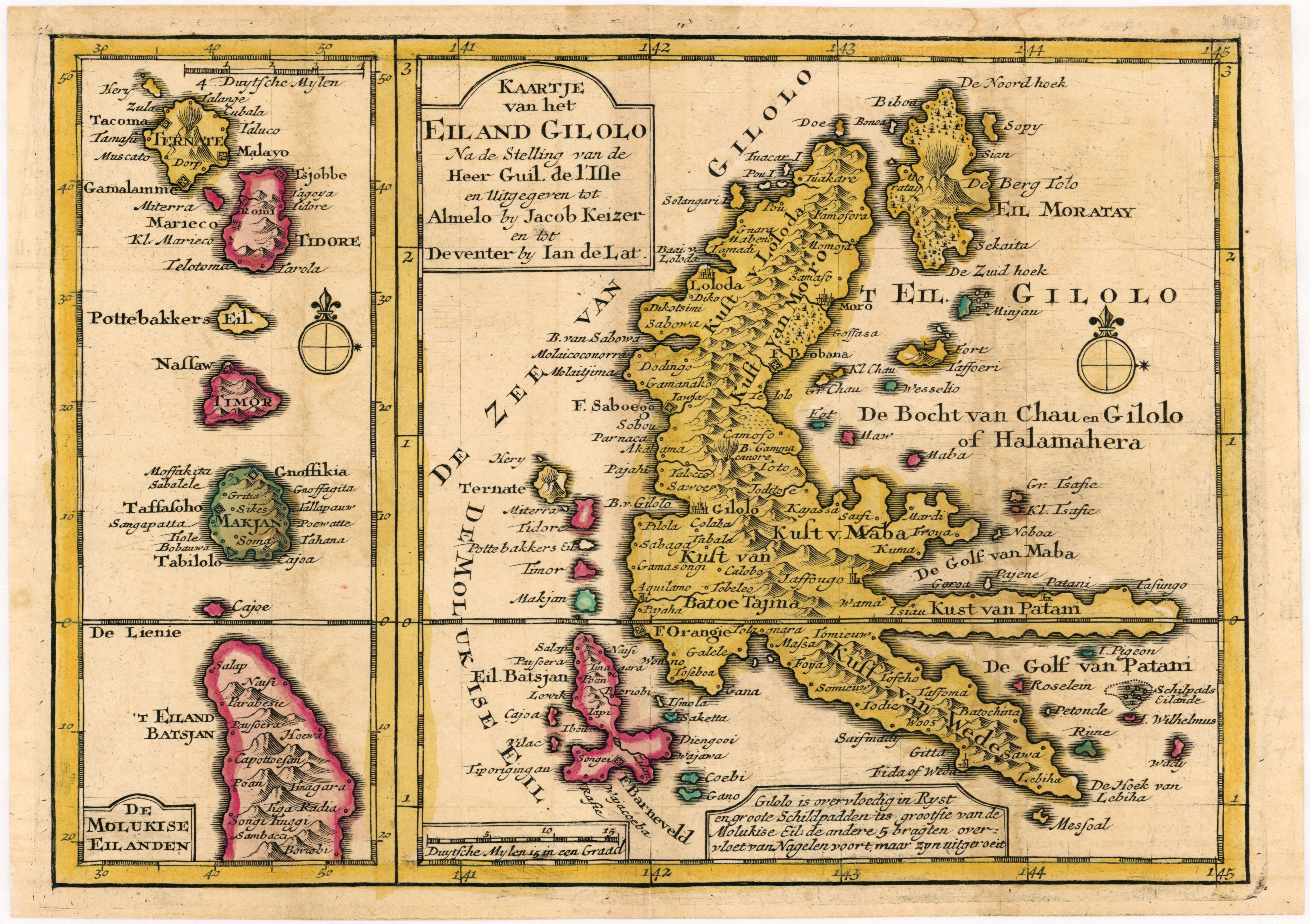
1747 Topographic map of Halmahera Island and Maluku Islands, Indonesia
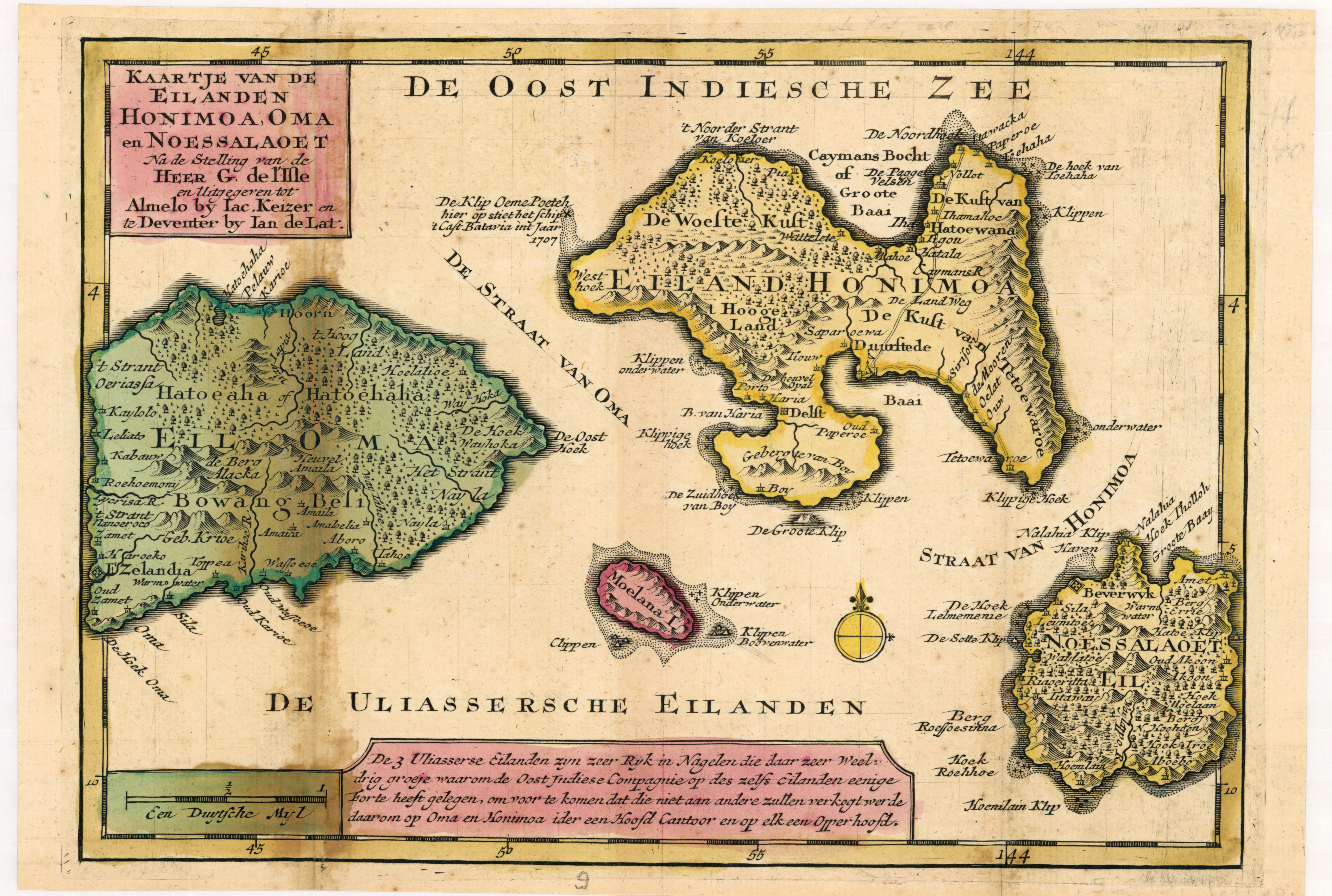
1747 Topographic map of the islands of Saparua, Haruku & Nusa Laut, Indonesia
1747 topographic map of Ambon Island, Indonesia
1747 Topographic map of the islands of Buru, Ambelau, Manipa - Indonesia
1747 Topographic map of Celebes (Sulawesi), Indonesia
1943 Japanese World War II Aeronautical Map of the Malaysian Peninsula and Sumatra
1940 tourist map of Bali, with a table showing sizes of mountains and b/w photos