Rand McNally map of Australia and New Zealand (1889)
Rand McNally map of Australia and New Zealand (1889)
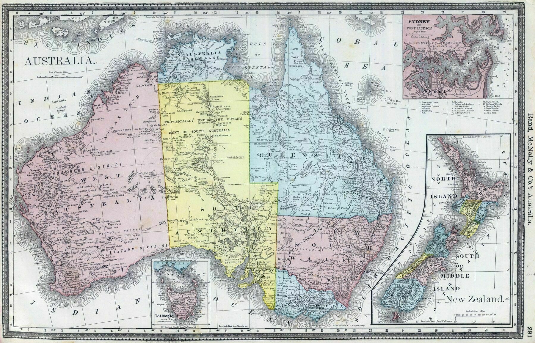
‘Wasn’t a lot mapped in the Pilbara and Kimberly back then’
Rand McNally map of Australia and New Zealand (1889)
‘Wasn’t a lot mapped in the Pilbara and Kimberly back then’
Ethnicity of New Zealand regions (European, Maori, Asian, Pacific peoples) in 2018
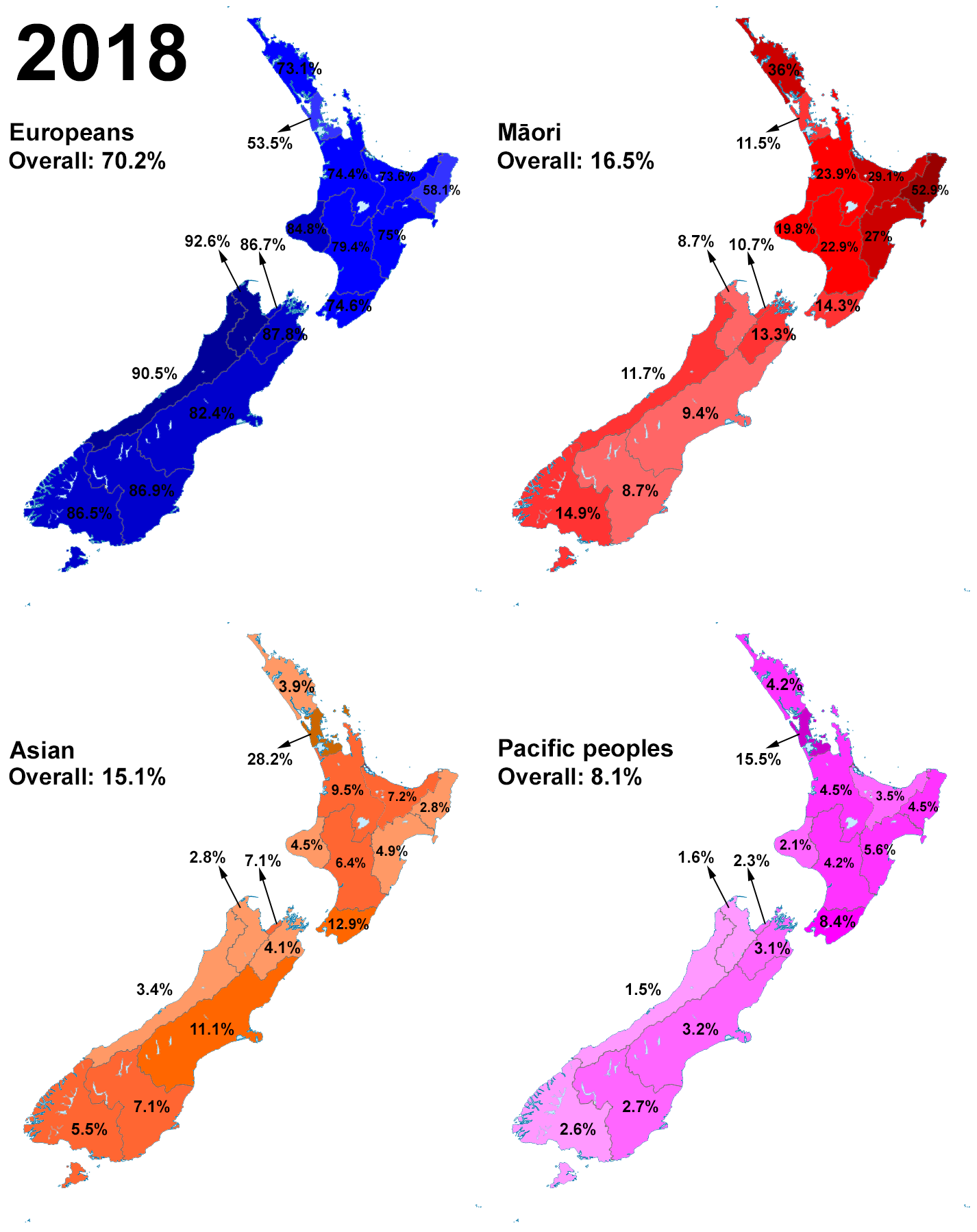
‘Maori are Pacific people, could they be double counting somewhat?
My great-aunt is Māori. She married a Cook Islander. So her kids are counted on the census as Māori and as Cook Islander. My mum is Māori. My dad is white. So I’m counted on the census as Māori and as New Zealand European. We don’t do blood quantum or mixed race stuff here. The way I see it, I’m me, and I’m Māori and NZ European, so I’m 100% Māori and 100% NZ European’
Average annual temperature map of Australasia (1908)

‘In 1839 the Colonial Office in England requested that all British colonies set up meteorological stations along their coastlines to improve understanding of the weather, and in doing so reduce deaths at sea. The New South Wales Governor George Gipps quickly organised observatories at Port Macquarie on the north coast on New South Wales, Port Jackson at the southern entrance to Sydney Cove, and at the Flagstaff Hill signal station in Port Phillip (which was part of New South Wales until 1851). This collection of stations was the first organised meteorological network in Australia.
The observatories were reportedly equipped with all the latest recording instruments and devices and the thermometer was kept in consistent conditions. These were not the same conditions that the Bureau of Meteorology have today, but they were a scientific improvement of the ad-hoc processes previously employed and a lot of effort has into understanding and homogenising the records to account for non-climatic influences.
The Bureau of Meteorology was created to consolidate the various meteorological services of Australia’s States which had developed extensive records of their regional weather during the 19th century. After complex negotiations, the Bureau was finally established in Melbourne through the Meteorology Act 1906’
1847 map of Australasia - by William Hughes
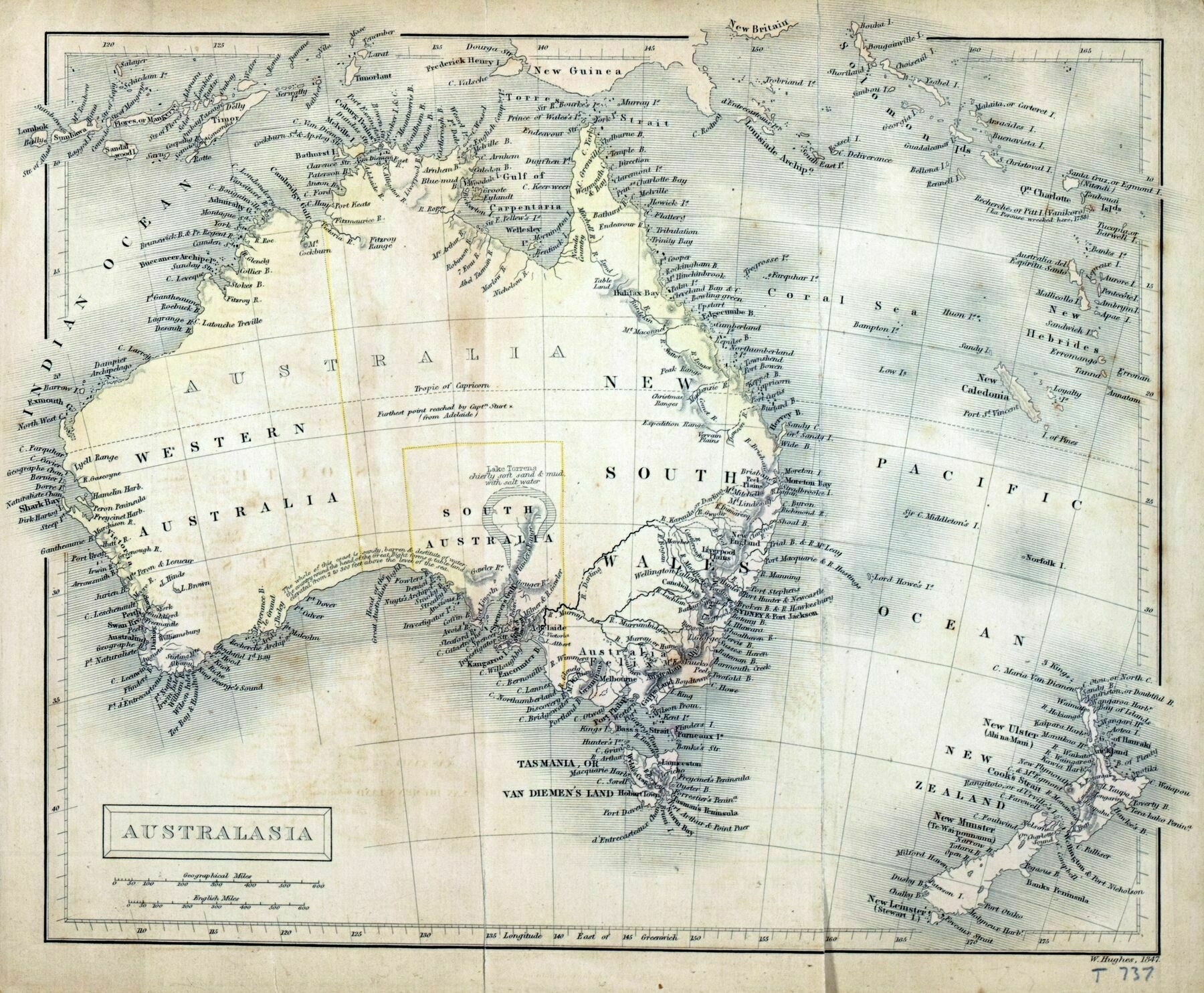
‘Am I seeing wrong or is Victoria labelled “Felix”???
Australia Felix (Latin for “fortunate Australia” or “happy Australia”) was an early name given by Thomas Mitchell to lush pasture in parts of western Victoria he explored in 1836 on his third expedition. On this expedition Mitchell was instructed to travel to Menindee, then down the Darling River to the sea, if it flowed there; or, if it flowed into the Murray River to go up the Murray to the inhabited parts of the colony. However lack of water forced Mitchell to follow the Lachlan River to the south-west as the only practicable route. He reached the Murrumbidgee on 12 May and followed it to the Murray’
The Decline of New Zealand Wetlands
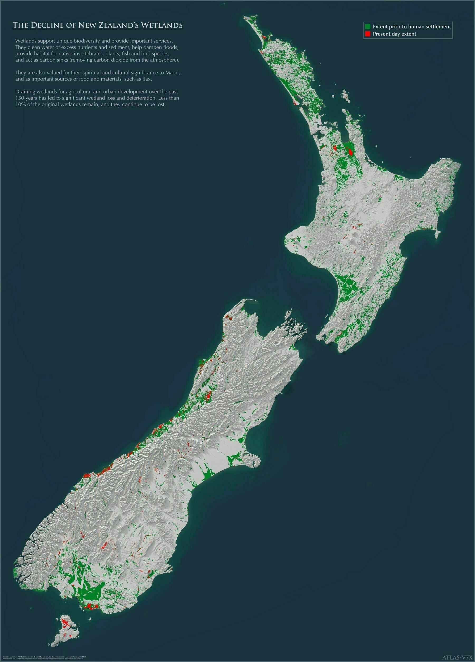
‘Yeah, people talk about the deforestation in Brasil and Indonesia, which certainly is terrible and needs to be curtailed, but practically every country has been guilty of the destruction of valuable native wildlands in the pursuit of greater croplands or farms, or for building material or some valuable resource.
For instance, the British Isles were once thickly covered in oak trees, and wouldn’t that make a useful caron sink right now, but no-one is suggesting we reforest the farmlands of Kent or Surrey.
If the richer countries, including Britain and New Zealand, don’t want to be the worst kind of hypocrites they should be doing much more to aid those countries that have developed slower to hold on to the undisturbed forests, wetlands and savana that they have left, and that should include financial incentives’
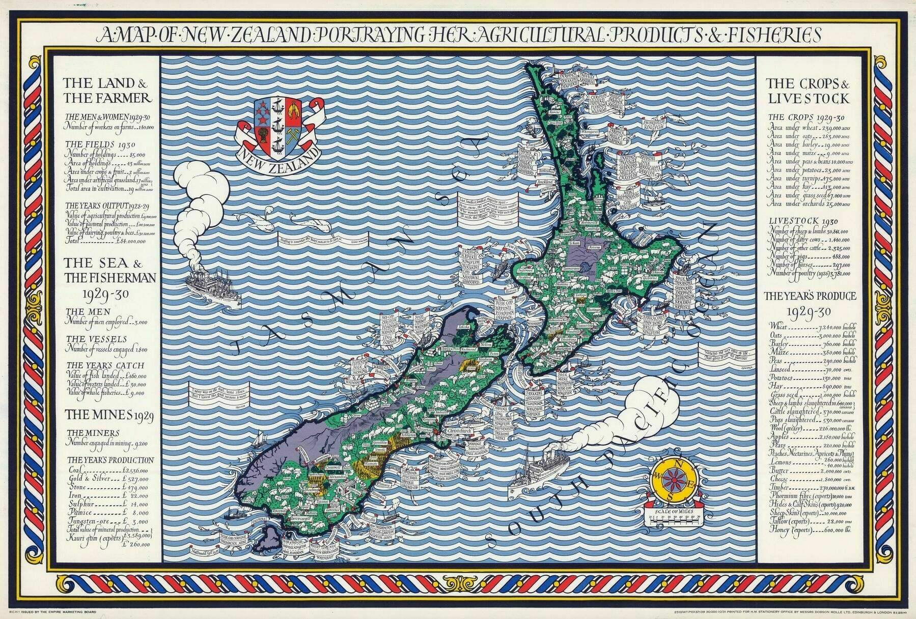
A Map of New Zealand Portraying Her Agricultural Products & Fisheries (1931) / Leslie MacDonald Gill
New Holland and New Zealand (1842)
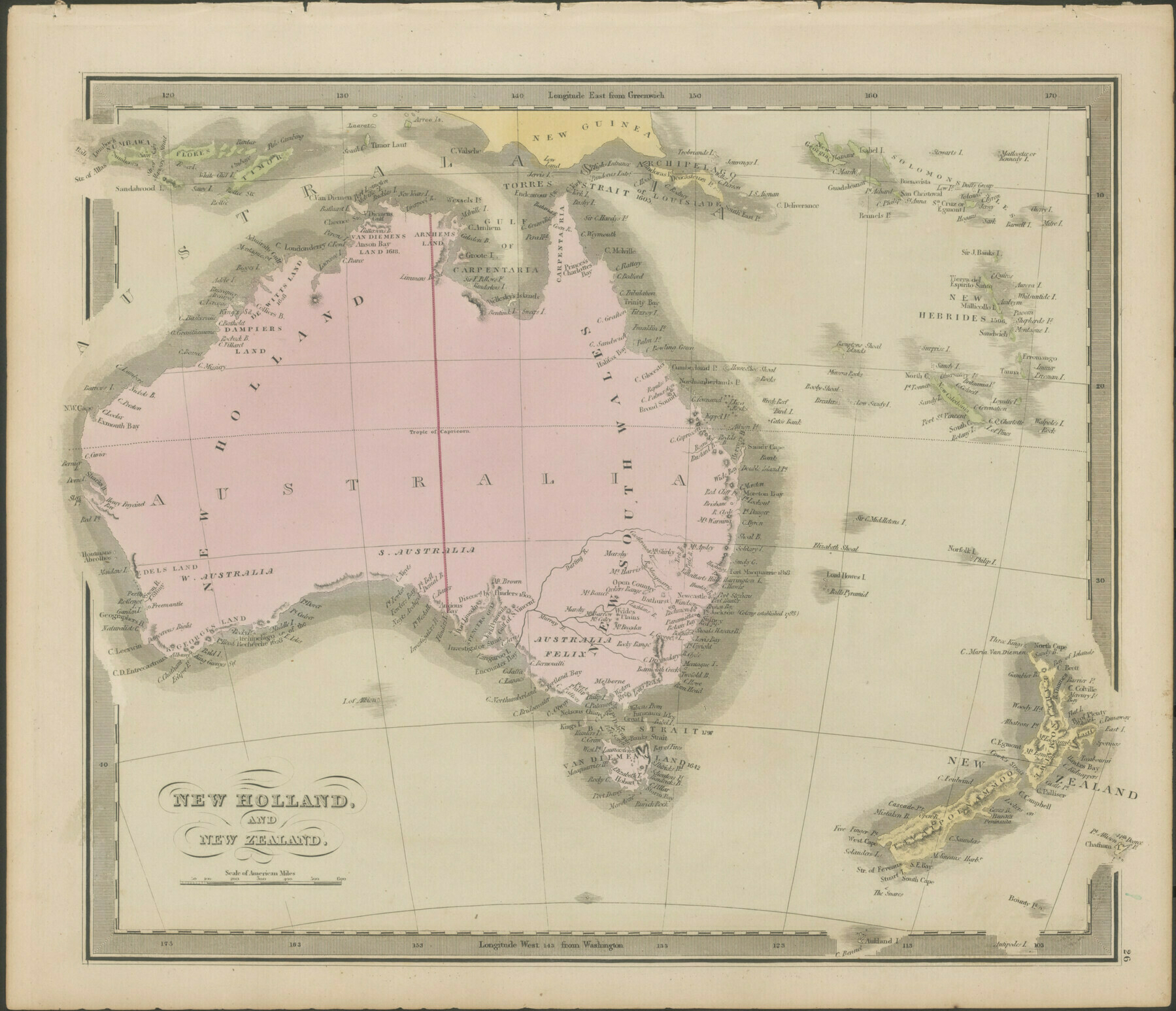
’“Sidney” and “Melborne”‘–RobotShittingDuck
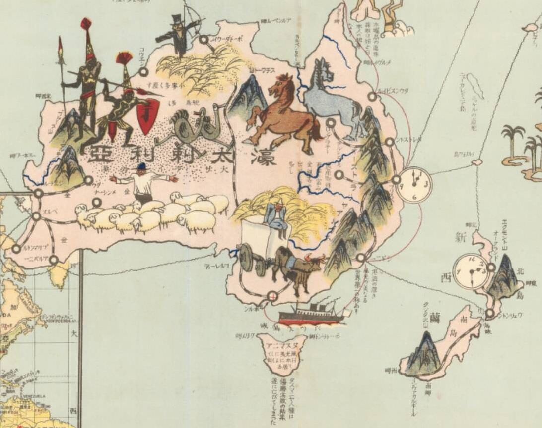
1938 Japanese pictorial map of New Zealand
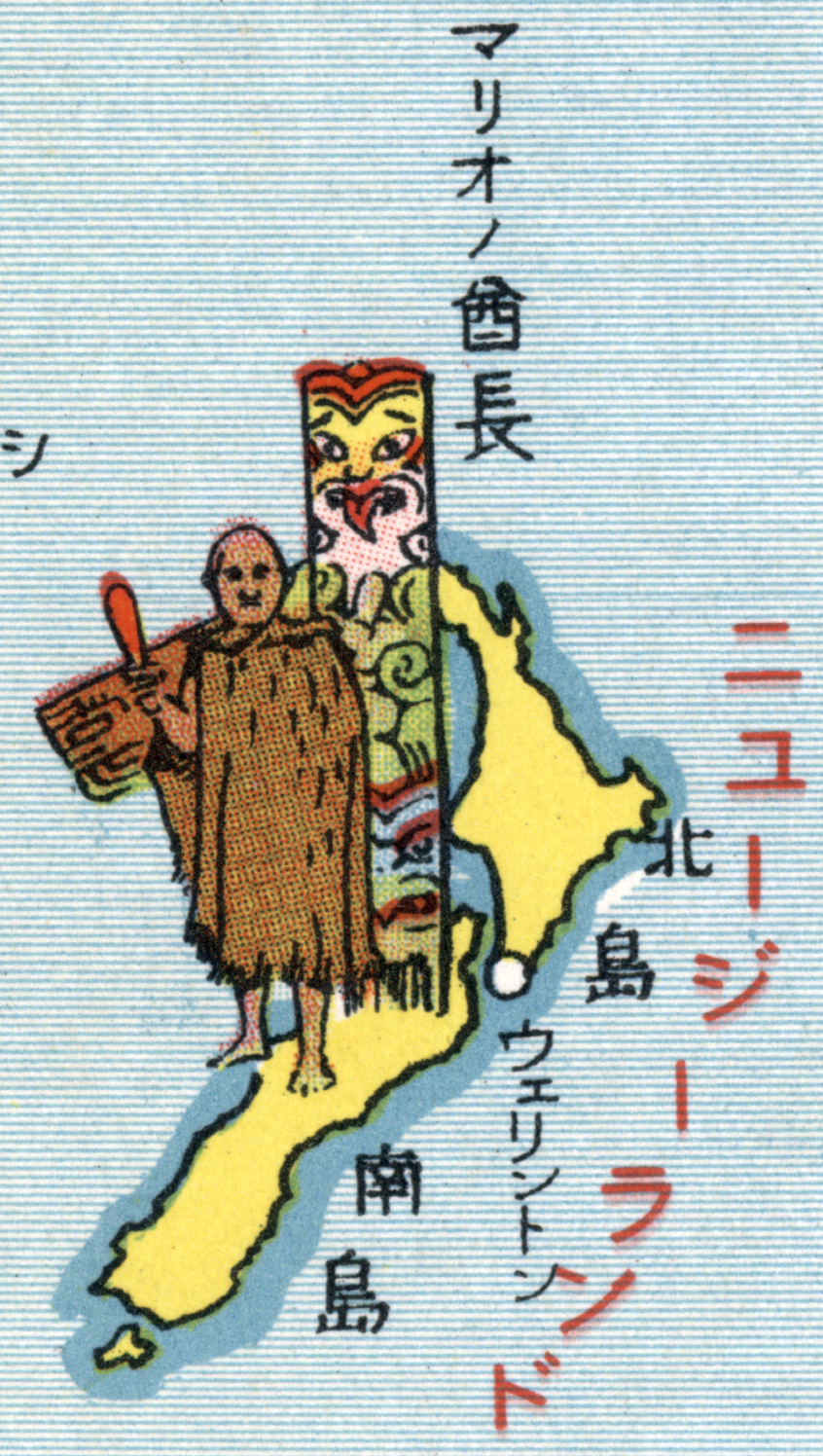
‘They wrote ma-ri-o chief instead of Maori chief … Mama Mia…’
1890s Japanese map of New Zealand
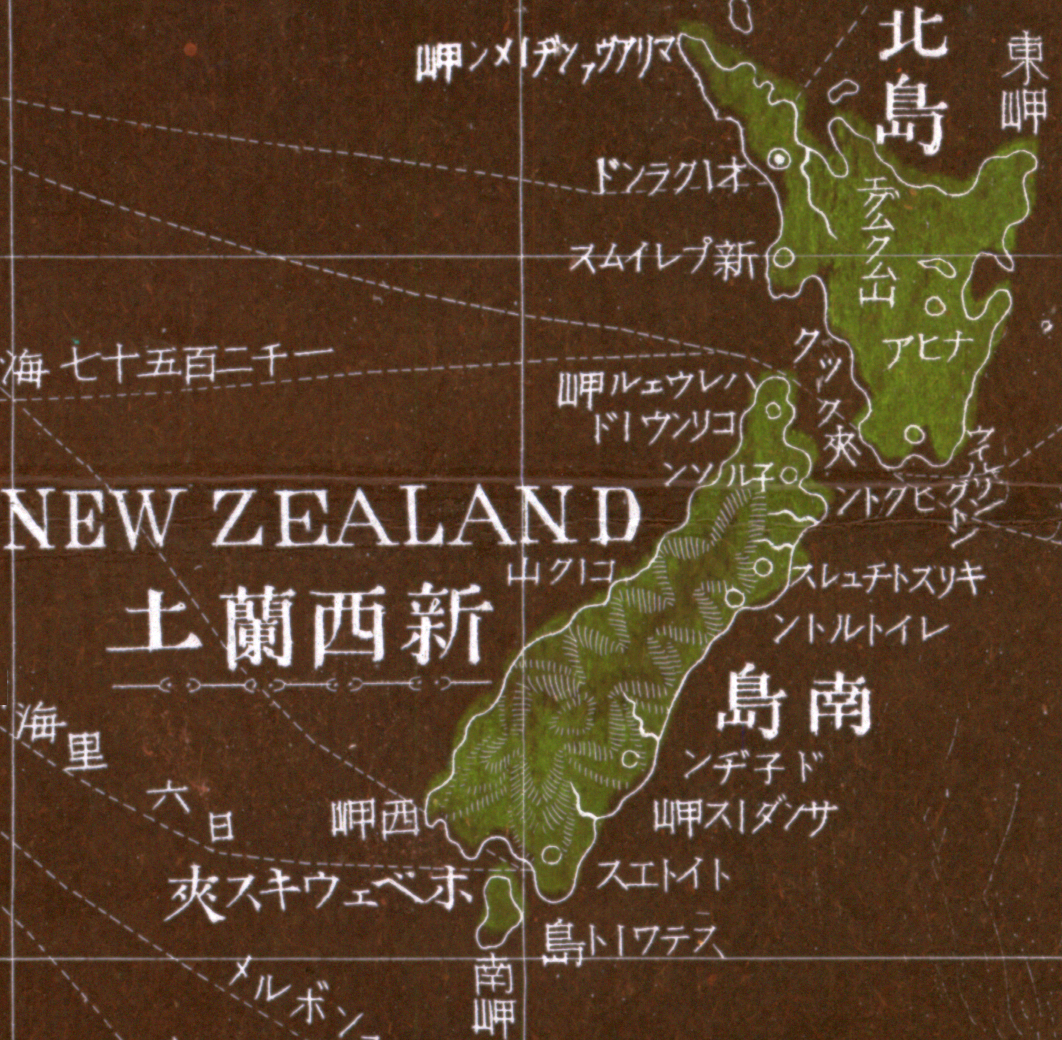
‘It looks like a picture from the title block of Evangelion’–ArhontNaPopustu
Māori population percentage per district in New Zealand
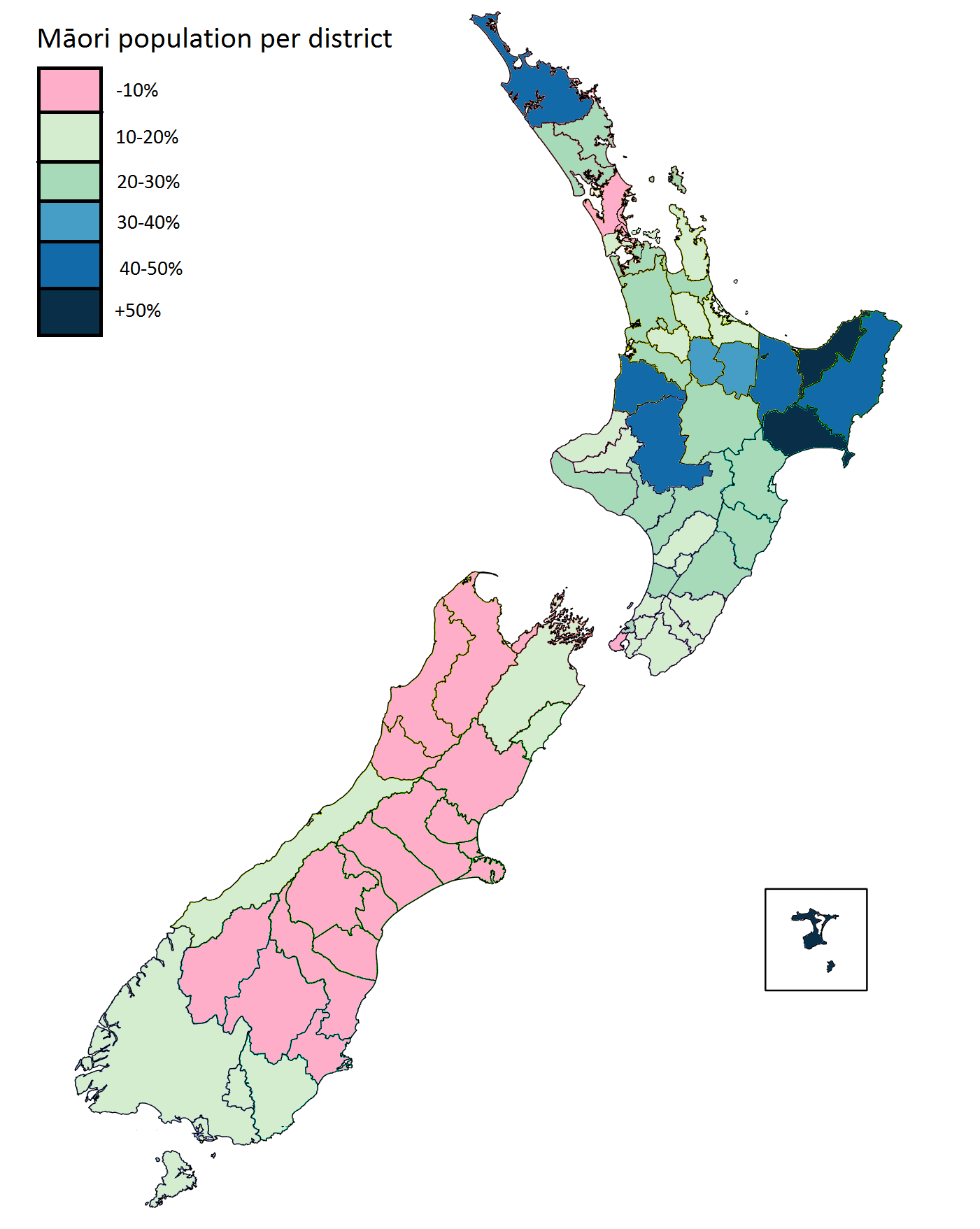
‘Do any of them still live somewhat traditionally, or is it like in the US? … sadly not. but there may be more dignity intact than what native americans have been left with - there aren’t ‘reservations’ at least. some ways of catching and preparing food are still used in some places, as is the language increasingly. and the tattoo culture remains strong. traditional dance, music, clothing etc. are mainly only to be seen in mocked-up tourist ‘villages”
Japanese map of Australia & New Zealand from 1924
“Ah, very Japanese indeed. Though they even got the emus! Strange lack of kangaroos though”–Teerdidkya
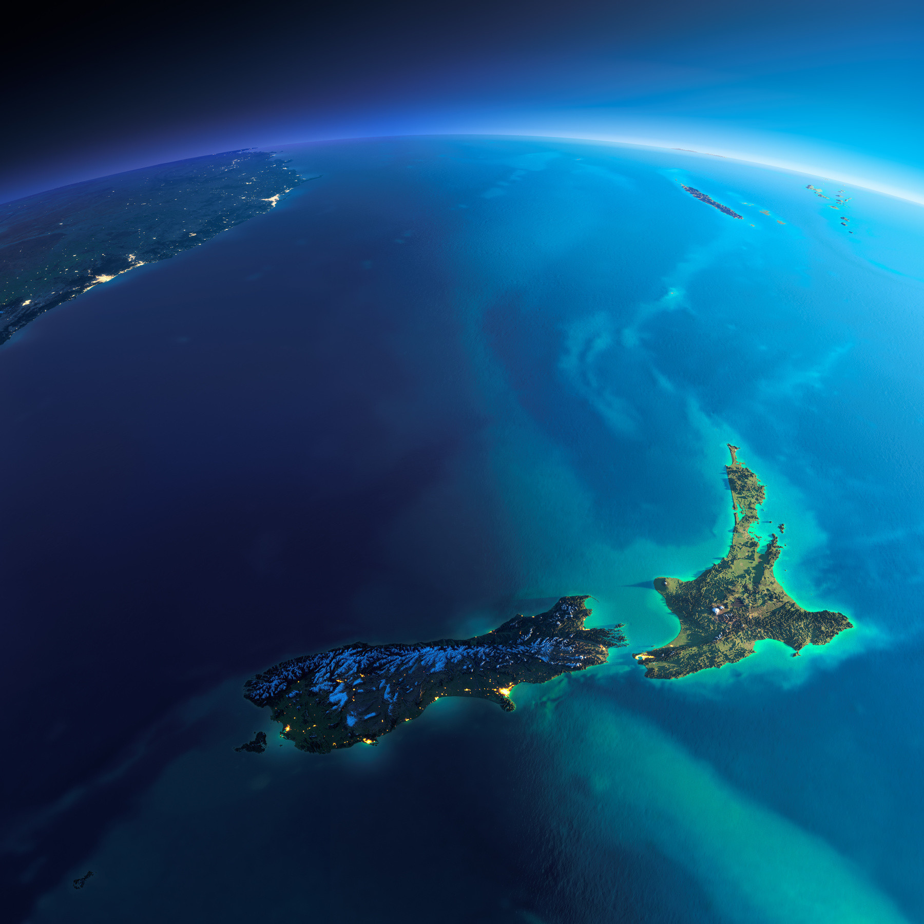
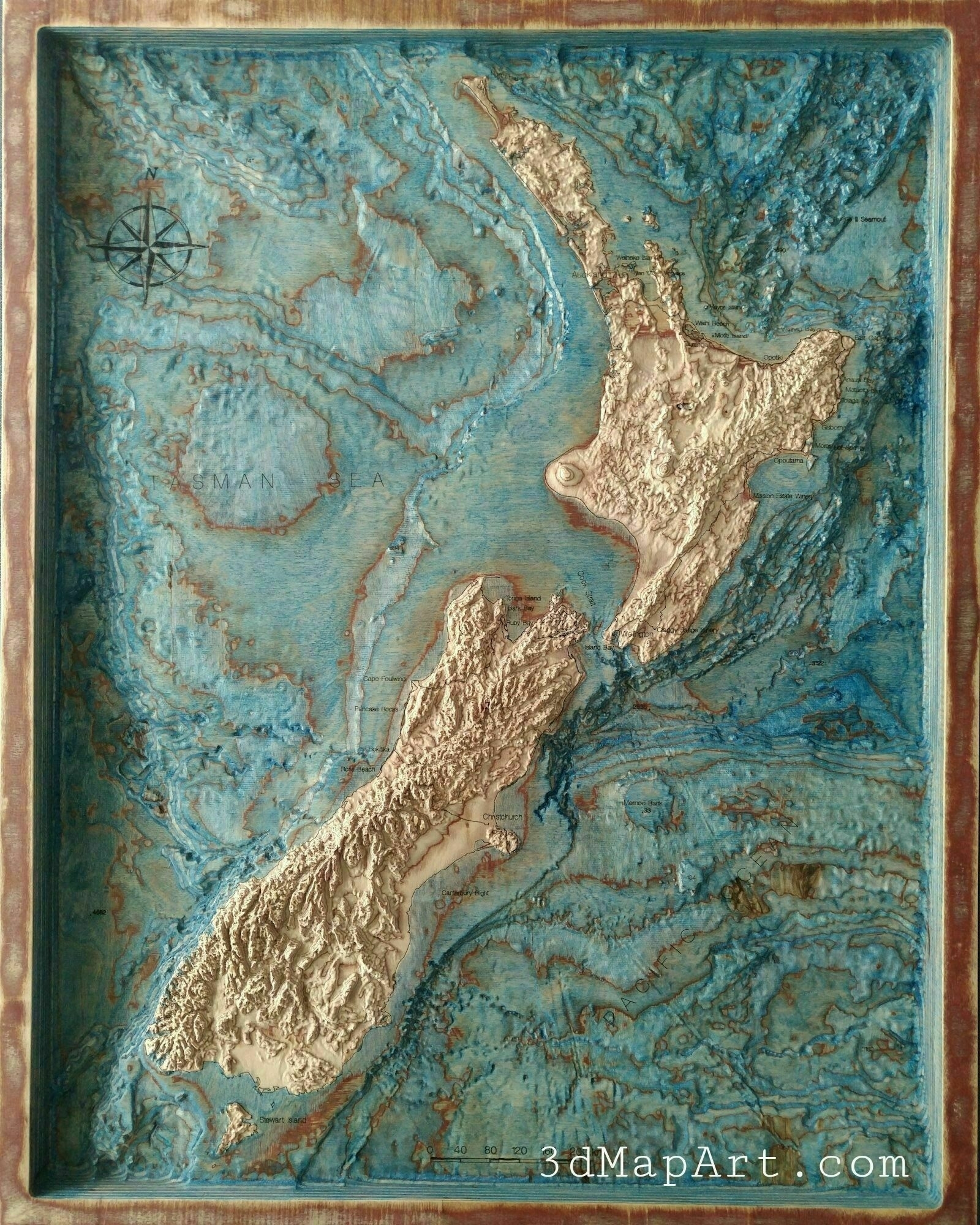
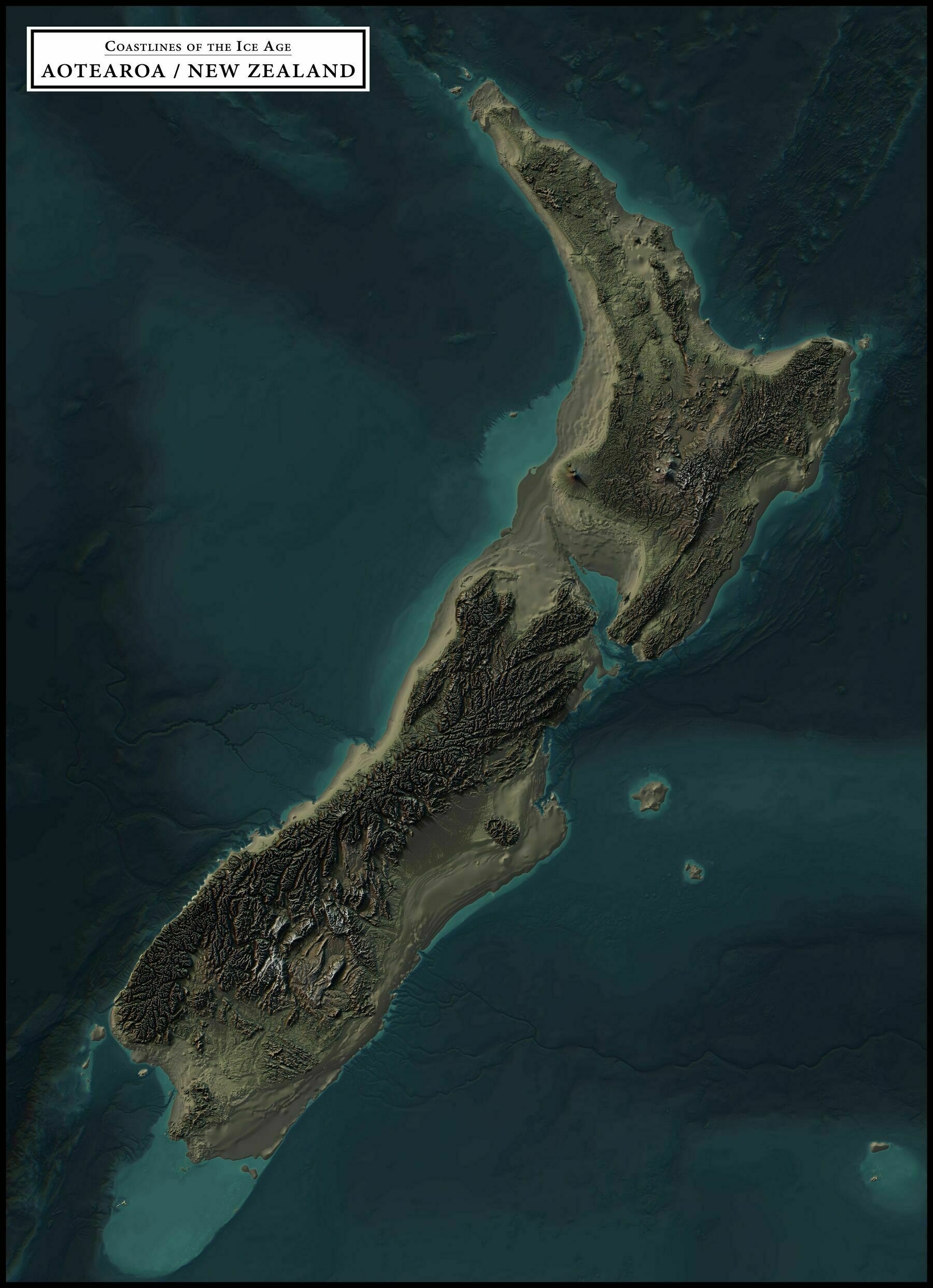
Exaggerated Relief Map of New Zealand at Sunrise
“r/mapswithonlynz … Does Australia not count? … Nah mate, that’s just the West Island”
1813 map of Australia, New Zealand & New Guinea
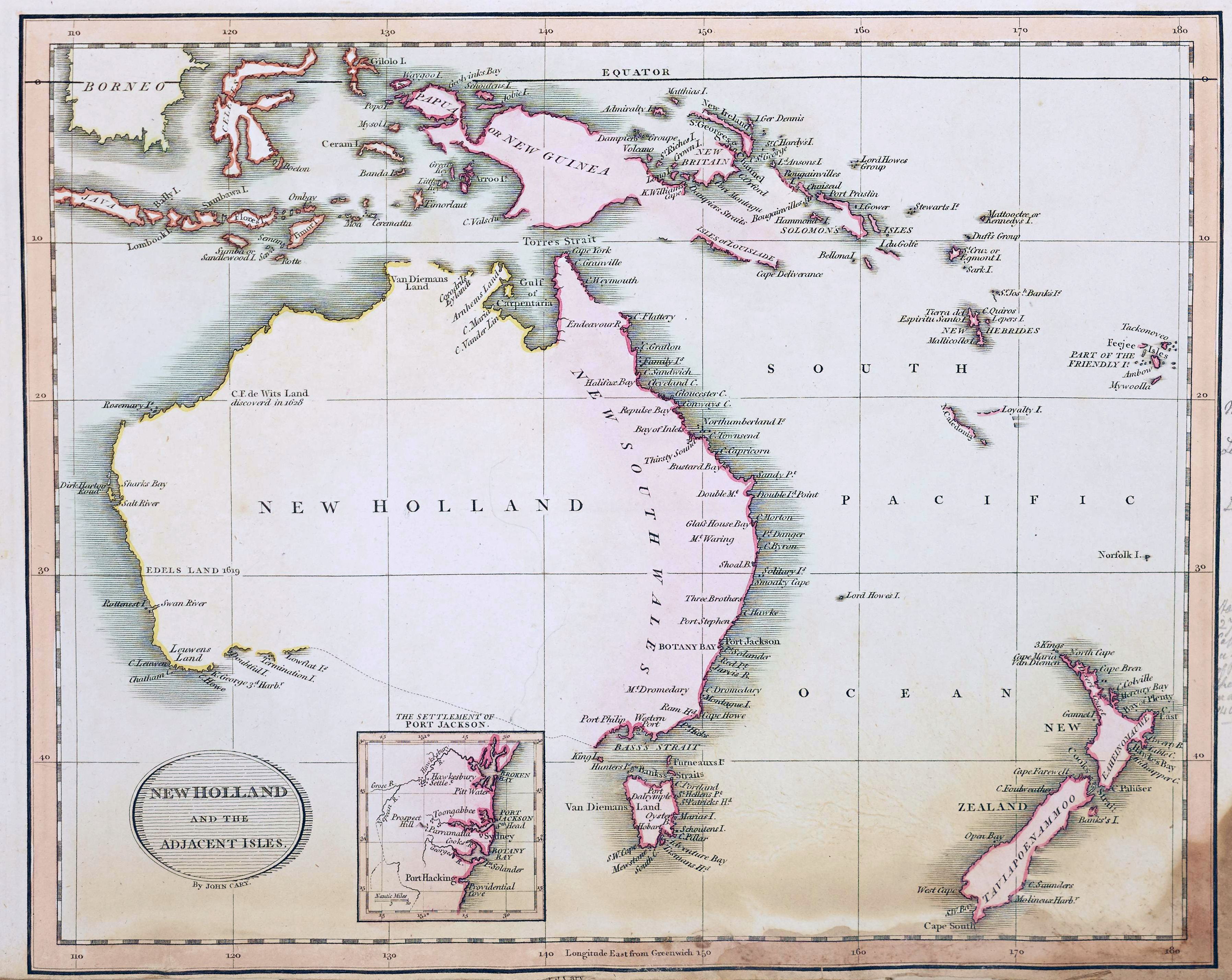
“Sydney really does look a lot like Chepstow if you close your eyes”–SmokeyBlazingwood16