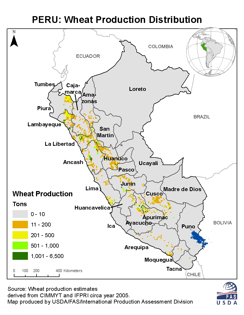
Climate map of Peru
Climate map of Peru
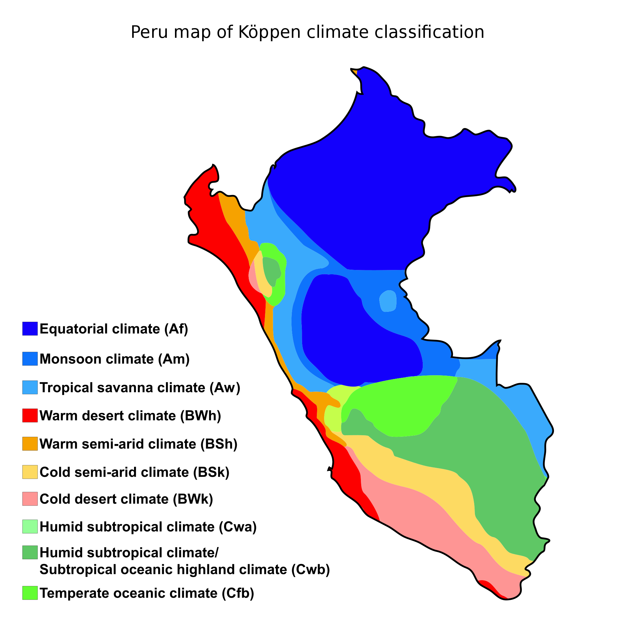
‘My family is from Lima, it is so dry, muggy, constant gray skies, desert feels like a disservice. My cousin never saw rain until he was 14 at a Madonna concert in Chile’
Climate map of Peru
‘My family is from Lima, it is so dry, muggy, constant gray skies, desert feels like a disservice. My cousin never saw rain until he was 14 at a Madonna concert in Chile’
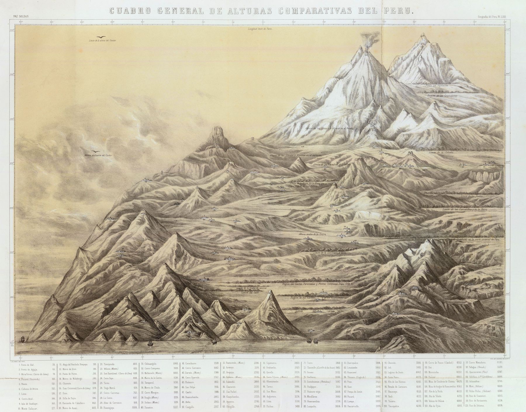
Exaggerated Relief Map of Peru - by Richard Edes Harrison (1938)
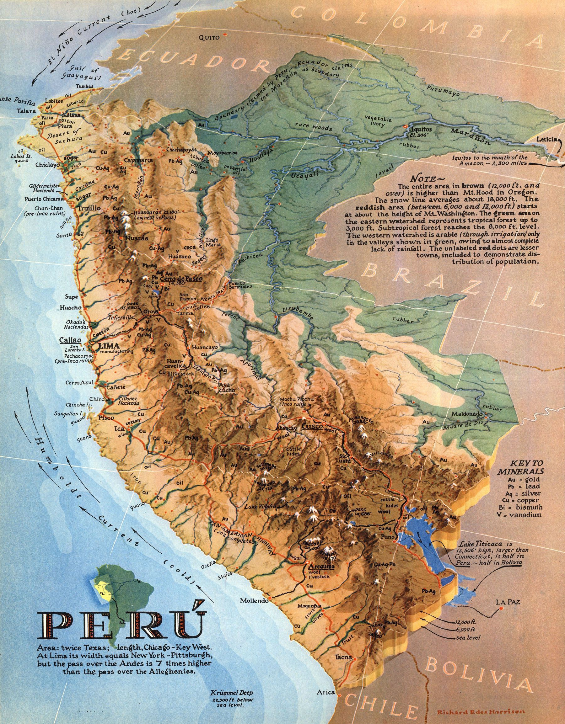
‘Wonderful map. First thing I did was look for the Callejón de Hualias - the valley at the foot of Mt. Huascarán (22,000 ft). There was a tremendous avalanche in the 1960s when three million tons of ice and snow broke off the summit and rolled right down. Probably the best depiction of Peruvian Amazonia I’ve ever seen’–CountHonorius
