Topographic map of Switzerland (1969)
Topographic map of Switzerland (1969)
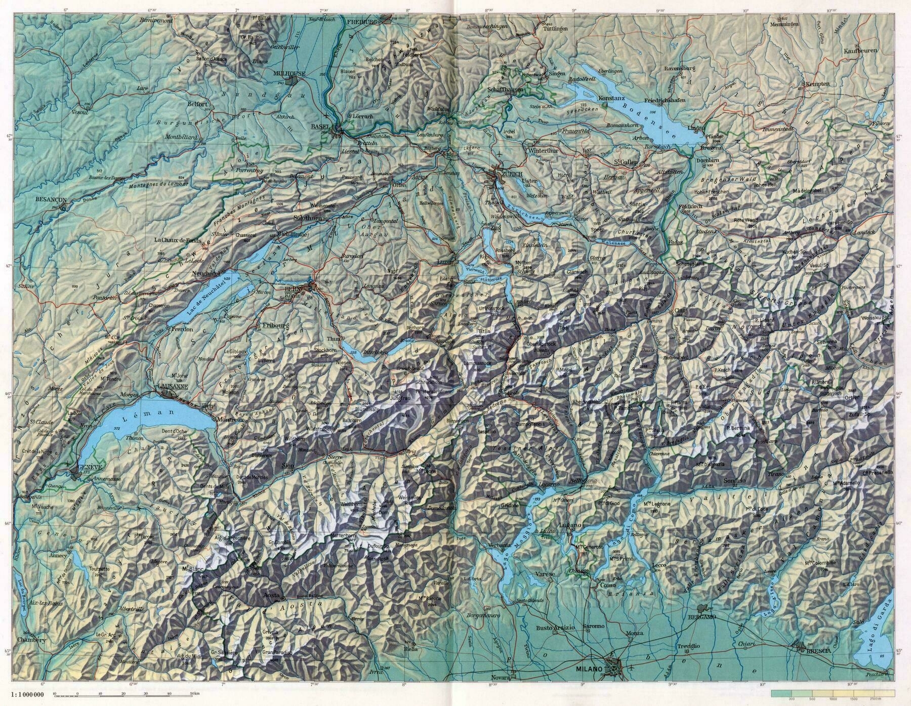
‘I like how you can draw lines across the most defined features and will come out with the same general shape of Switzerland’
Topographic map of Switzerland (1969)
‘I like how you can draw lines across the most defined features and will come out with the same general shape of Switzerland’
Topographic map of Luxembourg
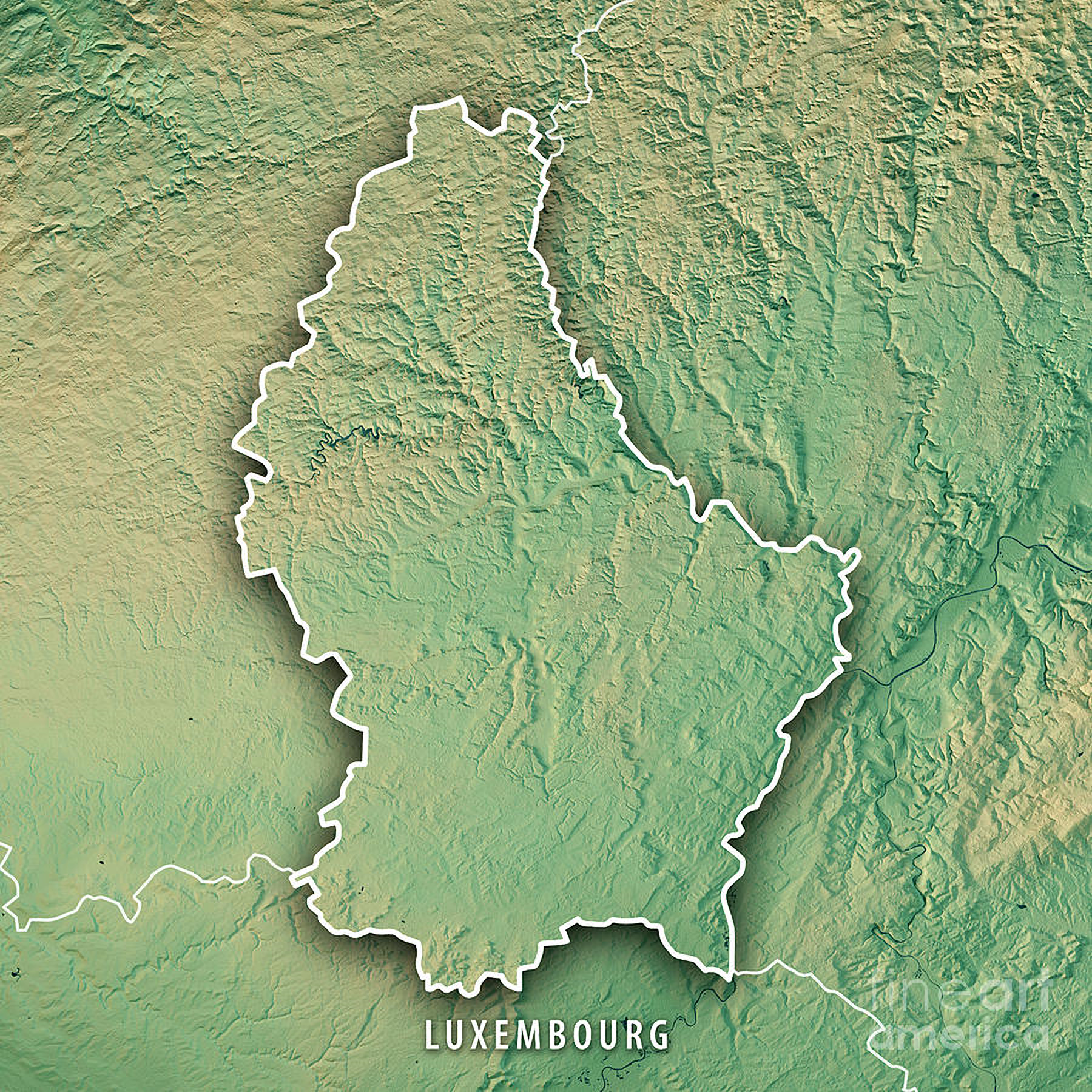
‘My mayor of 17 years resigned to become the US ambassador to Luxembourg’
Topographic map of Somaliland
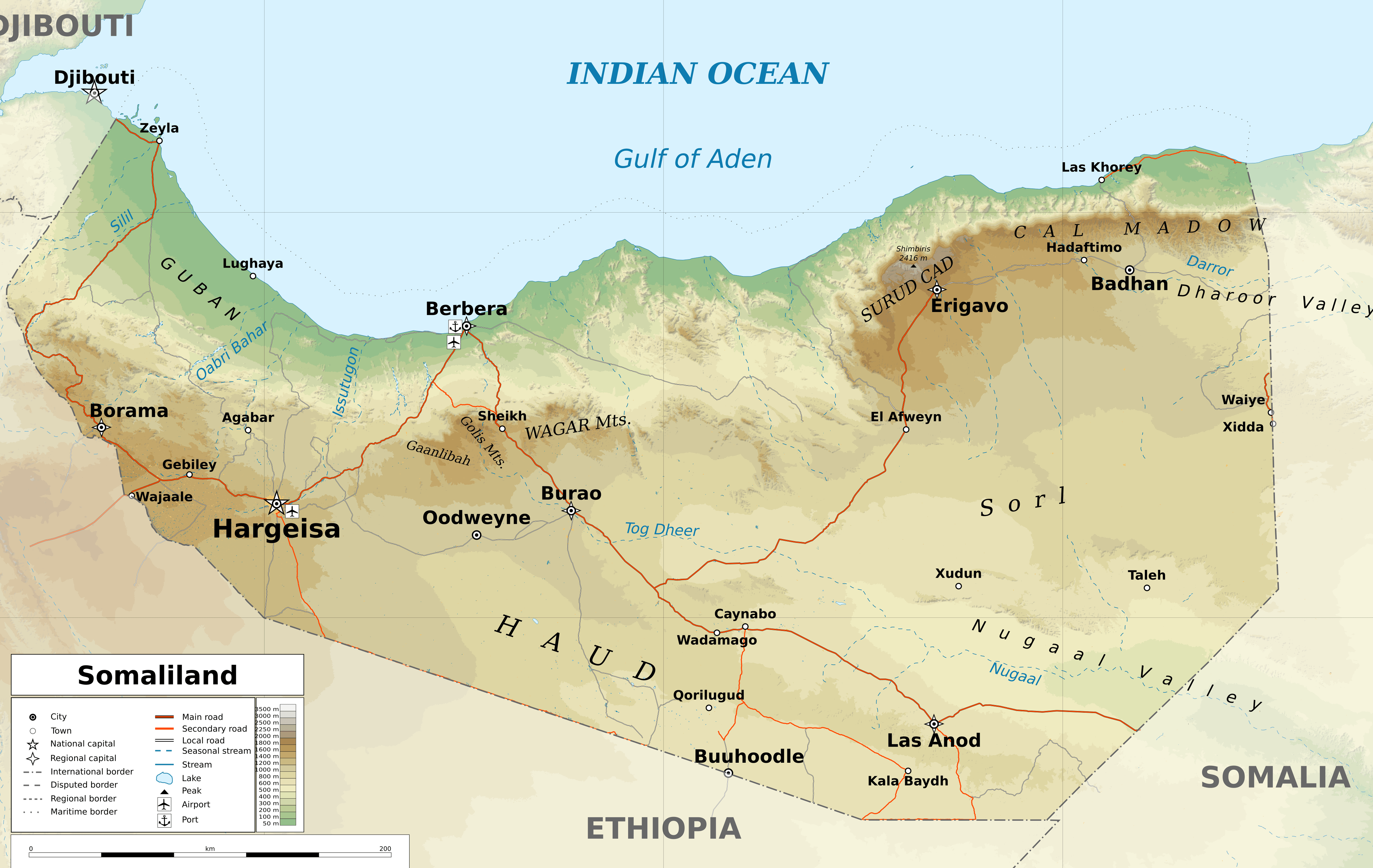
‘What’s the political status of this these days? Still under the Somali yoke?
There is no yoke as there is no government to speak of in Mogadishu. It’s operating independently and is fairly safe to visit last I heard. Had big issue lately with a fire in a market, that market was around 40% of the GDP’
Relief map of Africa (1990)
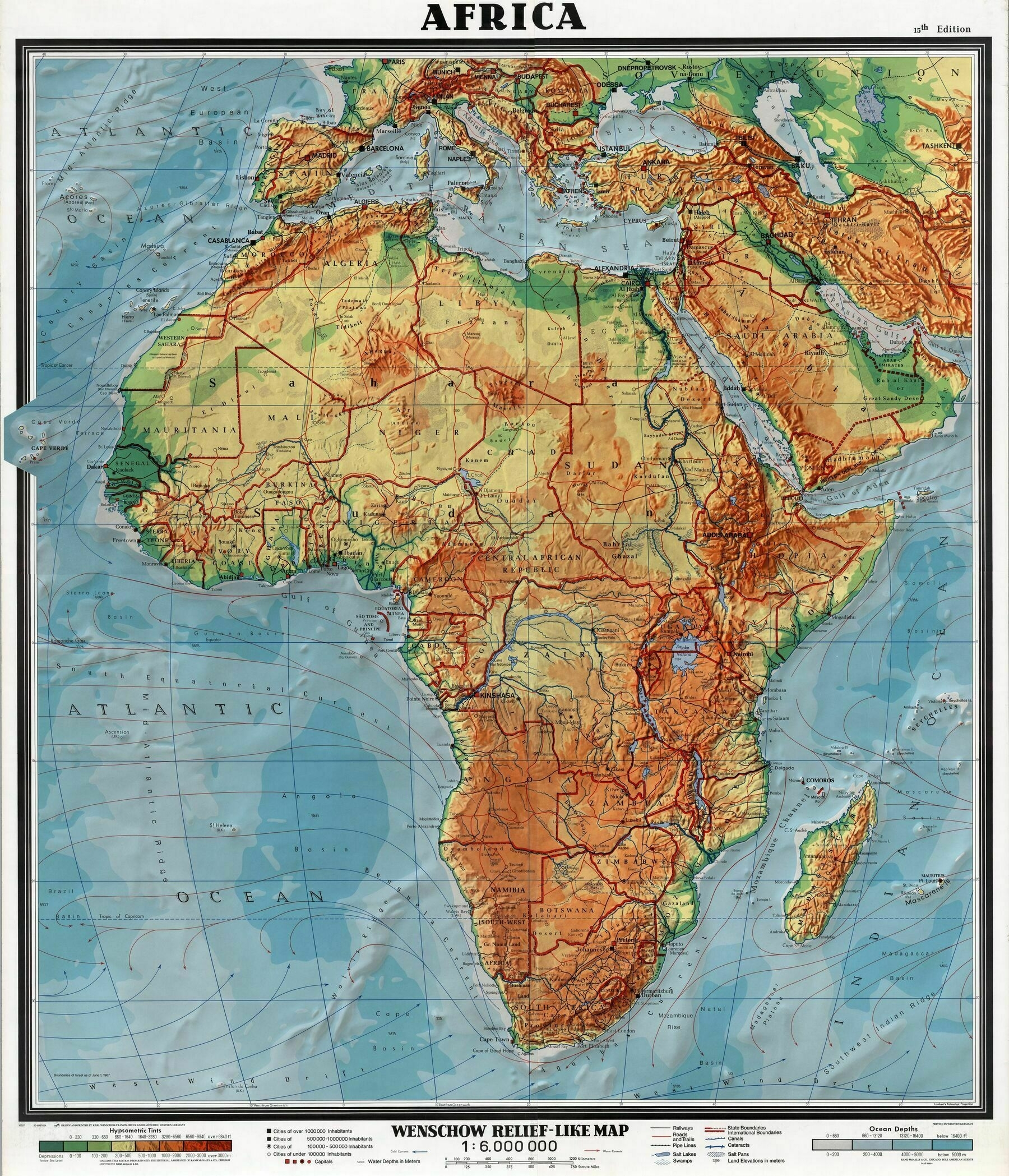
‘I thought sub saharan Africa was mostly jungles and forests. Am I uninformed?
You can still have hills in a jungle.
Depending on how you define Sub Saharan Africa, it ranges from arid Savannah to tropical rainforest’
Relief map of Slovenia
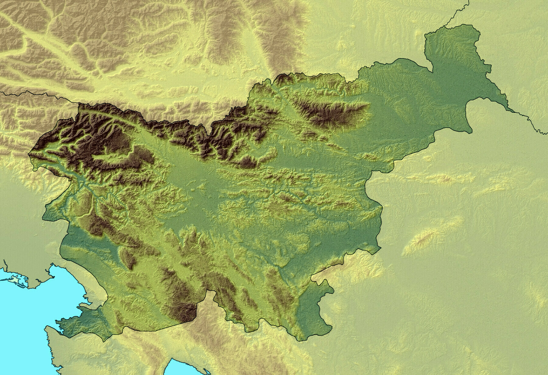
‘It cracks me up how a country like Italy with thousands upon thousands of miles of coastline just needs to have that Trieste area and leave Slovenia with an even more measly stretch of coast. It almost seems petty.’
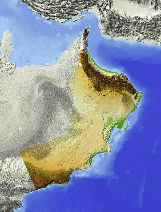
Relief map of Saudi Arabia
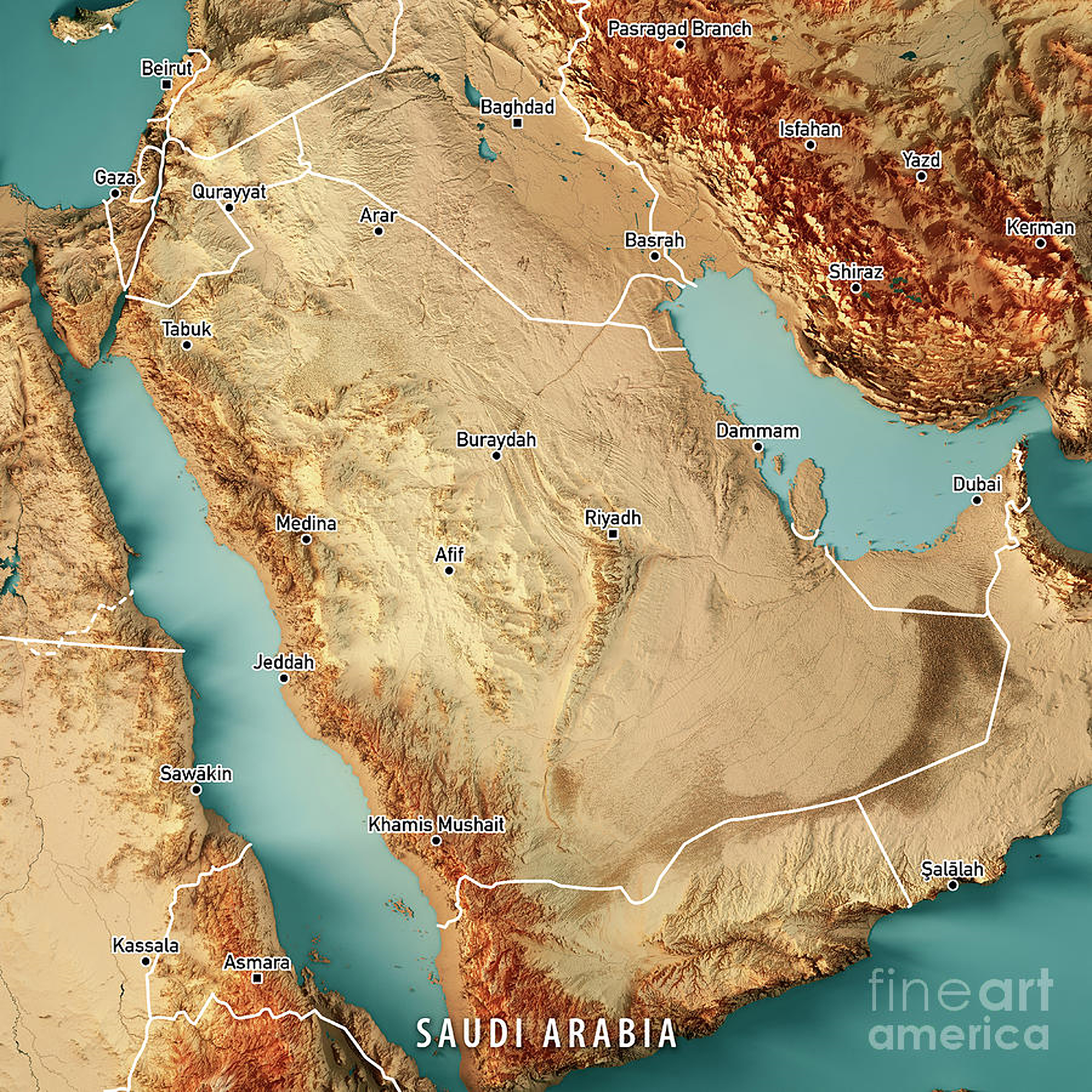
‘The country that will host the Asian Winter Games in 2029…
It snows every year in the Saudi north. The snow blankets the sand.’
1969 shaded relief map of the United States
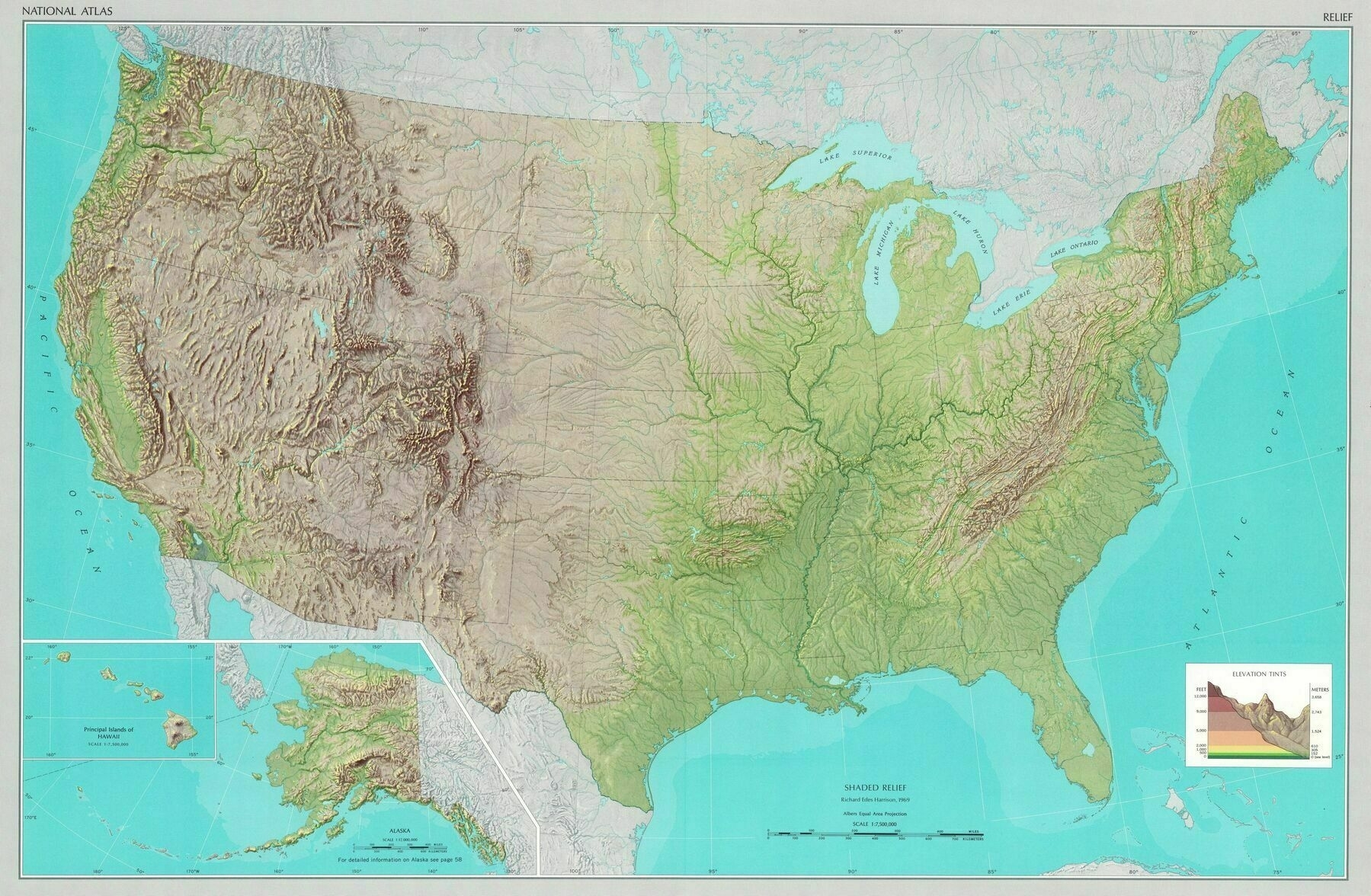
‘they just don’t make em like this anymore’
Relief map of Pakistan
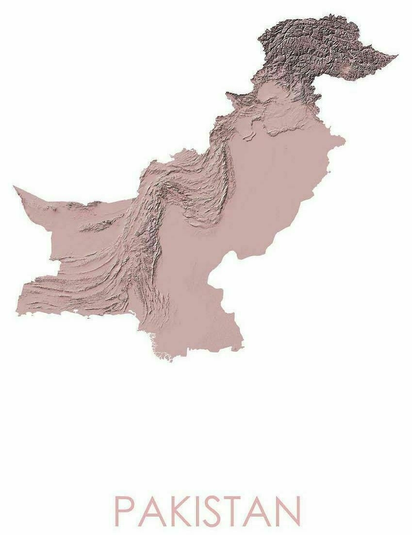
‘I know most of Pakistan’s population lives in the Indus River belt but are there any major cities in the westernmost Pakistan, like closer to Iran border? It looks pretty rough and dry terrain
There is Quetta’
Relief map of Myanmar
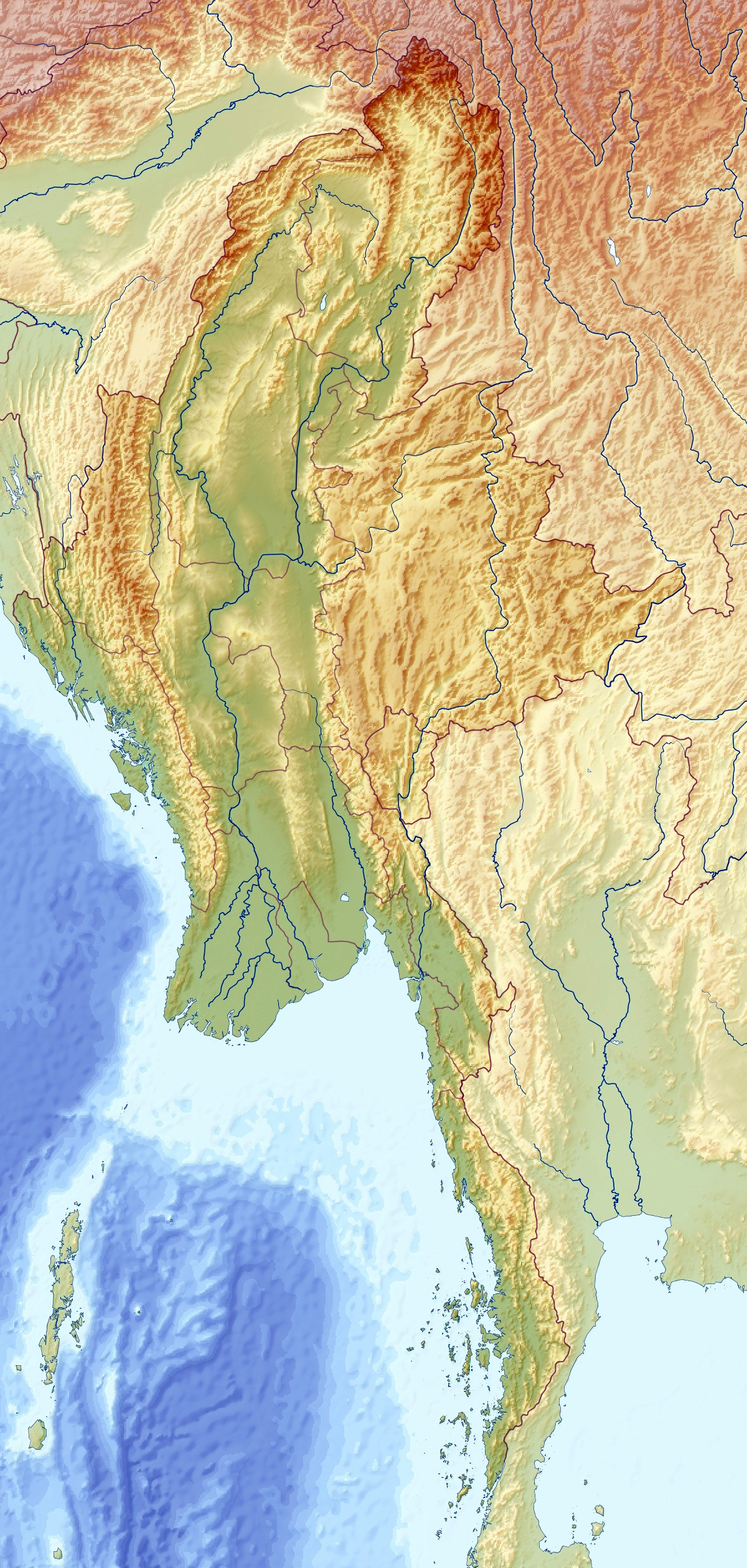
‘You most likely know it as Myanmar, but it’ll always be Burma to me’
Exaggerated Relief Map of Mexico at night
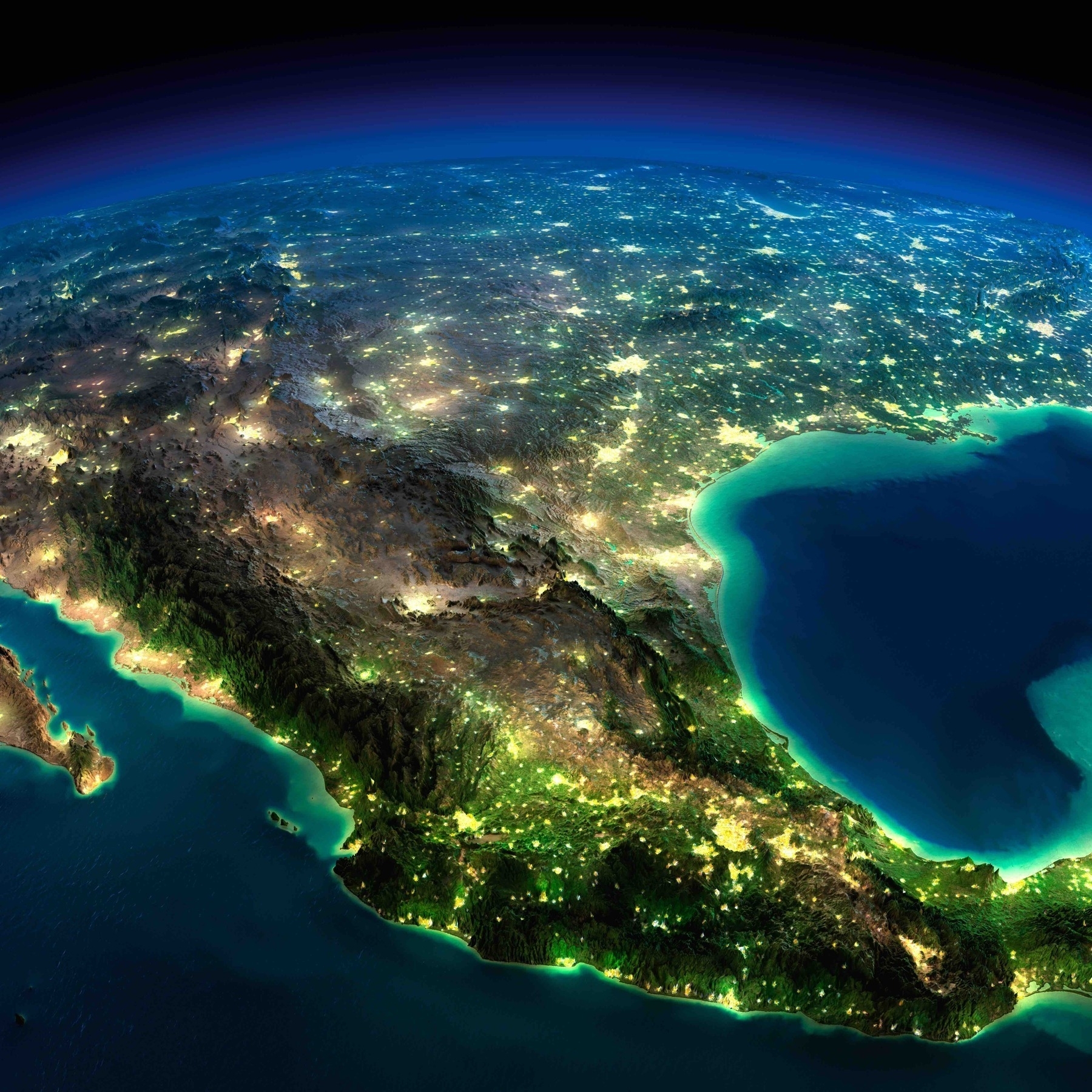
‘Look at North ! it’s beautiful’
Topographic map of Colorado - Joy Division style
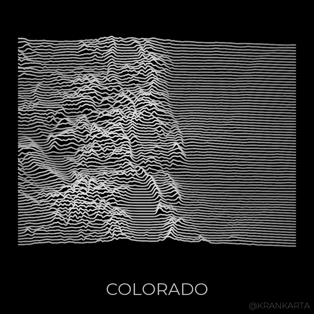
‘Is this available as a T-Shirt yet?’
Topographic map of North Macedonia
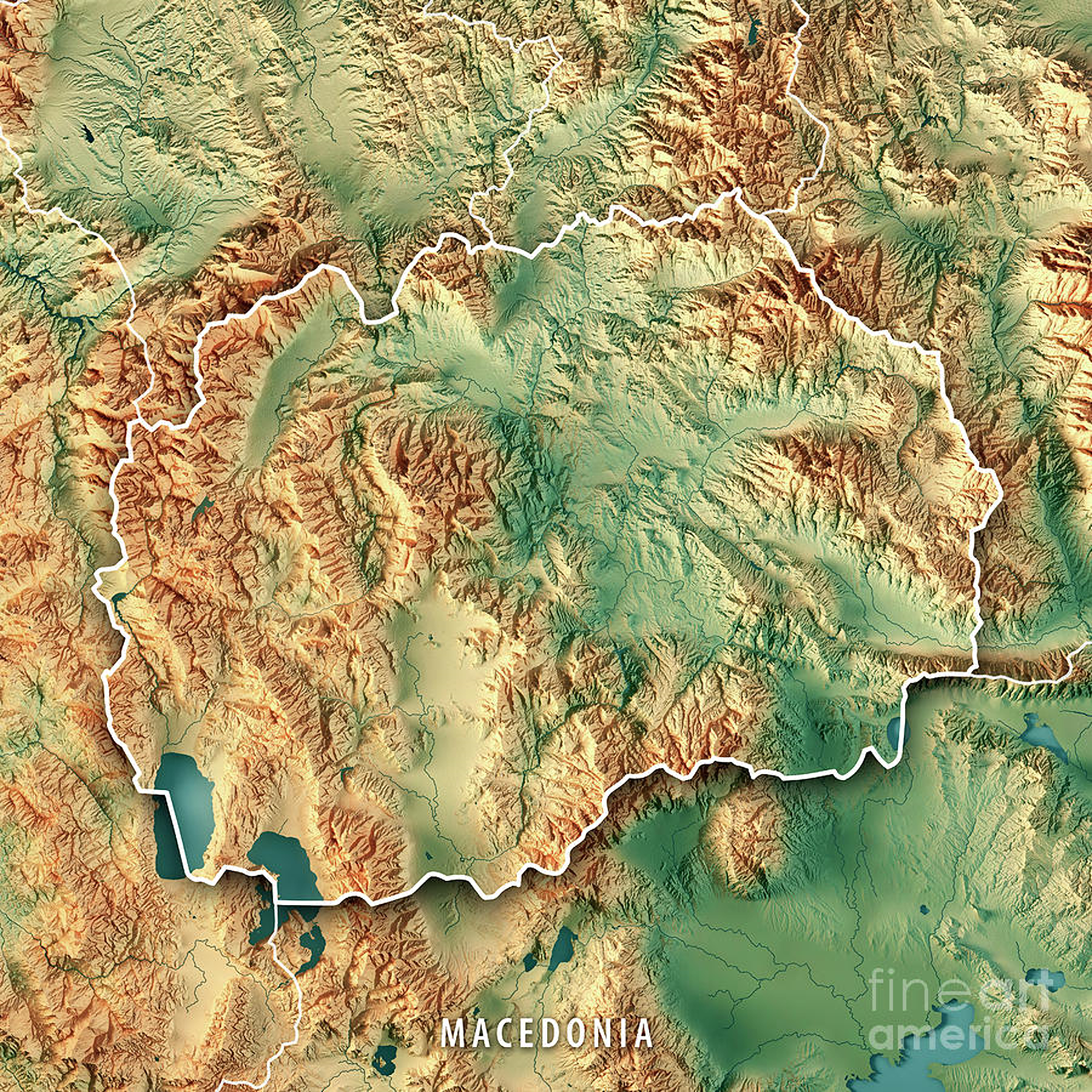
‘Will North Macedonia get a navy if they build that Aegean-Danube canal?
What would be the purpose? A canal will not give them territorial waters to protect.
At the moment they do not have an air force to patrol their airspace, NATO does that for them’
Topography of Angola
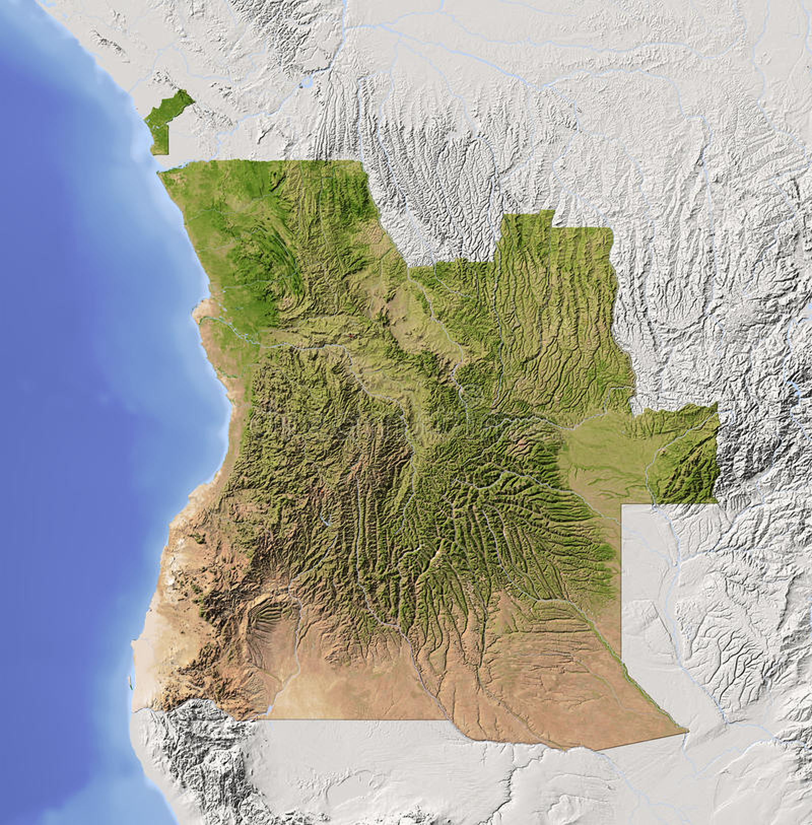
‘The little piece in the northwest is the exclave province of Cabinda, four former kingdoms separated from the rest of Angola by the DR Congo’s tiny strip of ocean access’
Topographic Map of Hungary
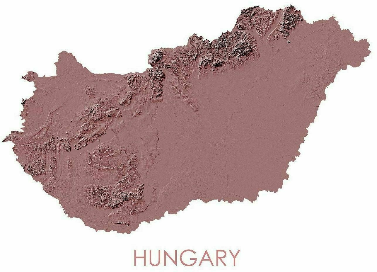
‘Mmmmm, Pannonian Basin
The Pannonian Basin, or Carpathian Basin, is a large basin in Central Europe. The geomorphological term Pannonian Plain is more widely used for roughly the same region though with a somewhat different sense, with only the lowlands, the plain that remained when the Pliocene Epoch Pannonian Sea dried out. It is a geomorphological subsystem of the Alps-Himalaya system, specifically a sediment-filled back-arc basin which spread apart during the Miocene. Most of the plain consists of the Great Hungarian Plain (in the south and east, including the Eastern Slovak Lowland) and the Little Hungarian Plain (in the northwest), divided by the Transdanubian Mountains’
