Languages of South Africa
Languages of South Africa - by Tomislav Addai
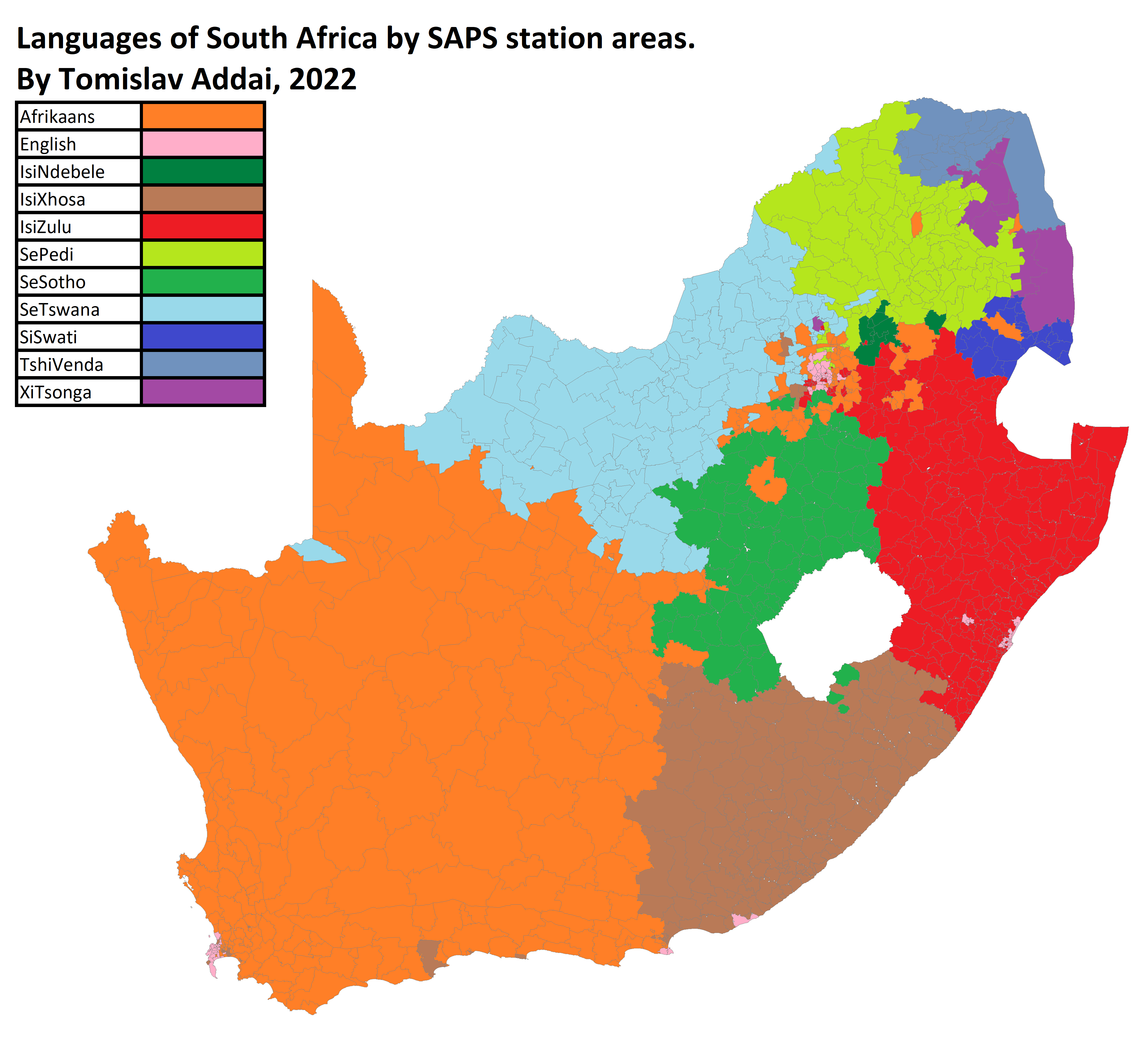
‘The trouble with this kind of map is that languages are spoken by people, not by land. The western half of South Africa is sparsely populated. In fact, Afrikaans is spoken by 13.5% of people, while English is spoken by 9.6%.. Both isiXhosa (16%) and isiZulu (22.7%) have more speakers than either European language.’

