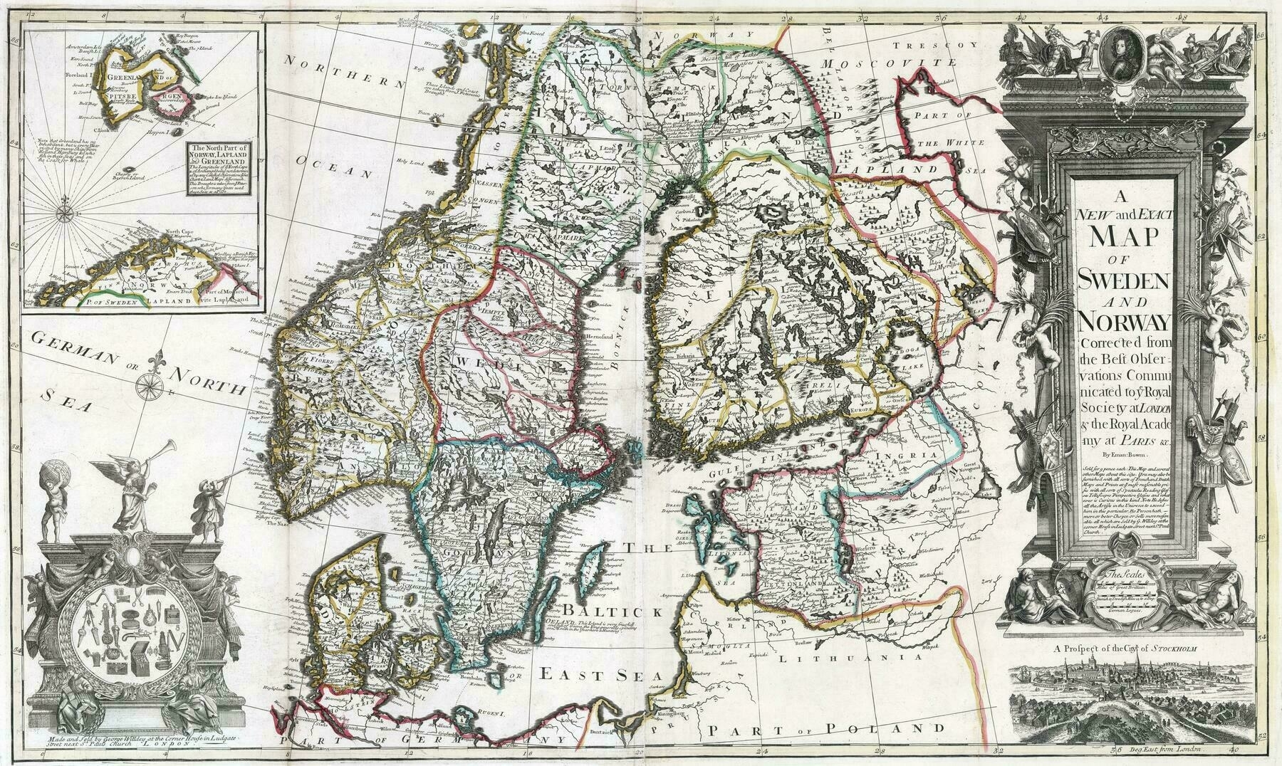
1717 map of Scandinavia and the Baltic region
1895 map of Denmark and its territories
1895 map of Denmark and its territories
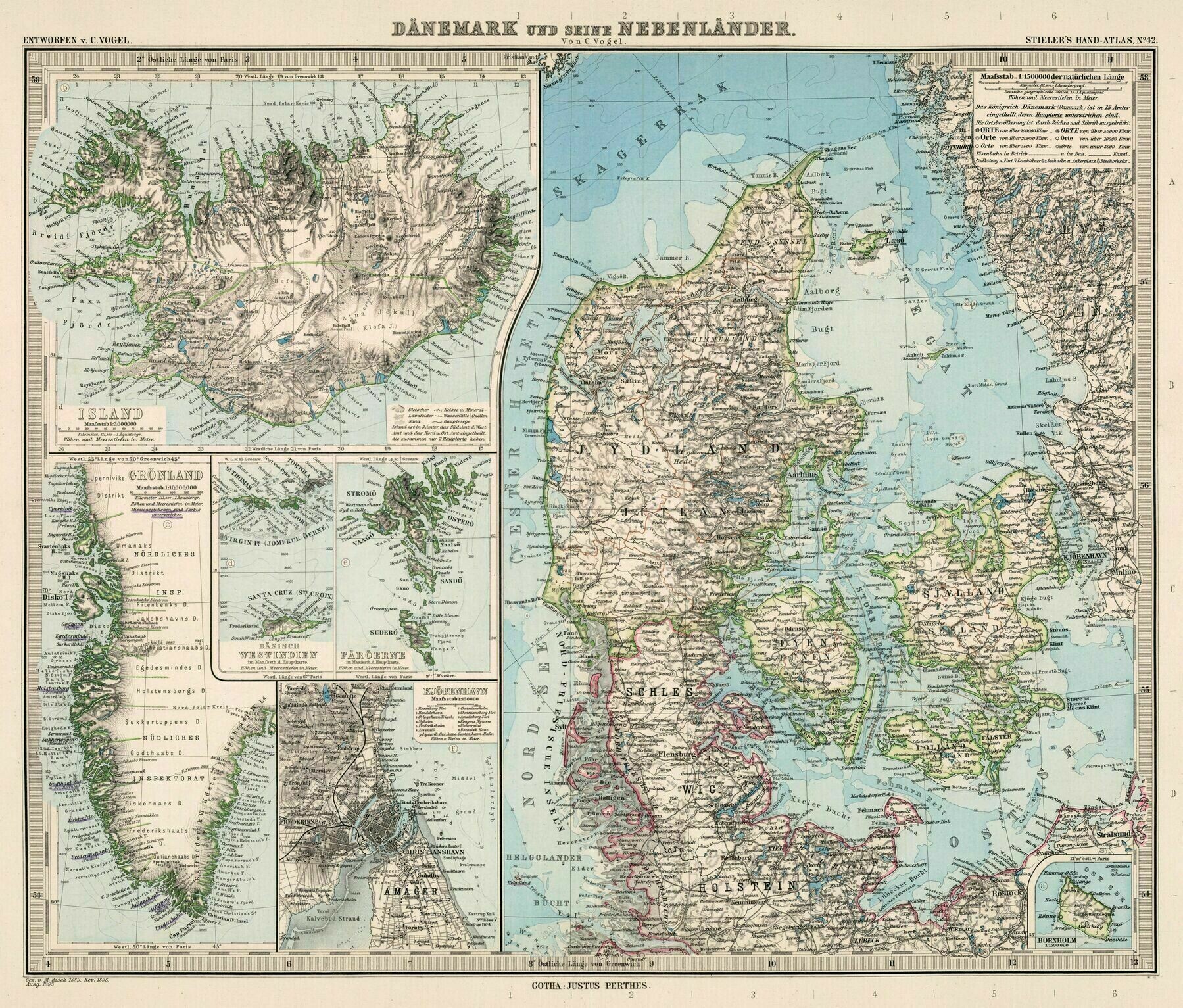
‘There is something about these maps that… I dont know, just make them better looking then what we have today. So classy and stuff. Anyway, interesting to see how Denmark saw itself in those days. And weird seeing Iceland as a “territory” i know it was one, but seeing it in history is kinda weird, to used to see it as a independent country’–NobleAzorean
1872 map of Denmark
1872 map of Denmark
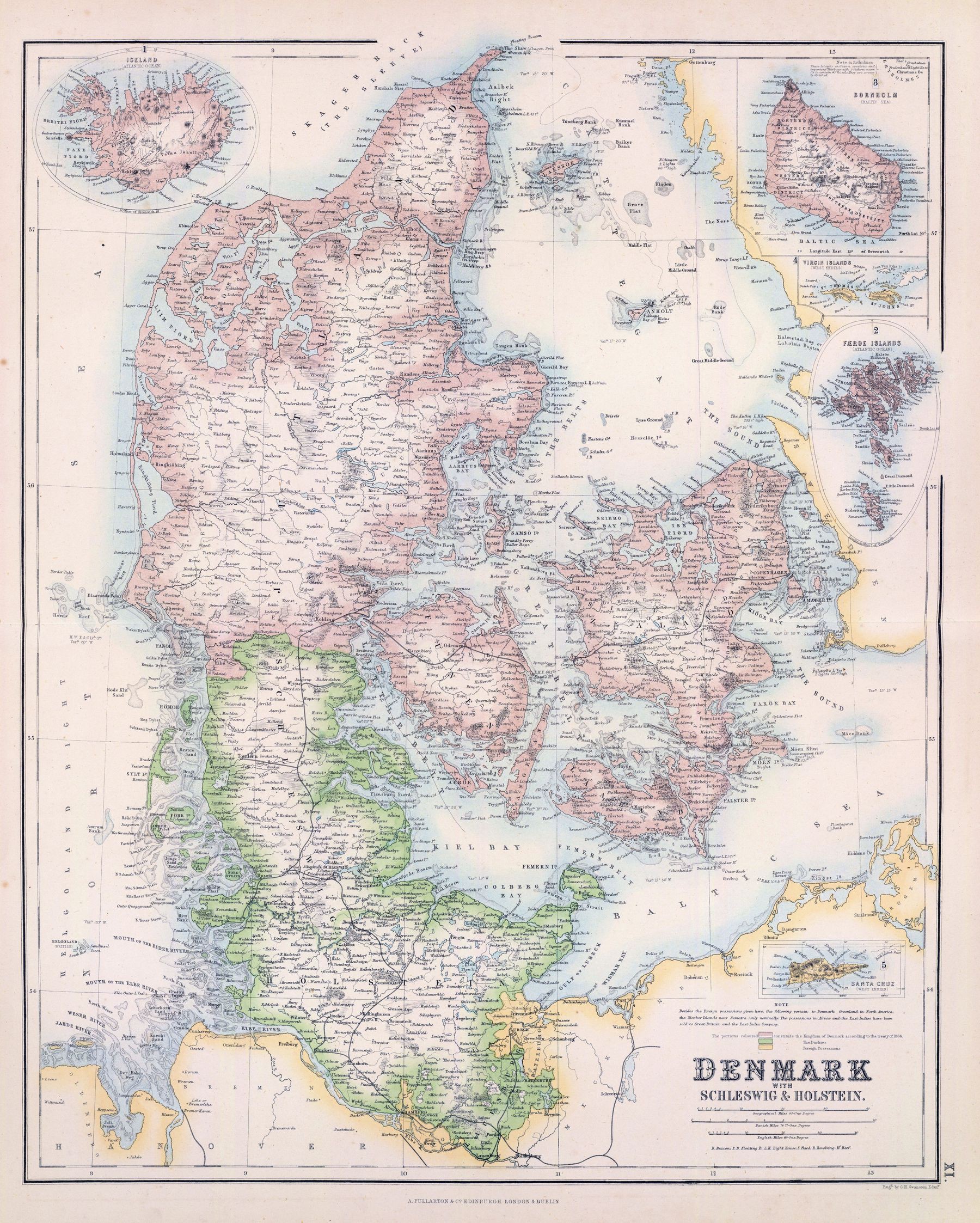
‘For some reason the island Ven (Hveen on the map, NE of Copenhagen) in the sound is colored as being a part of Denmark, even though it has been Swedish for 200 years at the time of the map. Mistake, or was there a movement to not accept the loss of the island?’–OldGriffin
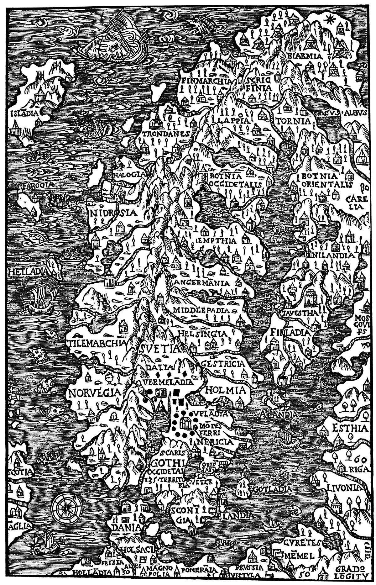
Map of Scandinavia (1555)
River basins of Scandinavia and the Baltic states
River basins of Scandinavia and the Baltic states
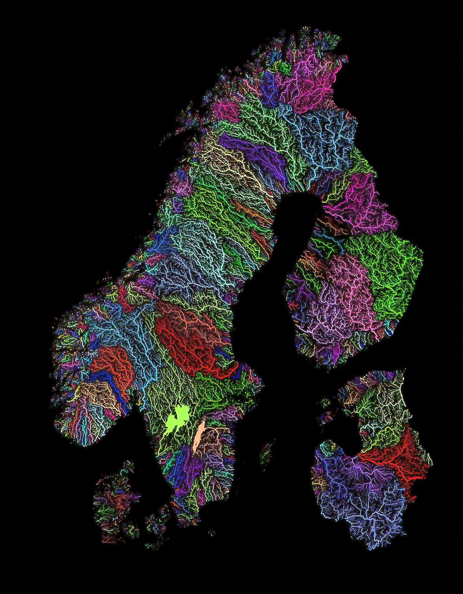
‘Out of Nordics, Sweden has the largest lake (Vänern; 5545km²) and Finland the second-largest (Saimaa, 4400km²). These are the largest and second-largest lakes in Europe (excluding Russia’s Ladoga; 18130km² and Onega 9700km²). Finland used to have half Ladoga before WW2. The Caspian Sea (371000km²) is in Asia and is the largest lake in the world … This guy lakes’
The Dogs of Scandinavia (1892)
The Dogs of Scandinavia (1892)
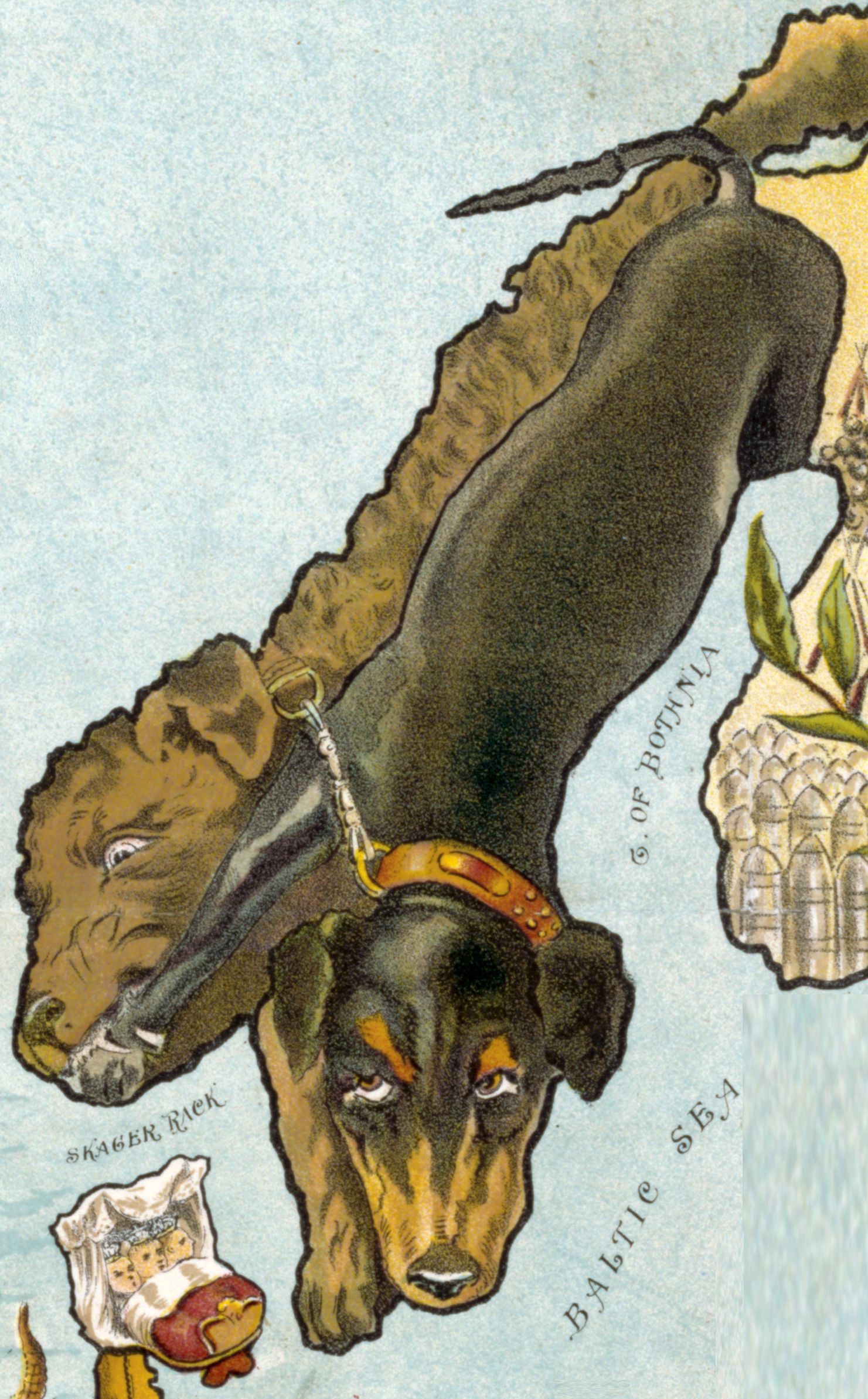
‘The reason Norway is muffled by the Swedish dog there is that Norway was under a Union with sweden at that time and had no say in foreign matters’–Tronderbart
Military map of the Danish Island of Als (1851)
Military map of the Danish Island of Als – drawn at the conclusion of the 1st War of Schleswig-Holstein in 1851 ; produced in the outbreak of the 2nd Schleswig-Holstein war in 1864
[4728 × 4791]
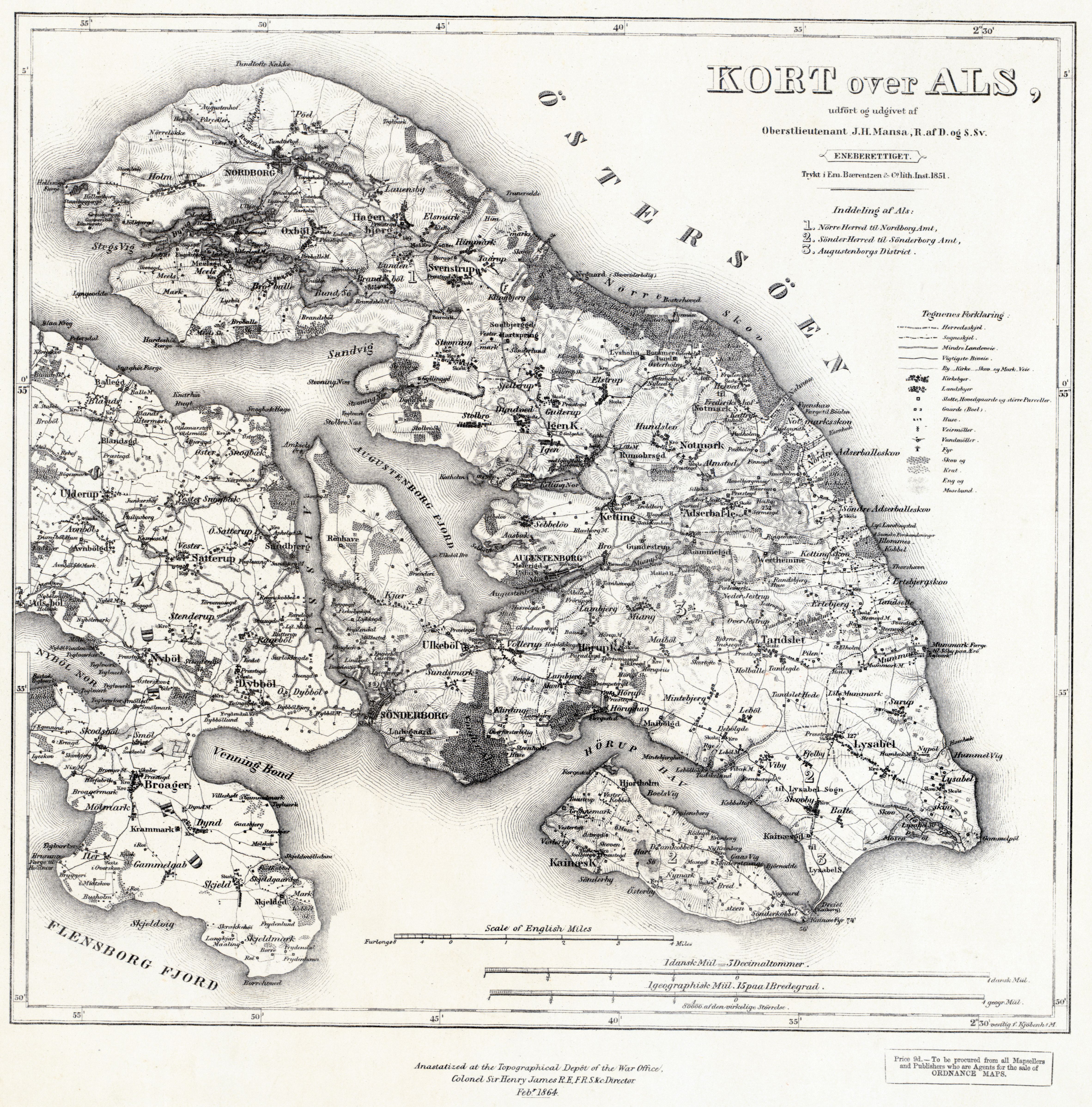
“I just glanced at the picture before reading the titel and was like ‘wtf, why is that a picture of Als’”–Packimus
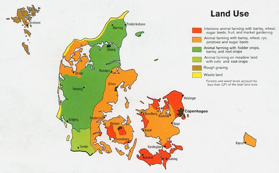
Denmark - Land Use (1974)
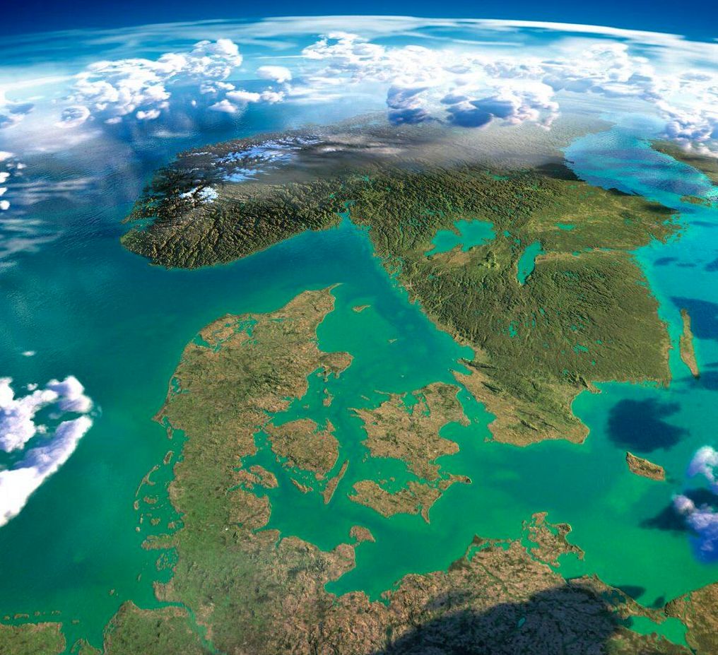
Exaggerated relief map of Denmark and southern Norway/Sweden
Exaggerated relief map of Denmark and southern Norway/Sweden
[1016 × 927]
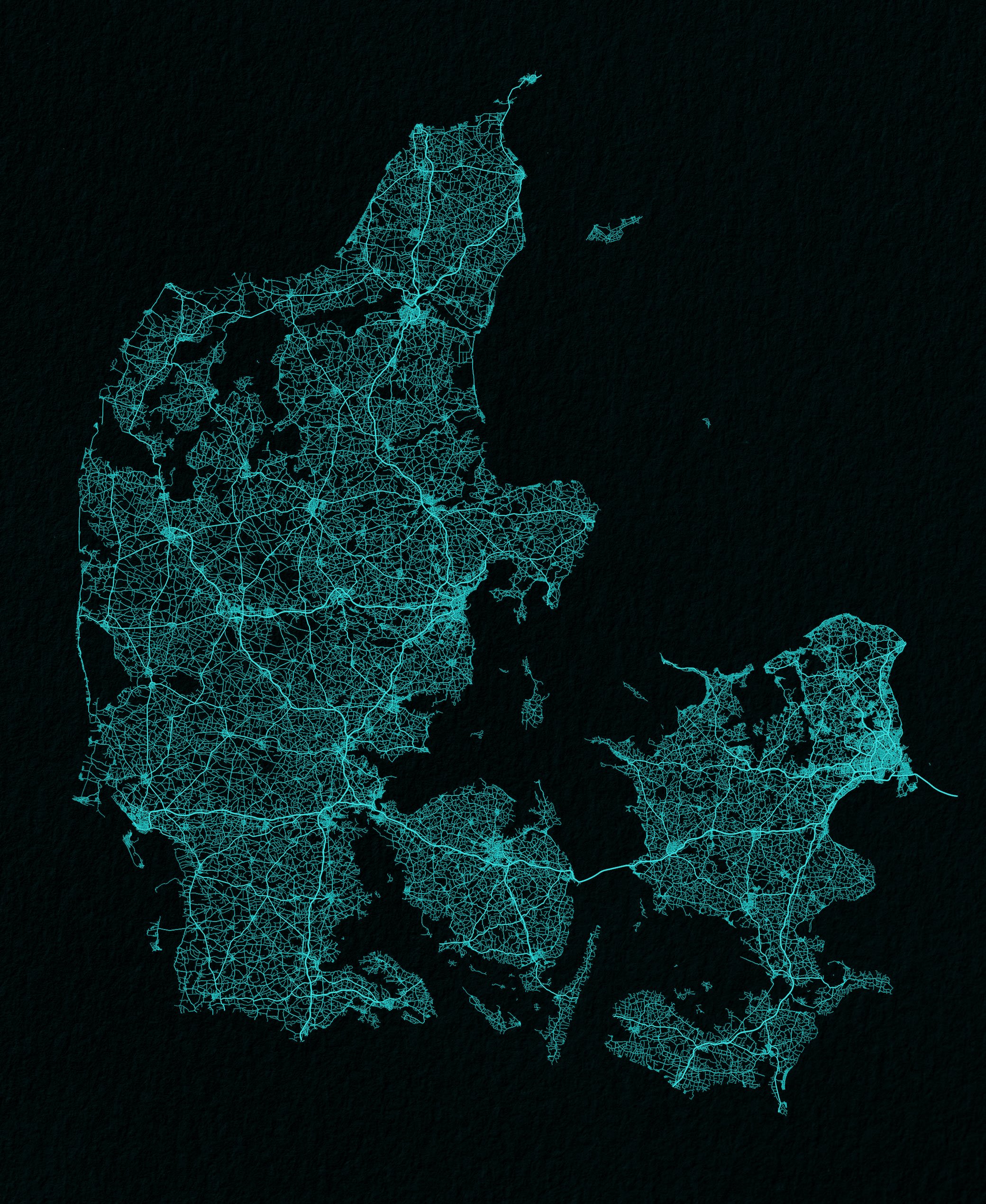
Denmark drawn up by roads
Languages in Schleswig (1838)
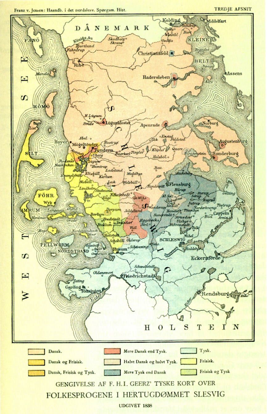
“Makes me wonder how alike (or not) those three languages sounded in the trilingual areas”–DassiD
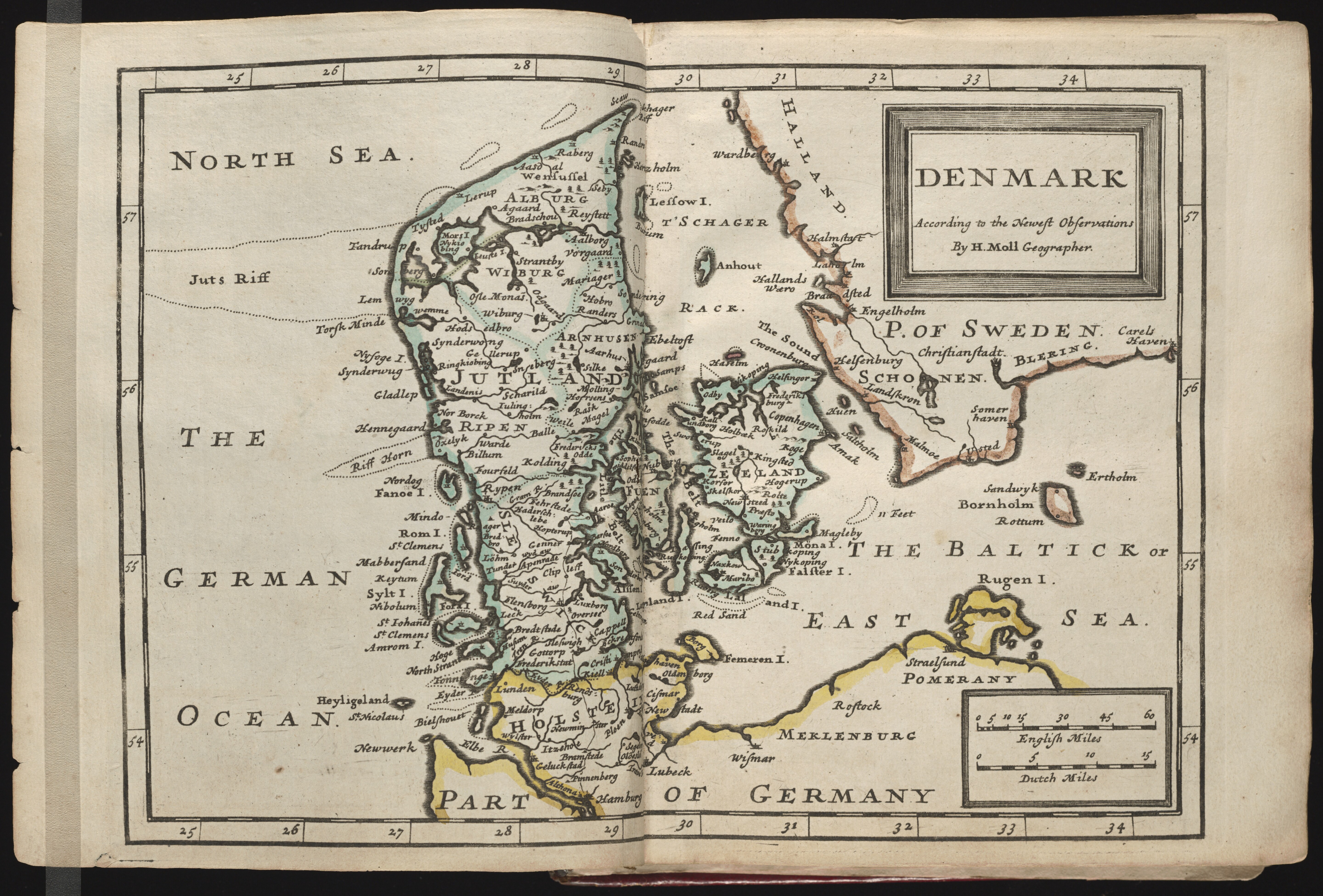
1724 map of Denmark - by Nicolas de Fer
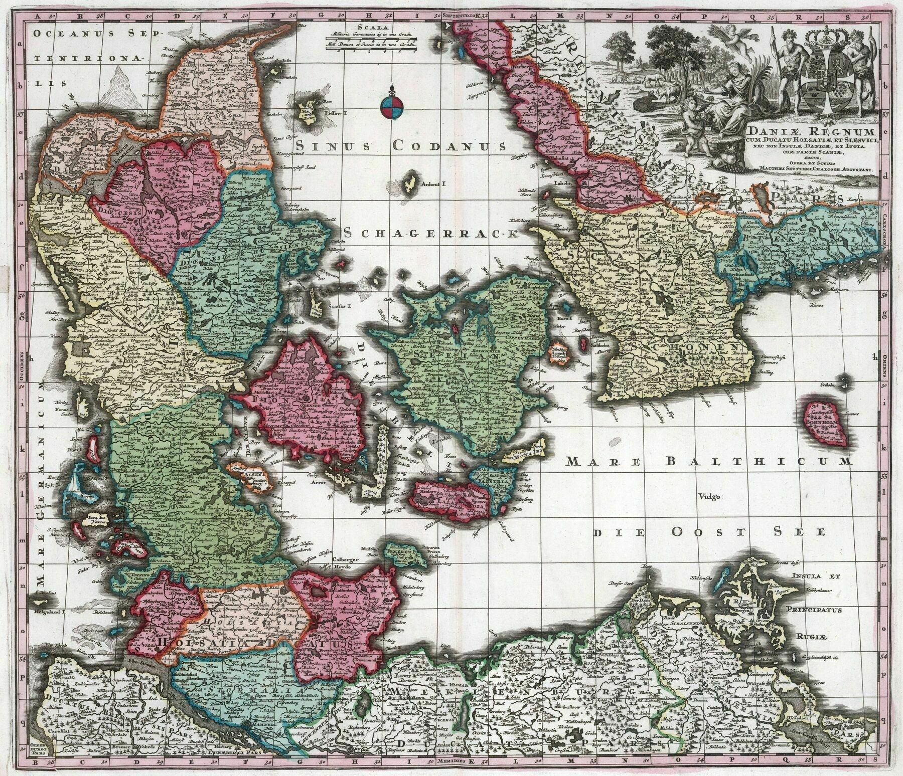
1752 map of Denmark - by Johann Baptist Homann
1646 map of Denmark
1694 map of Denmark

Detailed Terrain Map of Denmark and the surrounding region

1884 map of Bornholm, Denmark
Tourism map of Denmark, 1884(?), including the then Danish Iceland and West Indies islands of St Thomas, St Croix and St Jan.

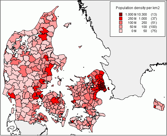
Denmark Population Density (2007)