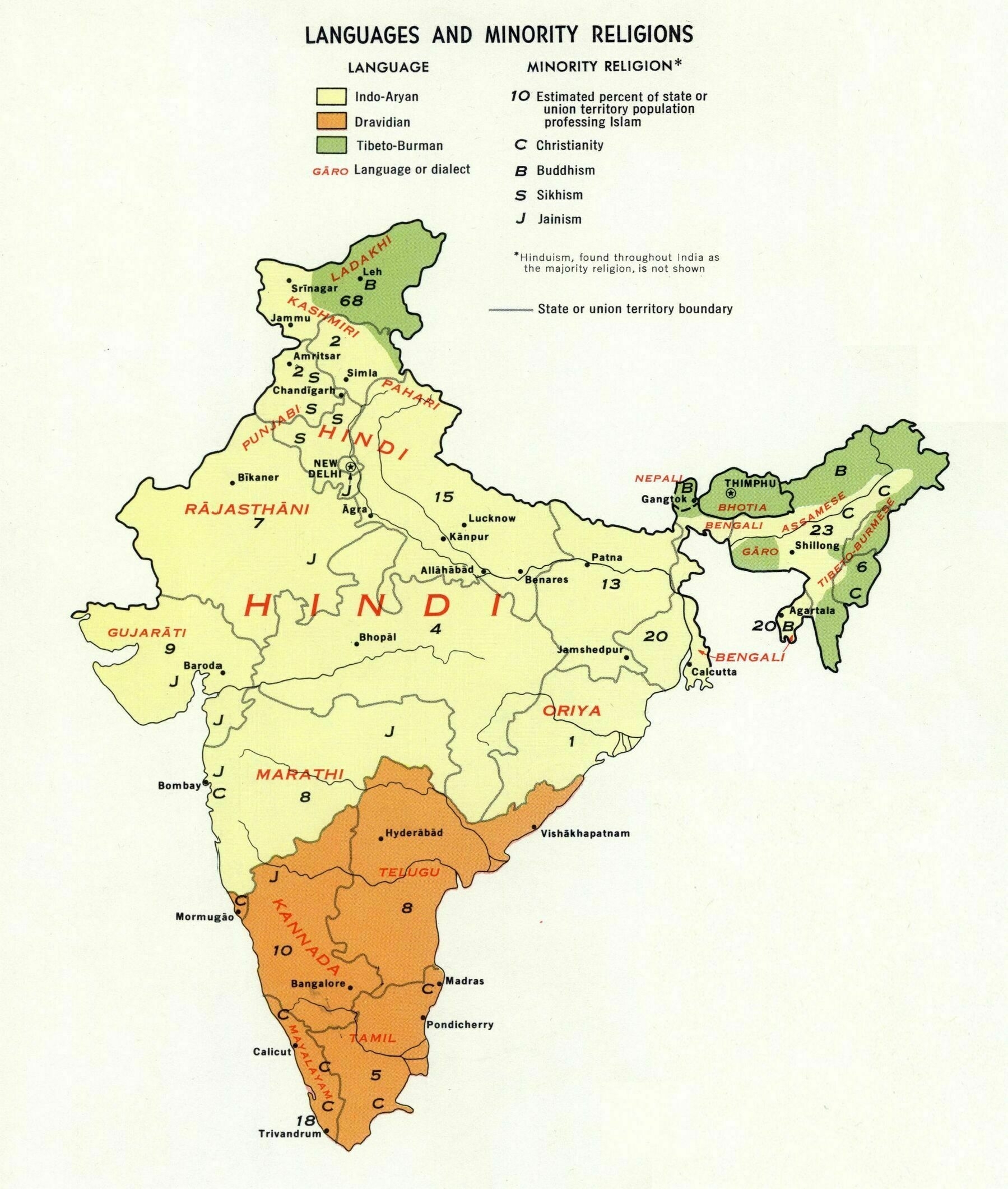
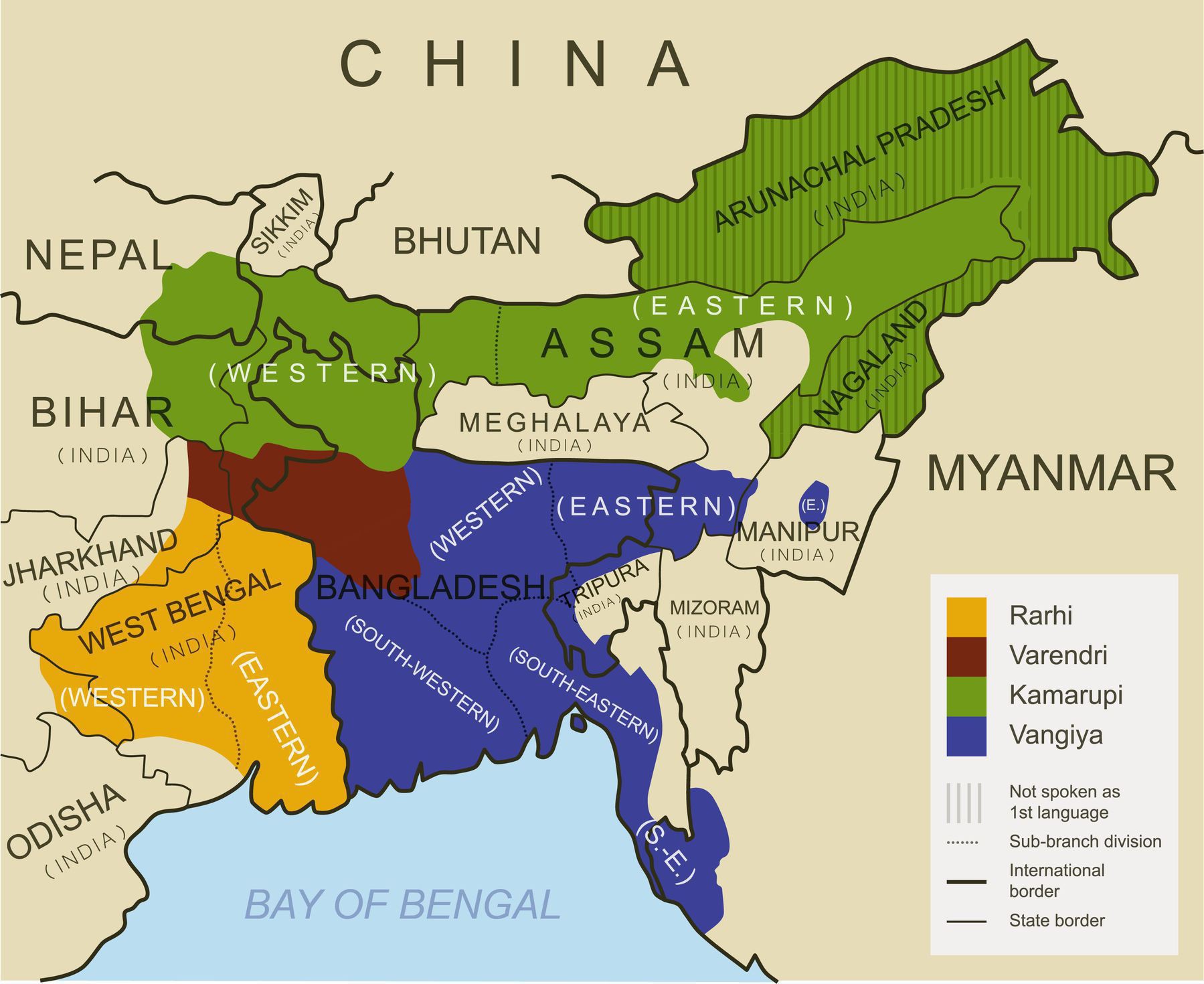
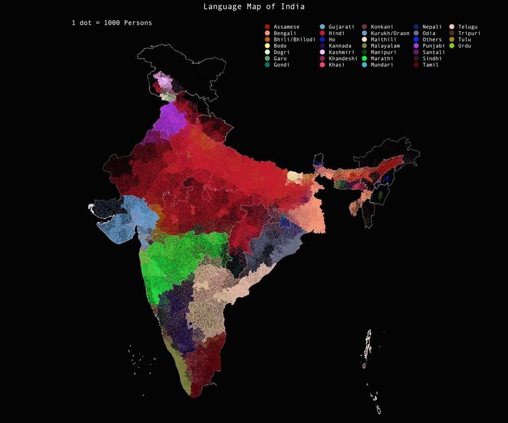
Railway map of South Asia (1915)
‘TIL I learned you can take a train to Sri Lanka’–RitaRaccoon
Railway map of South Asia (1915)
‘TIL I learned you can take a train to Sri Lanka’–RitaRaccoon
Sub-branches of the Bengali-Assamese languages. The map is based on the historical ranges
[3095 × 2529]
The Languages of India (1862)
‘It’s interesting to see how many there are. I’m sure there are thousands of sub-dialects in those families.
A friend at college is Tamil he would often discuss how he is not Indian. He did that because I asked he wasn’t angry it was a historical discussion. He even said look at how his Indian friend has light skin and a large nose (compared to his) just like I did. It was true there is a sharp contrast between north Indians and the southern Dravidian speaking peoples’–dghughes
Population density heatmap of India - one of a new series of maps by Robert Szucs of Grasshopper Geography
‘Chronology of Bihar
Physical map of India and adjacent countries (1917)
‘gawd dayum, this is really cool. Thanks for sharing !’–hellouralive
New Borders in India from August 2019 - dividing the state of Jammu and Kashmir into two union territories to be called Union Territory of Jammu and Kashmir and Union Territory of Ladakh
Percent of People Speaking Primary Languages in India
“Nagaland’s only having 12.9% of people speaking their plurality language I found interesting. It turn’s out that’s only about 250,000 people and one of 16 or so tribes, making Nagaland no more populated than a large city elsewhere in India. According to wikipedia there is no majority language but English is typically used in government and higher education – When I lived in Nagaland, the blanket term for all their languages was nagamese lol …. In my time spent travelling in India, I never met anyone from Nagaland (or, for that matter, from the Seven Sisters in general). It’s such a fascinating and unique place!”
1936 map of South Asia
[9776 x 7246]
Territorial Distribution of Andamanese Tribes in the early 1800s and 2004
“The Sentinelese have done a good job keeping outsiders away. They are a fascinating group and probably the world’s most isolated human population”–the_broccoli
Topographic map of India
“There is exactly zero chance Nepal or Bangladesh would ever allow their territory to be used by the Indian military”–vancian14
1786 map of Bengal, Bahar, Oude & Allahabad : with part of Agra and Delhi - by James Rennell
[9761 x 6687]
First Language/Mother Tongue in India reported in 2011 Census by District
“India is more diverse than Europe.
However, many minority languages are rapidly declining in favour of the dominant state languages. In that sense, each state is becoming more homogeneous despite interstate migration”–Zaketo
Language map of India
“Shame it doesn’t show Bhojpuri, Magahi or Rajasthani”–nyetflix
Andaman Islands Tribal Distribution (1923)
“When the missionary died last year from visting the Sentinelese it was something that could have been prevented had he listened to common sense. Those people have made it clear as a community that they wish to be left alone and the Christian thing is to respect those wishes”–CaptainObvious110
Languages of Sikkim
“Oh, interesting. Sikkim is India’s least populous state with ~600,000 people. These languages all seem in the Sino-Tibetan family, the Tibetan branch, and a lot of them endangered”–MeekHat