1921 map of Japan, Korea and Taiwan - by Kenji Ogura
1921 map of Japan, Korea and Taiwan - by Kenji Ogura
‘Looks like a very high quality map’
The Japanese advance in Asia, 1930-May 1942
The Japanese advance in Asia, 1930-May 1942
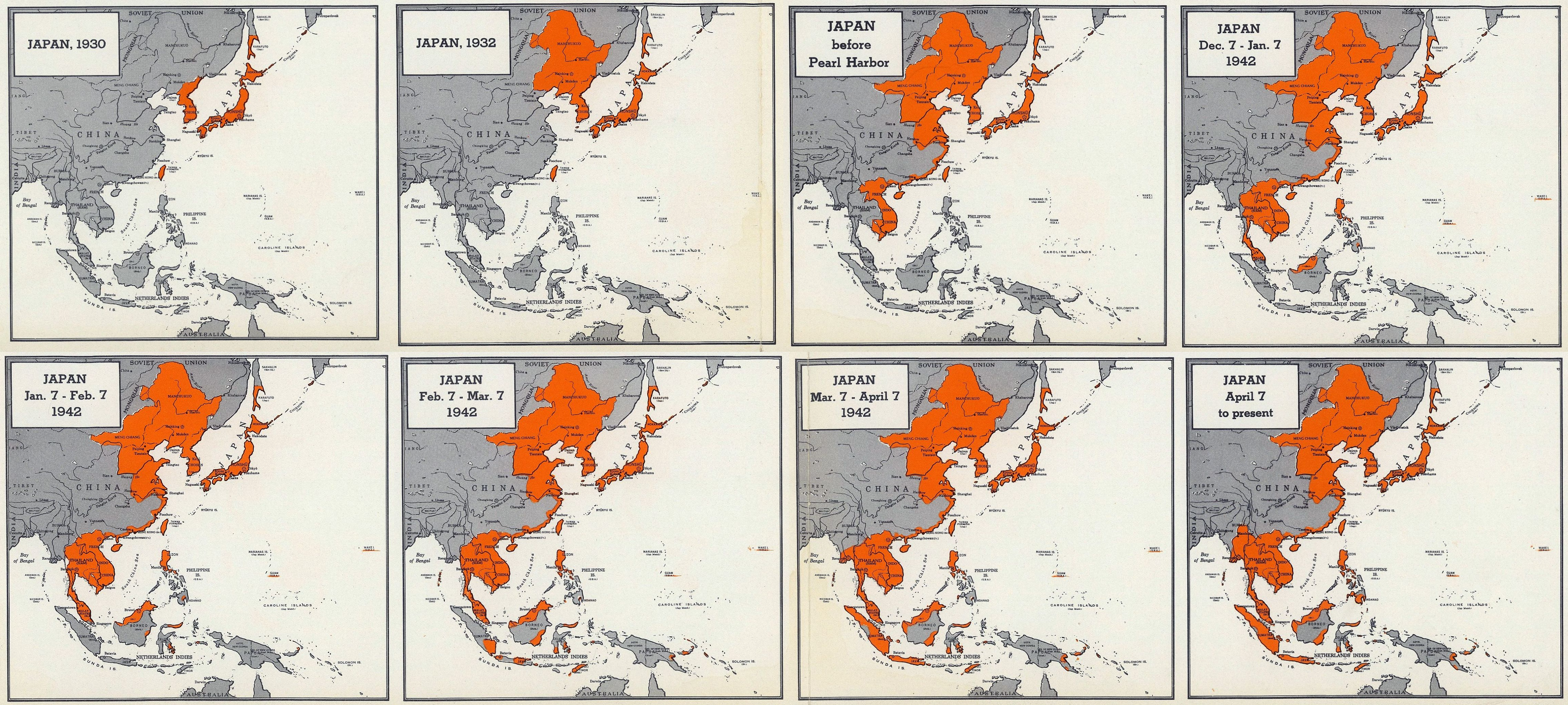
‘What is the current estimated population of their peak holdings? Would they be the largest country in the world by population?
About 60% of the Chinese population was under Japanese Occupation in Late 1944 I Think. So Japan should have either the Second or Third largest Population in the world. (Britain is still the largest since they have India). I estimate about 350 Million’
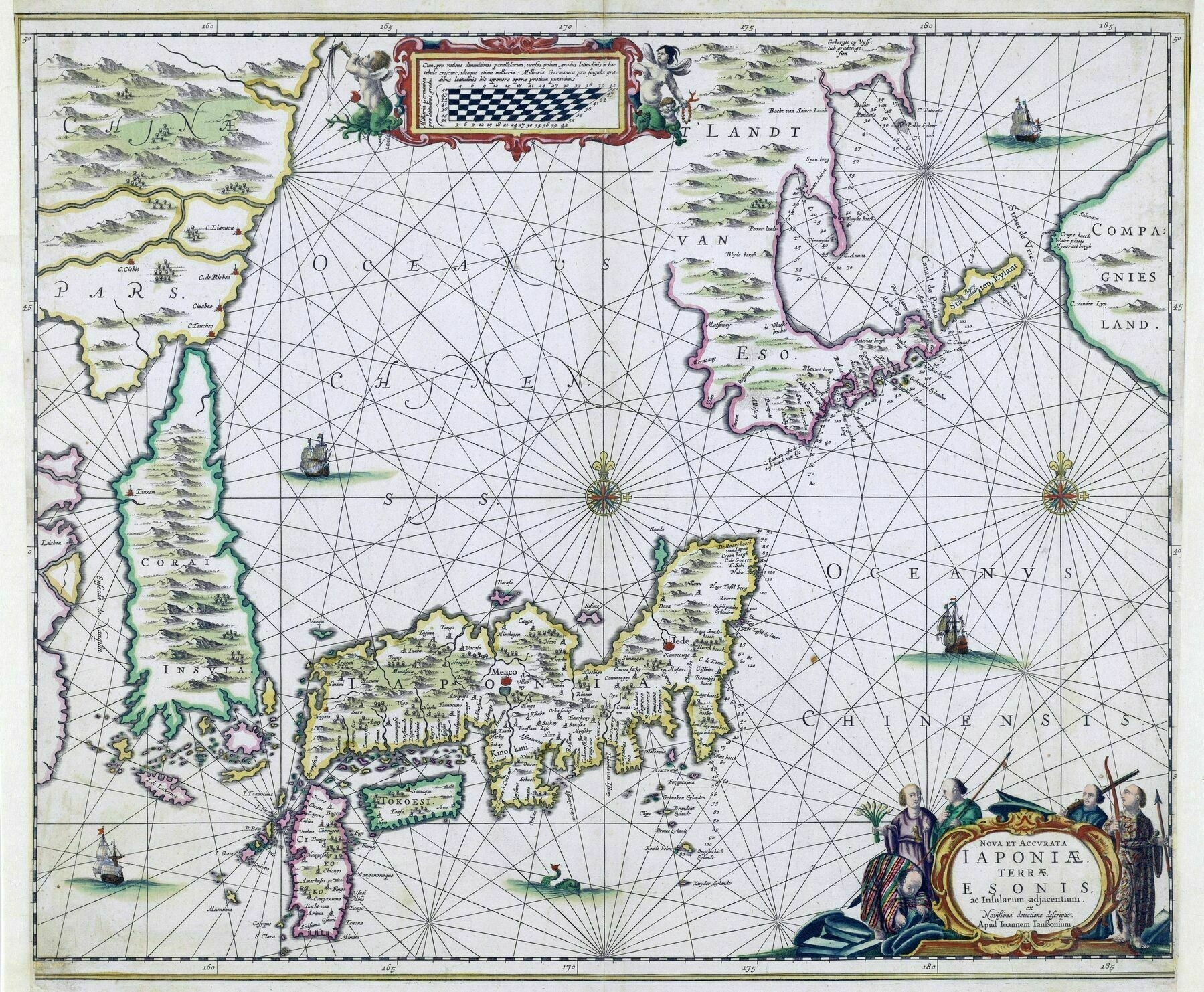
1658 map of Japan and the Korean Island. Hokkaido is a peninsula connected to mainland Asia
1658 map of Japan and the Korean Island. Hokkaido is a peninsula connected to mainland Asia ; Compagnies Land and Staten Eylant [to the right] are two of the Kuril Islands, sighted by Vries on his 1643 voyage
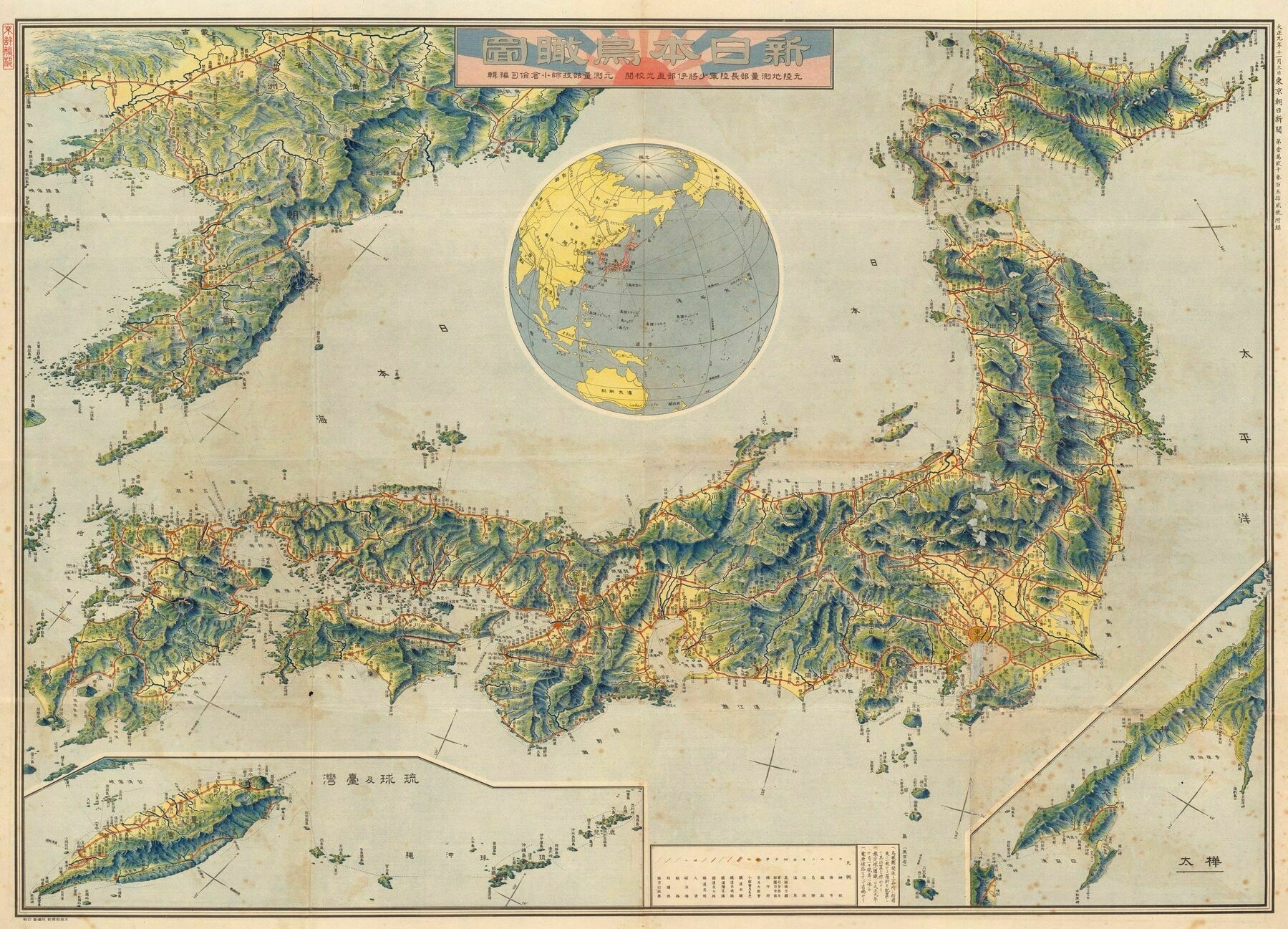
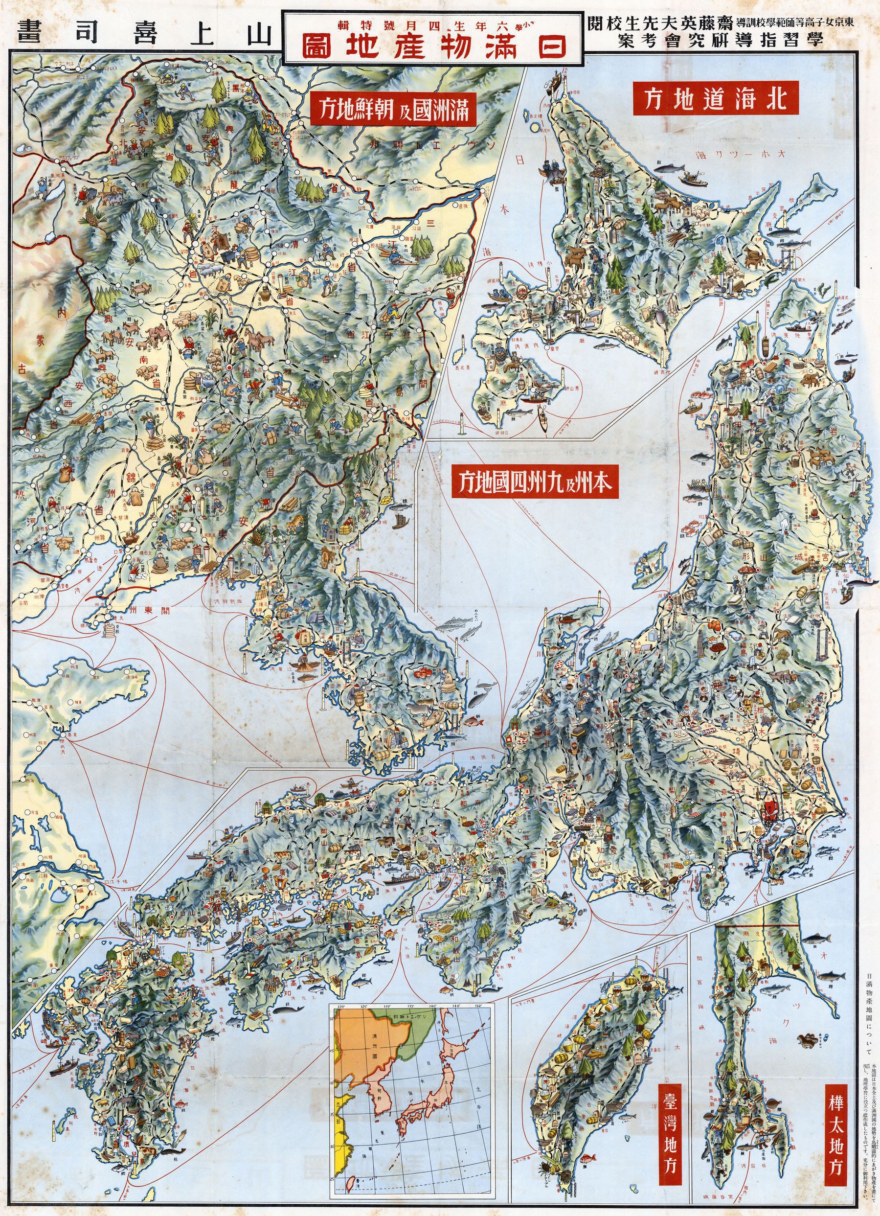
Illustrated map from the 1930s of the Empire of Japan
Illustrated map from the 1930s of the Empire of Japan - drawn by Yamagami Kiji. In addition to [modern day] Japan, it also includes Taiwan, Korea, Manchuria and southern Sakhalin
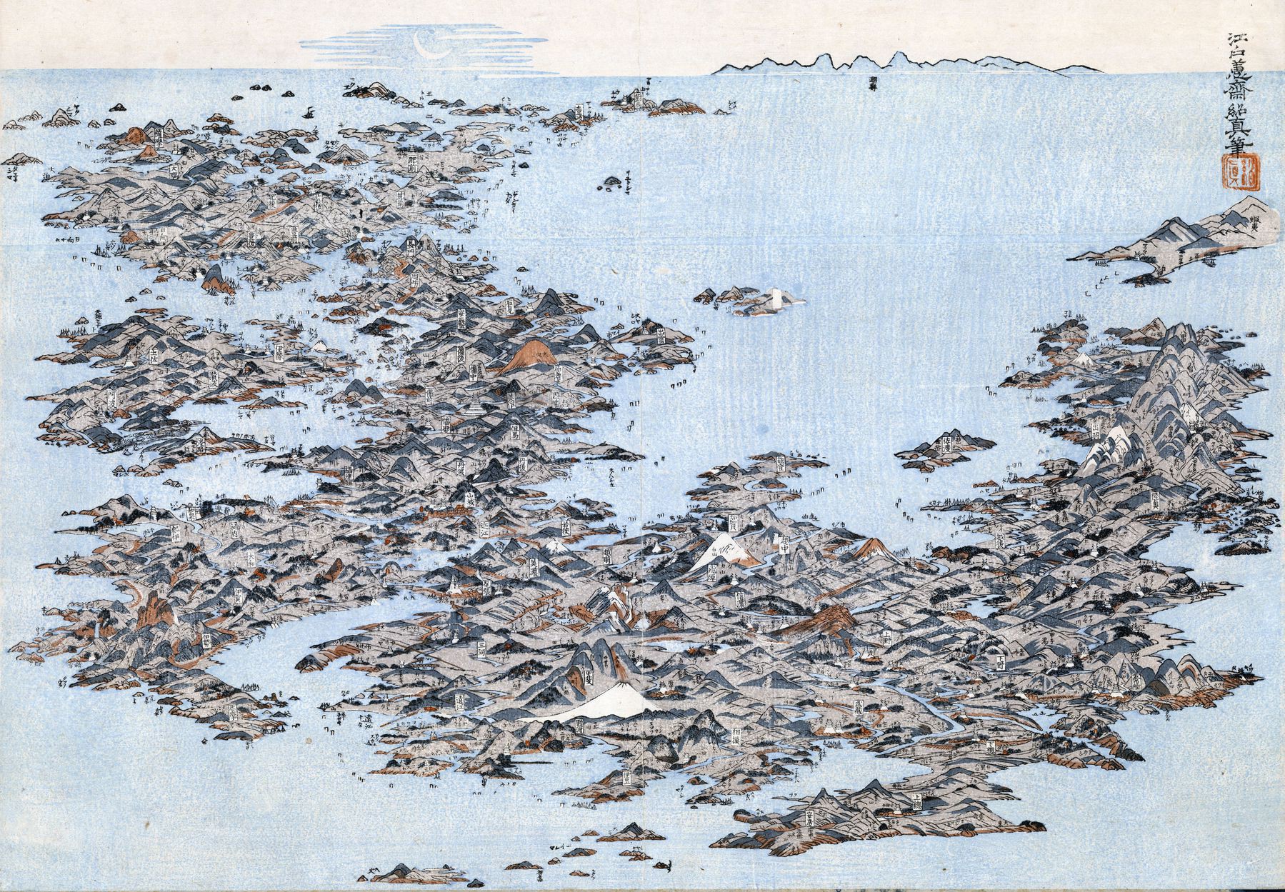
1820 panorama of Japan - by Masayoshi Kitao
1946 Map of Tokyo, Japan - with areas destroyed by the bombardment of 1944-1945 shaded green
1946 Map of Tokyo, Japan - with areas destroyed by the bombardment of 1944-1945 shaded green
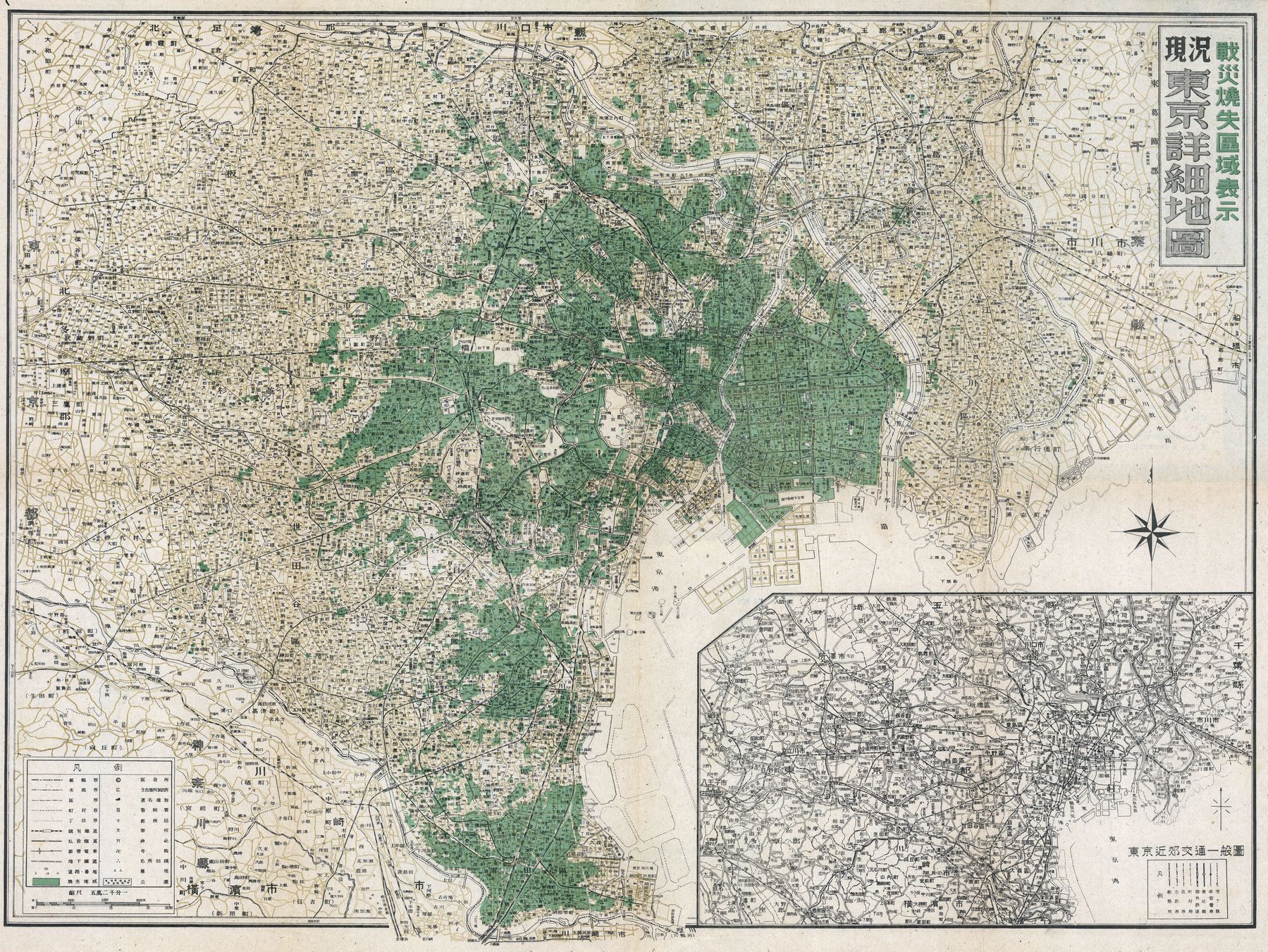
‘Thanks, with this map as a layer in Google Earth I can search for some old districts of Tokyo, right? Or were the rest demolished by locals later?’–Nachtzug79
Historical Japan - National Geographic
Historical Japan - National Geographic
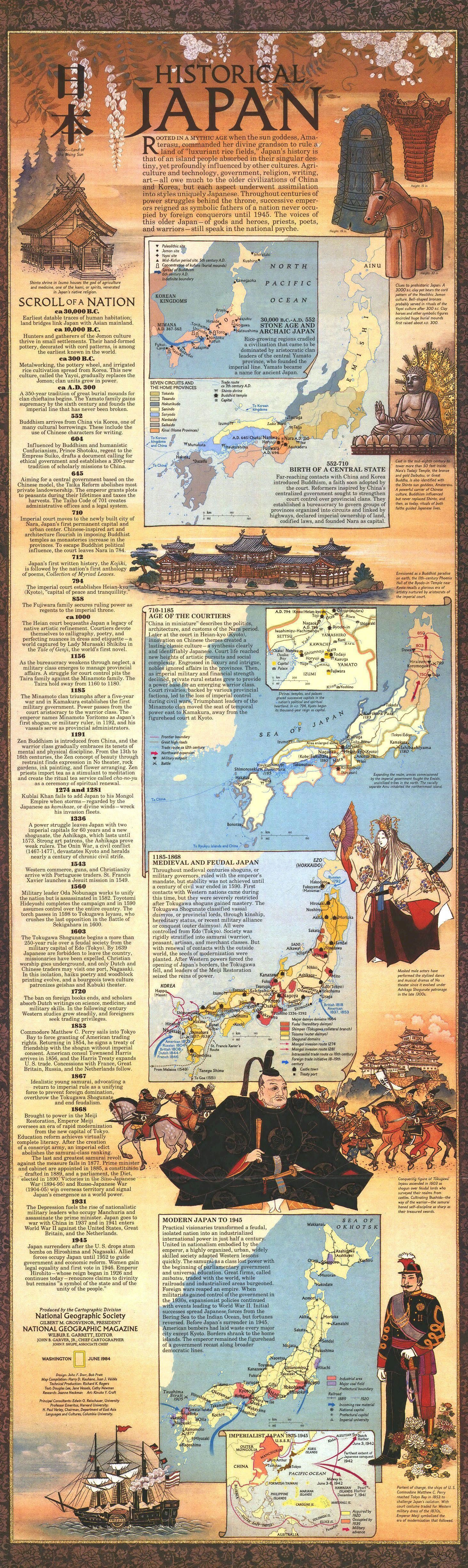
‘Wow. This is awesome!!!’–Jefferson779
Manuscript map tracking the movement of the American ships along the western shore of Edo (Tokyo) Bay from Chiyogasaki to Haneda, 1853. This forced Japan to open to the West
Manuscript map tracking the movement of the American ships along the western shore of Edo (Tokyo) Bay from Chiyogasaki to Haneda, 1853. This forced Japan to open to the West
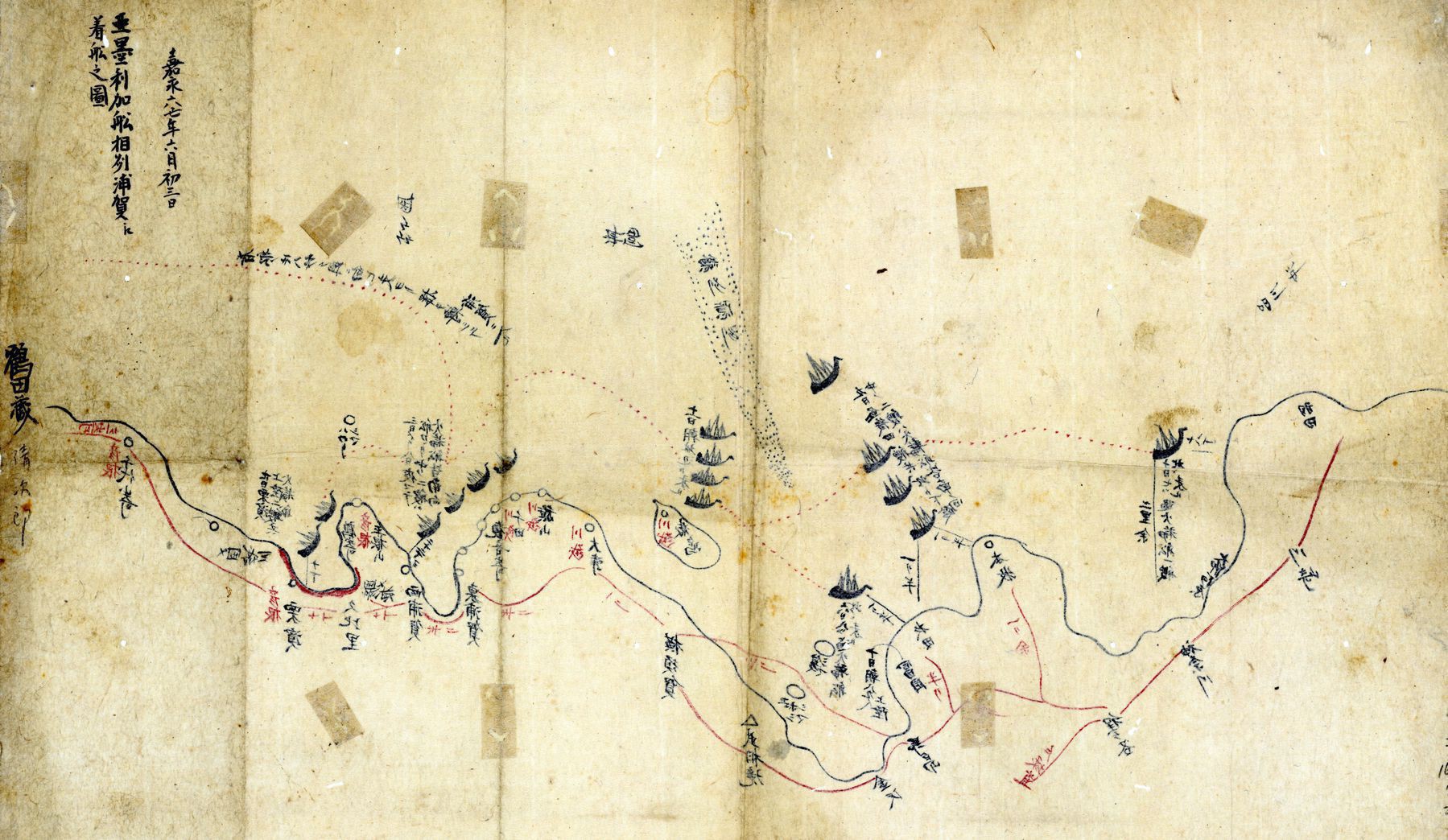
’“open the country, stop having it be closed.”
- Matthew Perry, 1853’–PrimaryKale7
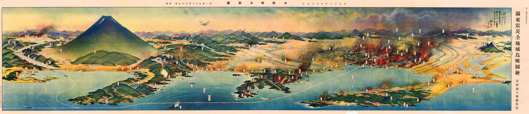
Pictorial map of Tokyo, the Kanto Plain and Mount Fuji, showing the effect of the 1923 earthquake and subsequent fire
Pictorial map of Tokyo, the Kanto Plain and Mount Fuji, showing the effect of the 1923 earthquake and subsequent fire
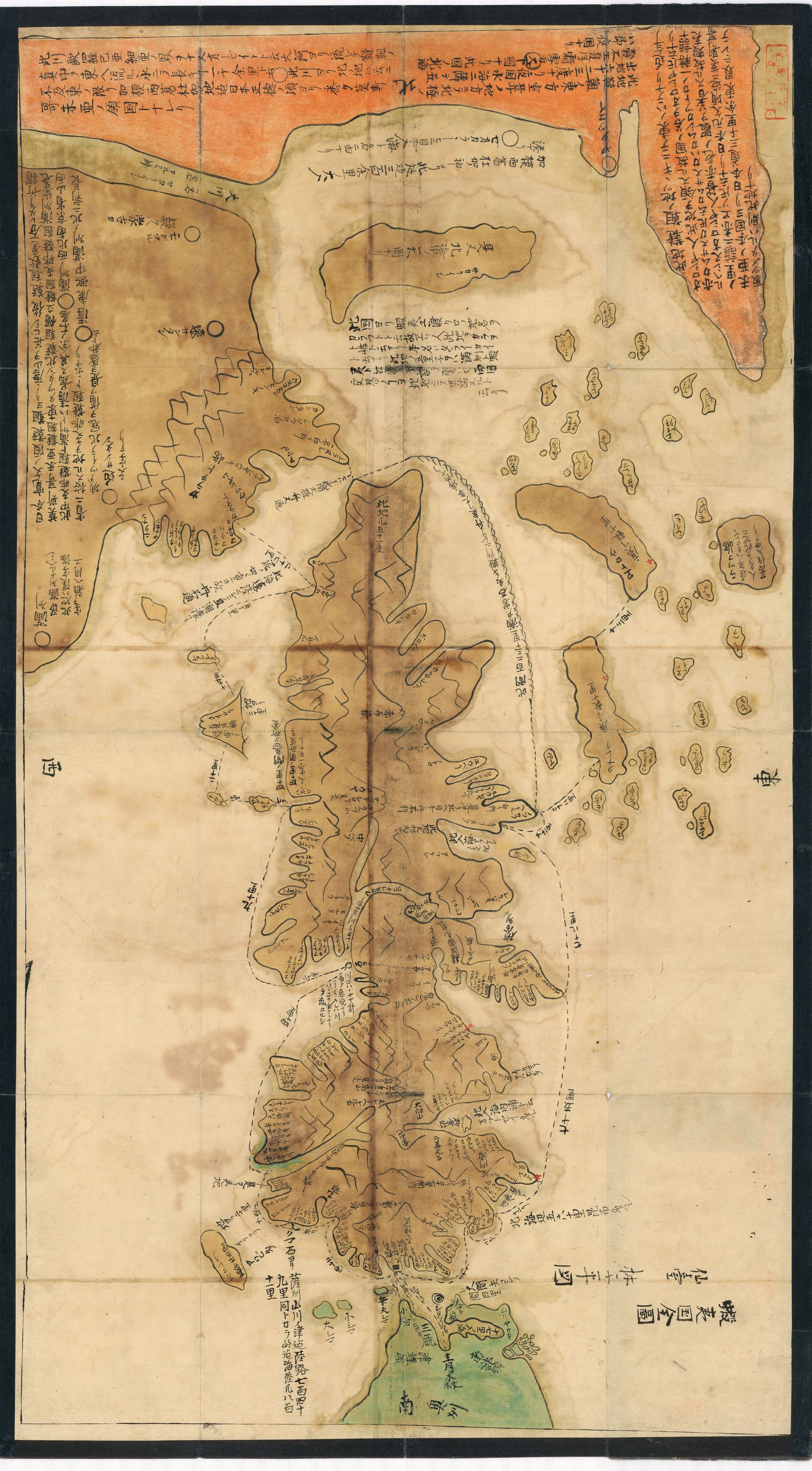
Hand-written early 19th century map of Ezo [Hokkaido], showing the northeastern tip of Honshu in green - by Shihei Hayashi
Hand-written early 19th century map of Ezo [Hokkaido], showing the northeastern tip of Honshu in green - by Shihei Hayashi. It is a copy of a map contained in the controversial Sangoku Tsūran Zusetsu, published in 1785
1886 map of Japan published in Kyōto, with illustrations of tourist places and other charts and tables
1886 map of Japan published in Kyōto, with illustrations of tourist places and other charts and tables
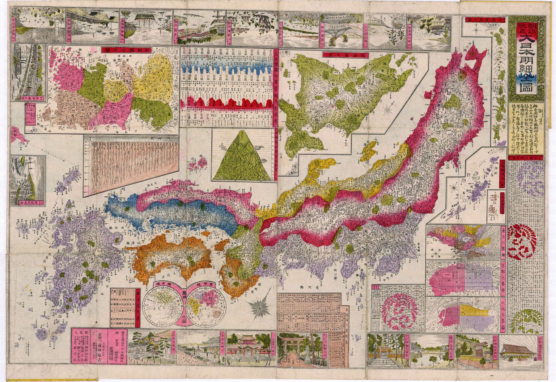
‘Wow. So much detail’–TheDesertWalker
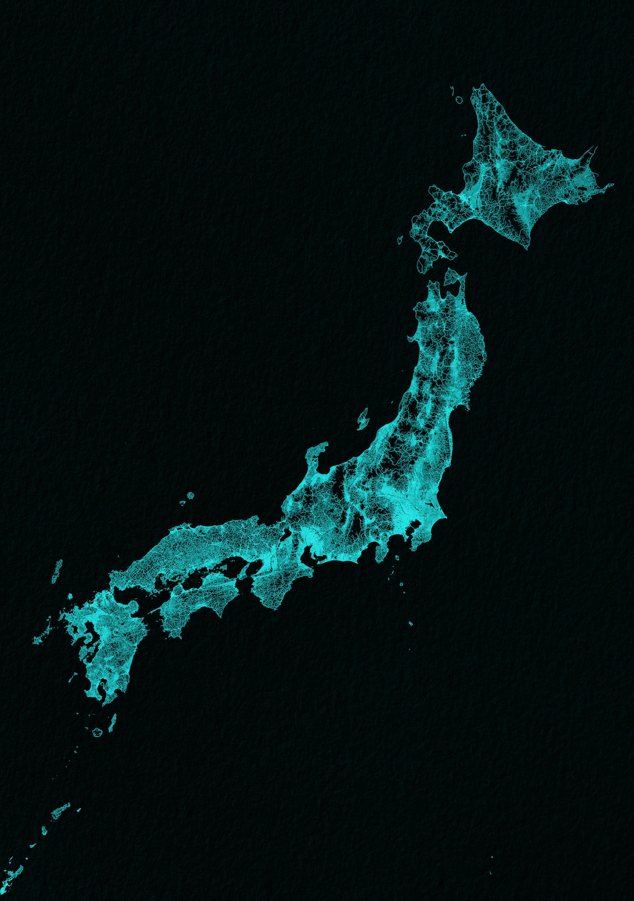
Japan drawn up by roads
Japan drawn up by roads
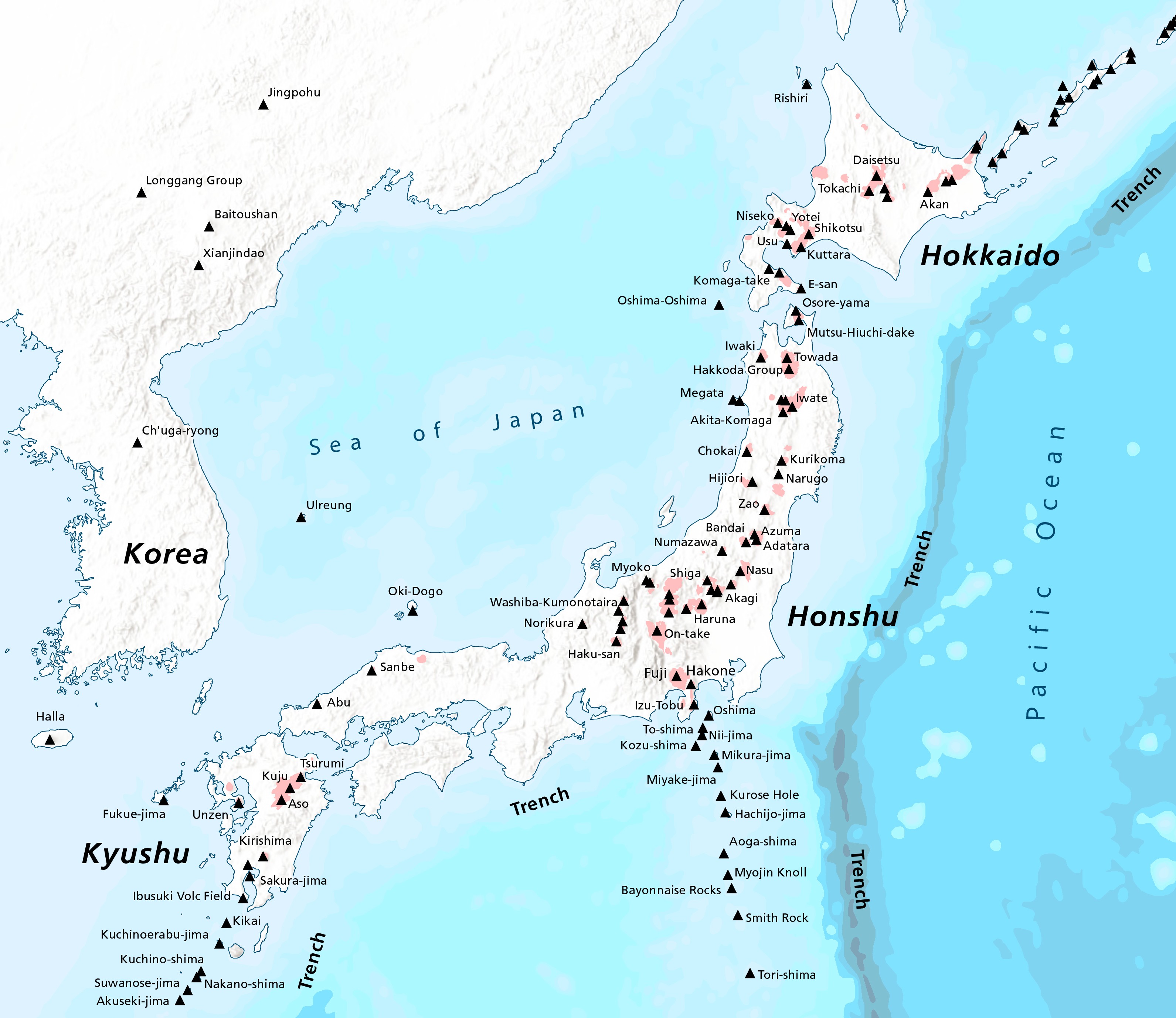
Volcanoes of Japan
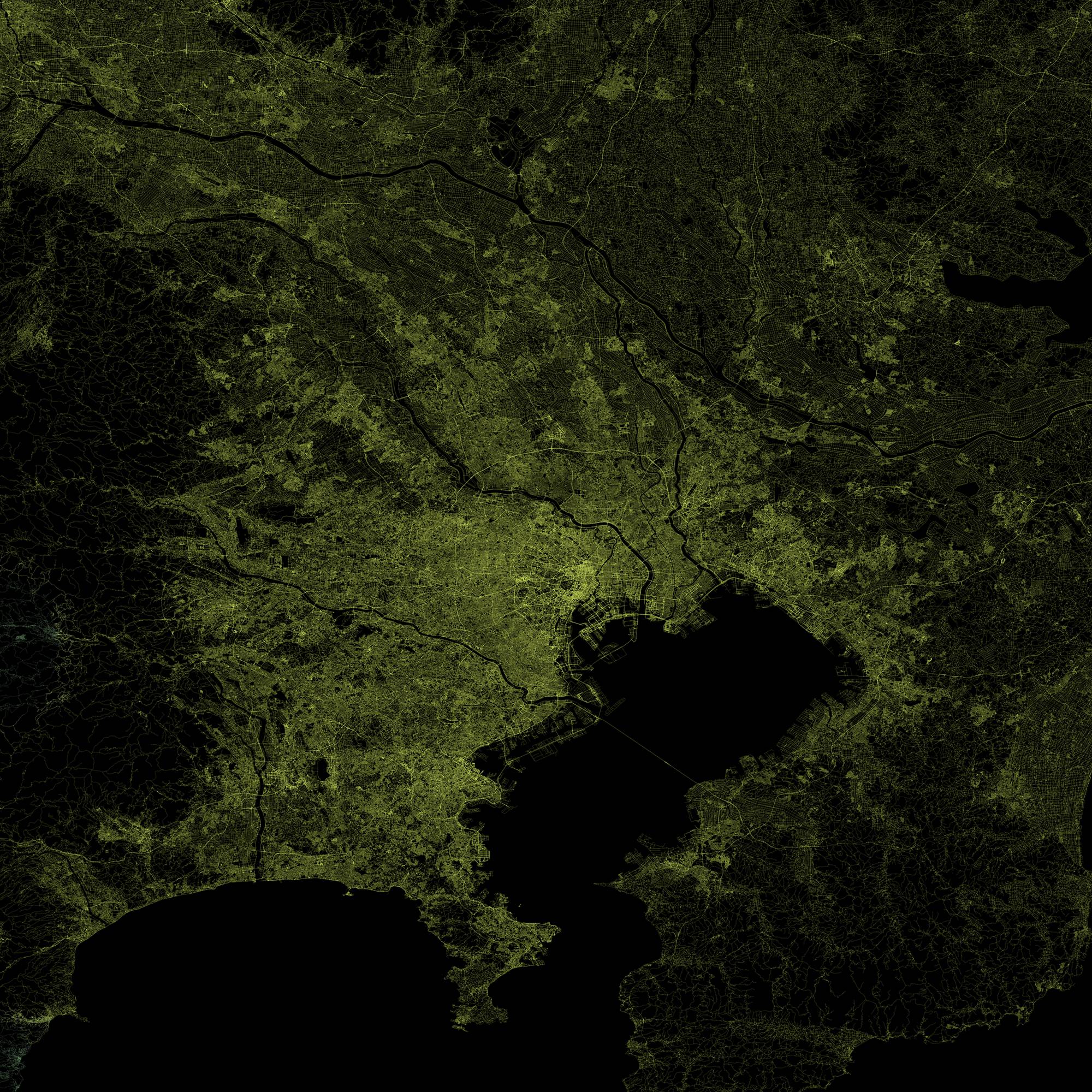
Roads of Tokyo, Japan
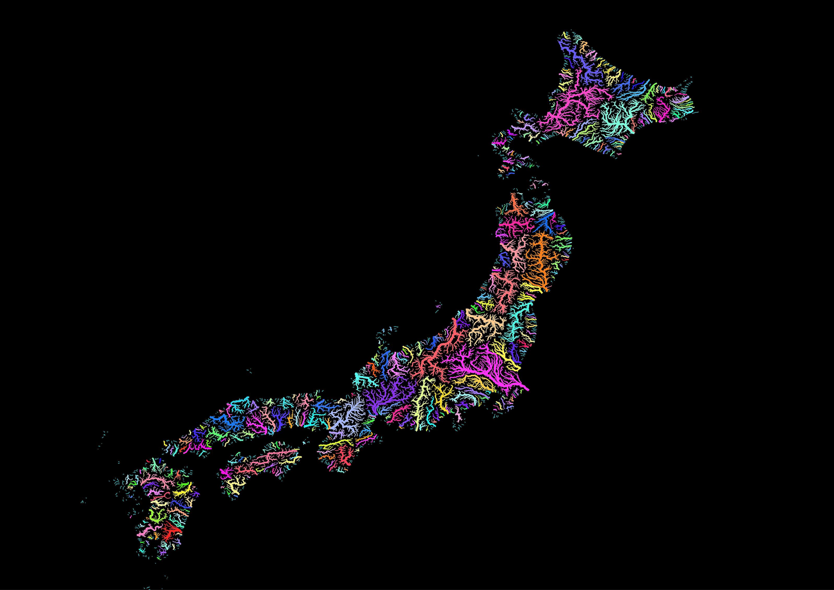
Japanese river basins in rainbow colours
1740 map of Japan - by Matthias Seutter
1750 map of Japan
Five Japans (1936) - by Richard Edes Harrison
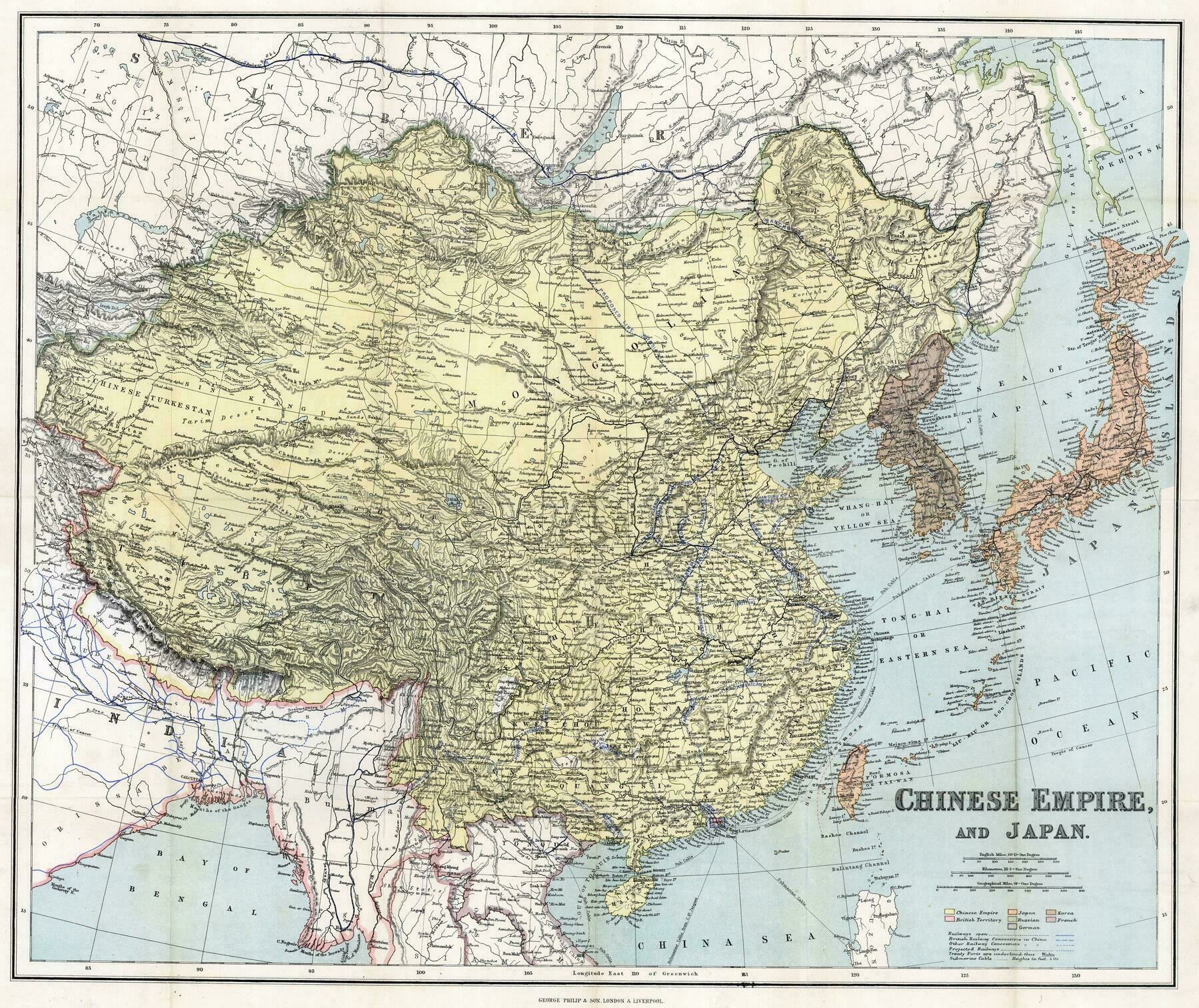
1894 Stanford's map of eastern China, Japan and Korea
Greater Tokyo Area Road Map
1654 map of China and Japan - by Willem Janszoon Blaeu
Japan, the target : a pictorial Jap-map (1942)
1886 map of Japan showing various tables and charts
