1725 map of the Caspian Sea and the Kamchatka Peninsula
1725 map of the Caspian Sea and the Kamchatka Peninsula - by Johann Homann
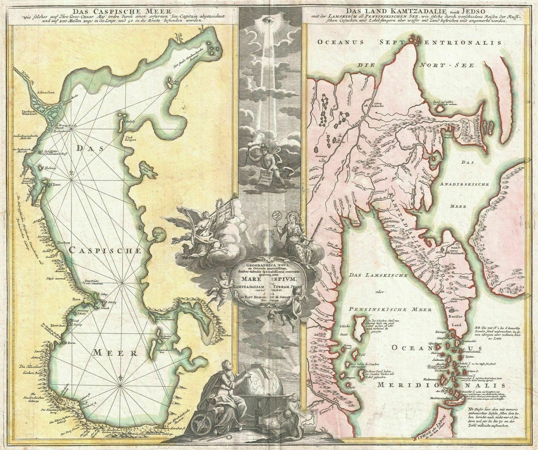
1725 map of the Caspian Sea and the Kamchatka Peninsula - by Johann Homann
Siberian indigenous languages in the Russian Empire, according to 1897 census

1878 ethnographic map of European Russia - by Aleksandr Fyodorovich Rittikh
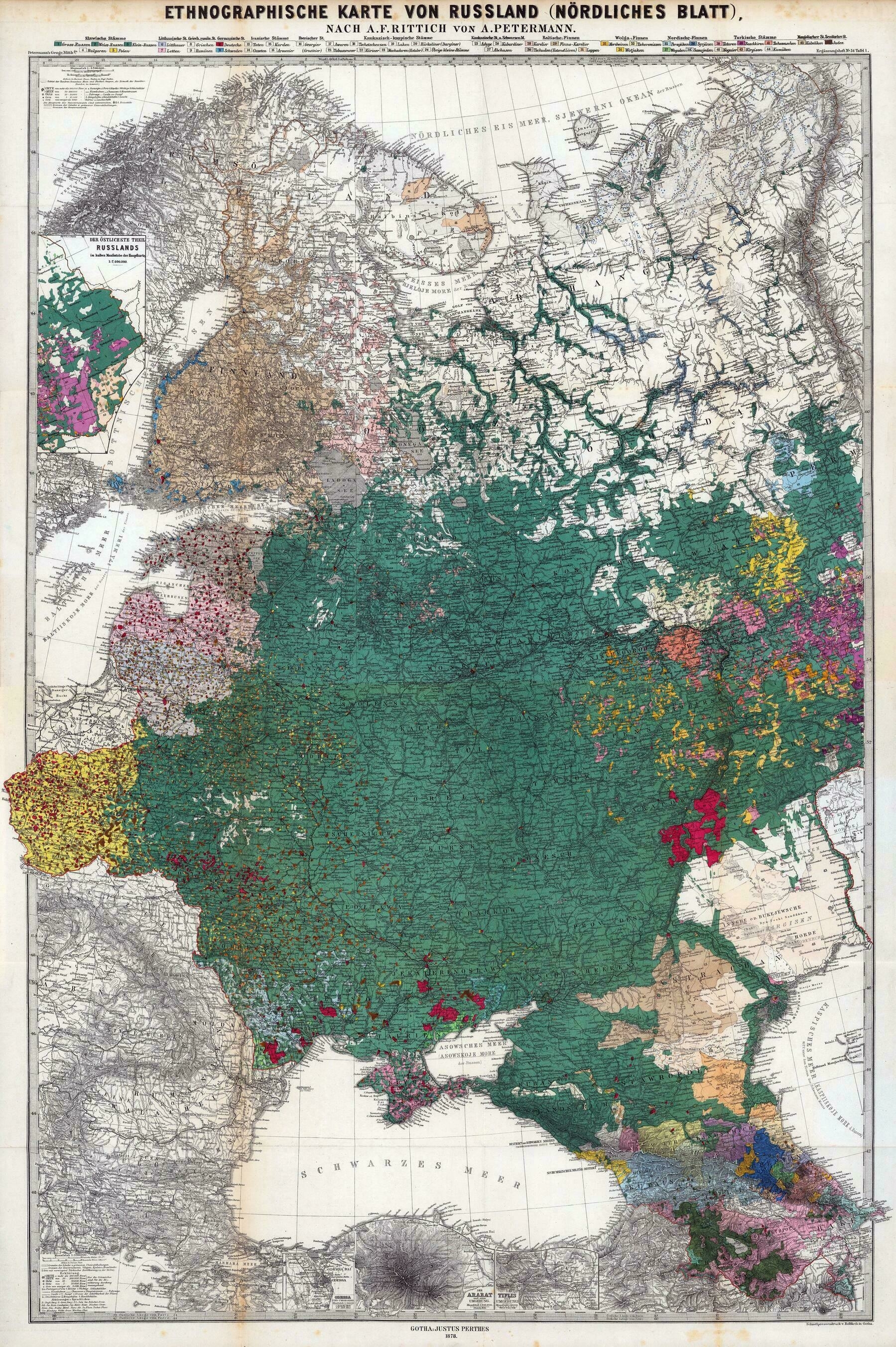
‘I recognize Volga Germans, Bessarabia Germans and Crimean Germans
Germans were a significant minority in almost all parts of Eastern Europe’
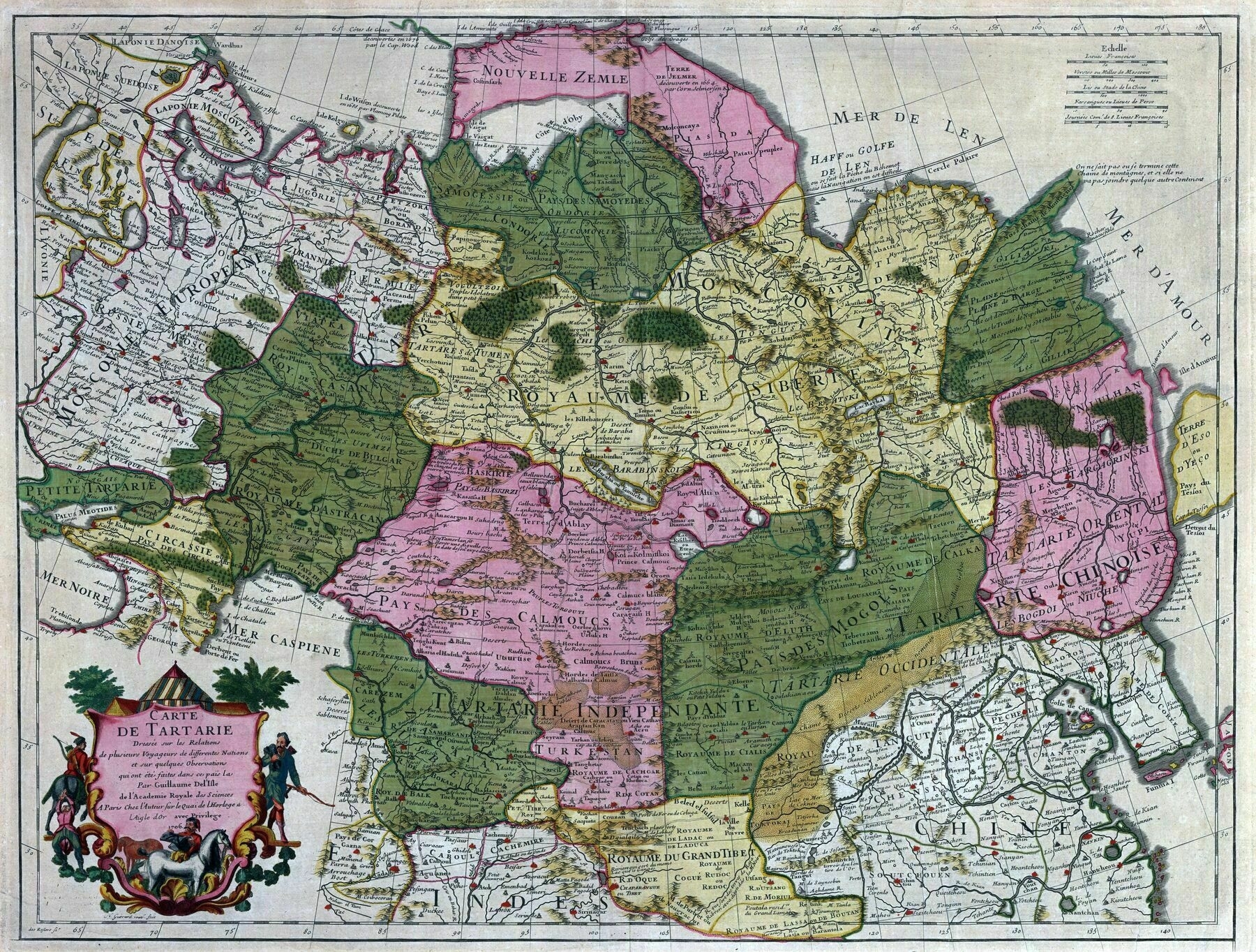
1782 map of the Russian Empire
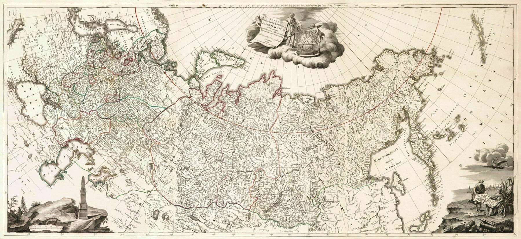
‘I wonder how well the Russians actually controlled the more eastern regions
Mostly limited to what later would become the route for the trans-Siberian railway, so the most southern strip of Siberia. The construction of the railway led to an economic boom in the region, since it is rich in coal and iron. The northern parts of Siberia where very remote and had extremely low population compared to its size, so there was also no real incentive to control those regions. When the 20th century oils and gas fields where found the northern part also became more interesting, and just like a century before new cities where created due to the economic interests.
Around this time (late 1700s) it was just beginning to be the case that the Russians would use a route through the steppes and were starting to settle the steppes with farms.
But for 200+ years before that they actually didn’t have control of the steppes and anyways were more interested in using the river routes through the forest to get furs. Furs were the entire reason for the expansion to the Pacific. They also used a northern route along the Arctic up until 1700 before going entirely through the river routes.
wikipedia.org/wiki/Siberian_River_Routes
Prior to the late 1700s the Russians did not have a big advantage over the various Khanates on the Asian steppes, at least not an advantage with the small bands of cossacks that they conquered the forest belt with. I remember reading an account about the cossacks on the river routes - they would have to haul all the grains they needed east with them from the Urals because they couldn’t farm on the steppes. It was too dangerous. There was at least one settlement attempt where they tried to grow grain that got annihilated by mounted archers of some confederation or another.’
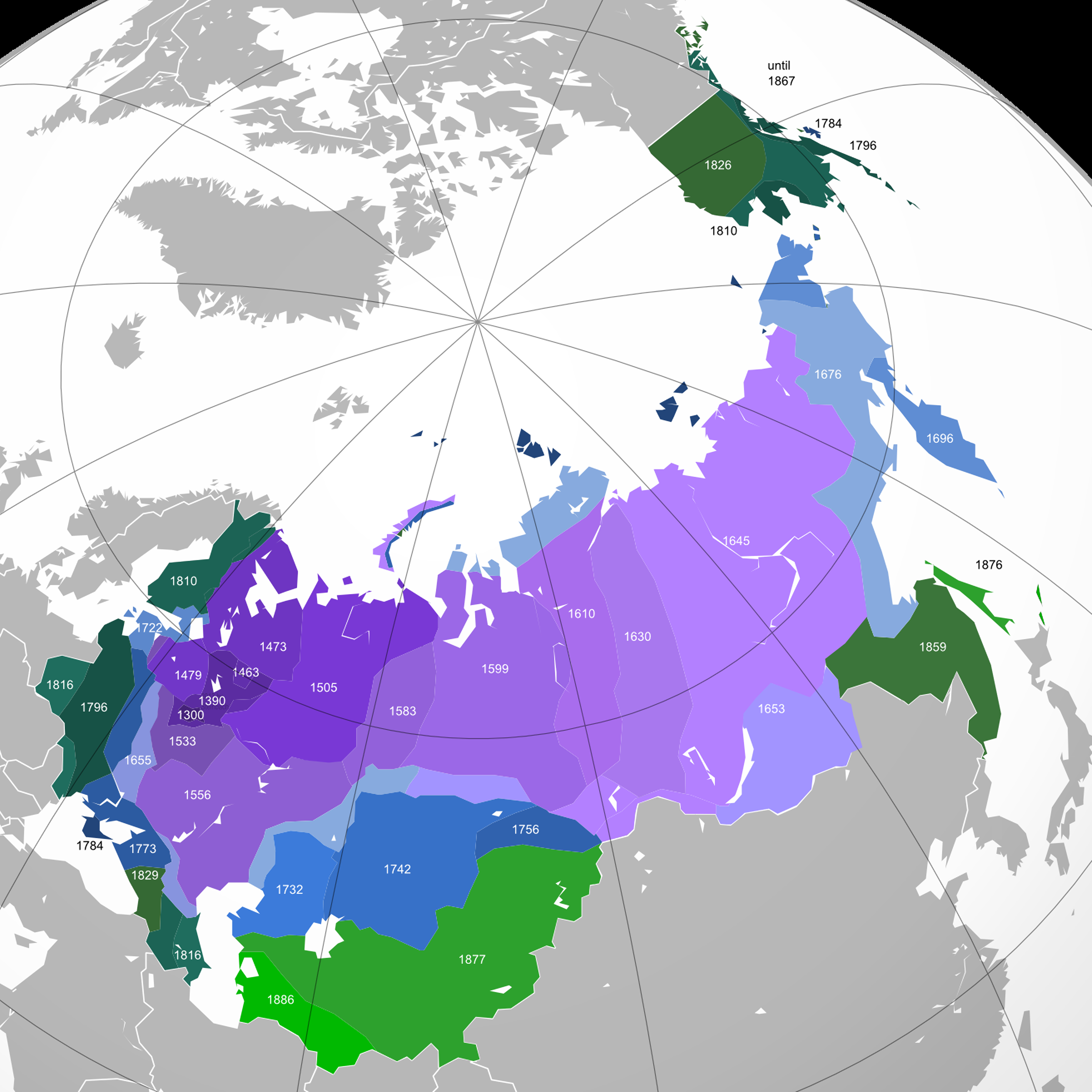
Expansion of Russia by year, from 1300 to 1914
‘Im pretty sure Russia had some small colonies on the Californian coast (Fort Ross) and a few in Hawaii.
Is that why the California wine region “Russian River” has its name?
I grew up there, and I’m ashamed to say it probably wasn’t until I was in middle school that I realized people weren’t just referring to it as “the rushin(g) river.” I had even been to Fort Ross multiple times on school field trips and family trips, but I guess I never put 2 and 2 together.’
1939 map of Russia in Europe and its border states
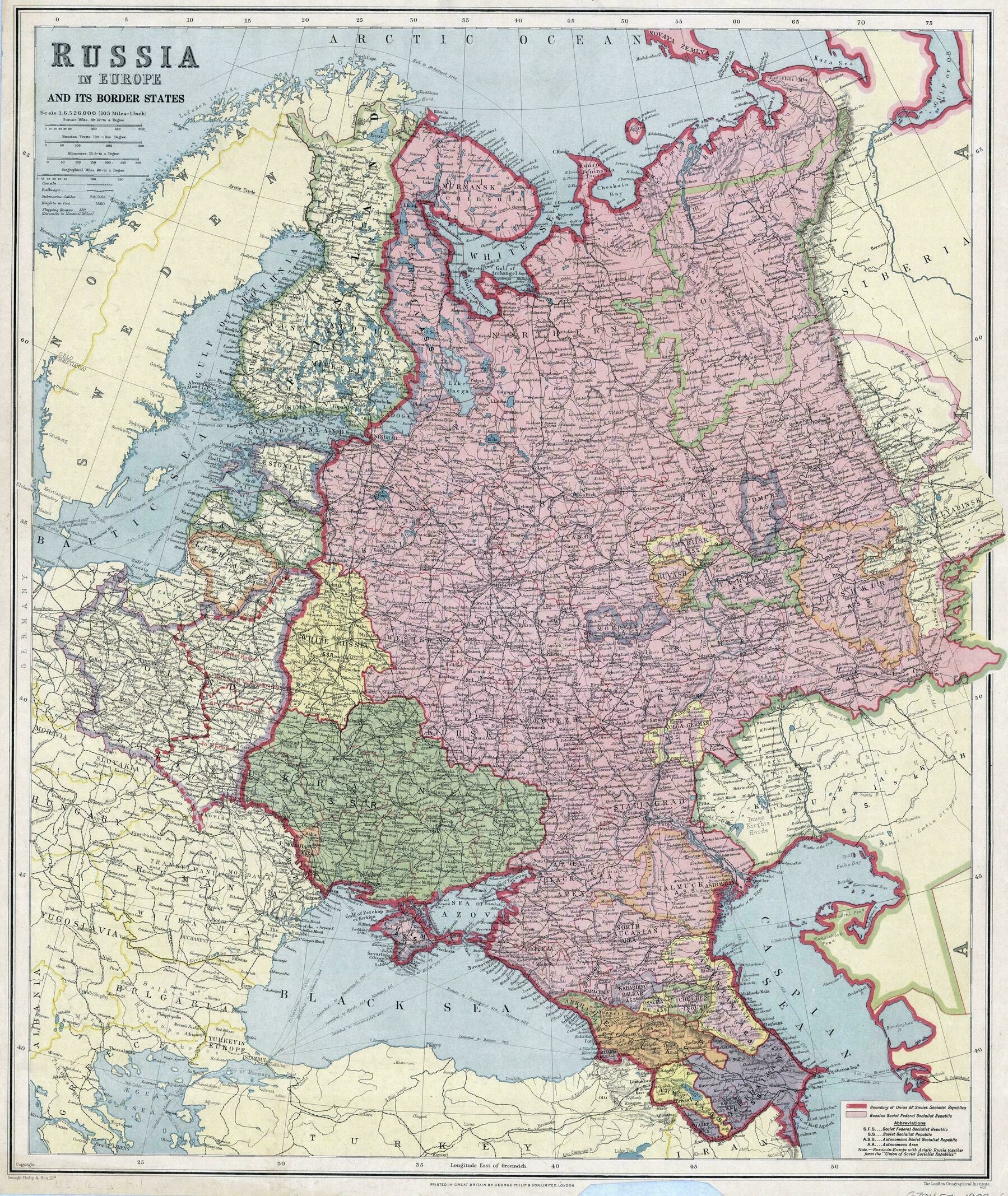
‘This is super interesting. Thanks for posting!’
1842 map of Russia showing the territories annexed since the accession of Peter the Great - by John Arrowsmith
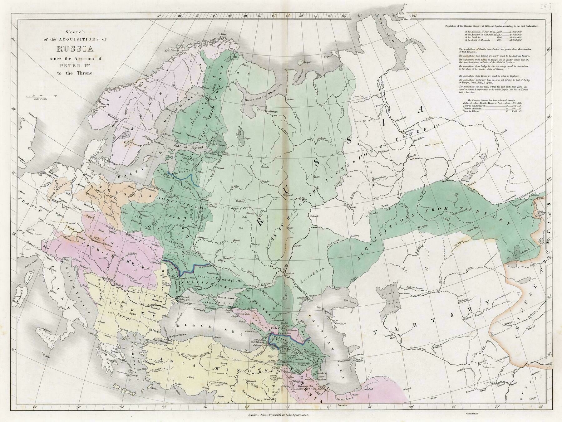
“Didn’t he also incorporate mazandarin for a few years?”
1834 map of Russia and Poland - by John Arrowsmith
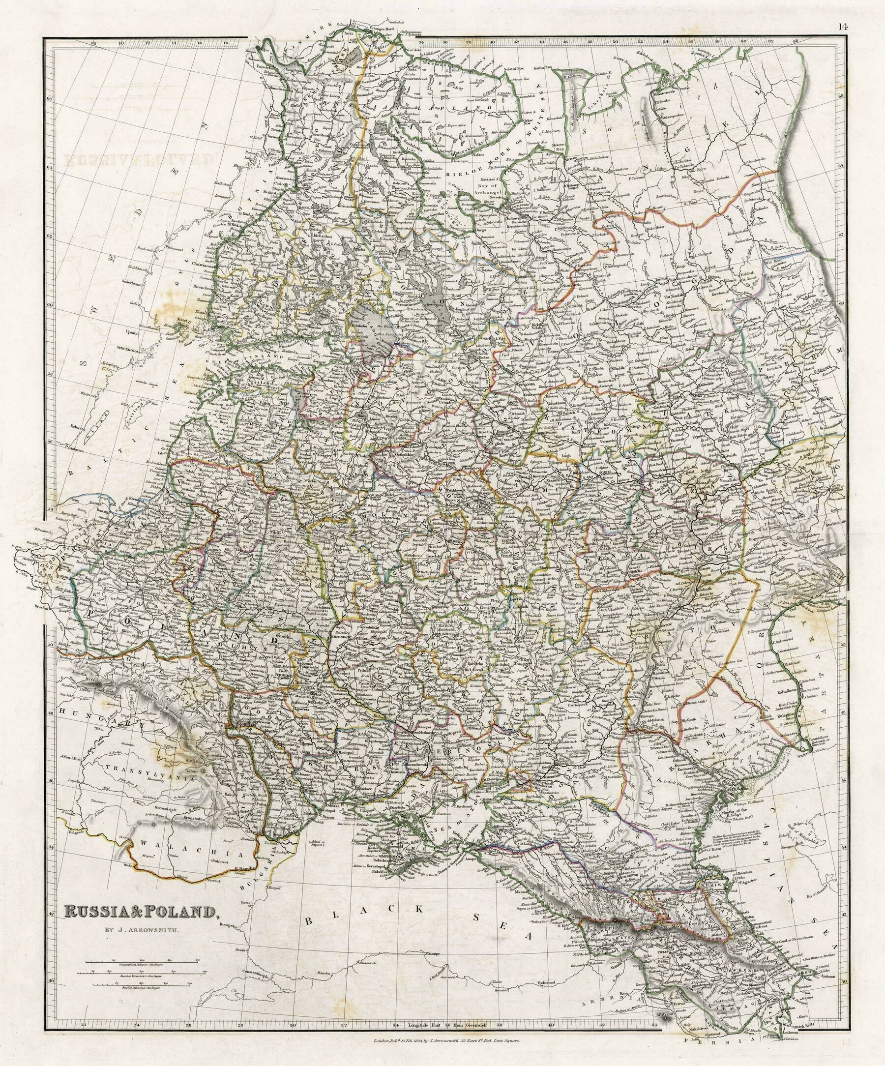
‘Interesting seeing Nowy Targ as Neumarkt
Also worth noting that Poland wasn’t entirely under Tsarist rule, but also Habsburg and German states’
Russian Forest Cover
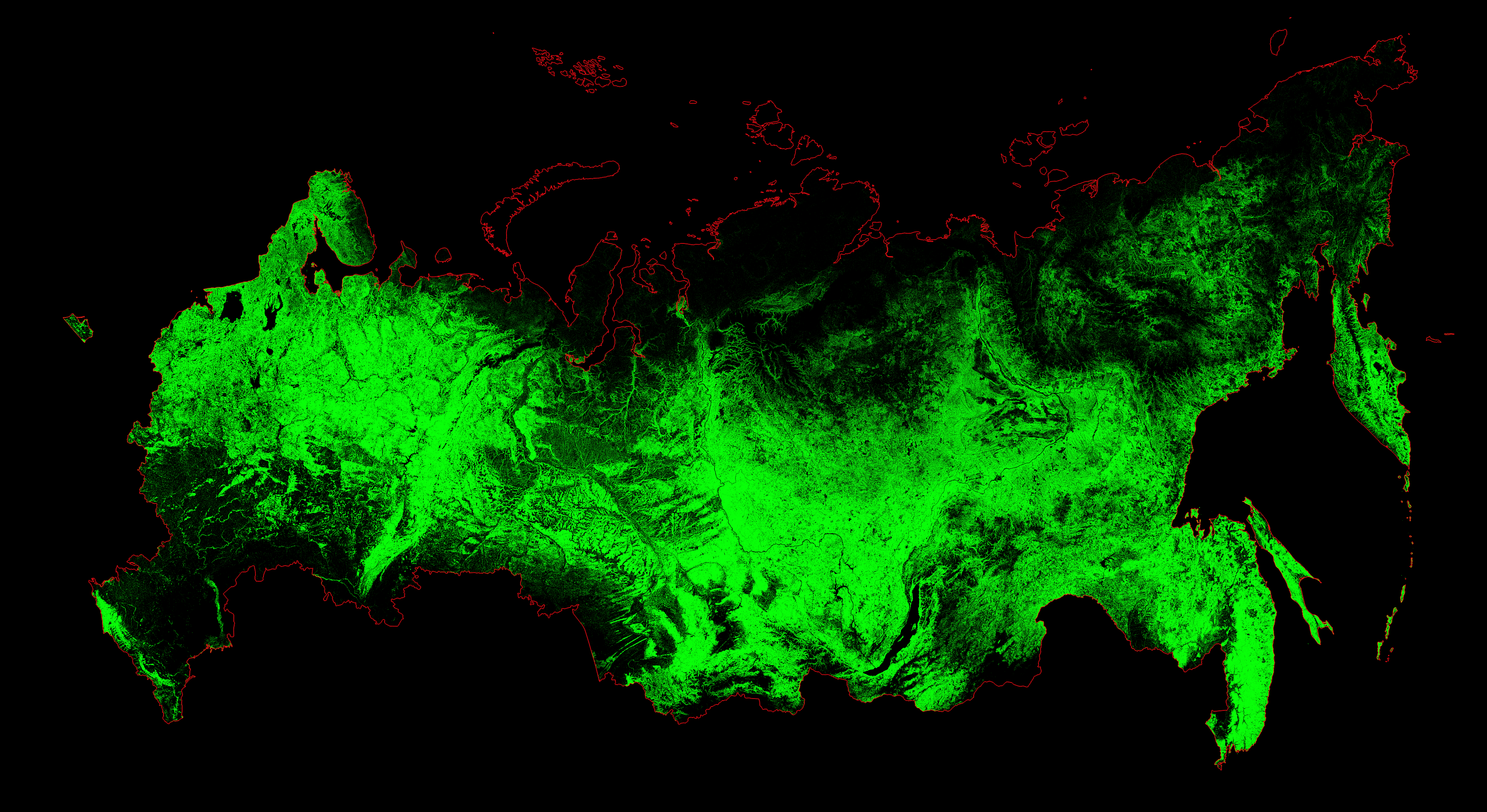
‘Is this a Rorschach test? Kind of looks like a grasshopper’
Ethno-Linguistic Composition of the Caucasus, 1990
‘This is a really detailed and interesting map thank you :)‘–HiroYeeeto
East Slavic languages in the Russian Empire (1897)
‘Half of Buryats don’t speak Buryat. Yakuts and Tatars know their national languages better, and virtually all Chechens, at least those grown up in the Chechen Republic, speak Chechen’–mahendrabirbikram
1872 map of the Aral Sea
‘Kazakhstan is trying to let a little more water in, but there’s not much that can be done. Much of the water that did fill the sea is needed in other areas or is just gone. The Soviets not only diverted much of the water that went into the sea, they did a horrible job of it, trying to turn the desert into cotton fields. The canals were poorly built and huge amounts of water was wasted. It’s estimated that in the largest canal, anywhere between 30-75% of the water was wasted, either being evaporated or leaked. Now days, much of the population still relies on that same irrigation system. Most of the nations are just to poor and don’t have the capability to improve them.
It’s a vicious domino effect, where taking the water creates a dry, salty desert. Dust storms spread the toxic sand and salt over the irrigated land and more water and pesticides and fertilizer is needed to make the land productive, but they end up in what was the lake bed and is now a desert. Another dust storm picks up and the cycle repeats, destroying both sides of the system.‘–]a_filing_cabinet
Soviet map of the Kamchatka Peninsula (1967)
‘Disappearing Earth is quite a good recent novel set in Kamchatka’–dexter_sinister
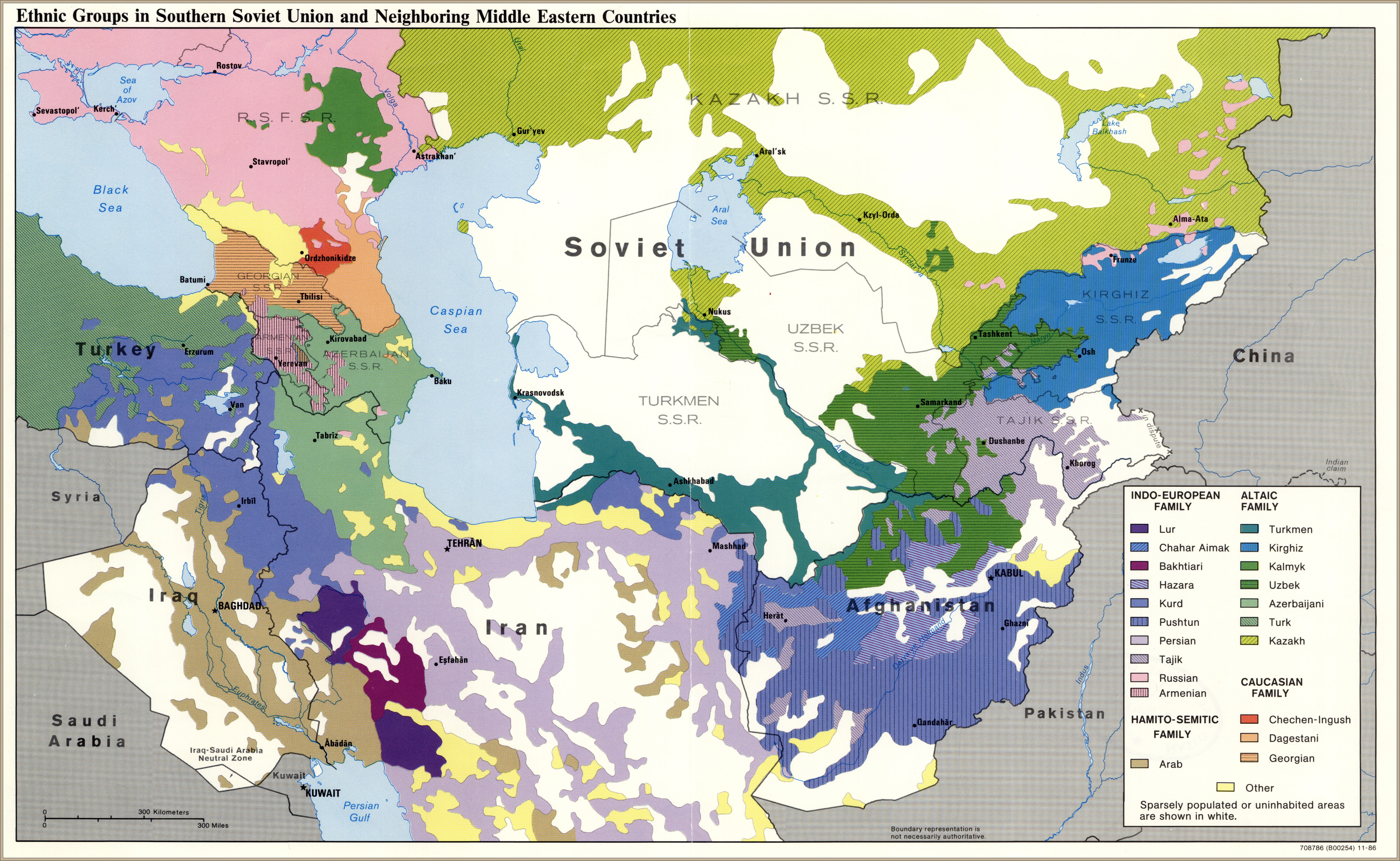
Ethnic groups in southern Soviet Union and neighboring Middle Eastern countries (1986)
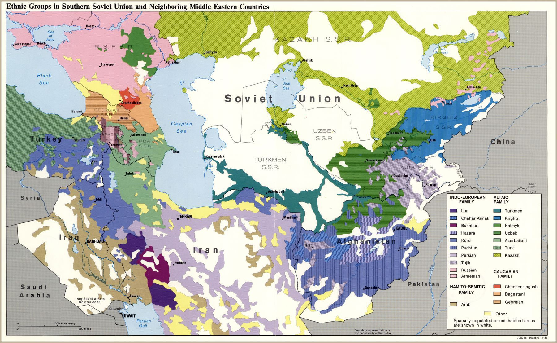
‘Ethnic Russians would only be in the majority in Crimea and the built-up parts of the Donetsk and Lugansk oblasts, and pretty much every ethnic map of Ukraine that I’ve seen (whether Soviet or Western) has reflected this. This was most likely an oversight on someone’s part – the guy making the labels forgot that Ukraine would be included, or accidentally put “Russian” when he meant “East Slavic”, or something like that’–Lazar_Taxon
1937 Geologic Map of the Soviet Union
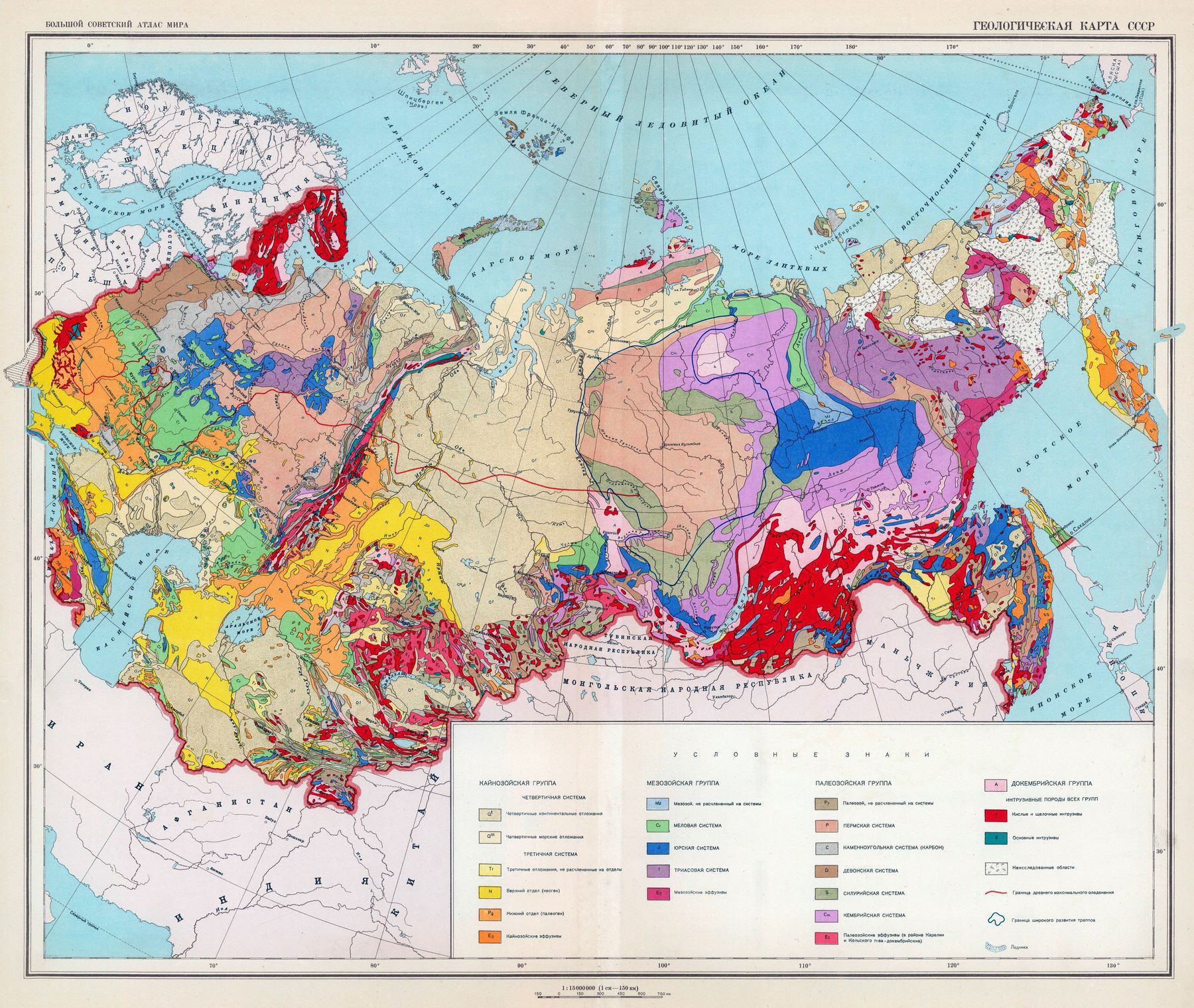
‘A fascinating insight into just how diverse the Soviet Union truly was in regards to terrain. Do you think Krushchev looked at a map like this before launching the Virgin Lands scheme?‘–AllAboutRussia
Forced-Labor Camps (Gulags and individual local camps) in the Soviet Union (1951)
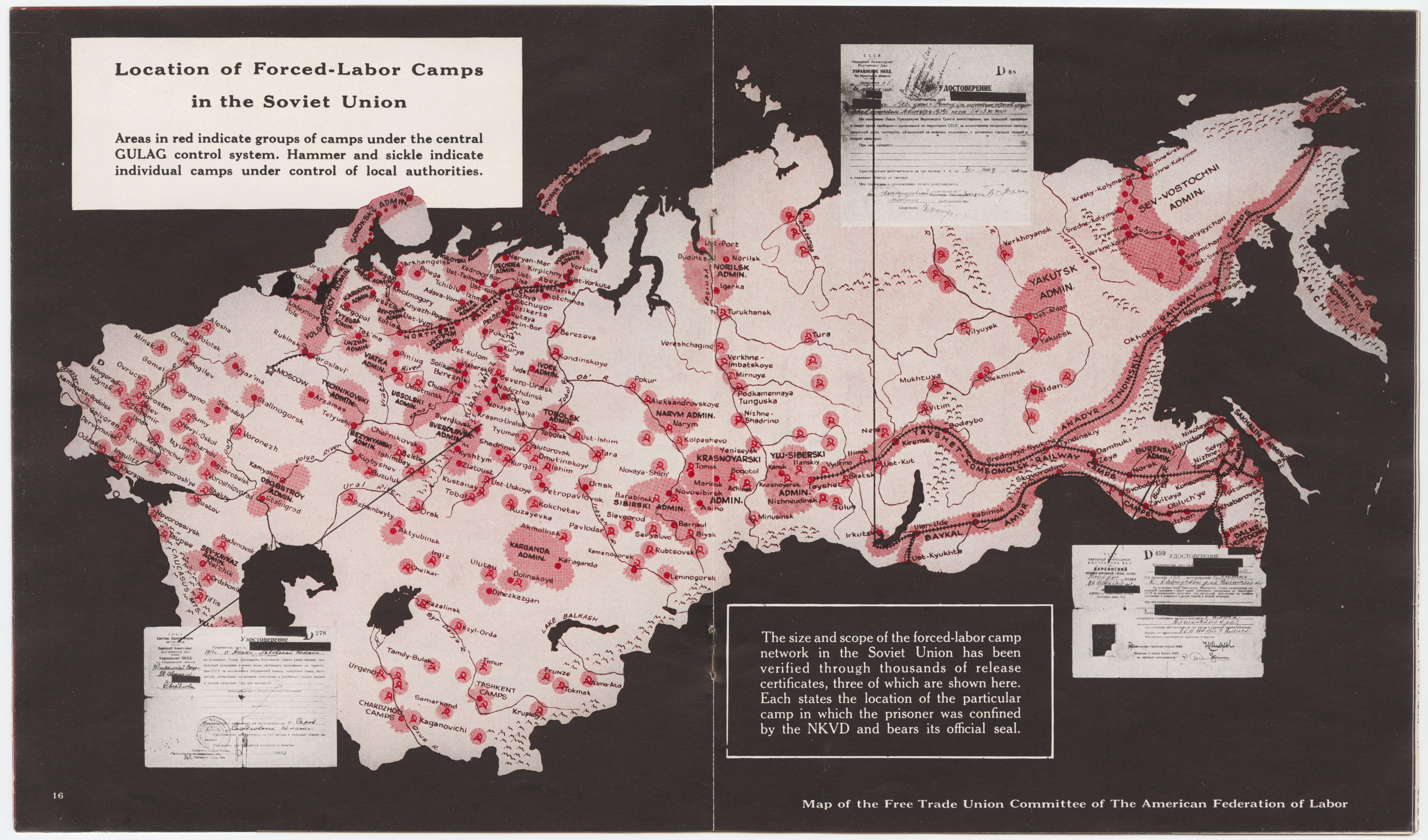
“A lot of my Ancestors died in those. They were farmers in an German enclave, an autonomous German town for German settlers, in Eastern Russia. They settled there before the first World War”–Satan_Stoned
Soviet map of the Baikal, Transbaikal Region (1967)
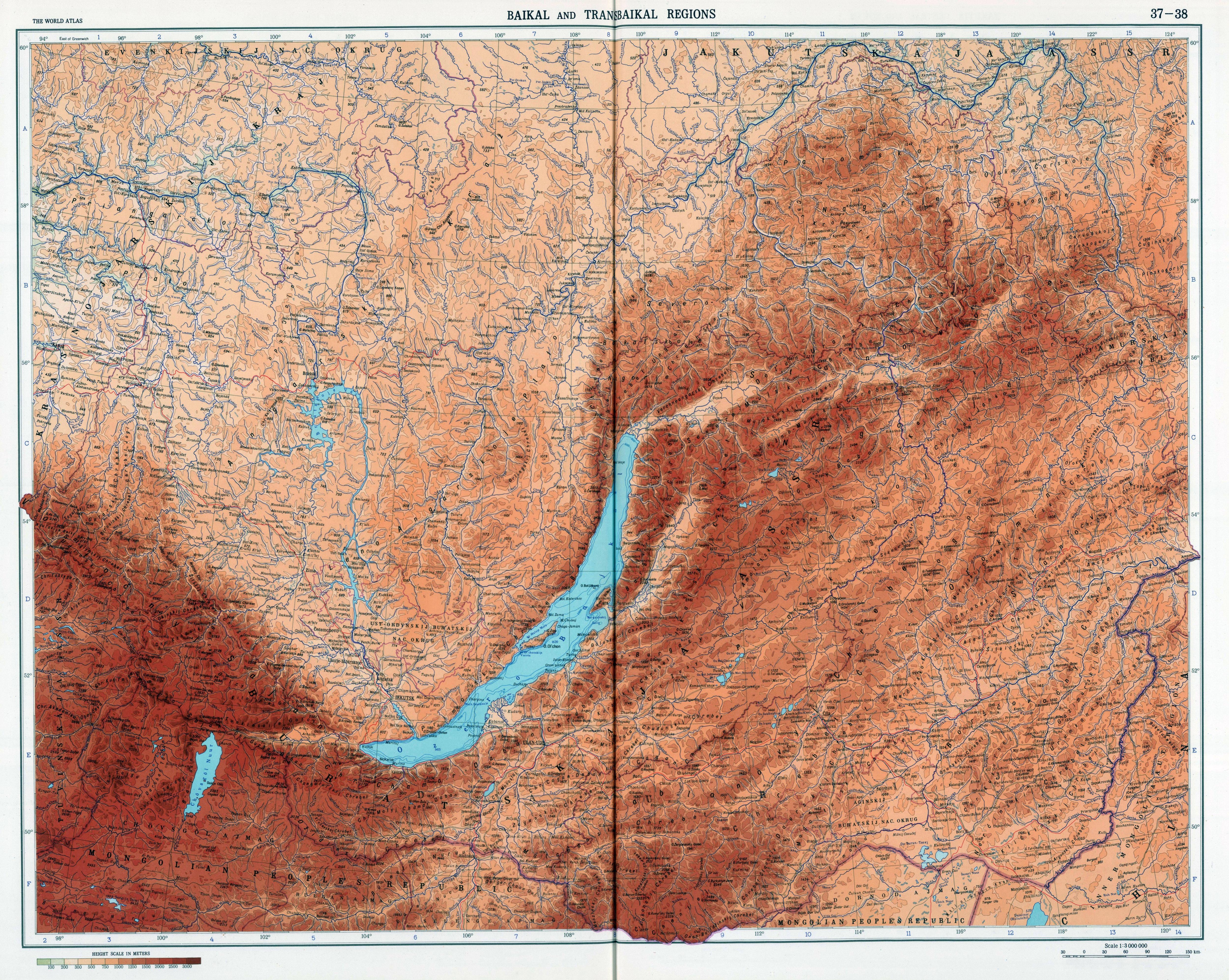
“Irkutsk is a city with a lot of historical architecture, I think it can be one of the interesting city for tourism, on the railway between Krasnoyarsk and Vladivostok. But, like all East Siberian cities, it’s kinda poor and depressed.
Vladivostok is a beautiful sea city. In Khabarovsk, i got robbed, so I do not like the city :) Ulan-Ude, a very strange city. This is the Buddhist capital of Russia, with many Buddhist temples, such as the Ivolginsky datsan. But I do not like the city itself I wasn’t on Krasnoyarsk, and can’t say anything about it. And Novosibirsk, largest city of Siberia, must be visited i guess.
And Chita, awful city, i even recommend to don’t getting off the train. City has one of highest crime rate in Russia for years, and very bad reputation”–Vaval