1921 map of Japan, Korea and Taiwan - by Kenji Ogura
1921 map of Japan, Korea and Taiwan - by Kenji Ogura
‘Looks like a very high quality map’
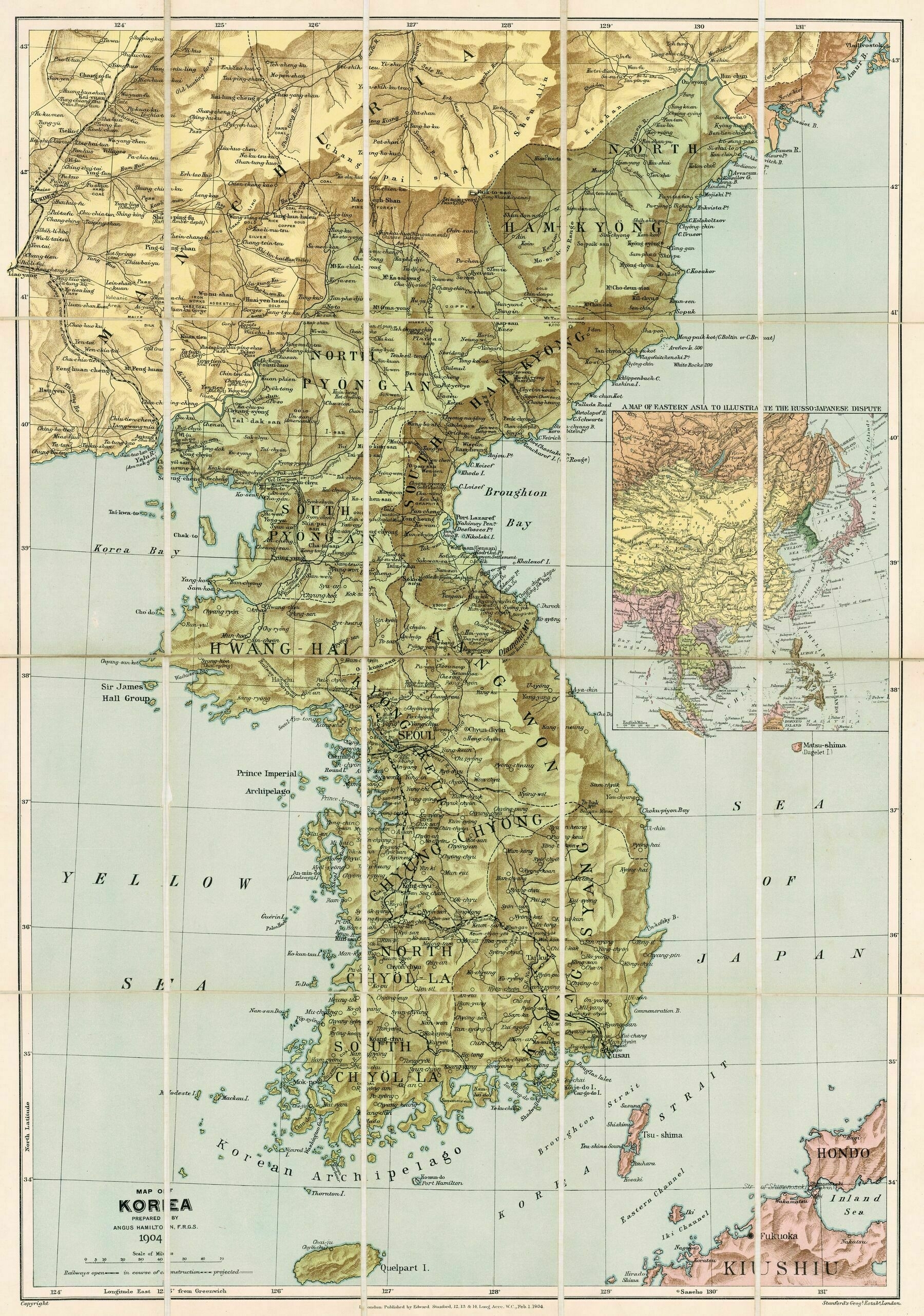
1904 map of Korea
1904 map of Korea
‘Besides Armenia and Korea, what other nations have a sacred mountain that they largely do not actually control?
Israel? Judaism think the Sinai is sacred and it is owned by Egypt’
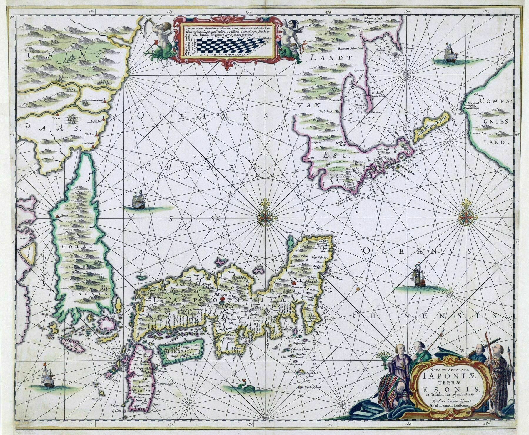
1658 map of Japan and the Korean Island. Hokkaido is a peninsula connected to mainland Asia
1658 map of Japan and the Korean Island. Hokkaido is a peninsula connected to mainland Asia ; Compagnies Land and Staten Eylant [to the right] are two of the Kuril Islands, sighted by Vries on his 1643 voyage
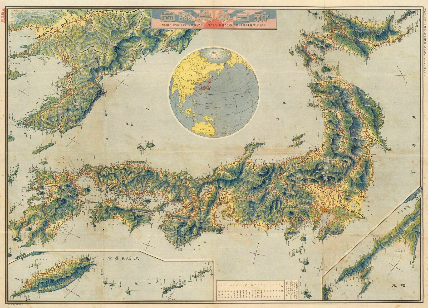
Illustrated map from the 1930s of the Empire of Japan
Illustrated map from the 1930s of the Empire of Japan - drawn by Yamagami Kiji. In addition to [modern day] Japan, it also includes Taiwan, Korea, Manchuria and southern Sakhalin
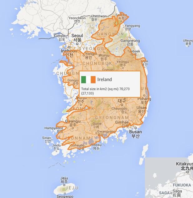
The Republic of Ireland into South Korea
The Republic of Ireland into South Korea
“Now I definitely don’t want the north back”–Nazi_Marxist
1738 map of the Kingdom of Korea
South Korea drawn up by roads
South Korea drawn up by roads
The Republic of Ireland into South Korea
The Republic of Ireland into South Korea
“Now I definitely don’t want the north back”–Nazi_Marxist
North Korea / South Korea drawn up by roads
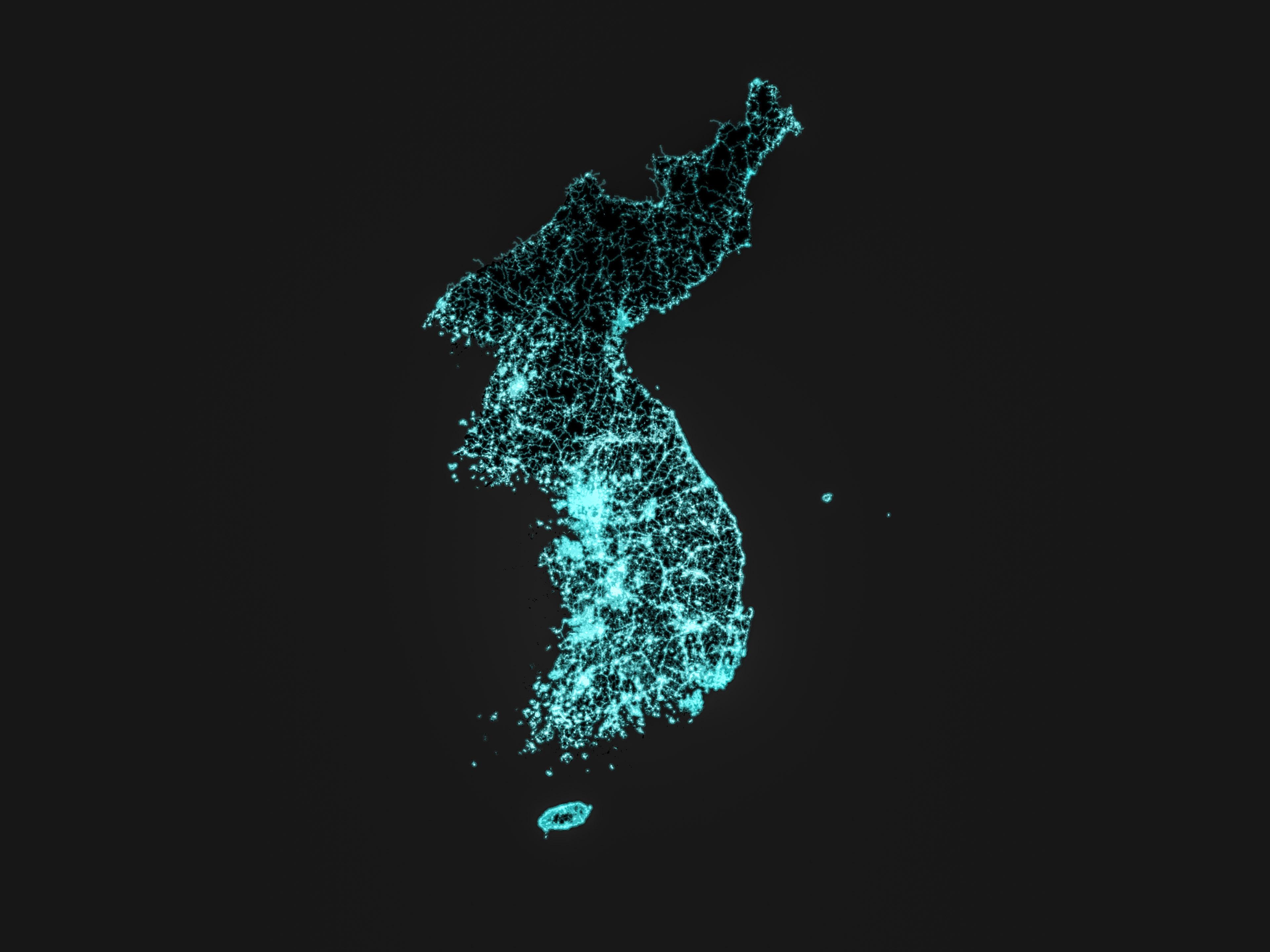
“Until you realize those roads are probably all poorly maintained and not lit”–theonetruefishboy
Land Cover Map of the Korean Peninsula
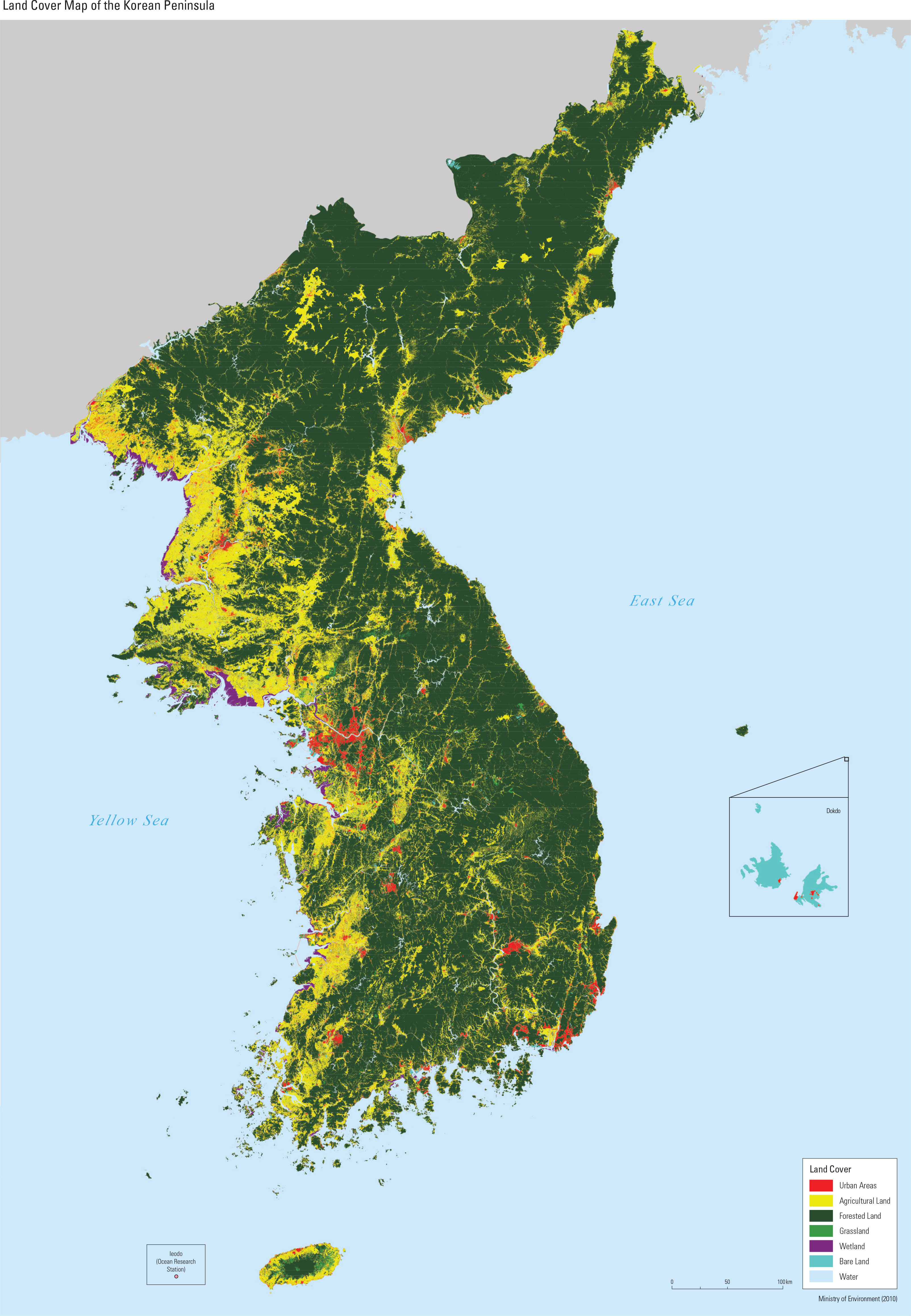
“I’ve taken dozens and dozens of bus trips and train trips up and down the South Korean countryside.
This is what the vast majority of the country looks like. Just rice paddies everywhere”–Geo_OG
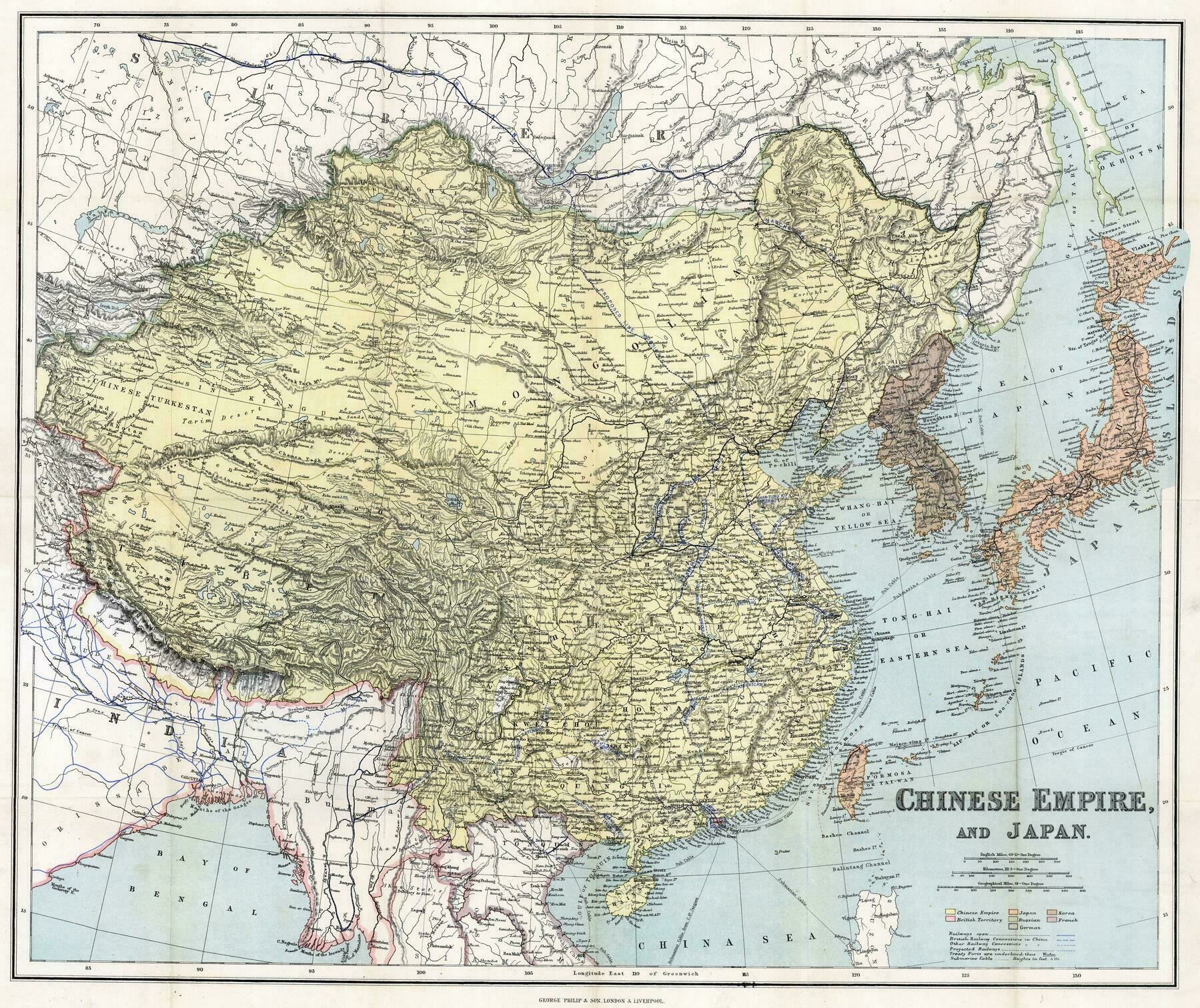
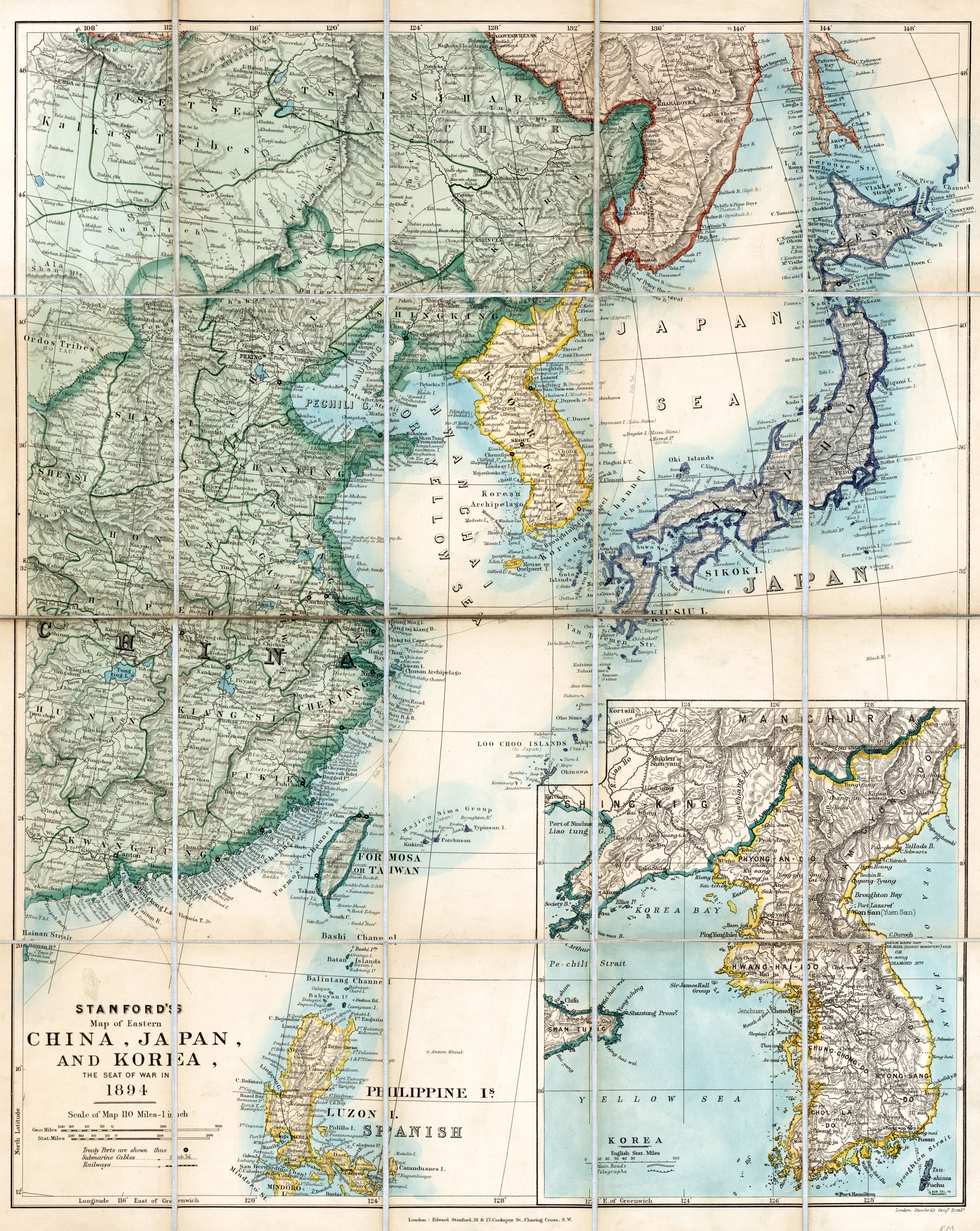
1894 Stanford's map of eastern China, Japan and Korea
Map of Korea during Russo Japanese War (1904-1905)
Japan, the target : a pictorial Jap-map (1942)
1915 map of Japan, Korea & Taiwan