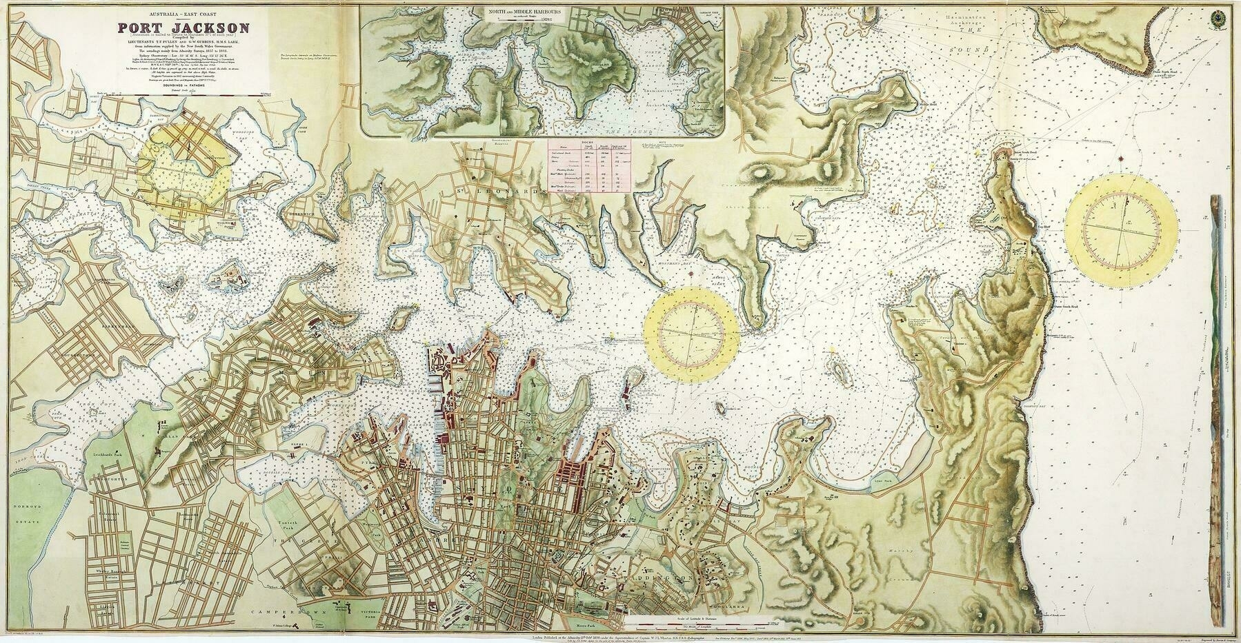
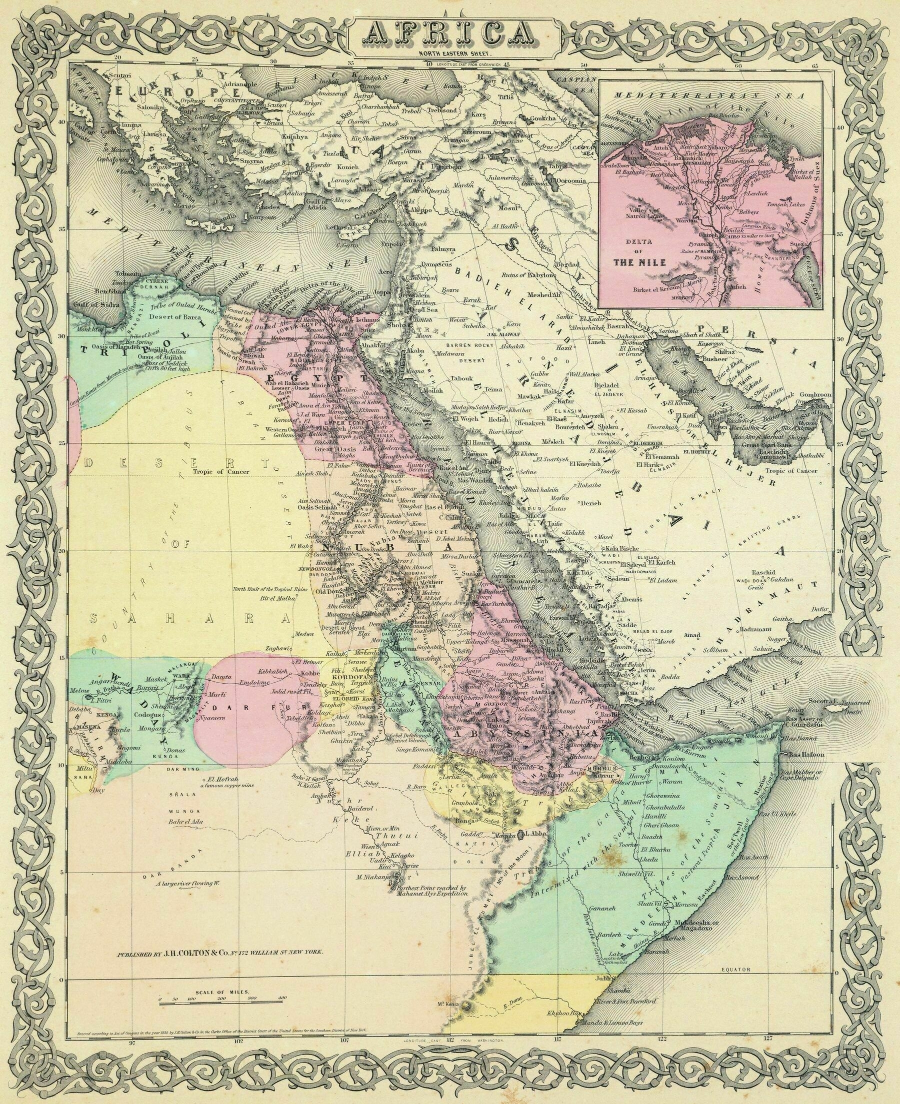
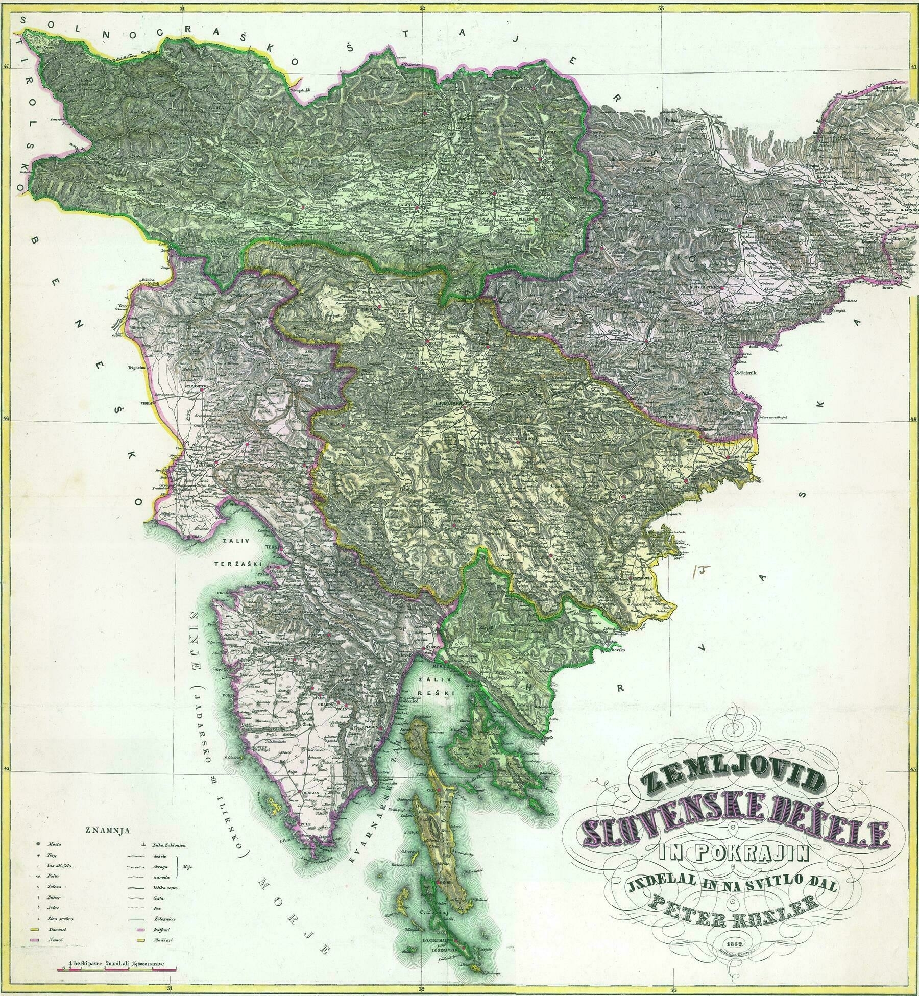
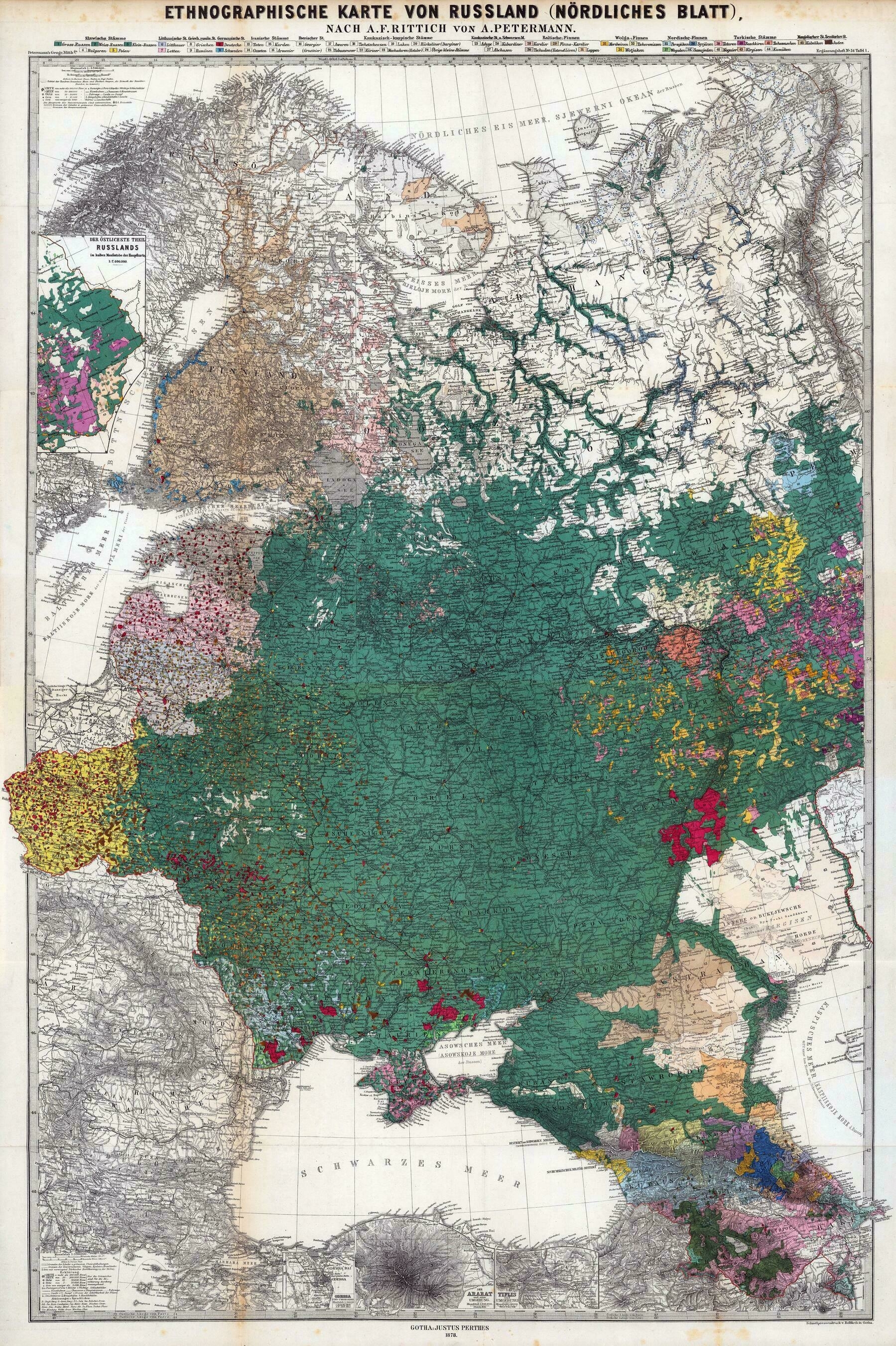
Ethnographic Map of Great Britain and Ireland, according to Dr. Gustaf Kombst - by A.K. Johnston (1850)
7548 x 8970
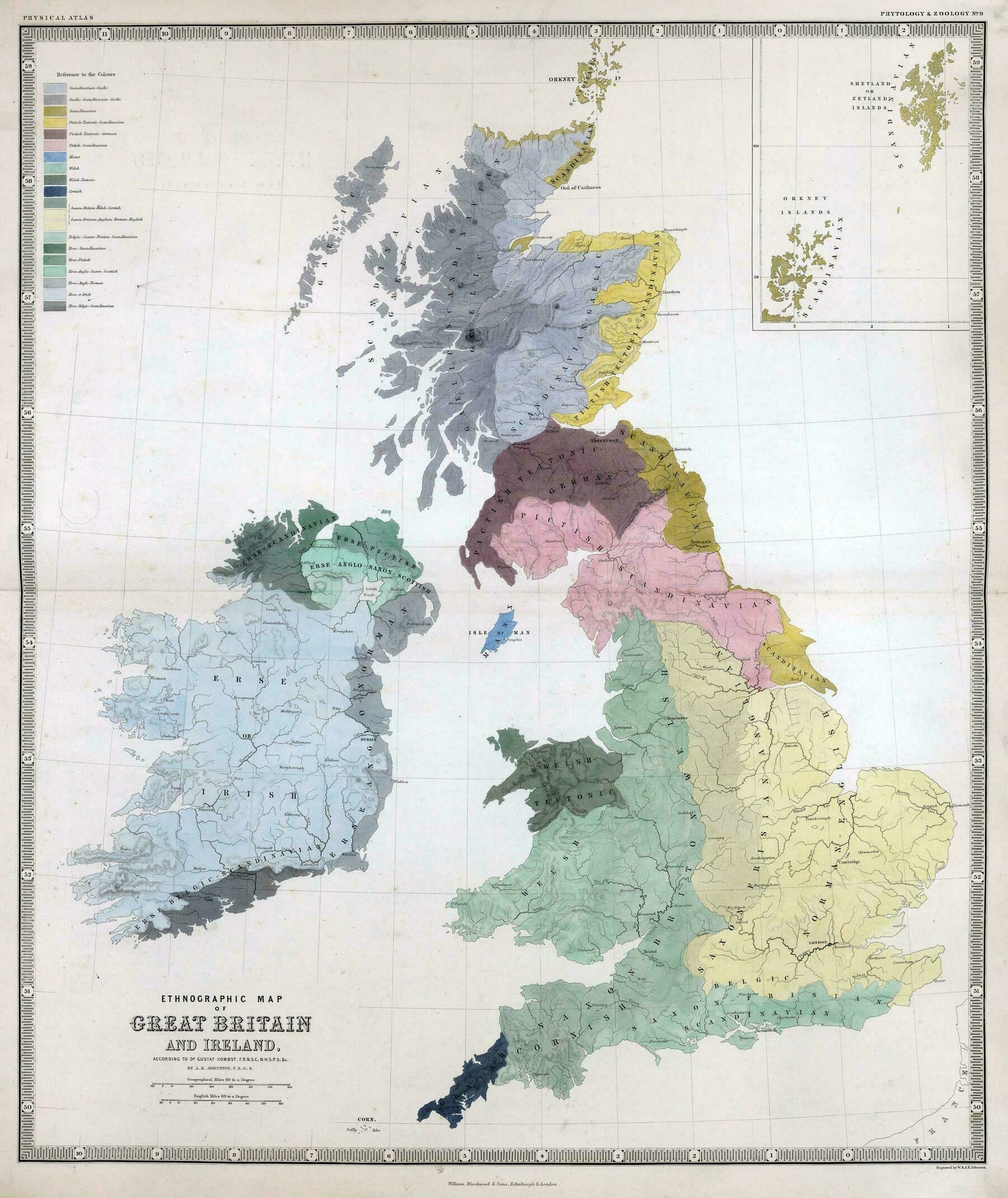
‘This is fantastic! Very good work here.
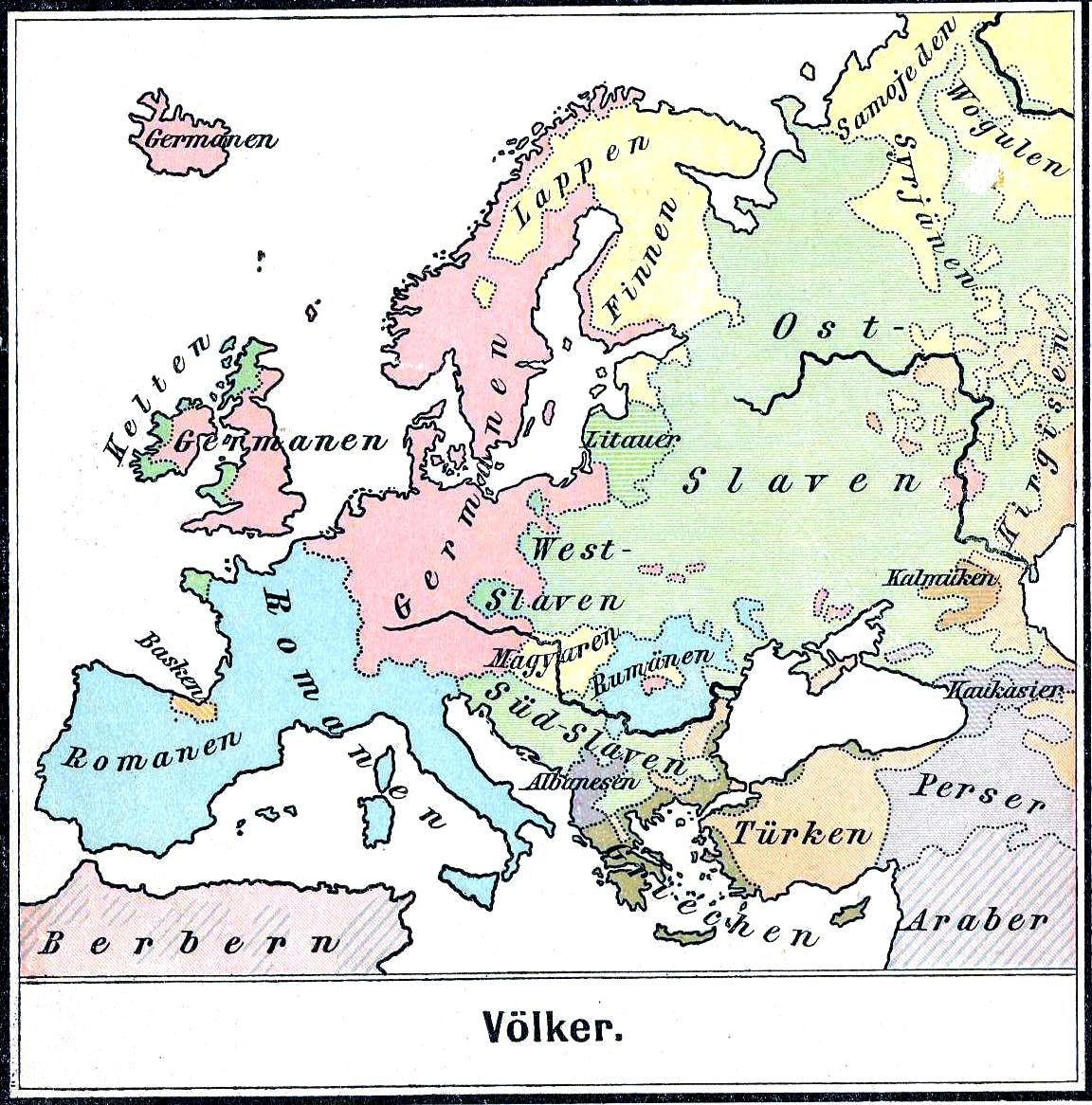
It should be noted however that this is primarily a cultural influence map, as the amount of DNA contributed by Scandinavians (and likely even Angles and Saxons) was pretty minor compared to the people that lived here previously. The days where conquerers would replace populations was long over at this point, they just took over the positions of power and influence at the top of society.
So are you saying that a DNA based map would look significantly different?
I’ve done a little research into this (for genealogy purposes), and believe that the majority of the DNA in Britain is still pre-Celtic and Celtic. Later waves of conquerers (northwest Germanic Angles, Saxons, Jutes, Frisians), Scandinavians (mainly Danish with some Norwegian), and Norman (mostly French) only contributed a minority part of the genetics to the current population. The new groups that came in usually just took over the upper echelons of power and privilege in society, so their cultures kind of became more of an influence (or dominant), but the DNA they contributed overall wasn’t very large.
If I had to estimate, it would be around:
40% Pre-Celtic
40% Celtic
15% Anglo-Saxon
1% Viking
1% Norman
3% other’


