1908 Ottoman map of the Pacific area
1908 Ottoman map of the Pacific area
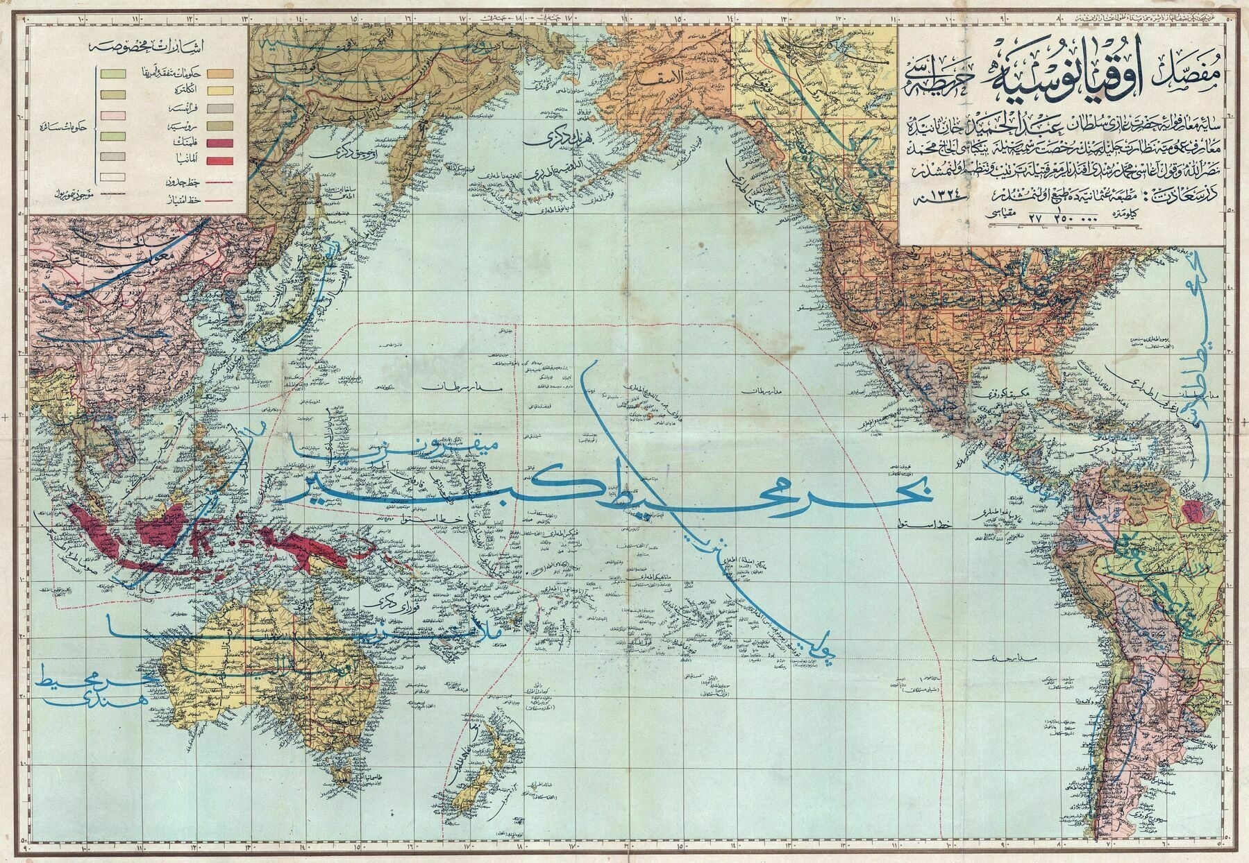
‘Polyyyyyyyyyyyyyyyyyyynesiiiiiiiiiiiiiiiiiiiiiiiiiiiiiiiiiiiiiiiiiiiiiiiiiiiiiiiiiiiiiiiiiiiiiiiia and also Assssssssssssssssssssssssssssssssssssssssssssia’
1908 Ottoman map of the Pacific area
‘Polyyyyyyyyyyyyyyyyyyynesiiiiiiiiiiiiiiiiiiiiiiiiiiiiiiiiiiiiiiiiiiiiiiiiiiiiiiiiiiiiiiiiiiiiiiiia and also Assssssssssssssssssssssssssssssssssssssssssssia’
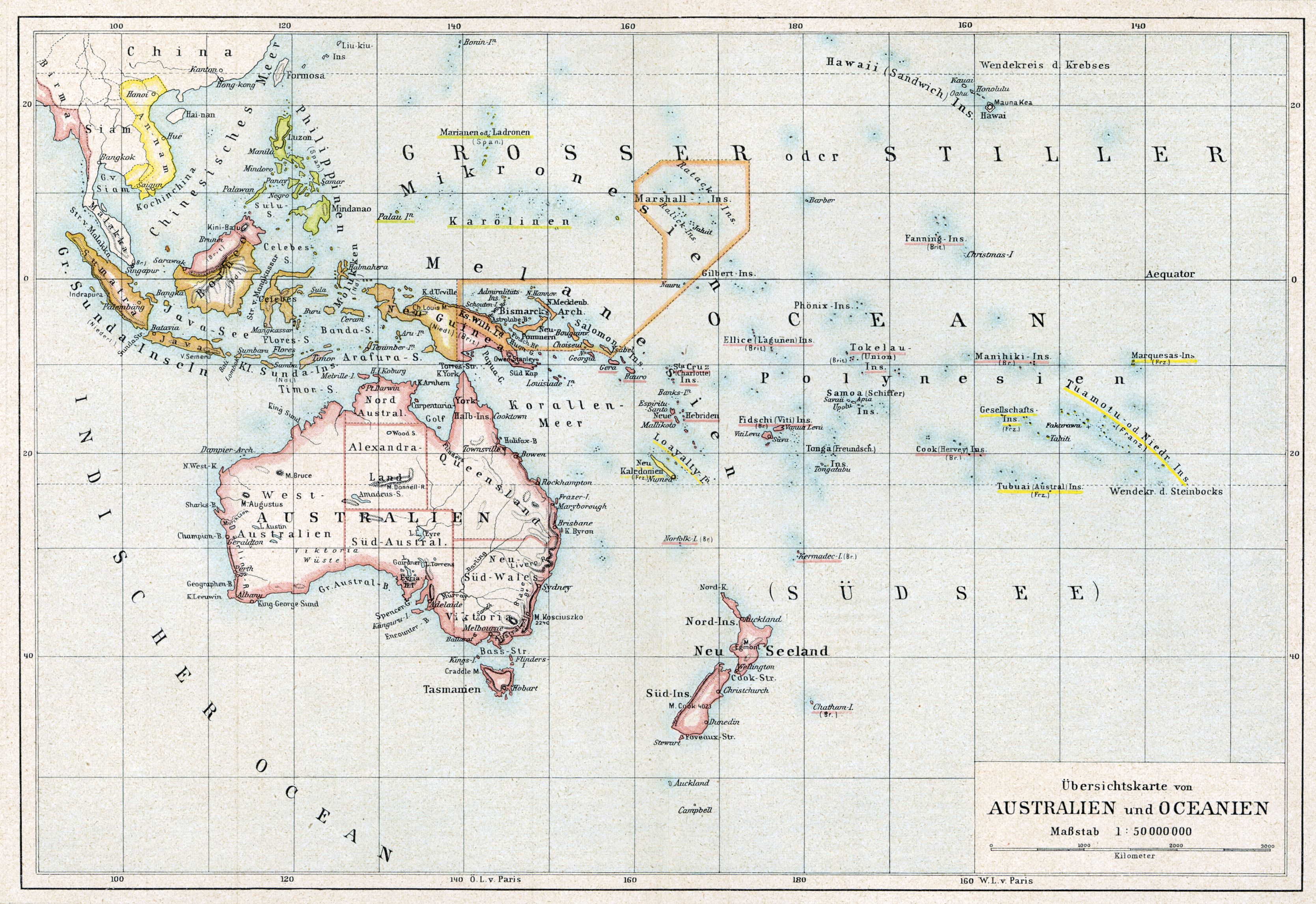
1802 map of East Asia, Southeast Asia and Oceania - by Johannes Walch
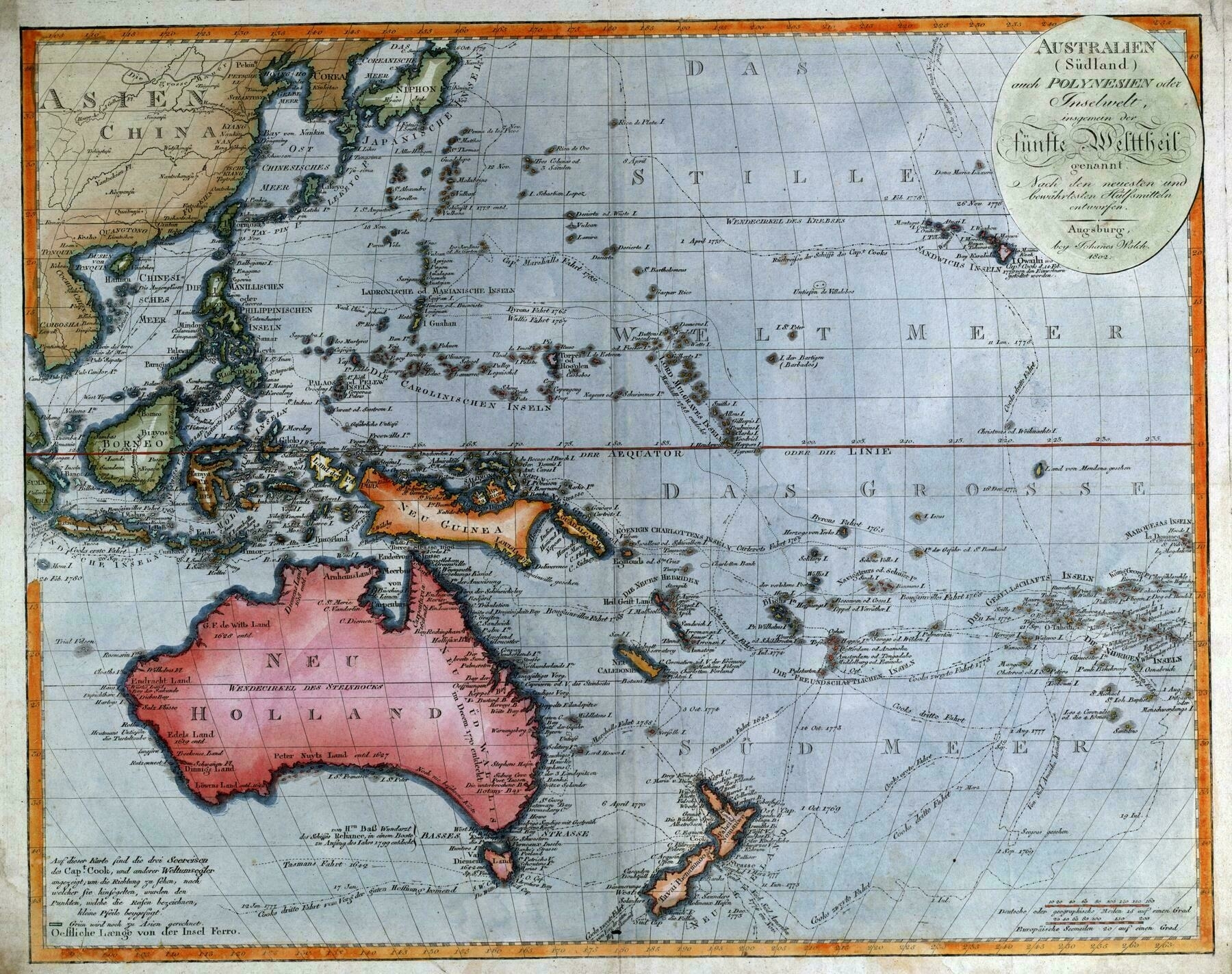
‘Beautiful! This is more accurate than I thought possible in 1802
Same. Amazing what they could do with surface-level measuring and surveying, before satellites, or even airplanes!’
Average annual temperature map of Australasia (1908)

‘In 1839 the Colonial Office in England requested that all British colonies set up meteorological stations along their coastlines to improve understanding of the weather, and in doing so reduce deaths at sea. The New South Wales Governor George Gipps quickly organised observatories at Port Macquarie on the north coast on New South Wales, Port Jackson at the southern entrance to Sydney Cove, and at the Flagstaff Hill signal station in Port Phillip (which was part of New South Wales until 1851). This collection of stations was the first organised meteorological network in Australia.
The observatories were reportedly equipped with all the latest recording instruments and devices and the thermometer was kept in consistent conditions. These were not the same conditions that the Bureau of Meteorology have today, but they were a scientific improvement of the ad-hoc processes previously employed and a lot of effort has into understanding and homogenising the records to account for non-climatic influences.
The Bureau of Meteorology was created to consolidate the various meteorological services of Australia’s States which had developed extensive records of their regional weather during the 19th century. After complex negotiations, the Bureau was finally established in Melbourne through the Meteorology Act 1906’
1847 map of Australasia - by William Hughes
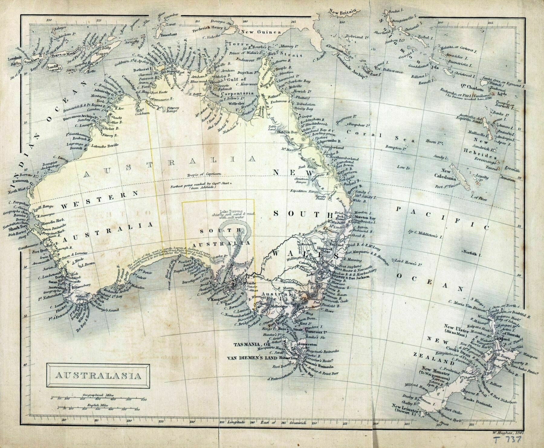
‘Am I seeing wrong or is Victoria labelled “Felix”???
Australia Felix (Latin for “fortunate Australia” or “happy Australia”) was an early name given by Thomas Mitchell to lush pasture in parts of western Victoria he explored in 1836 on his third expedition. On this expedition Mitchell was instructed to travel to Menindee, then down the Darling River to the sea, if it flowed there; or, if it flowed into the Murray River to go up the Murray to the inhabited parts of the colony. However lack of water forced Mitchell to follow the Lachlan River to the south-west as the only practicable route. He reached the Murrumbidgee on 12 May and followed it to the Murray’
1819 map of Asia and Oceania
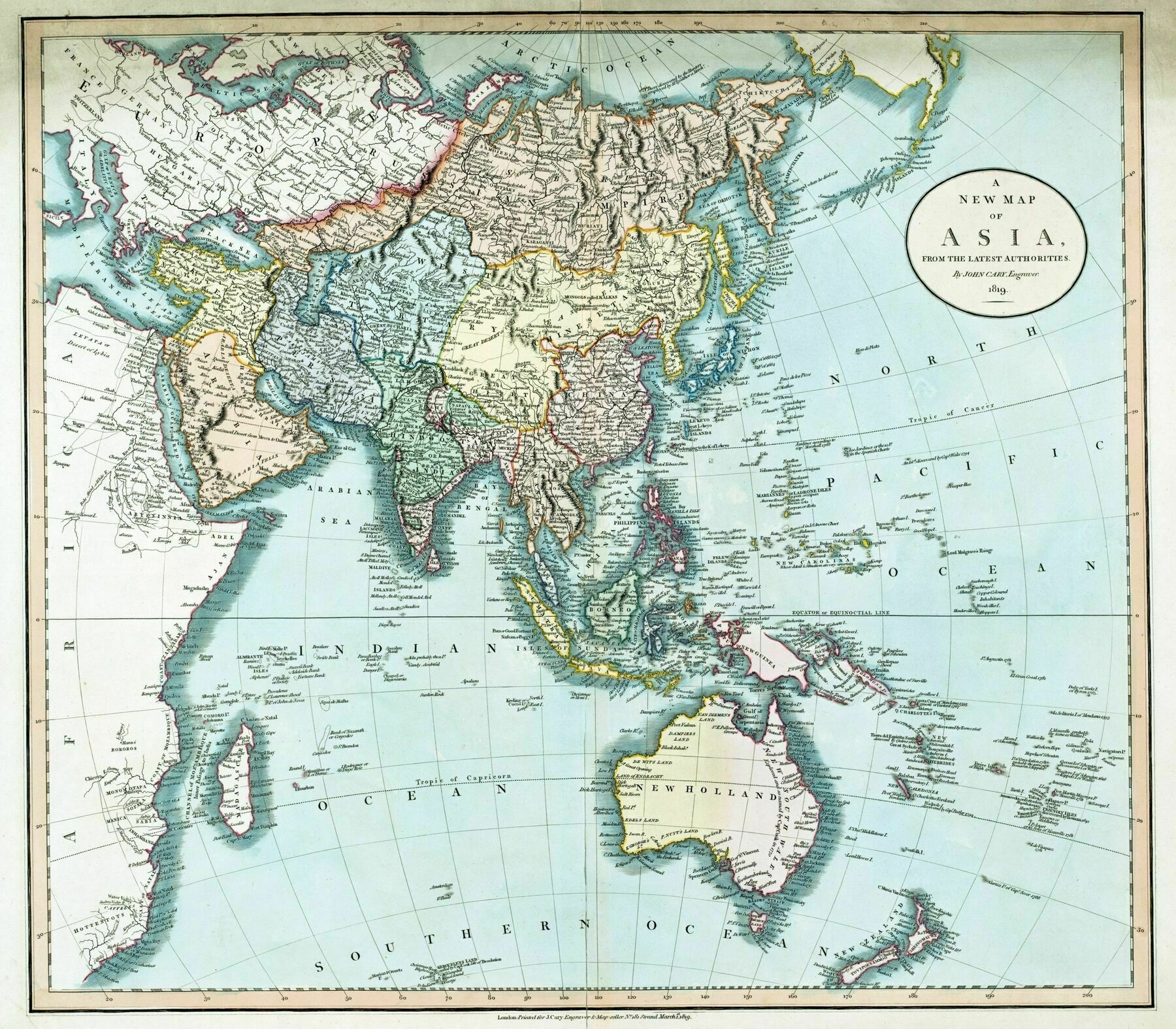
‘Interesting it’s still referred to as New Holland with ongoing British colonisation
No. Perth, in Western Australia, was not founded until 10 years after this map, by the British. Also Adelaide in South Australia, and even Melbourne in Eastern Australia.
The east coast of Australia–unmapped by the Dutch–was mapped by James Cook in 1770 and thus known as New South Wales. Sydney was established in 1788. So it’s correct that the other three coasts of Australia were still known as New Holland.
It’s a lesson in how things can be named but not recognised as belonging to a particular power until they are colonised, since actual use of the land supposes an entitlement to it.
The Dutch were great explorers and commercial agents but since they found no commercial use in Australia they didn’t have any need to assert a claim to their discoveries.
Australia is a fascinating lesson in this aspect. The same applies to New Zealand which the Dutch discovered 127 years before Cook fully mapped it on his way to Australia. If the Dutch had behaved differently they would have exerted more influence’
1819 map of insular south east Asia and Australasia with notes on European discoveries of Australia. The picture shows a Maori canoe view in New Zealand, with a Kangaroo
‘Off the east coast of the South Island, Banks Peninsula is shown as Banks’s Island, as drawn by Cook in 1770, but by 1819 it had been charted as a peninsula for a decade.
In the far south, Stewart Island is shown joined to the South island, again as drawn by Cook, and again by 1819 it was known for a decade that it was not thus joined but separated by Foveaux Strait’
Japanese map of Oceania from 1938
‘Check out that tree house!’–DonaldDuckNoPants
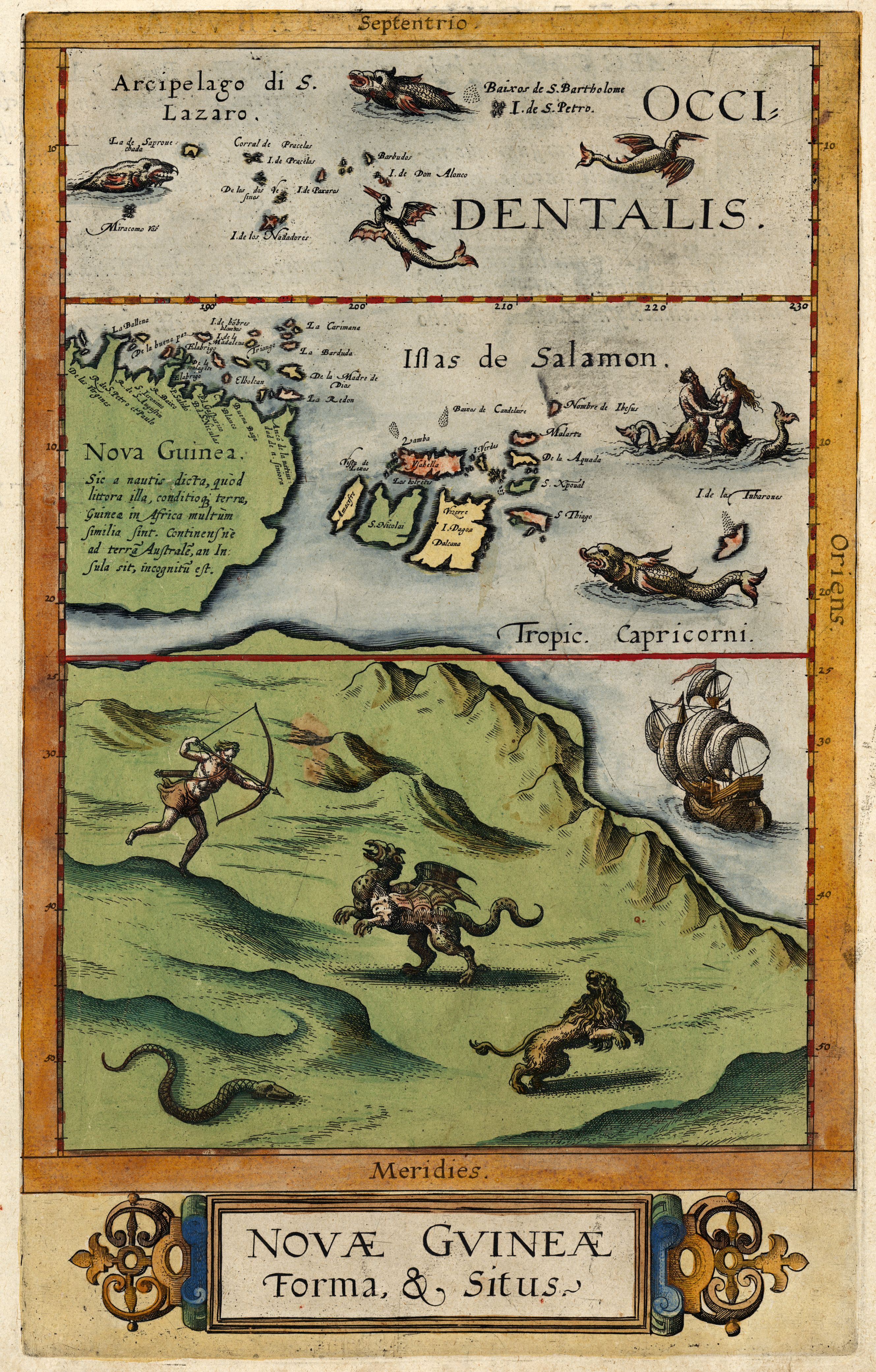
1813 map of Australia, New Zealand & New Guinea
“Sydney really does look a lot like Chepstow if you close your eyes”–SmokeyBlazingwood16
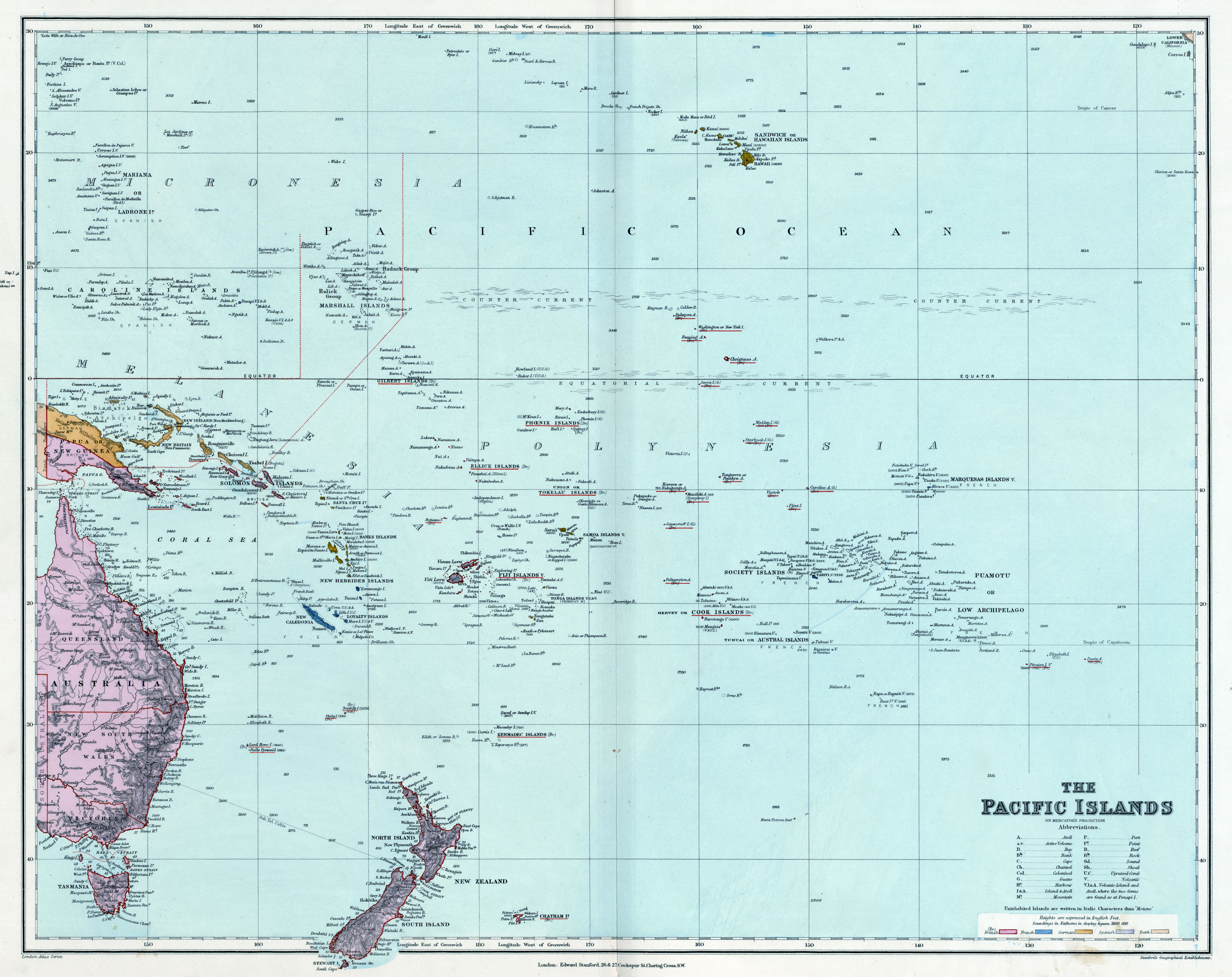
1863 map of Oceania
[8933 x 6654]
Laurie and Whittle’s 1797 chart of the Indian and Pacific Oceans between the Burma, New Holland and Japan
[5000 x 6194]
“This is the eastern half of a Map currently held on exhibition called ‘Terra Australis to Australia’ at The Treasures Gallery, National Library of Australia”–AJgloe
[9379 × 6306]
size: 6604 × 5263

“south east is sydeny more than that the rest of australia is technically a homeland to the most dangerous creatures in other words the rest is the wild australia”–iMMan9orDTruWae