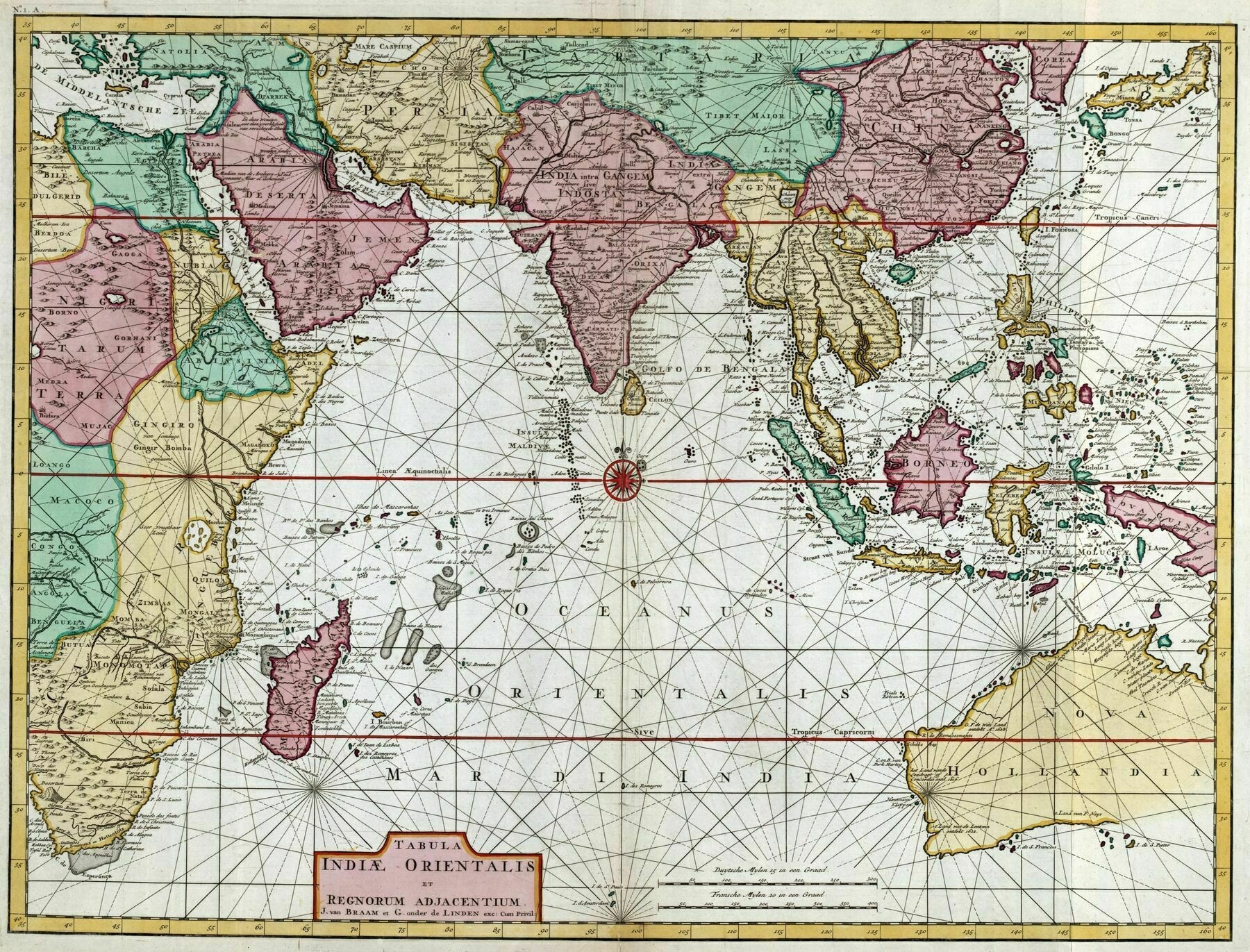
1724 map of the Indian Ocean and surrounding regions, showing Australia as Nova Hollandia
1724 map of the Indian Ocean and surrounding regions, showing Australia as Nova Hollandia
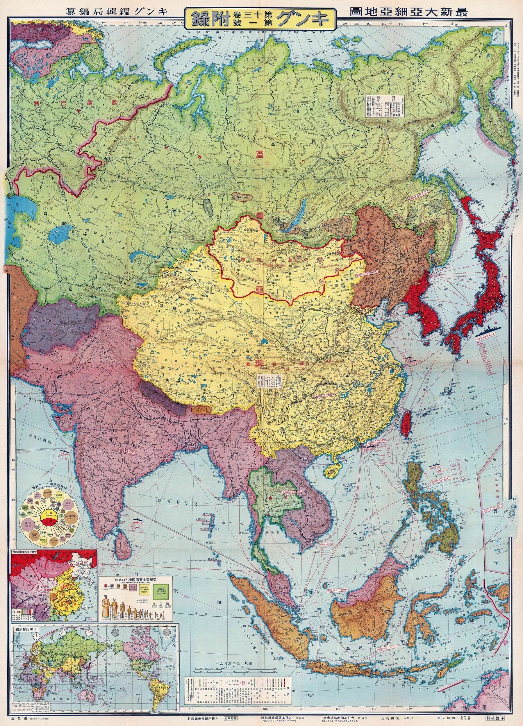
1937 Japanese map of Greater Asia
1937 map of Greater Asia - by Tadayoshi Fuchida & Henshukyoku Kingu
‘That’s an awesome map. Love the aesthetics of historical maps made in non-Western countries, especially Japan’
Japanese pictorial map of Asia from 1924
Japanese pictorial map of Asia from 1924
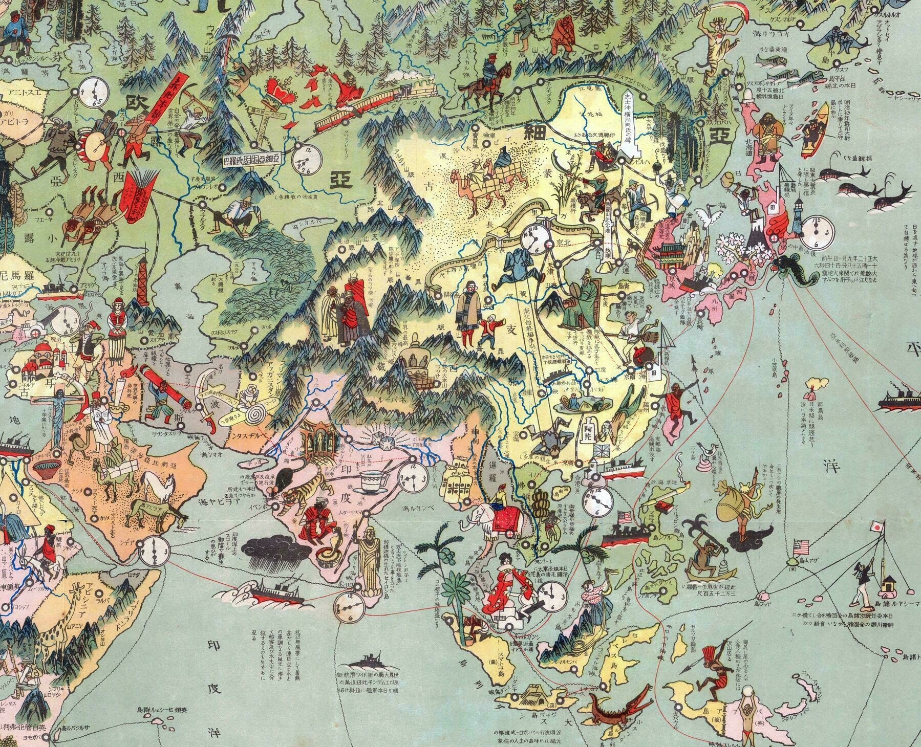
‘I really love these Japanese illustrated maps from the 1920s and 1930s. They are aways so colorful, and its interesting to see what little details the illustrators put on the map. Some things that jump out to me here are:
- The sinking Russian ship between Japan and Korea to mark the location of the 1904 Battle of Tsushima.
- The Japanese sailor raising a flag amongst the islands in the Central Pacific; former German colonies given to Japan after World War I (known as the “Mandates”.)
- A large gun turret representing the British naval base at Singapore.
- A Bolshevik spreading literature along the Trans-Siberian Railway.
- A cross with a crown on it at Yekaterinburg, where Czar Nicholas and his family were executed.’
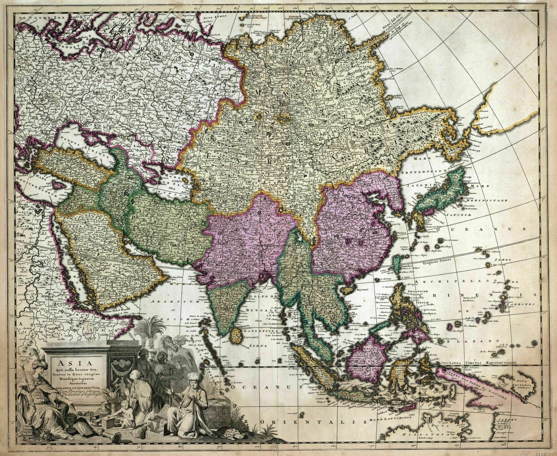
1710 map of Asia - by Gerard Valck
1887 ethnographic map of Asia
1887 ethnographic map of Asia - by Vinzenz Haardt
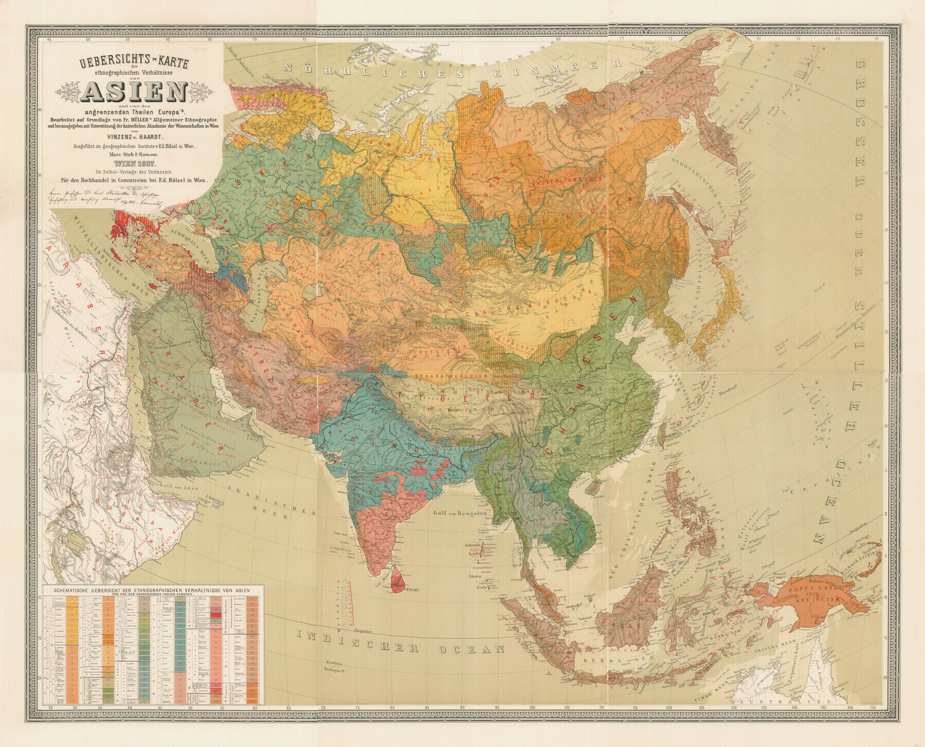
“There is a lot going on in NE Asia at this time.
Russia is settling the Amur Valley - they’ve only had fur trading posts in the East up until the late 19th c.
Largely in response to Russian annexation of Outer Manchuria, Japan decides to aggressively settle Hokkaido, most of which was either empty or settled only by Ainu before that.
In Inner Manchuria, the Manchurians are in the process of being Sinicized.
etc…”
1570 Ortelius map of south, east and southeast Asia
1570 Ortelius map of south, east and southeast Asia
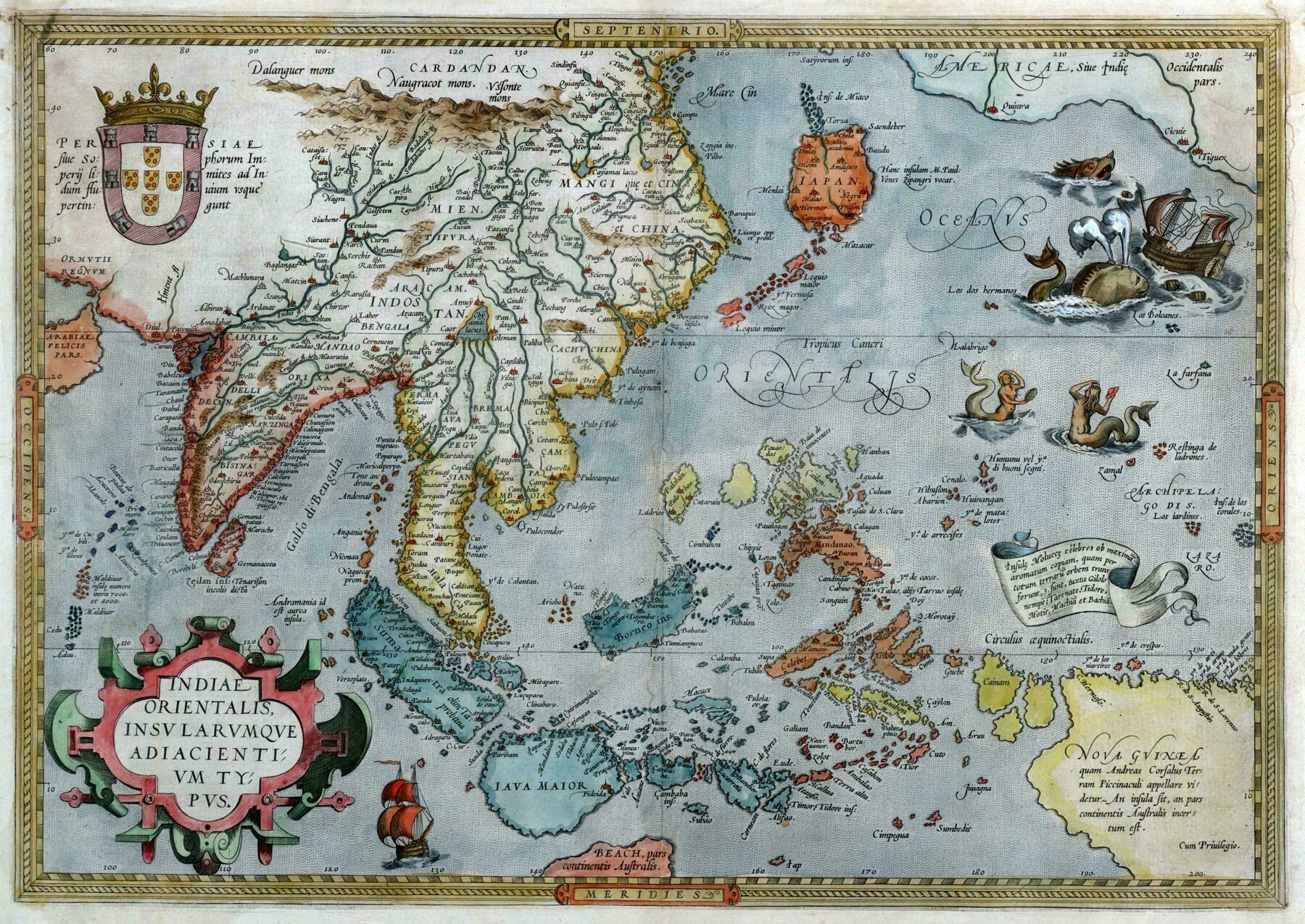
“I love the monsters in these old maps.
“No one comes back from there, so there’s probably huge monsters there or something”
OK, but did you see the boobs on that mermaid? Seems like it’s worth the risk to see some mermaid boobs.
Haven’t seen old Johnny in a while. I think he gave in”
1914 Japanese pictorial map of Europe, Asia and North Africa
1914 Japanese pictorial map of Europe, Asia and North Africa
‘I do like the sown effect on Africa, as if the Europeans just tied the lands together’
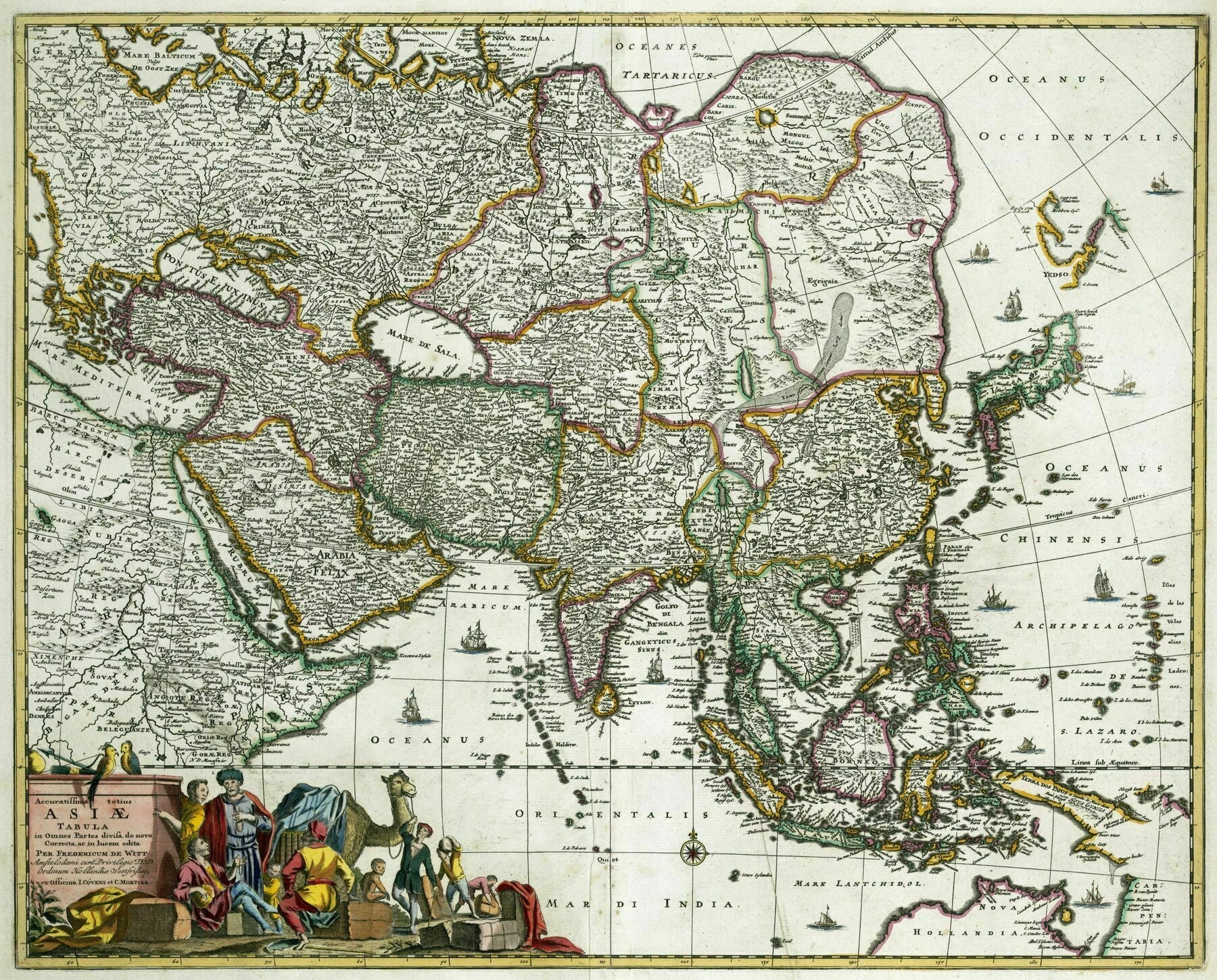
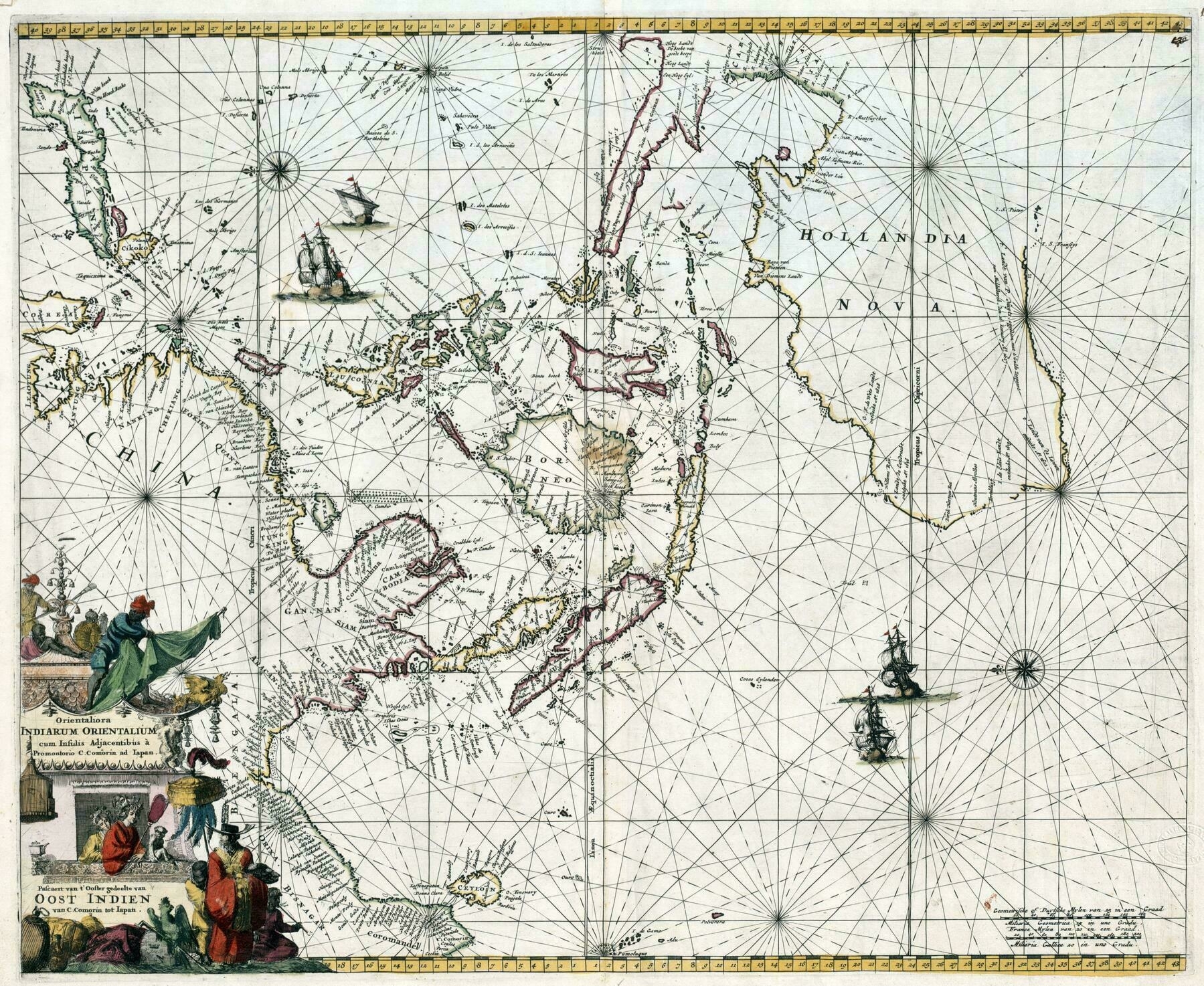
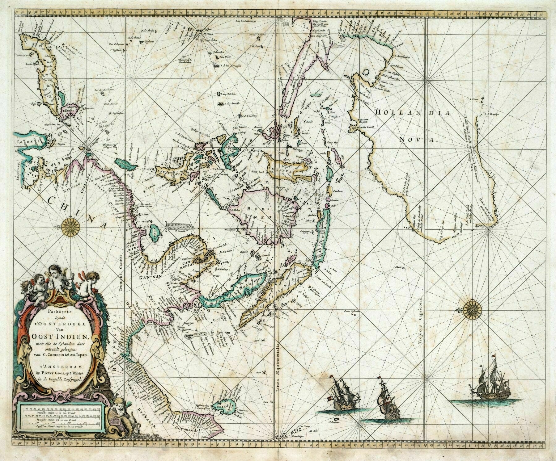
1675 map of Southeast Asia
1675 map of Southeast Asia, focusing on the Dutch sphere of interest - by Frederik de Wit
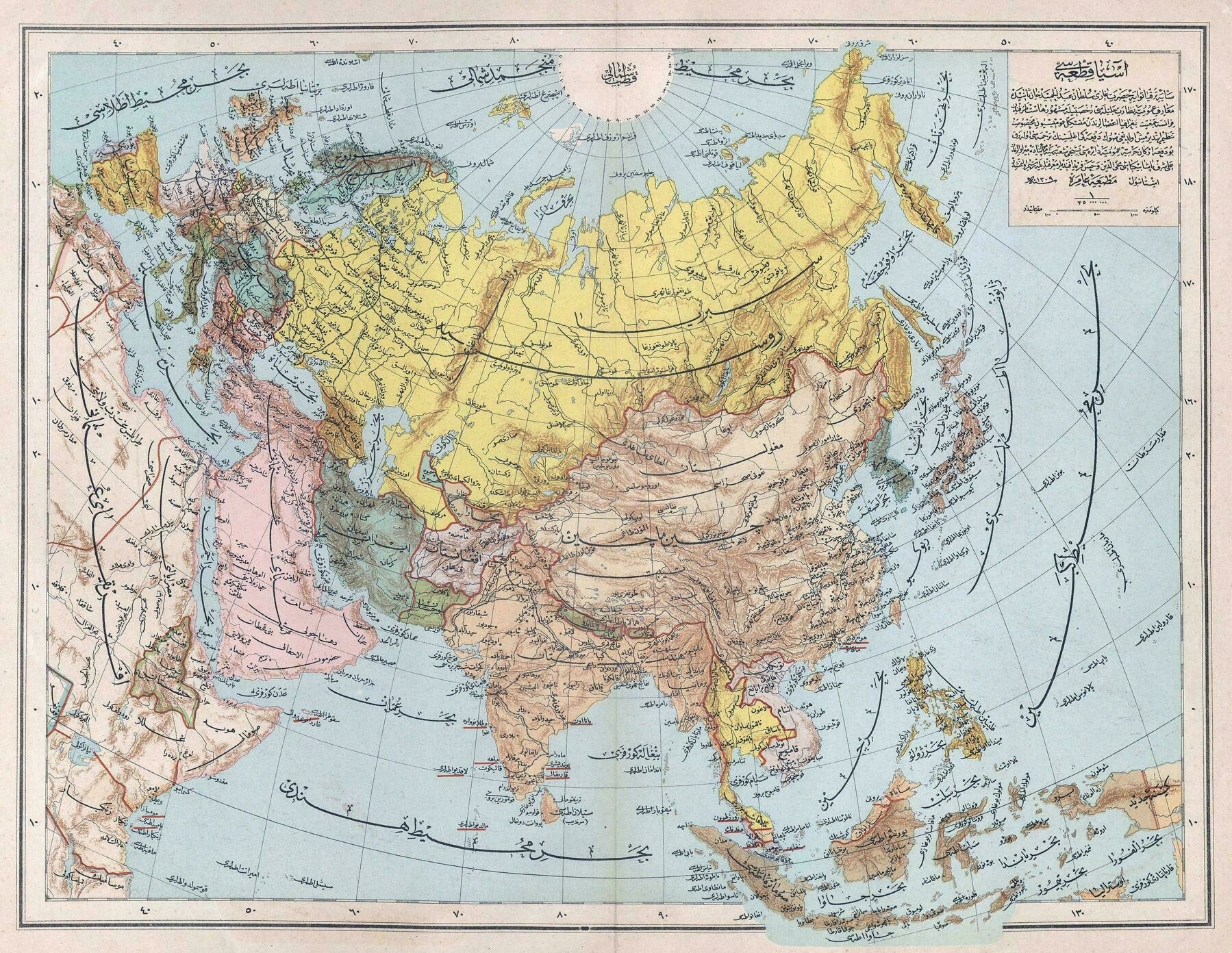
1893 Ottoman map of Asia
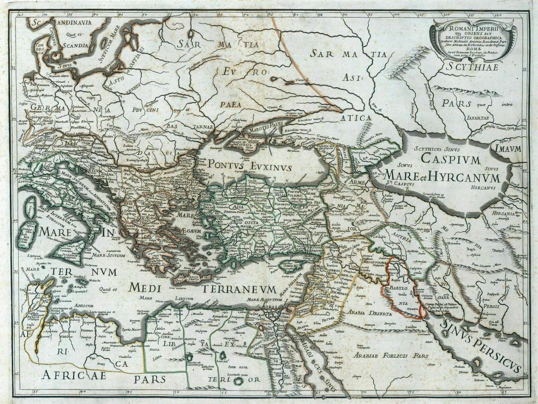
1669 map of the Roman Empire (east)
1819 map of Asia and Oceania
1819 map of Asia and Oceania
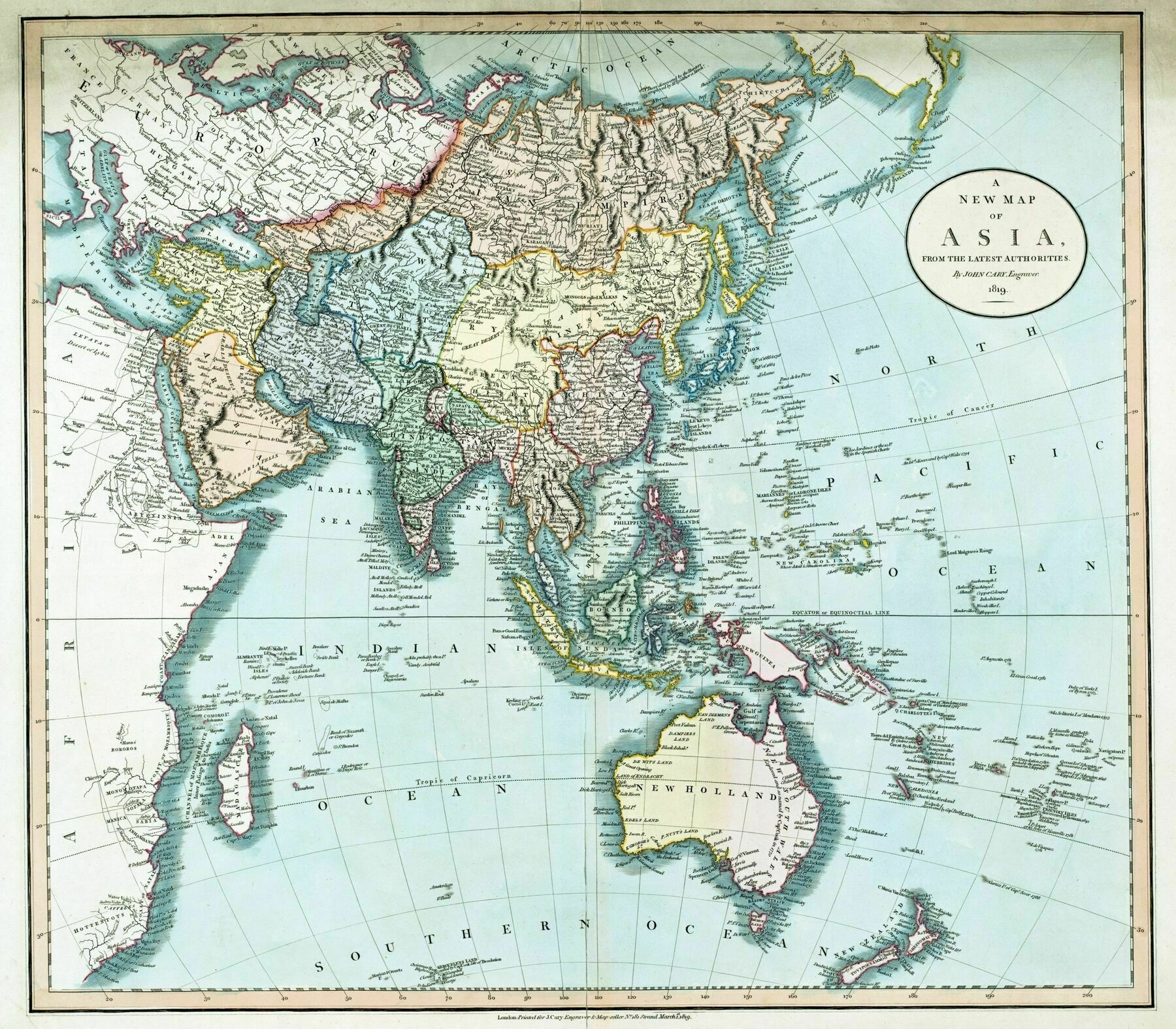
‘Interesting it’s still referred to as New Holland with ongoing British colonisation
No. Perth, in Western Australia, was not founded until 10 years after this map, by the British. Also Adelaide in South Australia, and even Melbourne in Eastern Australia.
The east coast of Australia–unmapped by the Dutch–was mapped by James Cook in 1770 and thus known as New South Wales. Sydney was established in 1788. So it’s correct that the other three coasts of Australia were still known as New Holland.
It’s a lesson in how things can be named but not recognised as belonging to a particular power until they are colonised, since actual use of the land supposes an entitlement to it.
The Dutch were great explorers and commercial agents but since they found no commercial use in Australia they didn’t have any need to assert a claim to their discoveries.
Australia is a fascinating lesson in this aspect. The same applies to New Zealand which the Dutch discovered 127 years before Cook fully mapped it on his way to Australia. If the Dutch had behaved differently they would have exerted more influence’
1666 Map of East Asia, South East Asia and Australia
River basins of south & east Asia
River basins of south & east Asia
‘Kinda wish the Mekong and Yangtze basins were further apart color wise, they almost look like 1 basin at first’
Night light pollution changes in Asia over the last 25 years
Night light pollution changes in Asia over the last 25 years (red - increase ; yellow - slight increase ; green - no change ; teal - slight decrease ; blue - decrease)
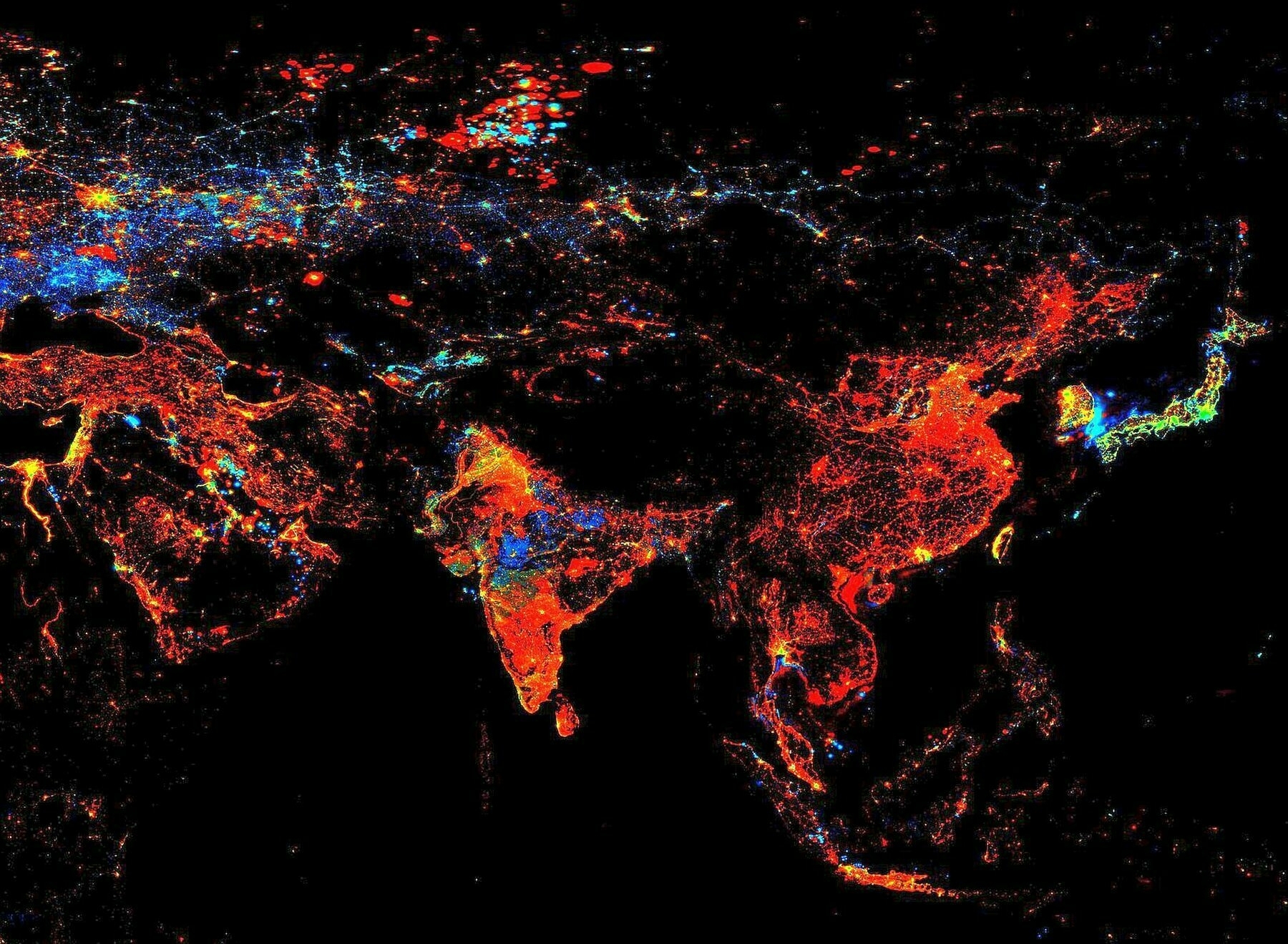
‘You can almost see parts of borders of Maharashtra, MP, West Bengal, Andhra Pradesh and Telangana’
Soviet physical map of Asia (1967)
Landform map of Eurasia (1945)
Landform map of Eurasia (1945)
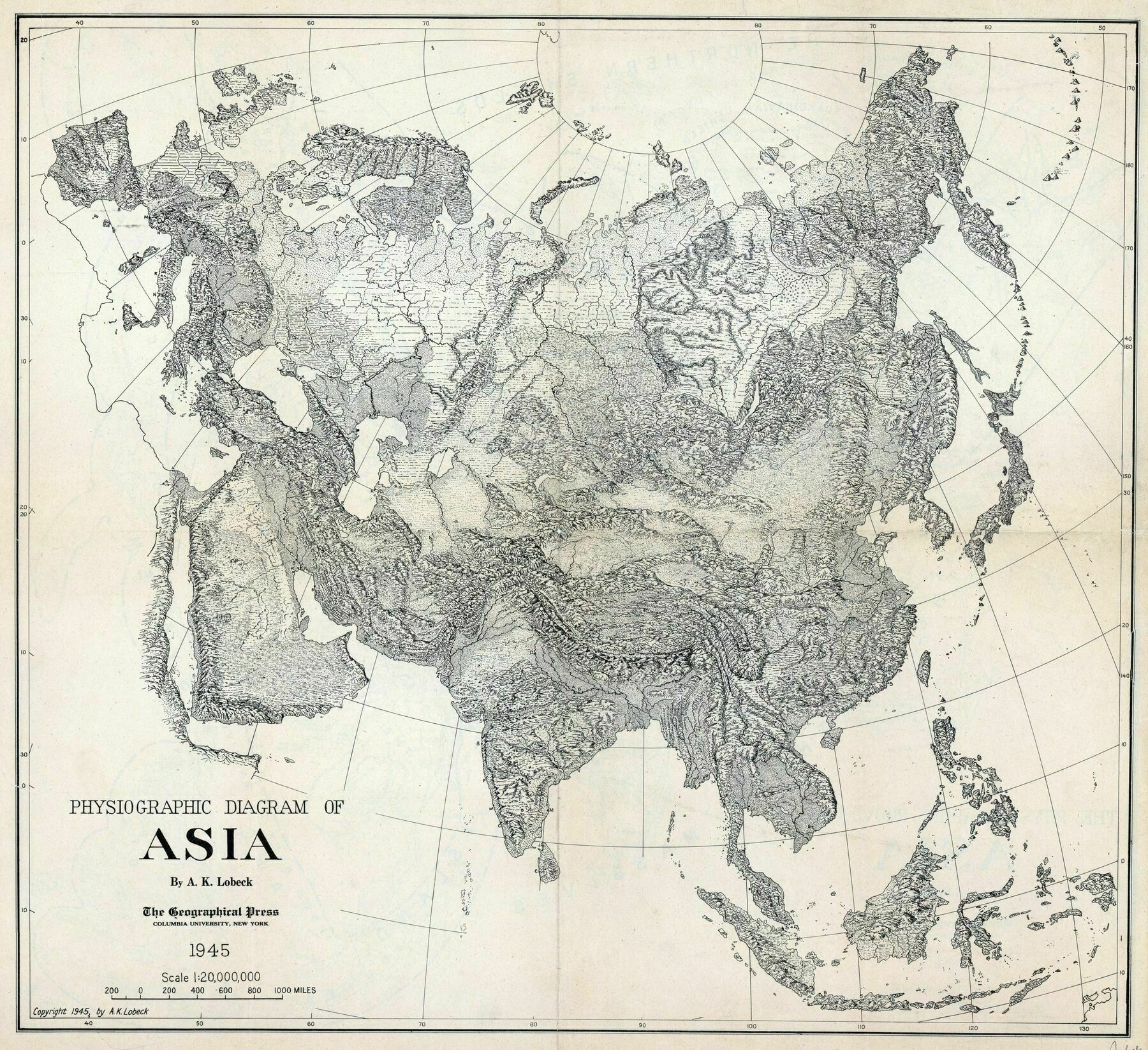
‘Never realised the Urals lined up with those snake like island in the Arctic’
Geographical distribution of Tai-Kadai languages
Geographical distribution of Tai-Kadai languages
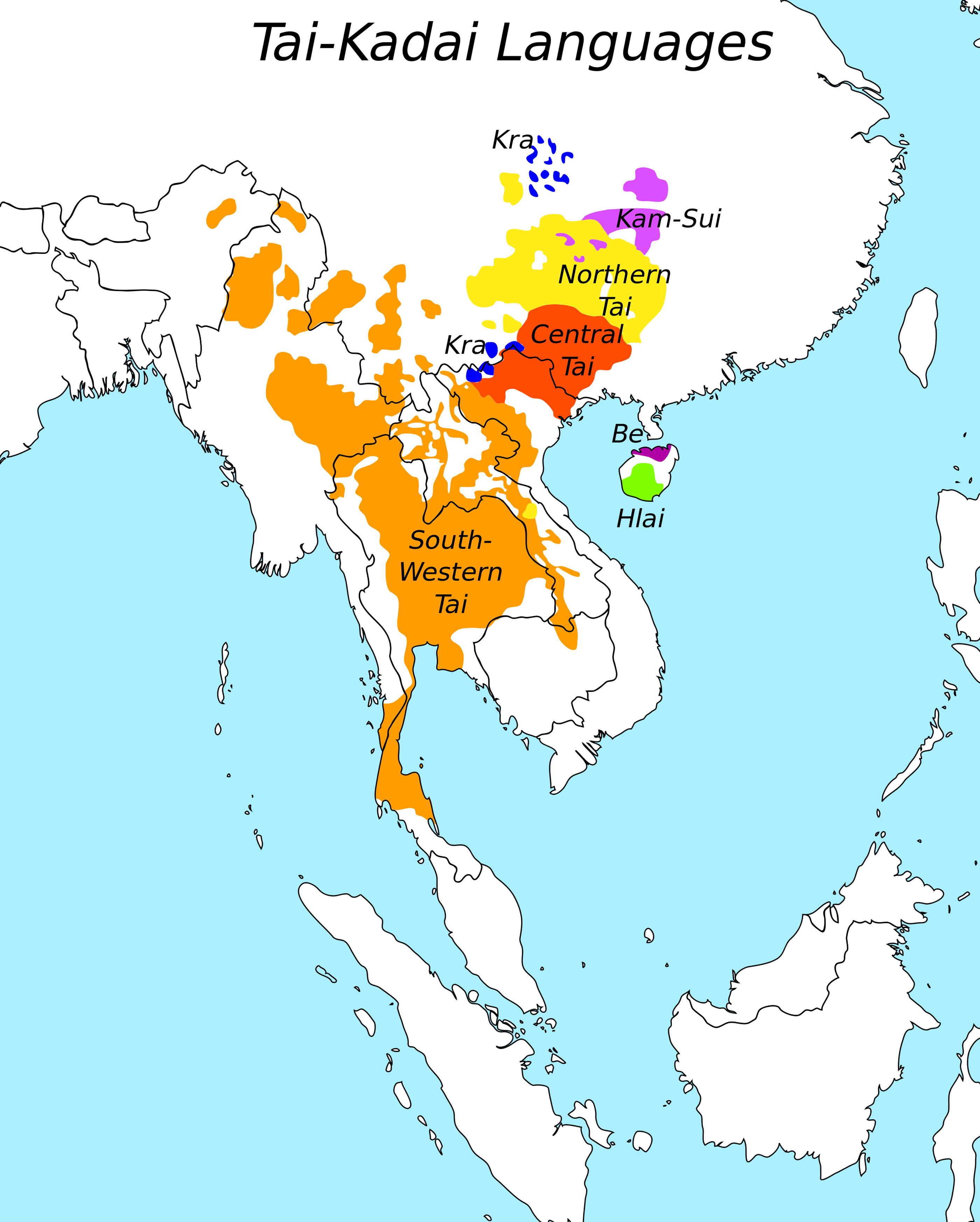
‘How are the ones in China? Are they dead? Are they alive? Are they “alive”? … Kra doesn’t seem to be hanging on as well as the other ones but generally they have pretty sizable native speaking populations (in/around the millions)’
1676 map of south and southeast Asia - by John Speed
1820 map of Asia - by Annin & Smith
1820 map of Asia - by Annin & Smith
‘This is a really sensible Europe-Asia division, I must say. I don’t understand why is Bashkiria with its Central Asian affiliations supposed to be in Europe. Nor the historical Pontic-Caspian steppe inhabited by Turkic nomads with an unclear difference from e.g. Kazakh nomads. Just because those lands got settled by a European power and the previous population got removed doesn’t make them European, at least not unless you think East Thrace became West Asian when settled by the Turks’–Humanophage
1856 map of Eurasia River Systems
1856 map of Eurasia River Systems
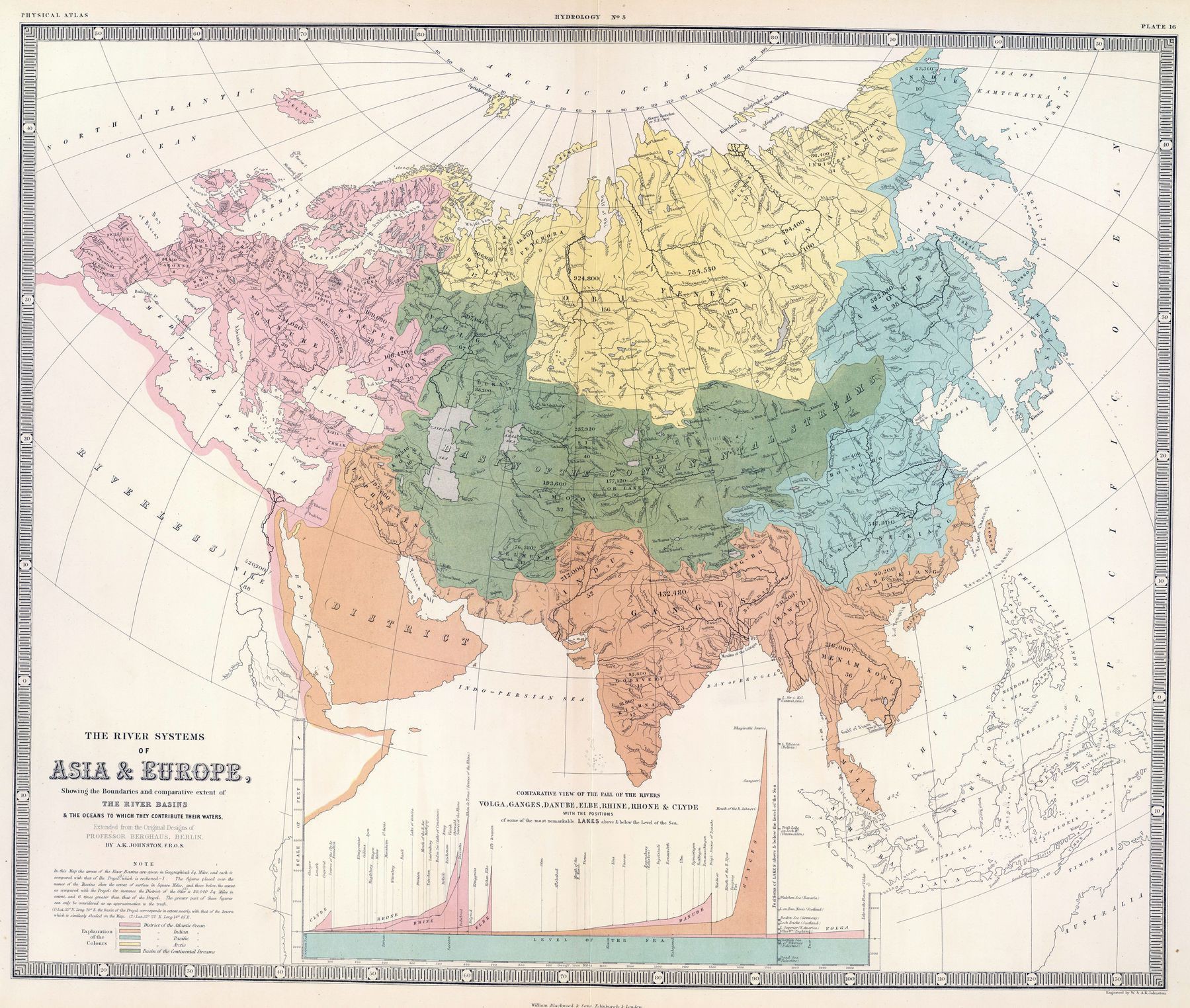
‘Didn’t notice the title at first & thought it was an alt-history map. You could almost divide the Basins into empires of their own; like in the Atlantic River systems most all of it was controlled by Rome, outside of Scandinavia, Germany, Poland, & Russia’–aces101
1801 Map of Asia
1801 Map of Asia
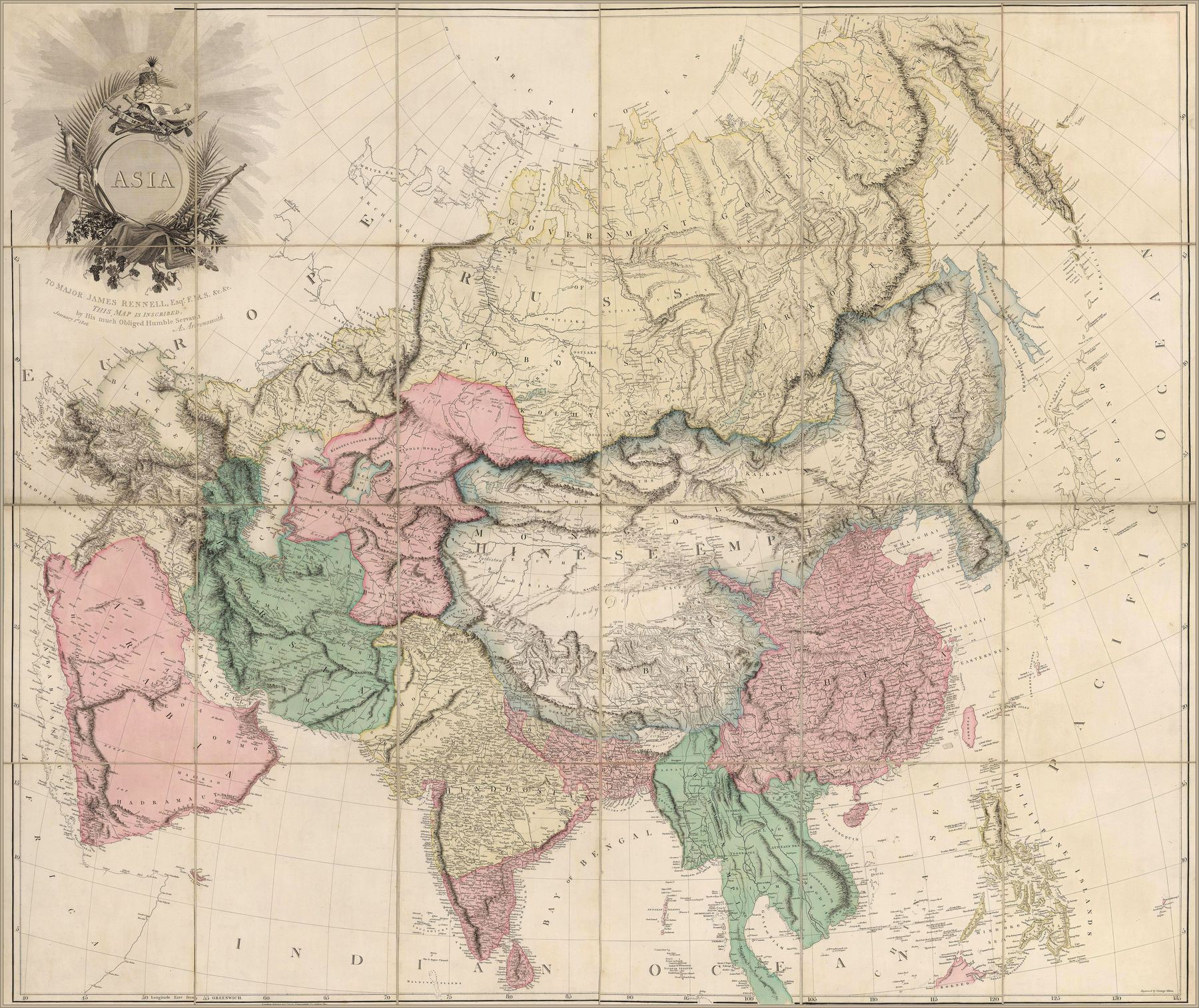
‘Fascinating! Some random observations:
The Caucasus range has scoliosis
The Red Sea is called the “Arabian Gulf” (rather than the bay between Arabia and India, which is unlabelled)
Lake Balkhash is swol
Mongolia includes Xinjiang
The Tarim Basin is called “Little Bucharia”, and Uzbekistan/Tajikistan is called “Great Bucharia”
The Chinese Empire includes Nepal, Bhutan, Korea, Sakhalin, and the mainland coast up to the Strait of Tartary
There are places labelled “Eluths” scattered all over eastern China (edit: apparently “Eluths” was an alternate name for the Oirat)‘–AbouBenAdhem
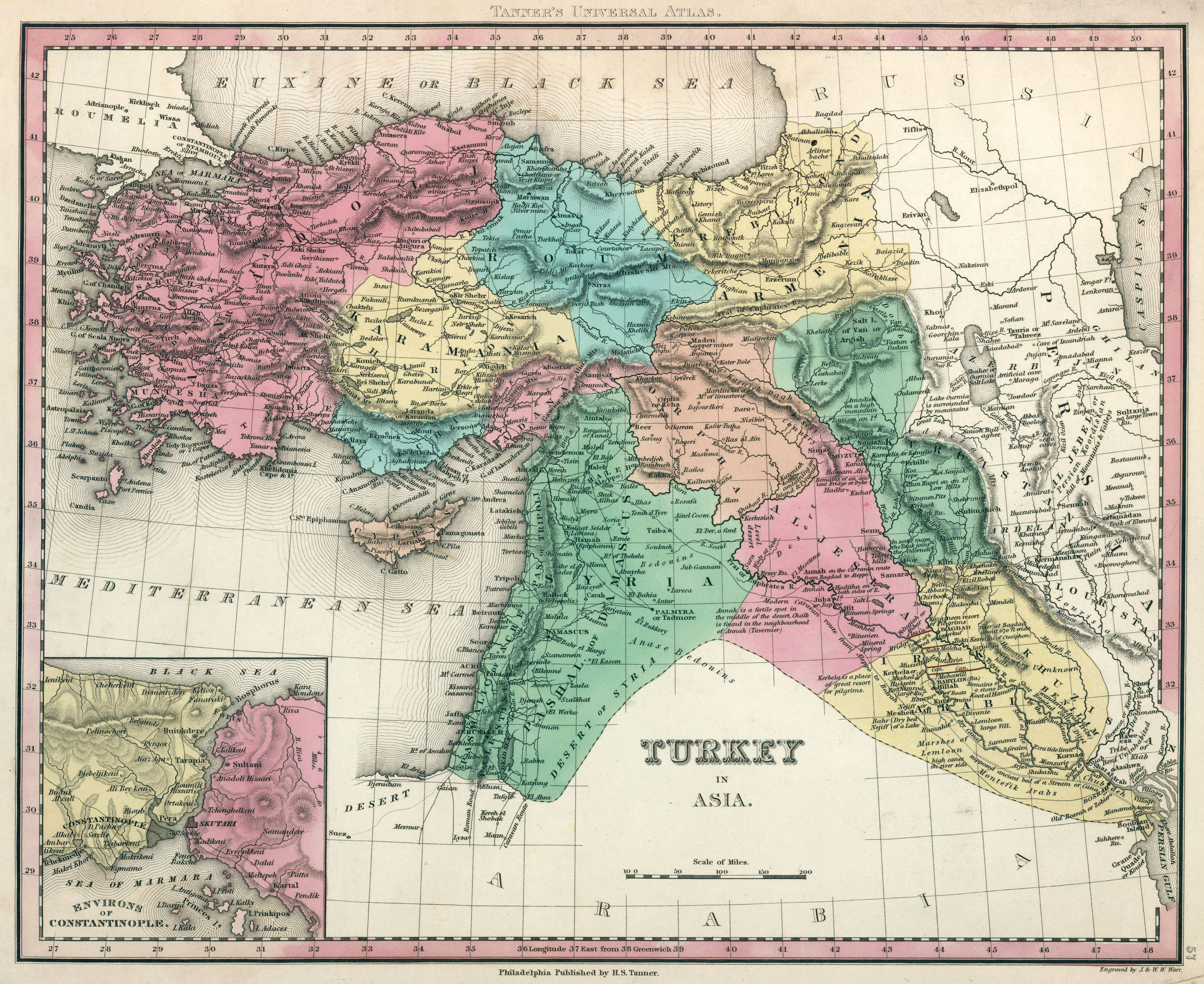
Turkey in Asia (1834)

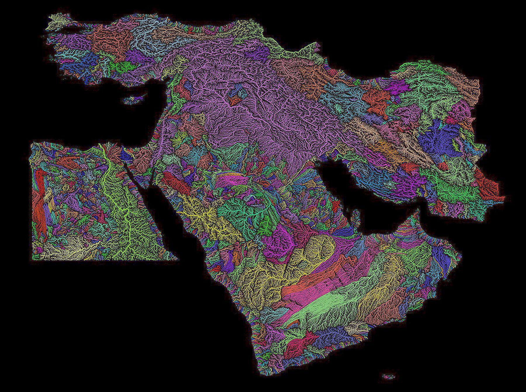
Middle East River Basins
Tree Cover Density and Human Settlements of south, east, and southeast Asia
Tree Cover Density and Human Settlements of south, east, and southeast Asia
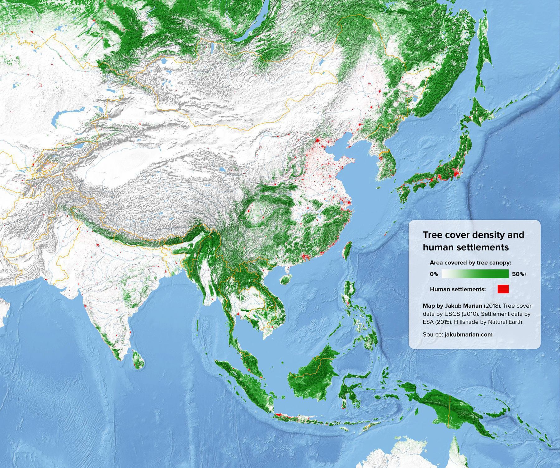
“This is such a good one.
Look at Japan, how its almost entirely forested mountains, except the 3 huge urban areas where all the people live.
Compare with China which in the North is completely flat and unforested farmland with a more spread out population. The south of China is more forested and mountainous, which could reflect the cultural and linguistic differences between the more unified north and the diverse south”–Fummy