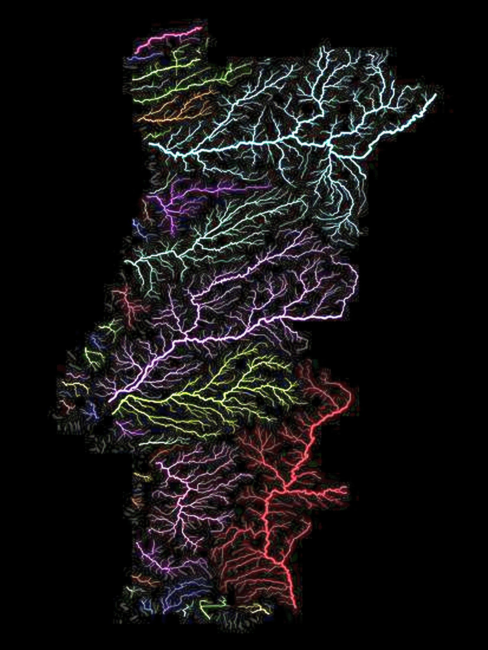
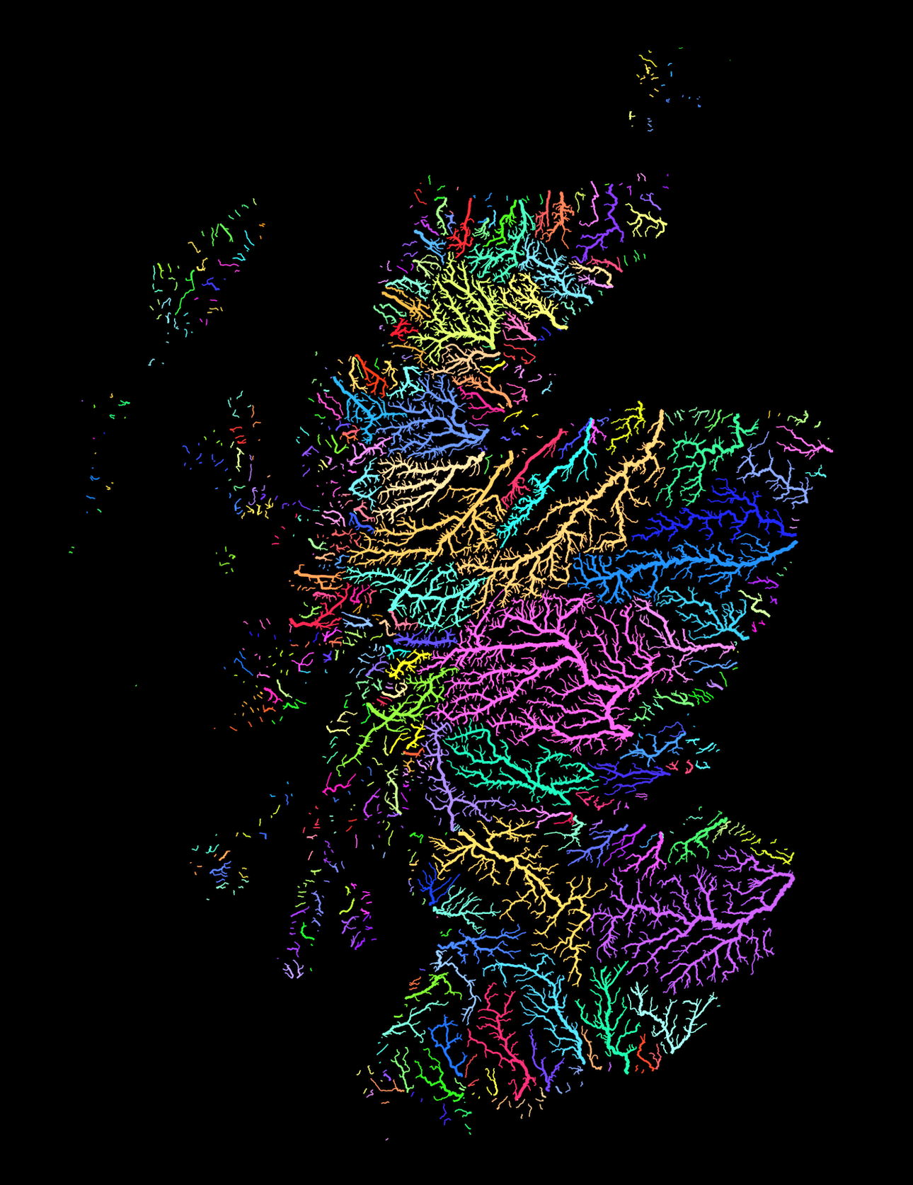
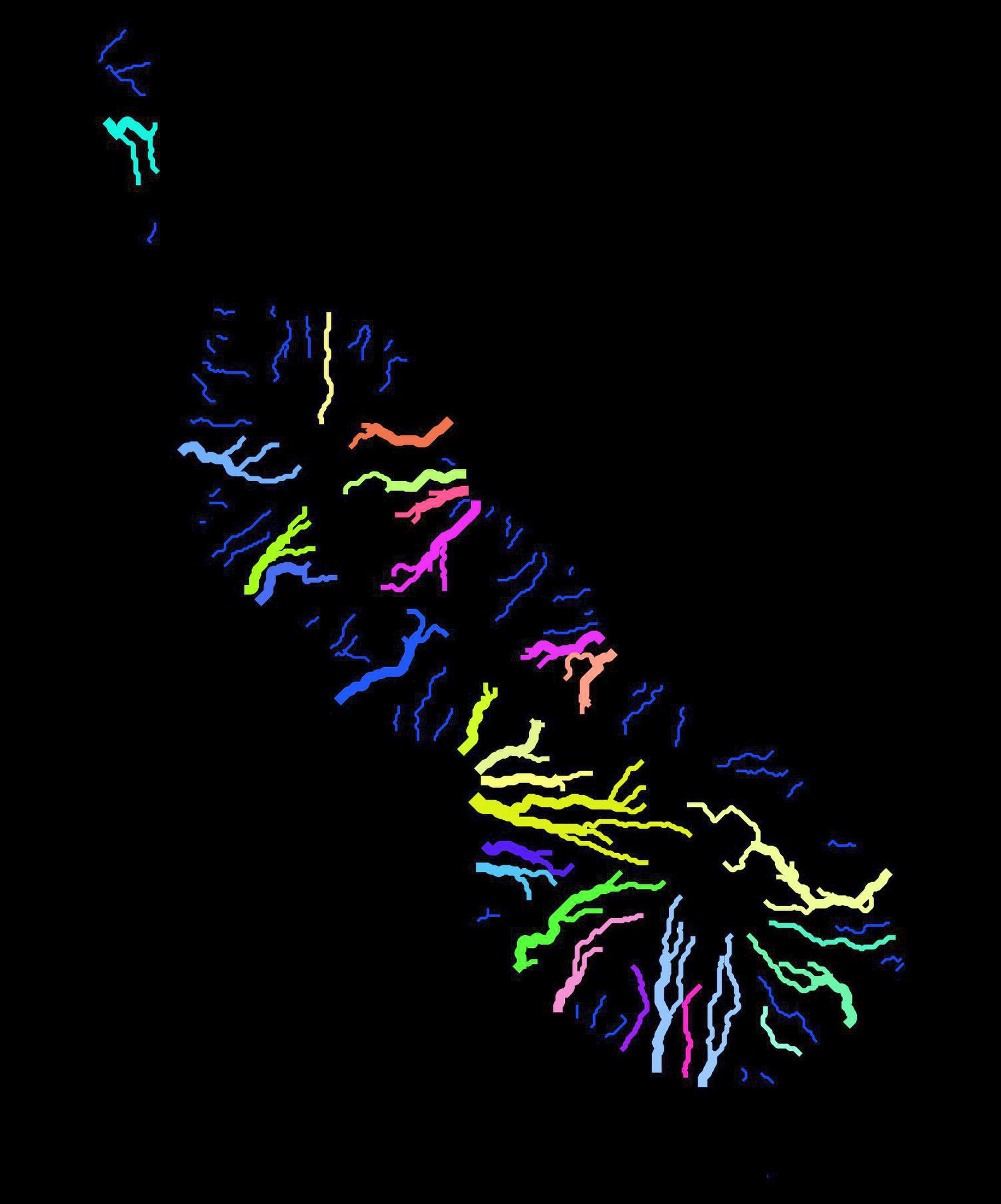
Scottish River Basins
Scottish River Basins
‘The shape of Scotland (and the rest of UK) is very beautiful. I like how Scotland has parallel lakes (lochs). How different is the history and culture of the islands off the coast when compared to the mainstream island ?
The highlands and islands of scotland have similar cultures due to their low population densities and the highland clearings having changed life there as well. They’re all much more rural and have much higher levels of Gaelic speakers compared to the Scottish lowlands.’
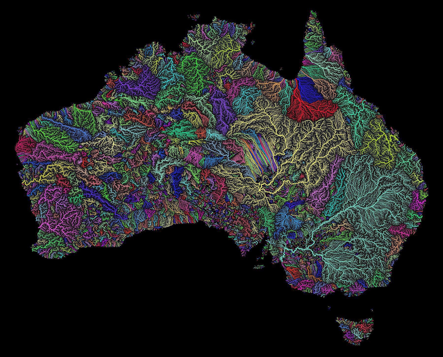
Australian Water Catchments
Australian Water Catchments
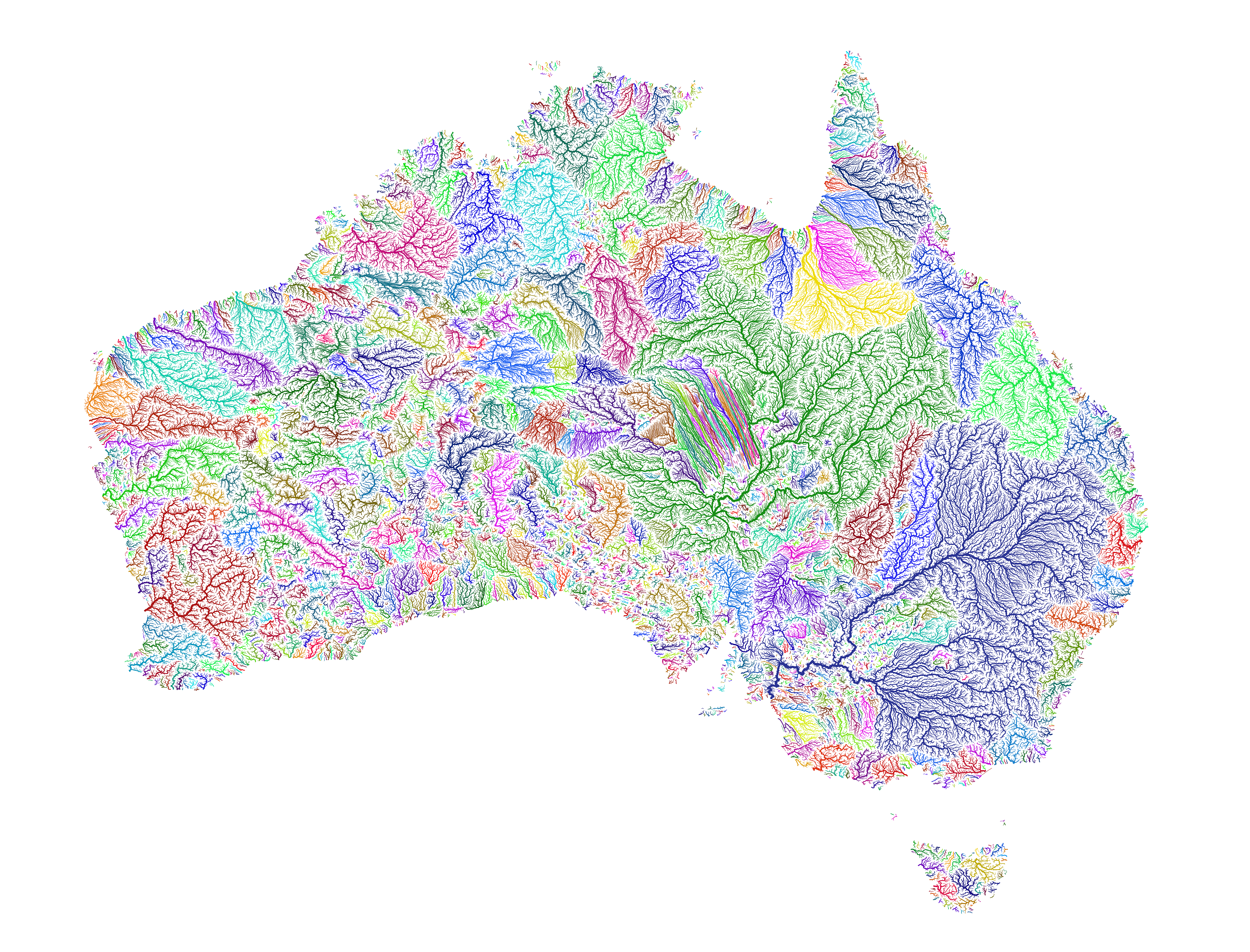
“anyone know what the strange grouping of straight lines in the middle is?
It’s the parallel dunes of the Simpson Desert. The map is procedurally generated by simulating where water would travel if there were enough to flow on the surface. Assuming the flow wouldn’t breach the dunes, it forces drainage into parallel lines between the dunes. In reality though, the fact that it basically never rains there, or at least in any significant enough amounts to create run-off means that these courses are more hypothetical than anything.”
Georgia Watersheds
Georgia Watersheds
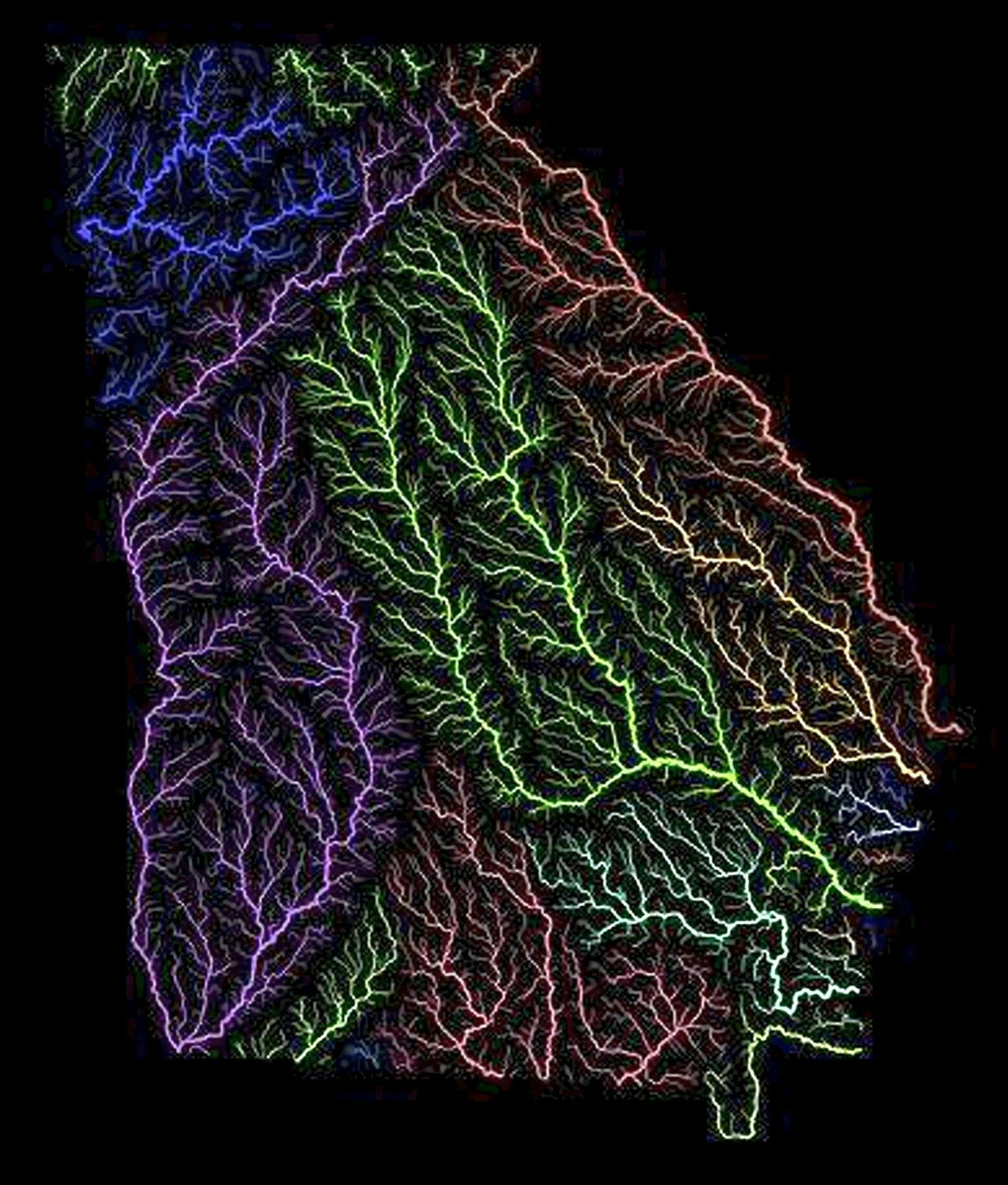
‘The bright purple one that cuts across southwest and then turns south is the Chattahoochee. Having lived in that area, I can confirm that it does indeed get hotter than a hootchie-kootchie’
River Basins of Australia, its States, New Zealand and Papua New Guinea
Rivers of Luxembourg
Rivers of Luxembourg
‘At first I thought one of them was called Wank
The other names aren’t much better: our, sure, mess’
River basins of Thailand
River basins of Thailand. The largest river basins are the Chao Phraya basin (blue), and the Mekong River basin (pink)
‘Woah, this is beautiful’
River basins of south & east Asia
River basins of south & east Asia
‘Kinda wish the Mekong and Yangtze basins were further apart color wise, they almost look like 1 basin at first’
Seaports in the World
Seaports in the World
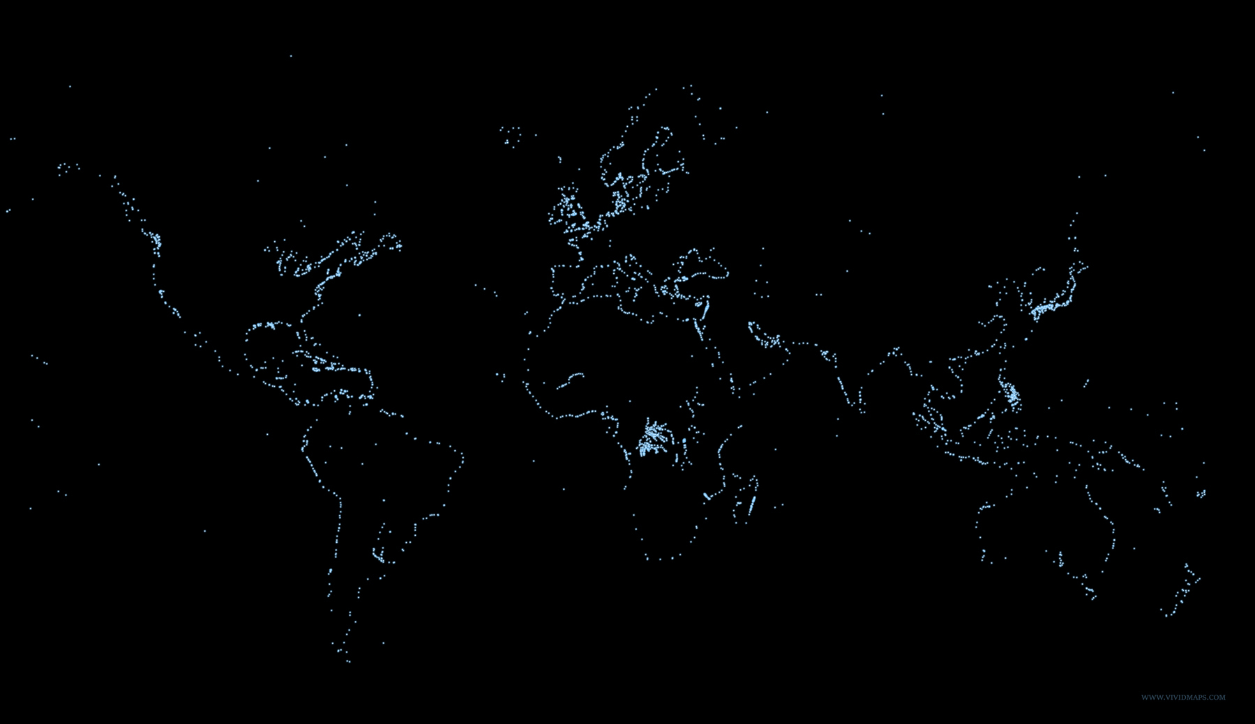
‘It’s fascinating that the ports are between land and the ocean’
Water catchments of South Australia
1866 strip map showing 2600 miles of the Mississippi River from its delta to its source at Lake Itaska
1866 strip map showing 2600 miles of the Mississippi River from its delta to its source at Lake Itaska
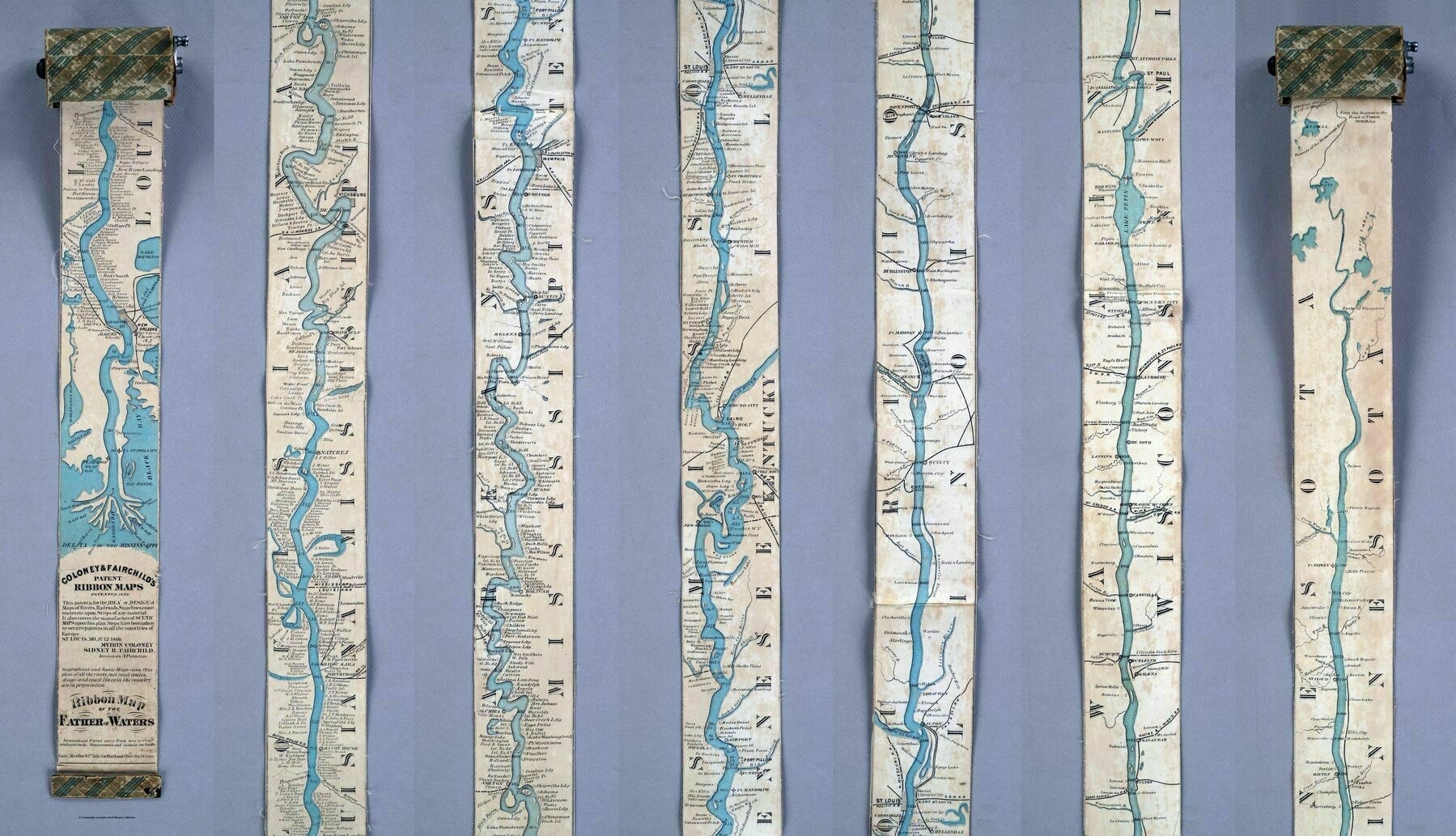
‘Wonderful map but how on earth do you take that picture?
You just take lots of individual photos and then just stitch them together’
1850 map showing the comparative length of the world's rivers and lakes
1850 map showing the comparative length of the world’s rivers and lakes. It includes a list of rivers and lakes at the bottom
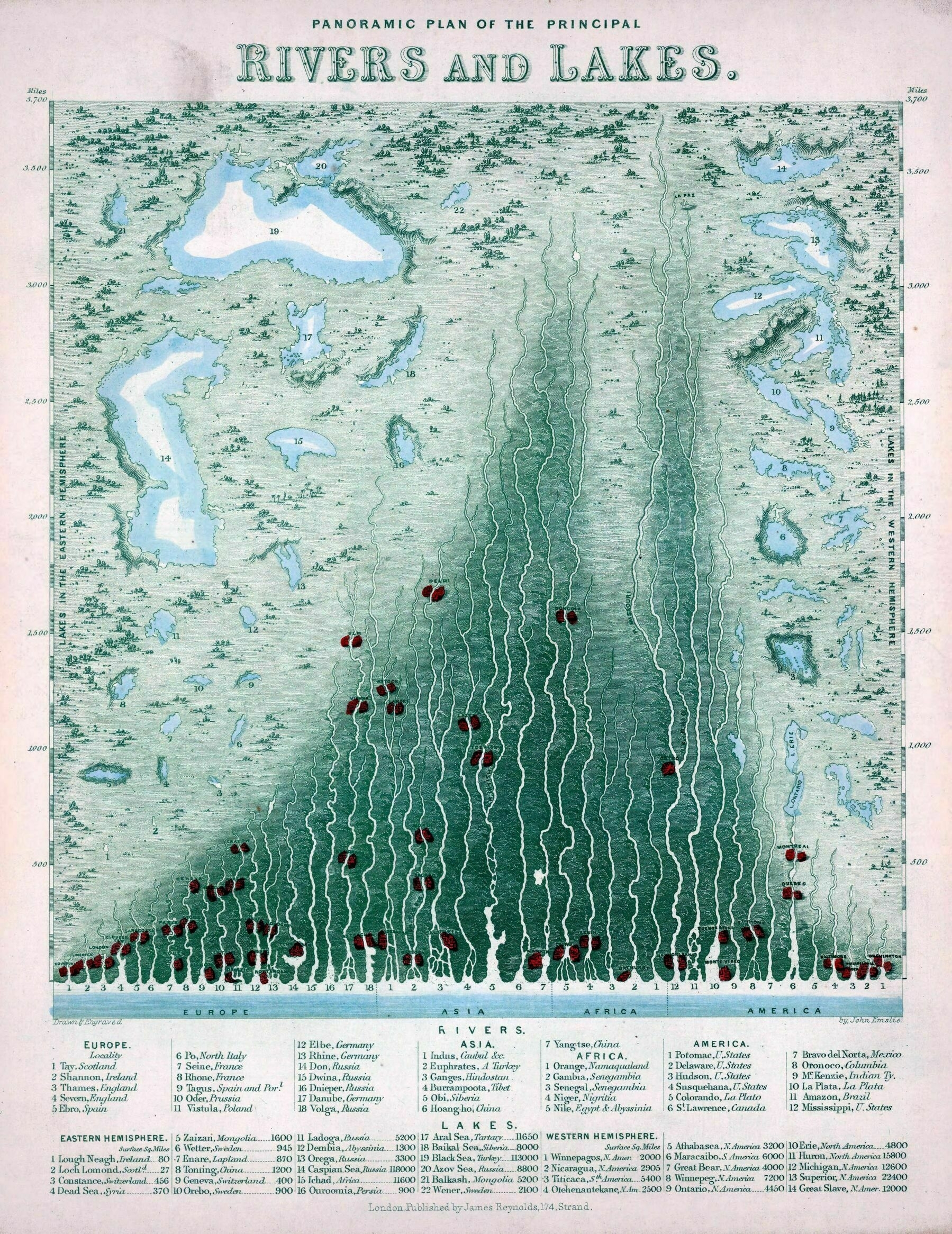
‘The main oddity with the Mississippi-Missouri system is that the Missouri is the longest of the two by a good long bit – the main reason that the Mississippi is considered the main river is really just because European mapmakers discovered it first.
However, even when the whole thing is measured from the Missouri’s headwaters – where it should be measured from, strictly speaking – it’s still shorter than the Amazon and Nile, although by a lot less than when it’s measured from the Mississippi’s headwaters.
Mainly, people tend to get excited when they realize the screwy way that the Mississippi’s length is usually reckoned, or sometimes just simply add the two rivers together. This map is old, too, and the interior of Africa wasn’t that well explored, so the precise length of the Nile probably wasn’t actually known – so by what people knew at this point, the considerably better-surveyed Missouri probably was the longest river of all.
(And that may also be a factor – the modern idea that the Mississippi is the longest river may very well still percolate from a time when that was an entirely reasonable conclusion.)’
1945 map of the Mississippi River Basin - by Edwin L. Sundberg
1945 map of the Mississippi River Basin - by Edwin L. Sundberg
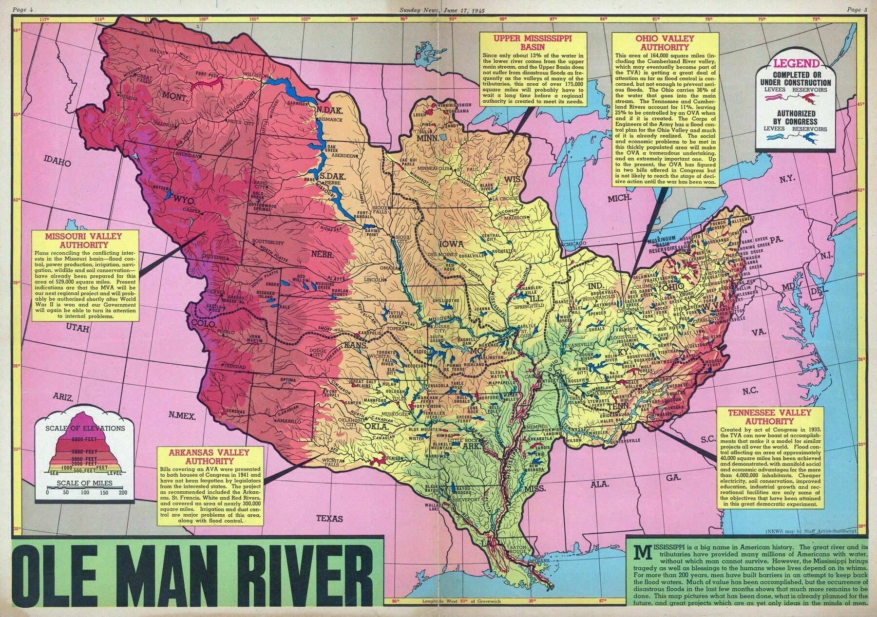
‘Awesome share, thanks! I like seeing this sort of non-contemporary map.
The Mississippi River, along with all the feeder rivers which make up the broader basin, has been very important to the development of the United States’
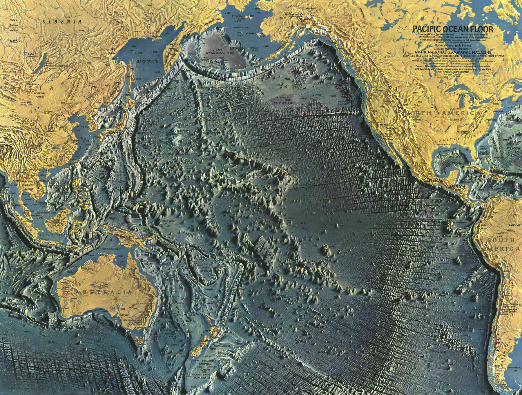
Detailed map of the Pacific Ocean Floor - 1969
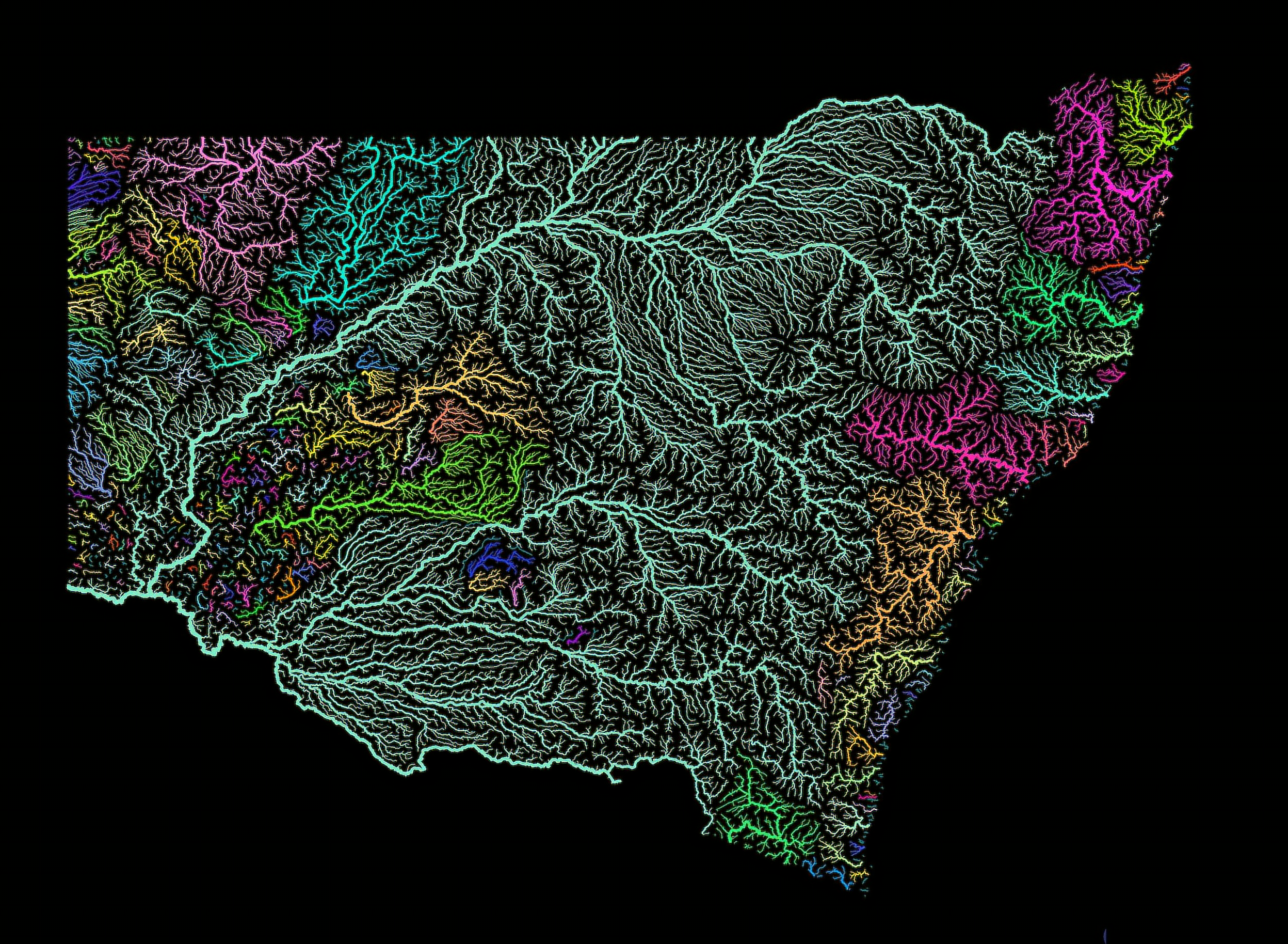
New South Wales Water Catchments
New South Wales Water Catchments
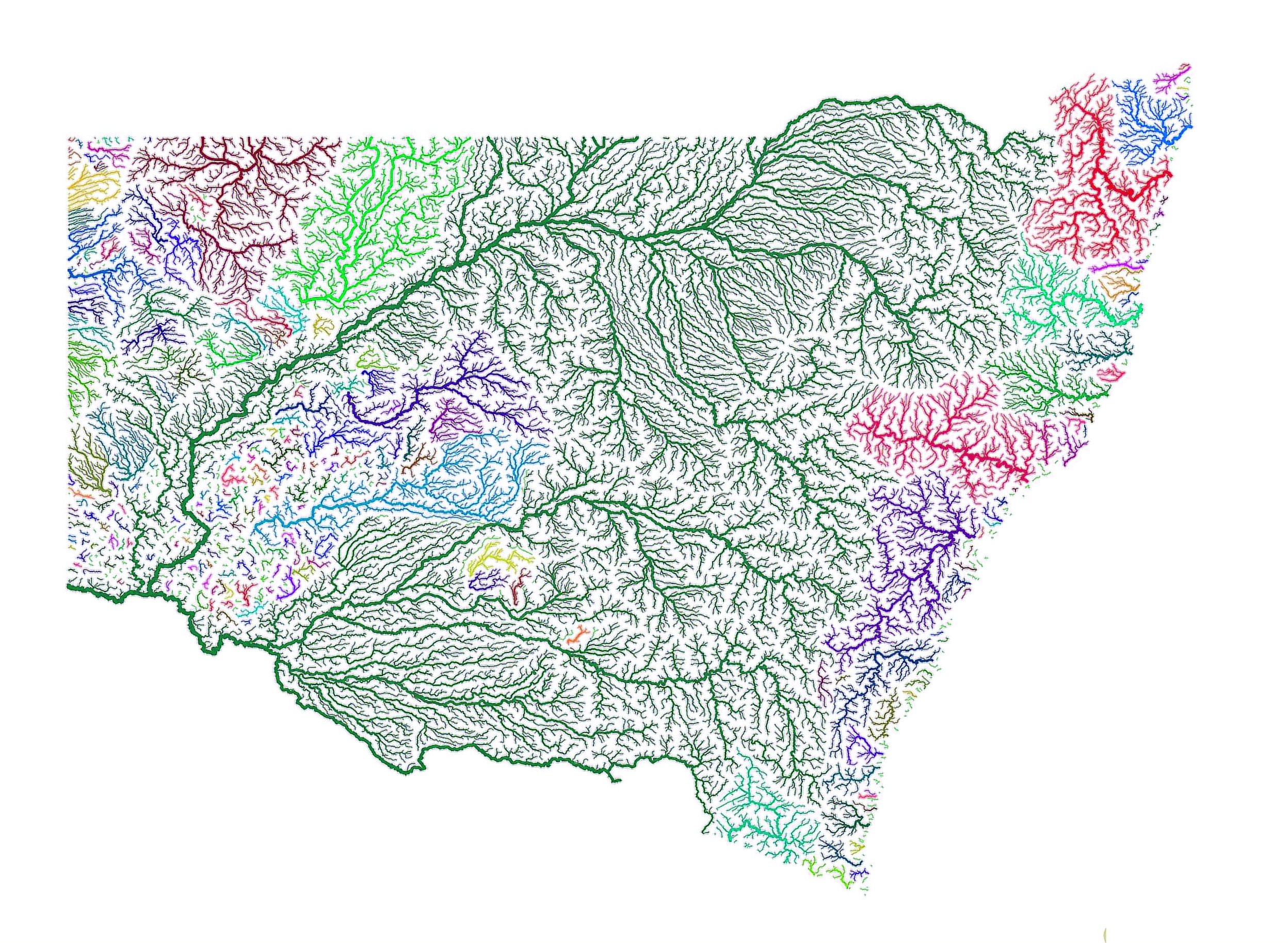
“How have I never realised until right now how similar shaped NSW is to the US?”–York_Lunge
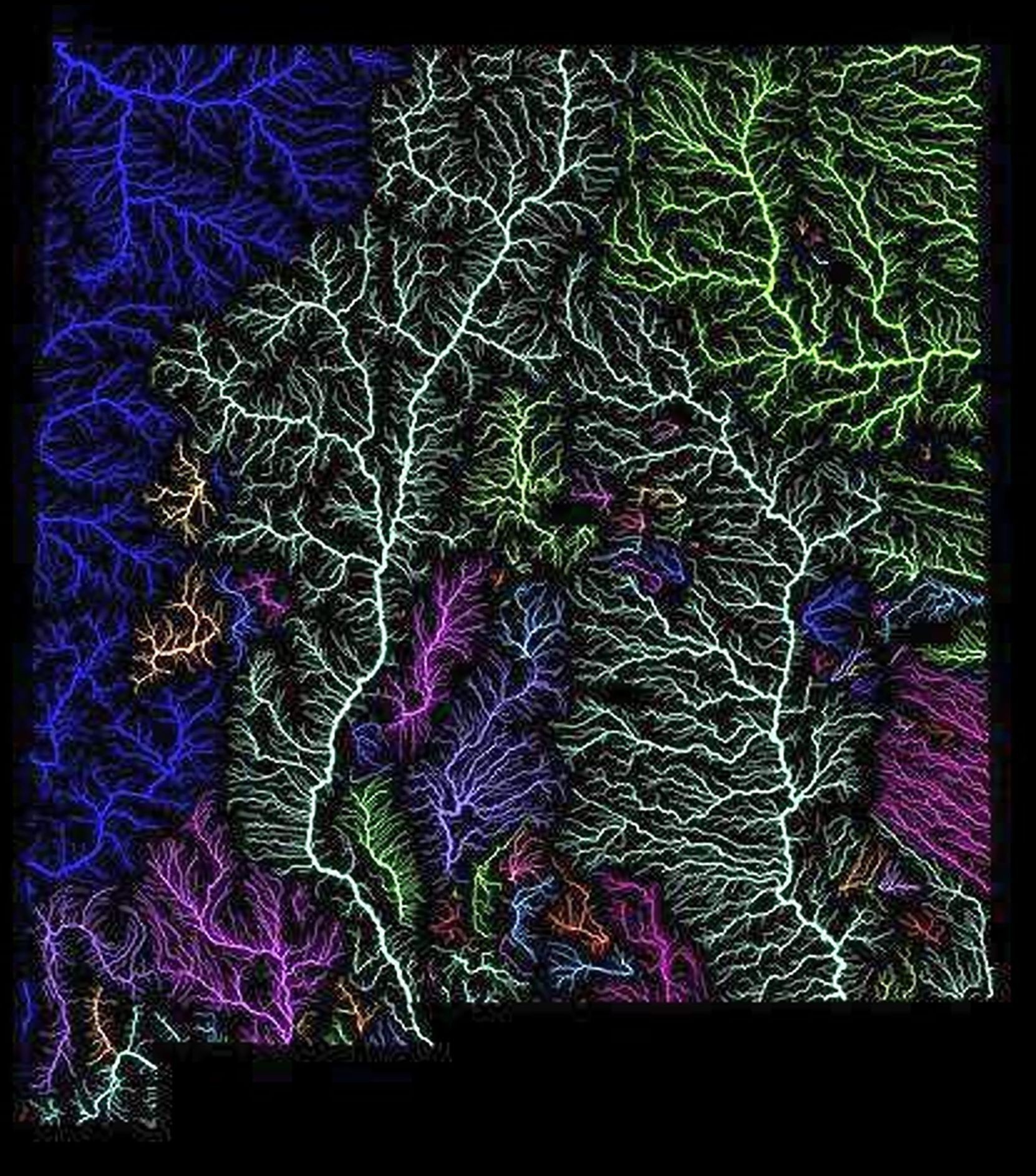
Watersheds of New Mexico
Mississippi Watersheds
Mississippi Watersheds
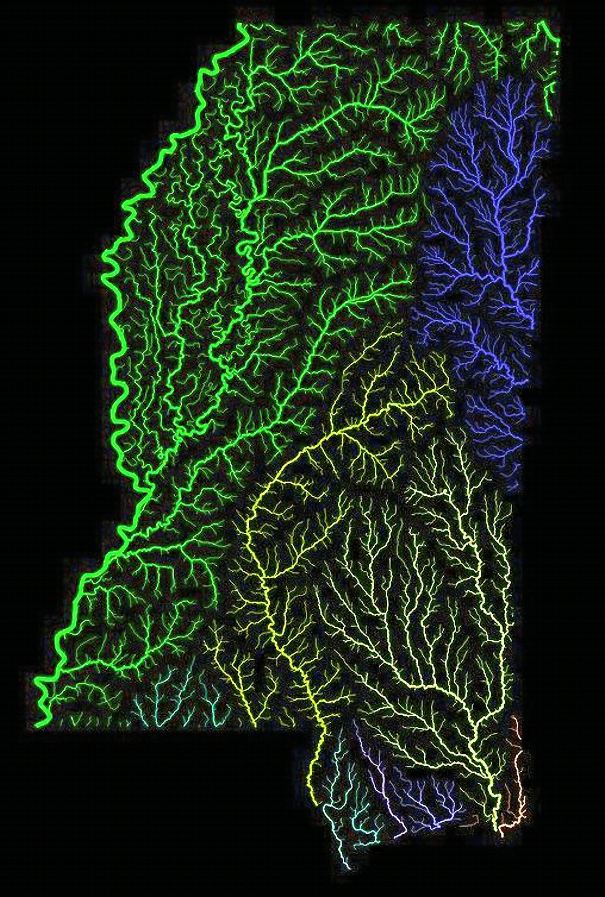
‘Very cool. I want a really high res version of this with labels’–thomaslsimpson
The River Systems of America (1856)
The River Systems of America (1856)
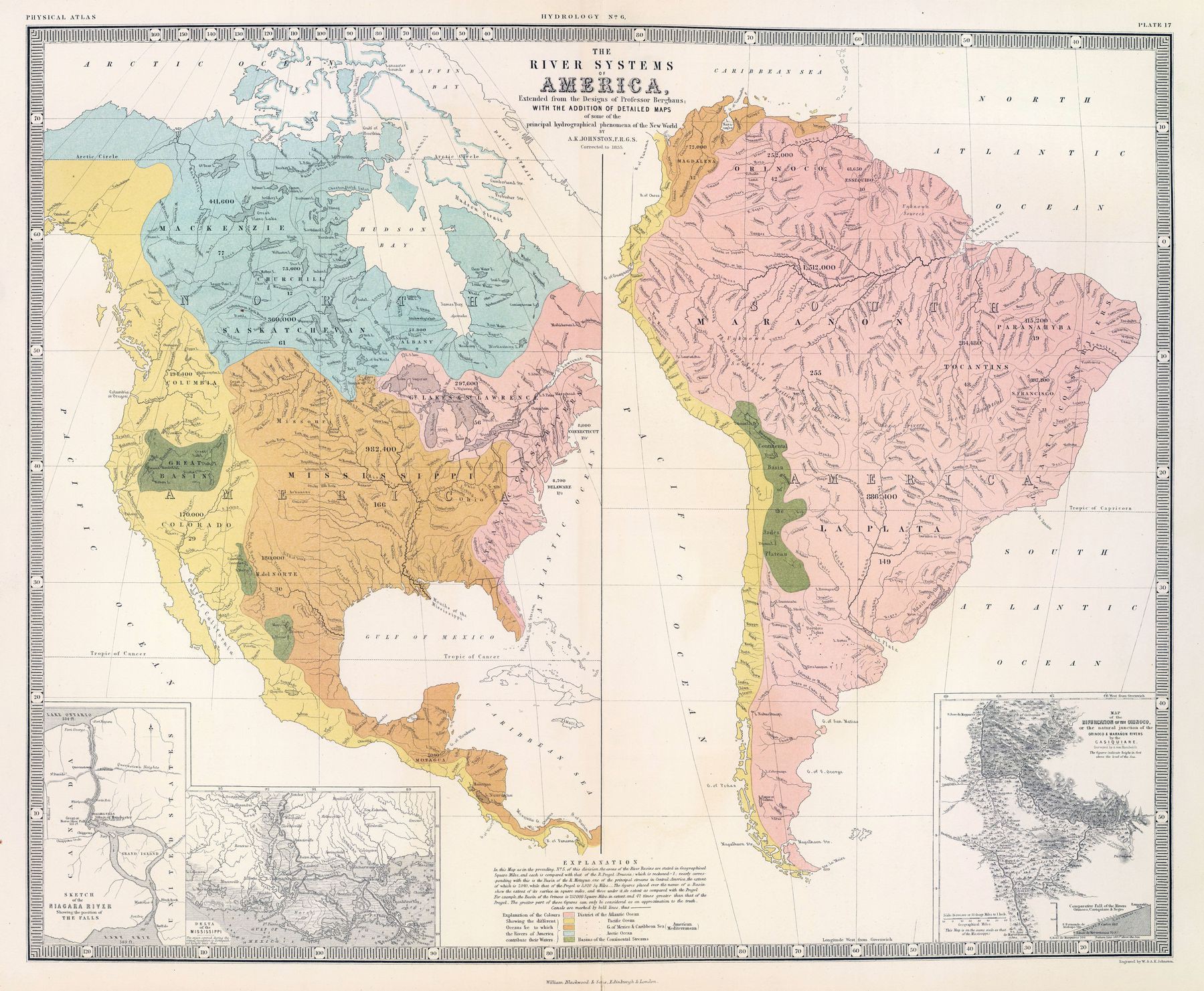
‘Fun fact. Technically a fish could swim through the USA from the Gulf of Mexico to the Pacific Ocean. A creek in Wyoming splits in two and eventually reaches both the Mississippi and the Columbia Rivers’–desperadow
Scottish River Basins
Minnesota Watersheds
Minnesota Watersheds
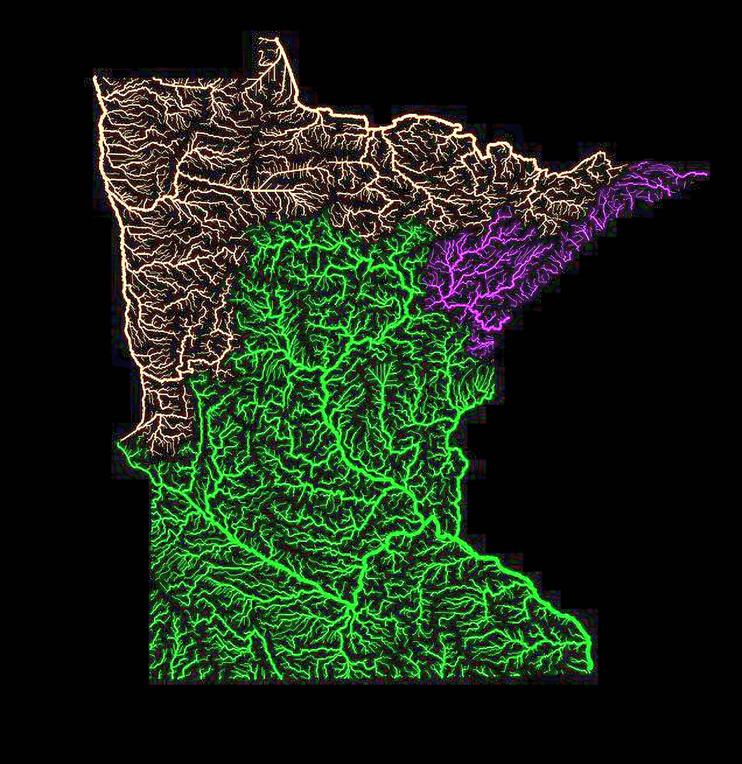
‘What’s amazing is how much of Minnesota drains into the Gulf of Mexico’–Xtoval
River basins of Bougainville
Water catchments of Australia
Water catchments of Australia
‘This is incredible. I love the way there are so many large catchment areas in the east of the continent however once you get in to the west it is all broken up into tiny sections … Tiny?! Some of those catchment areas are still the size of Belgium … Thank you kind sir for using my country as a measuring reference … For some reason, unknown to me, us Aussies use Belgium a lot when referring to the size of portions of Australia. I don’t get it, but that just happens … Belgium is probably the most well known, culturally significant country that’s extremely small.
It’s a good benchmark. Everyone knows about Singapore but everyone also knows that it’s basically just a city. Not everyone knows about Luxembourg and Lichtenstein.
But Belgium was a coloniser, and went to war with other European countries. It’s a big deal, so it feels meaningful to say “we’re so massive you could fit Belgium into one of our cattle stations”.’
Water catchments of New South Wales
Water catchments of New South Wales
‘Holy shit the Murray river has some reach … And the Darling River!’
Queensland water catchments
Queensland water catchments
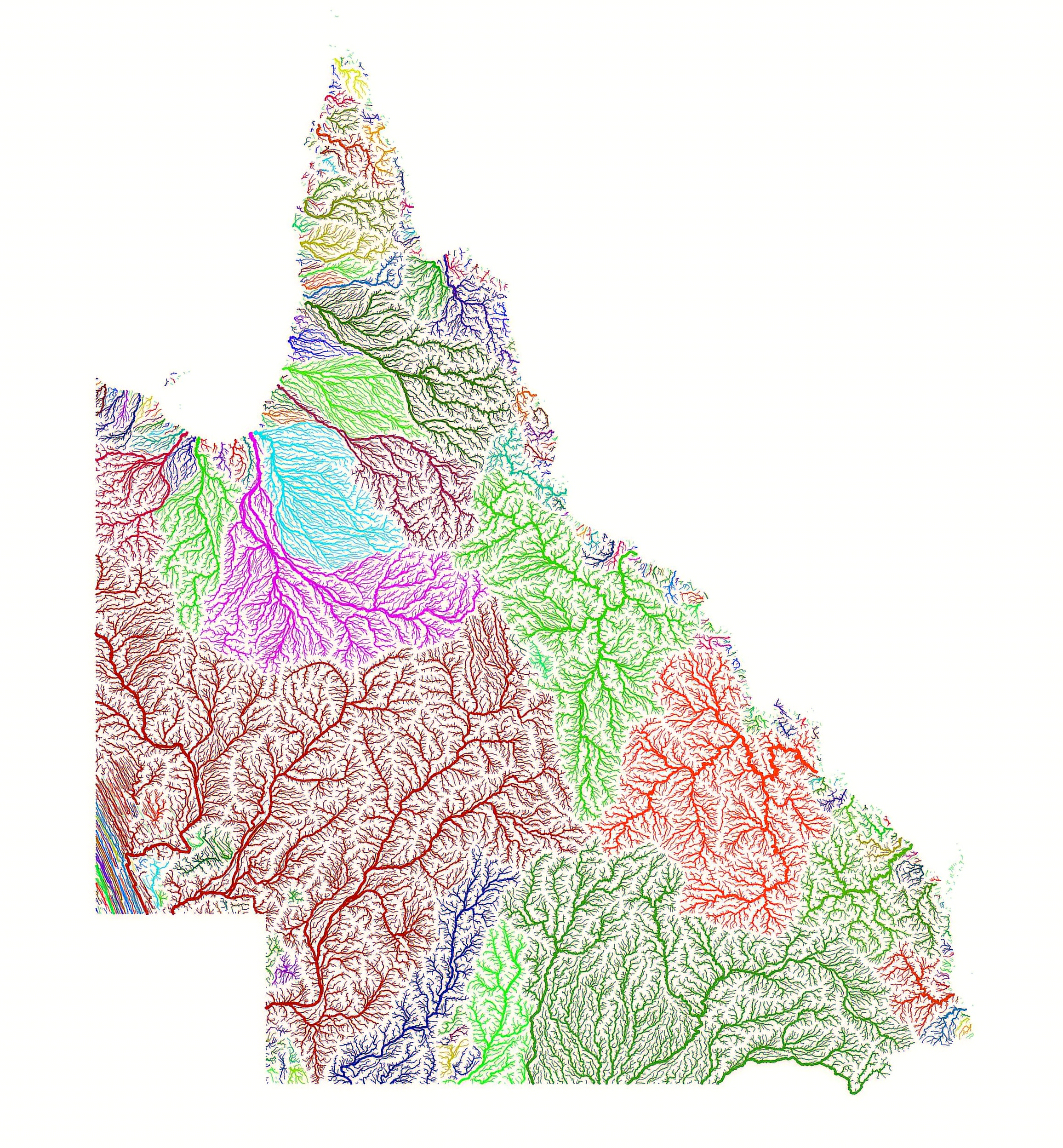
‘The big dark red one in the south west would be Lake Eyre Basin’–MegaMank
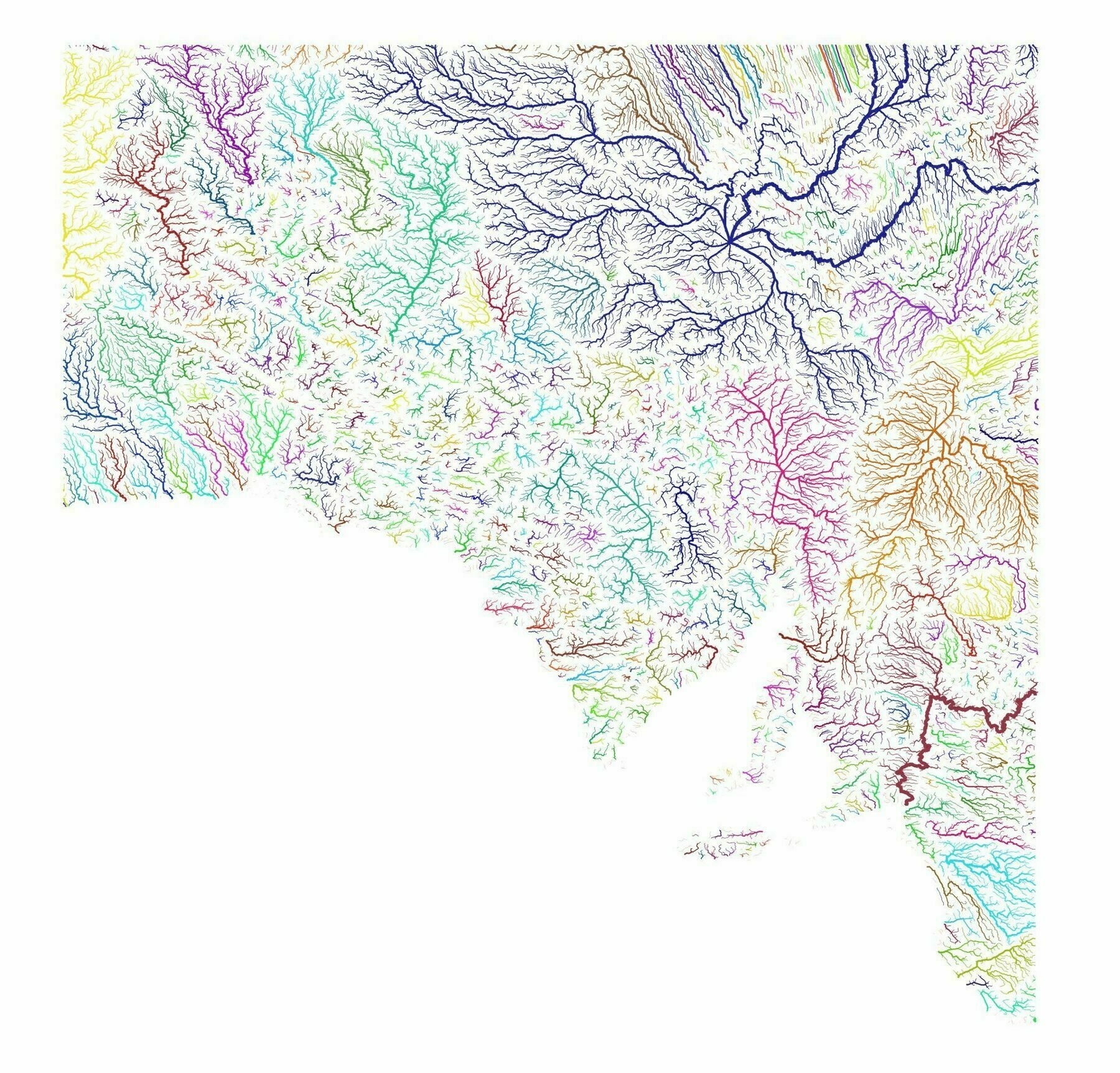
Brazilian river basins
Brazilian river basins
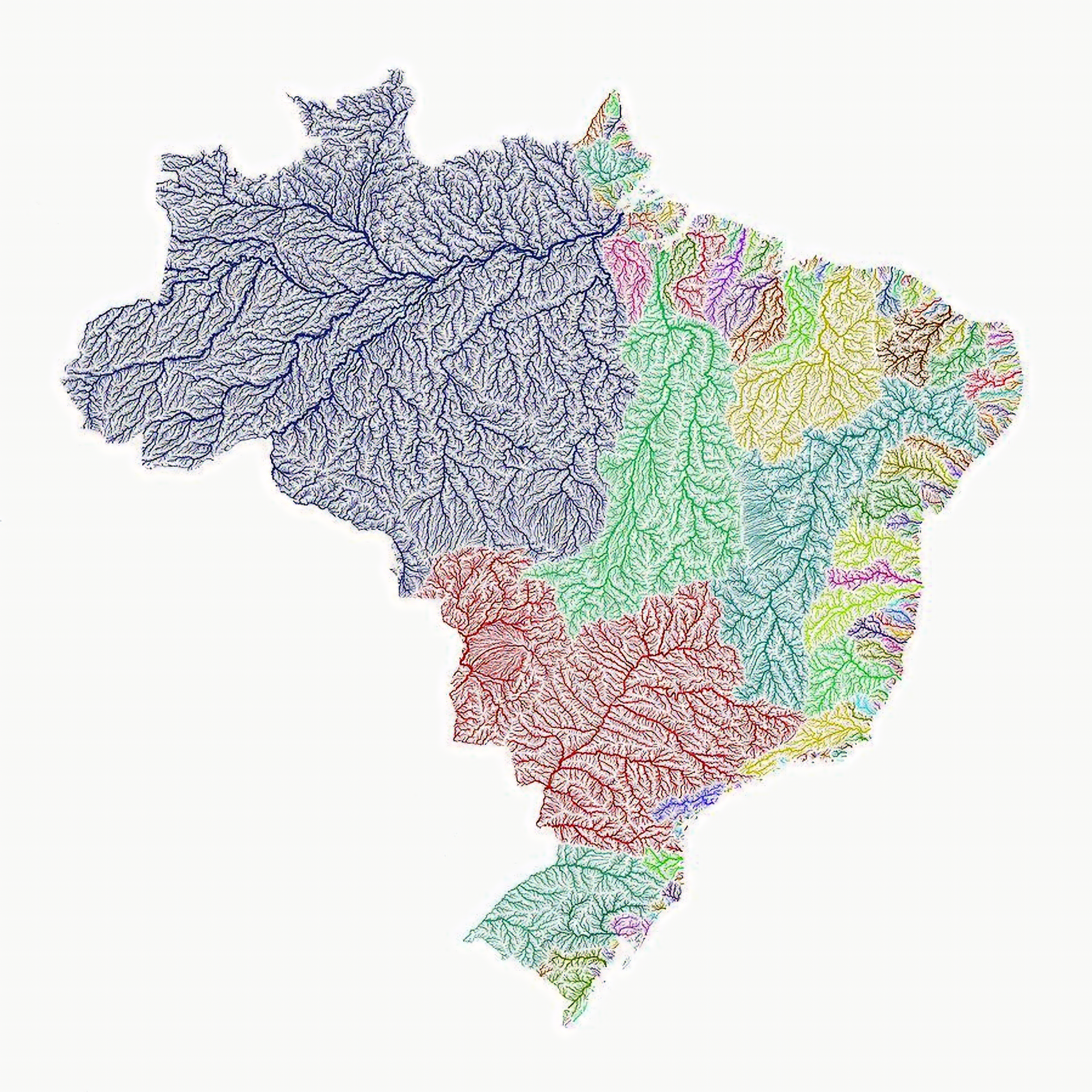
‘What a coincidence that the change in the color of the waters corresponds exactly to the currencies of the states!’–sapphocubas